The Road goes ever on and on; Down from the door where it began;
Now far ahead the Road has gone; And I must follow, if I can;
Pursuing it with eager feet; Until it joins some larger way;
Where many paths and errands met; And whither then? I cannot say.

[JRR Tolkien, Lord of the Rings]

Sunday 24 April 2016

ODP Day 11: Moel Famau to Prestatyn

Sunday 24 April
21 miles
Overcast start, 15 minutes of spitting rain, clearing to blue patches later

A decision needed to be made last night: to make an early start today so as to finish the walk, or split the final 21 miles into two days. For a number of reasons (including the lack of buses to our village if we were to travel home on a Sunday), we decided to split it.

At 4.30 this morning I woke up and after lying there for half an hour I gave Mick a violent shake and whispered quietly in his ear "Are you awake?". He grunted, which I took to be a "Yes".

"As we're both awake" I said "we may as well get walking." He grunted, which, I took as agreement and so I put the kettle on.

At 6am we were walking. At 6.30 we were stood atop my final Marilyn of this trip, Moel Famau, which didn't require any diversion at all; ODP goes right over its summit. There would have been a second Marilyn later in the day, but in return for getting up super-early I'd volunteered to omit it. It's so close to the A55 that it can easily be picked up when we're passing sometime.

From that first tower-adorned top, the route then goes along the ridge, and stays up high (well, except for a couple of long dips to cross roads) for a good while. All quite lovely it was and a highlight of the trip. Moreover as, contrary to the forecast of heavy rain all morning, we hadn't just packed away a dry tent, but we were walking without waterproofs too. And, course, at that hour of day, we had it all to ourselves.

Alas, all good things must come to an end and after a few miles we were back on farmland, and more of ODP's speciality: pointless ups and downs, including the worst example of the route. It was just at the point where we would have achieved 10 by 10, except that a ridiculously steep pull up a field had me so hot that I needed to either take a layer off (knowing I'd need it back on as soon as we levelled out) or to stop a while, so we declared it time for elevenses. It was 9.43 and we had walked 9.75 miles. It was as we sat there that I looked at the map and realised that we were about to finish our climb and descend straight back down to the road we'd just left. To add insult to injury, the road route would have been one side of a triangle; our up-and-back-down route was two sides.

With four miles to go a few calculations were done and it looked like we were going to be arriving in Prestatyn just after the easiest train home. Not really a problem, as although it would have been convenient to catch it, I'd set out this morning anticipating an arrival at least two hours later (that ridge walk had turned out to be far speedier than expected, with good paths and no stiles).

Even so, who can refuse such a challenge? We put a spurt on and arrived in Prestatyn with just enough time to visit the monument at the ODP end, take some photos, nip to the shop for a drink (water had run out at lunchtime) and get to the train station for the easy train. So, once again we finished a walk and spent absolutely no time looking around the destination town. I should perhaps feel bad about that, but I don't (and not just because we were in Prestatyn  in the relatively recent past anyway).

So, a successful trip completed, including 6 of my 8 intended Marilyns. If my memory isn't deceiving me, we had pretty good weather too, with only one morning of precipitation too, which was the snow showers on the morning of Day 3.

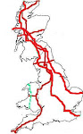
My opinion on Offa's Dyke Path as a whole, now that we've done the whole thing (ish. We did take quite a few deviations from the defined route, but we did walk from its start point to its end point), is that I won't be rushing to repeat it. It does have some excellent bits and some good bits, but they're joined by too much farmland walking to put the walk into my "enjoyed that so much I'd do it again" list. As for the pointless ups and downs, not to mention the with-a-purpose-but-unrewarded ups and downs, I will say that they served our purpose (i.e. a getting fit training walk) very well indeed.

(Gargh! So much for rushing to catch the easy train home. I've been typing this at Crewe station waiting for our connection. We let a slower train go, because we were told the next one would get us there earlier. Foolish mistake - the later one has just been cancelled.)

ODP Day 10: Llangollen to Moel Famau

Sat 23 April
19 miles (>4000' ascent)
Glorious start, clouding as the day went on

I'm sure it must be a common experience amongst people who navigate with a 1:50k map, that you reach a point where the map shows a long block of buildings with a footpath emerging in the middle of the rear of them, and (in the absence of any waymarks) you have no clue which way around or through those buildings you're meant to go. It happened to us twice today (once we guessed right; the other time we thrashed though a forest to the right place). At the first instance (which wasn't on ODP - we took to the Clwydian Way this morning so as to detour via the Marilyn Cyrn-y-Brain) we also had a sense of deja vu.  There I was thinking that by taking the Clwydian Way we were doing something novel, but it turned out we had, in fact, walked that way before during a circular walk out of Llangollen. Didn't help us with the navigation too much, mind - we just recalled that we'd had the same trouble last time without being able to recall the answer.

The yomp up Cyrn-y-Brain  (we could have taken a path, but opted for the more direct option) was through deep, old, woody heather, but once on top was a joy to walk on this gloriously clear day. Mountain bikers outnumbered walkers up there by a large factor.

Back on ODP, before it had chance to throw in many of its trademark undulations, we reached Llandegla where the church outdoes the one in Newchurch with its provision of refreshments. They've built a little kichenette in a back corner, and provided a large table and cushioned chairs as well as toilet facilities and a local history display. Taking a long lunchbreak there, it was only as we were about to leave that it occurred to me that, as we were to have a dry camp tonight  (without even passing any streams this afternoon) we should have rehydrated an evening meal whilst we were there and had it for our lunch. As it was, we topped up our water bottles, decided to worry about finding more water later, and went on our way.

A few miles later a pause was had to save the life of a lamb, which had squeezed under a tiny gap in a fence and couldn't get back to its mother. It gave us quite the run around and we probably would have failed in our quest if three other walkers hadn't come along and lent a hand. It was only a tiny thing and definitely needed its mother, so it was good finally to corner it and lift it back over the fence where it immediately went in for a lengthy feed. A satisfying good deed complete.

Because one Marilyn wasn't enough for us today, we then threw in another two (both very close to the path: Moel Gyw and Foel Fenlli). With 18 miles already walked with lots of up and down, the steep pull up the last one was slow work. In fact, it's been quite a hard day really, so I'm glad I set out refreshed from last night's B&B; I think I would have struggled to have done today's walk yesterday.

Looking over from the top of the last hill to where we intended to camp tonight things didn't look promising for a good pitch (all we could see was heather, no nice patches of grass), but we carried on regardless. A small deviation off path led us to a grassy area which is perfect in terms of position (i.e. out of sight and not near a path) but is probably the worst we've ever had in terms of slopiness. As we weren't moved to search any further for something better we've only ourselves to blame if we spend the whole night having to climb back up to the top of the tent!

As for the water situation, a couple of litres were begged from a hotel/restaurant sort of a place that we passed (it wasn't clear from its signage what it actually was) so we should (barring excessive thirst or mishaps) get us far enough to find either a stream or a tap tomorrow.

(Post blog note: I've just established that it's possible to get two cooking pots adequately clean without water with two used (but not squeezed out) tea bags!)

Friday 22 April 2016

ODP Day 9: Porth-y-Waen to Langollen

Fri 22 April
17.5 miles (3800' ascent)
Heavily overcast start, clearing to surprise us with sunny intervals this afternoon.

ODP is not an easy stroll in the park, but beyond the physical effort of the constant undulations we're finding the biggest issue is a mental one. In our opinion it is quite hard to huff and puff up 450', at quite a gradient, only then immediately to descend again, reaching the bottom of a valley only to ascend again. There was a bit of that again today, although we did have the treat of the section across Oswestry Old Racecourse Common, where the route stays up high for a good length of time, in very pleasant surroundings.

I'm not sure why ODP doesn't visit Llangollen, or at least have an optional route which does, as it seems to me that National Trails often make a special effort to detour to nearby towns or villages which offer amenities. Given the lack of shops and eating places directly on the northern end of ODP, Llangollen seems an obvious place to visit.

Having considered resupplying for the whole of the rest of the Path whilst in Welshpool, the decision made was that we would rather detour into Llangollen than carry that much food (I'd swear Mick's been slipping rocks into my pack as it is; I can do without extra food weight at the moment!).

The various options for getting to Llangollen were considered and the route selected saw us leave ODP just after Chirk Castle to lop off a corner (although that lopping did incidentally involve going up and over a hill rather than around the side of it). It was a lopping decision which was made easier by the fact that we've previously spent a couple of weekends in this town, and thus have walked before most of the bit of route that we have bypassed.

Having decided to come here the question then was where to stay. The thought of a campsite on a Friday night wasn't filling me with enthusiasm, so at lunchtime I greatly annoyed a dog in a kennel as I stood outside of its owner's house to use their BT hotspot (look Louise, I caught the autocorrect today! It was driving me mad last night with some of the things it was changing). Five minutes later a bonus, unscheduled B&B was booked.

We still had four miles to walk to get there and surprisingly, the highlight of the day came not on ODP but on that 'corner lopping' section, which boasted some fantastic views over the Vale of Llangollen. Worth that extra ascent, I declared.

The downside of picking a B&B at random and without any research was demonstrated when we arrived. It's certainly far from the best we've ever stayed in. I can live with dated (at an appropriate price) and I can live with a bit of dust around the edges of carpets and the like, but this room is seriously in need of a good clean. Oh, and the radiator valve is stuck partially on, combined with windows that don't open...

At least the shower is good.

As the B&B's advertised 'evening meals served every night' turned out not to include tonight, we went out and picked an eating place based on it being the first place we passed. That selection went well, as one of the photos above should show. Dee Corner is an eatery which doesn't skimp on serving quantities.

Thursday 21 April 2016

ODP Day 8: by Welshpool to Porth-y-Waen

Thurs 21 April
17 miles
Mainly very hazy sunshine

We don't have a good track record of sticking religiously to the route of defined long distance trails, so it should be no surprise that we started this morning not by returning to ODP, but by deviating even further.

Heading down the road to pick up the Montgomery Canal, to take us through Welshpool and out the other side, to reconnect with ODP at Pool Quay, did add a little distance but had a number of other benefits. The main ones were: 1) it avoided the need for us to use Powys's appallingly maintained footpath network across fields to rejoin ODP at the nearest point (one of the paths we needed ran right through the campsite; I found no obvious trace of it); and 2) it would take us right past a big supermarket.

Even though we'd not long been walking, second breakfast was declared in Morrison's cafe and I discovered that the way to an efficient resupply shop* is to order a cooked breakfast, and to have a cup of tea poured and waiting, before you go shopping. I reckon I broke my all-time resupply speed record by a factor of 3.

The Montgomery Canal is a changed place from last time we walked along it when, outside Welshpool the towpath became wild and lumpy with long grasses and wildflowers galore. It now has an engineered path, which wasn't too offensive for walking and which sped us along.

The problem with speed today was that the owner of Bankside B&B, in whose garden we're camping tonight, had requested for us not to arrive before 4, as he would be out. Fortunately, the day was a nice one for time wasting, so not long after we left the canal to take to the top of the River Severn's flood-defence mound (that being the route of ODP), a lengthy elevenses break was had (unusually, actually at 11am).

It was the first of a series of poorly timed breaks today, as not long later we happened across a picnic bench outside someone's house on which sat an honesty box and a tub of slices of various homemade cakes. We bought some for after lunch but resisted another stop.

Lunch was had in an uninspiring spot adjacent to the road in Four Crosses, chosen because there was a bench there, but not long later (just after an underpass bearing such an interesting exhibit on its walls that it took us an unusually long time to get to the other side of the road) we rejoined the canal, where a bench sat in a much more pleasing position, if only we'd waited a bit longer for lunch. (Incidentally, we could have followed the canal the whole way from Welshpool, but we'd done that before, hence today we opted to stick to ODP as it veered off to follow the Severn.)

The next break was spent perched on a fallen gatepost alongside the canal, with cold pop and an ice cream apiece from Llanymynech village store. Of course, there turned out to be a picnic bench 50 yards further on.

Leaving Llanymynech the day ended with a shock to the system: after a combination of canals and the level top of a flood defence, involving almost no change in altitude, suddenly we had a steep 400' climb over a pleasant little hill whose top houses a golf course.

On the other side lay our night stop (where we arrived with perfect timing just a few minutes after 4pm) and we were greeted by an offer of tea and biscuits, which were duly delivered to the tent :-). The B&B has BT internet too, which just about reaches to the tent, so I'll be able to post this blog tonight via the public hotpot, rather than having to loiter outside someone's house as we're passing tomorrow.

(*Yes, I know we only received a resupply parcel yesterday, but our parcels only contain evening meals. All other meals and snacks are bought as we go along.)

ODP Day 7: Newcastle to by Welshpool

Wed 20 April
16 miles
Wall-to-wall sunshine

Last night I read my blog post from 2008 describing our walk from Knighton (where we left yesterday afternoon) to Mellington Hall (where we passed mid-morning today). It confirmed the section as being the lumpiest on ODP and I'd remarked that the steepest ascents were saved for the end of that stage. I did wonder, as I read those words, whether the ascents really were steeper, or if it was just our perception of them at the end of a very lumpy day. I have now been reminded that, yep, they are steep indeed.

The worst thing about these ascents is that you don't get rewarded for the effort by a nice high-level walk at the top. No sooner have you finished climbing than it's a knee-killer of a descent, ready for the next climb.

Given their steepness, and that it was a glorious day that soon started warming up nicely, we wondered how a southbound chap we met was managing to walk wearing a jacket and balaclava. He showed no signs of glowing as we passed the time of day, whilst I'm sure Mick and I were glistening at the very least.

Finally, we got to the top of a climb and below us we could see Mellington Hall and, way further in the distance, Welshpool, with much flatness between them.

And thus we found ourselves in rather nondescript farmland again - the penalty for wanting flatness - although there was one final short sharp shock towards the end of the day.

As part of the logistics planning for this walk, I'd struggled to come up with somewhere to send a resupply parcel. Eventually, the day before we left home, I concluded that the best option was to commit to making the detour to a campsite just outside of Welshpool and sending it there. My original plan for that detour was a little circuitous and involved a walk along a B road, but this morning I noticed an alternative: by leaving ODP sooner (at Forden) we could take to some footpaths along the Severn, keeping us off-road.

We did have slight misgivings (not about missing a bit of ODP - we've walked this bit before) but about how viable the paths would be, given our experience on Powys footpaths a couple of days ago when we tried (and failed) to cut a corner at Gladestry.

The first section of path went well; indeed, it was well marked. Of the next section we could find no trace at all, not even an access point (not even with the assistance of digital mapping). A longer route was taken and through a farmyard we went, assisted not one jot by any signage whatsoever, not to mention the locked gate we had to climb (and we must have been on the right line at that point as there was no other possible option).

We'd just shaken off some overly inquisitive cows who staged a hot pursuit of our progress across their field when we got to firm evidence of the RoW in the shape of a very official-looking stile, sporting a very official looking closure notice. The next section was, apparently closed for safety reasons, until such time as a solution could be found (no detail was given as to the issue requiring a solution). Further inspection gave the date of the temporary order as 25 August 2010. Hmmm, more evidence as to how seriously Powys takes its responsibilities as to RoWs?

Obviously, we ignored the notice and proceeded with fingers crossed that whatever the closure-causing-issue had been, it wouldn't stop us getting through (the path being squeezed between river and railway, we feared that it had washed away). Happily we popped out at the other end with no problem at all. There was no closure notice at that end - nor any evidence that anyone ever goes that way.

The faff with the footpaths took an unreasonably long time (as unpleasant as the road would have been, it would have been the easier and quicker option) but we did finally reach the campsite where we're pretty sure we've been undercharged (£5 for 2 people on an 'all facilities' campsite?!) even though we questioned the price and offered more.

So now we lie here in the tent with the Severn a stone's throw in front of us, and with the sun streaming in to the front of the tent.

Tuesday 19 April 2016

ODP Day 6: Beyond Kington to Newcastle

Tues 19 April
18 miles (ish); 3800'
Overcast start, clearing to increasingly sunny intervals

Our day didn't get off to the best start. ODP is so well waymarked that one can get rather lax in navigation. That can cause a bit of an issue when either a waymark is missing or you miss one. Within five minutes of setting out this morning, having passed a marker and not seeing anything else, we merrily continued on the same path until Mick asked me to confirm we hadn't gone awry. We had, and thus within the first five minutes we had added half a mile to our day (by the time we realised our deviation it was easier to go around Herrock Hill than backtracking to go over it).

Things did then go more smoothly, or as smoothly as such a violently undulating day can go. Moreover, my fears of the last few days that I had dreamed our 2008 walk along ODP (a fear based on recalling almost nothing from the last couple of days' route) were disproved as lots and lots of today was familiar, right down to "isn't there a tap available for walkers in the next farmyard?" (there was).

Perhaps the reason for the recollections of today's route was because whereas the last few days have involved a lot of low-level fields which look very much like any number of other fields we've walked through over the years, today majored in very fine surroundings.

The LEJOGer who we met yesterday (grahamslongwalk.wordpress.com) was met again about 2.5 miles before Knighton and it seems that we must have spent last night camped about half a kilometre away from each other, as the crow flies (the path at that point takes a circuitous three-sides-of-a-square route around a field).

After a further chatette with him, on we strode to Knighton where the first cafe we saw was chosen as our lunch venue. A good choice we later declared, as the omelettes were huge and well-stuffed, the salad fresh and the pile of chips home-cut.

Just what you need after a big lunch is eight miles of further undulations and the pull out of Knighton is a little steep. What views from the top, though! By then it was so warm and sunny that we got down to our shirtsleeves for the first time since Day 1.

Only one group of three people was seen heading south from Knighton to Kington this morning,  but the section just north of Knighton was more popular, with six people seen in the latter stages of our day, one of whom paused for a chat.

We don't usually consider 18 miles to be a long day, but with the cumulative effect of the number of undulations today (none was individually significant; the biggest was only 450'), it felt longer, so by the time we pulled up our final incline to Quarry House B&B, it was just gone 1630 and we were more than happy to have reached our destination. We were even happier when shown our room; this place is rating highly in our opinions so far.

ODP Day 5: Hay-on-Wye to beyond Kington

Mon 18 April
17.75 miles(ish)
Overcast but dry

Eurgh! That's how I felt at 2.30 this morning when I was woken by a migraine. Quandary: the effective pain killers contain caffeine and would keep me awake for the rest of the night; ordinary paracetamol would take the edge off, but then I wouldn't be able to take the stronger option in time for them to take effect before we got walking. I opted to take nothing and by about 4.30 I dropped off again.
With appropriate pills inside of me before breakfast, a bit of a rethink was had as to schedule and I expressed a preference to add a day into the itinerary, making the next 3 days relatively short. Decision made, off we set, aiming for Kington.

ODP shouldn't be underestimated in terms of uppity downityness, and we'd had a good chunk of up before second breakfast. We'd been torn whether to aim for the church in Newchurch for that break, in the hope of being able to use a plug socket inside, but the promise of a sheltered bench outside if it was locked. About a mile short we declared ourselves too hungry to continue, so plonked ourselves down on a suitable bit of grass, whilst I muttered about how good it would be to find an 'honesty barn/shed' with tea making facilities and an honesty box - like the one on the north end of the Pennine Way.

A mile later what should we find outside the church but a 'tea and biscuits here; help yourself' sign? Well, it would have been rude not to! A short while after we'd served ourselves the chap who provides the makings and the clean mugs arrived, so we chatted as we supped and whilst our phones charged a little. Donations given, we dragged ourselves away for some more undulations, where we met a couple of south-bounders, to whom (amongst other topics) we tried to sell the TGO Challenge.

East of Gladestry we proved once again that "shortcuts make for long delays (Mr Frodo)" as we tried to take a more direct bridleway. Alas, a lack of maintenance and waymarking across fields (not to mention barbed wire and firmly tied gates) made the route too difficult, leading to a backtrack. If that hadn't happened, we probably wouldn't have met the LEJOGer who happened by as we were lunching.

Hergest Ridge (Marilyn) was then bagged (although I have a suspicion that we did actually visit it's summit in 2008 as well, but at least I can be certain this time) before we passed the incongruous stand (or should that be a troop?) of monkey puzzle trees and started our descent into Kington.

By then I was feeling completely well again, and the day was still young, so contrary to the morning's stated intention of cutting short, a couple of hours were killed with tea and a very early evening meal in a cafe, before we continued on.

We did cut slightly short, though, as it had been my intention to visit another Marilyn, Bradnor Hill. Suddenly, however, I felt like we would be too conspicuous trespassing across the (moderately busy) golf course with our big packs and walking poles and thus I decided I'd rather return another time and be a little more stealthy (or perhaps the detour to the club house to ask permission). Looking at the hill from the other side, the intended descent may have been a bit tricky too, with fences in the way and a farmer on a quad bike doing his rounds.

At the point where I'd intended to end the day I went for a scout around and out of the feasible pitches I could find the most discrete was on an old grassy dead-end track in a forest. It's pretty well hidden, but with the down side that we certainly won't be getting the morning sun (I say optimistically hoping that there's going to be some sun).

Monday 18 April 2016

ODP Day 4: Beyond Pandy to Hay on Wye

Sun 17 April
15 miles
Wall-to-wall sunshine to start, sunny intervals later. Cold.

The day started with an accidental lie-in, with the double bonus that: 1) breakfast was had in a warm tent, with the sun full upon it; and 2) by the time the tent was packed away it was bone dry - a nice change as it had been sopping yesterday morning.

It was approaching 8.30 by the time we strode off, under a cloudless sky, to complete the final ascent up to the Black Mountain ridge, where ice lay over the puddles, but with the sun blazing down it felt warm indeed.

It was a busy place up there first thing. Before the first hour was out we had passed 18 other backpackers (three D of E groups), but after the final group this fine ridge was all ours for quite a while before day walkers started appearing. They'd missed the best of the day as, by then, clouds were forming. Happily, however, the views lasted all day; we'd enjoyed sunshine on our last visit, but with such a haze on that occasion that views were severely curtailed.

Taking the trouble to detour a couple of dozen paces from the path, with about a foot of ascent, the summit of Black Mountain was bagged (a Marilyn), and not long after we paused for lunch, entertained as we did so by watching nearby paragliders. They were a plentiful bunch today. Up there with the numbers of D of Eers.

Unfortunately the warmth of this morning didn't last. As the northerly wind picked up and the sunny spells became more spaced out, it grew noticeably colder and more layers were donned. I maxed out at 4 (all long-sleeved) during our lunch break, although some did later come off as we got towards the valley.

It feels, as the path starts its descent from the ridge, like Hay should be just a few minutes away, at the bottom, but in fact it is still 5 miles distant. The last couple of hundred yards of that distance were walked in the company of a chap who may or may not (depending on fitness) be tackling part of the Cape Wrath Trail next month. Ways were parted as he went off to his accommodation and we went in search of socks, as one of mine laddered on Day 2 and disintegrated into holes yesterday. The sock mission accomplished, a circuitous route was then taken to the Co-op, as I made a very poor job of navigating through the town. At least Mick was saved some steps as I then left him sitting like a vagrant at the roadside with both packs as I nipped a few minutes over the border to England in my quest for groceries.

Back in Wales, we soon abandoned the Path for the day as it's another campsite tonight and this one lies about half a mile (all uphill!) off-route.

(Postscript: must be tired. Not only did we oversleep quite considerably this morning, but we put tea on to rehydrate this evening and lay down to wait for it to do its thing, and promptly both fell asleep. It was a late tea tonight!)

Sunday 17 April 2016

ODP Day 3: Monmouth to beyond Pandy

Sat 16 April
18 miles (ish)
Early wintery showers then brightening to sunny periods.

It was raining again as we awoke this morning but unlike yesterday we didn't have a short day ahead and thus weren't at leisure to have a lie-in. That was a shame, particularly in view of the quartet of ignorami, resident in two nearby motorhomes on the campsite, who returned from the pub at gone midnight and decided to stand outside our tent to conduct a loud and lengthy final conversation of the night. When one of them took a phone call we could even hear the person on the other end. They didn't take our hints (i.e. loud responses to parts of their conversations), and no convenient heavy shower passed through at that point to force them indoors, so it was a while before they went in to commence moving furniture (or so it sounded). It was gone 2.30 by the time I got to sleep, although on the plus side I did get to listen to quite a big chunk of my current audio book.

It was raining quite heavily by the time I left the tent to go to the toilet block this morning. It was snowing quite heavily by the time I returned and it was with frequent showers of sleet and snow that we spent the first part of the morning. It was quite a sociable morning too as we passed the time of day with one southbound section hiker, two north bound section hikers and one Swiss chap doing the whole route over the course of two months, taking every opportunity to visit towns and tourist attractions on the way. Then there was the lady farmer with whom Mick had one of the best quality conversations about the weather I've heard for ages (when she deigned to reply to his initial comment about the sunshine; at first she just stared at him before going into rant mode about how crap (her word!) the weather's been this year and the impact on her sheep).

The most notable thing about the rest of the way to Pandy, which was largely across enclosed farmland, was how little of it we recognised. One bench in a clearing in the forest, an orchard and White Castle were familiar. Of the other 99% of the way neither of us had any recollection at all.

Within the grounds of White Castle was where we had lunch (and chatted to a couple of cyclists who popped by to say hello as one of them has also backpacked the Path). Nice and warm in the sunshine, it gave my feet and socks the chance to dry out after another muddy, waterlogged morning (we kept our overtrousers on and sported solid mud almost to the knees and spatters right up to hip level).

Our arrival at the Old Pandy Inn, at about 3.15pm, was ill-timed, as it had been our intention to kill some time and eat there before continuing on to camp. All looked promising as a couple were just tucking into freshly served meals as we arrived, but alas, it transpired that the cook had just knocked off for the afternoon and that evening service didn't start until quarter to seven, which was a bit late for our purposes. So we pouted and the Landlord came up trumps, rustling up a huge bowl of chips for us.

A couple of hours later, very well hydrated, we set back out and nearly made it up on to the ridge before deciding that with the cold wind and forecast subzero temperature we might be better in a more sheltered spot. Backtracking by a few minutes we found a pich relatively well hidden down in a dip (which would make it a dreadful choice if rain was forecast). It's not the most level pitch we've ever had, but nor is it the worst.

Friday 15 April 2016

ODP Day 2: to Monmouth

Fri 15 April
11 miles?
Overcast, low cloud, occasional short-lived drizzle

Our ordinary backpacking routine would have seen us up at 6 this morning and walking around 7.30, but that's not how this morning went. I first awoke at 6.25, looked at the time, listened to the rain, thought "Nah!" and went back to sleep. It was gone a quarter to eight by the time I made moves kettlewards for our breakfast brew. It was twenty to ten by the time we set out.

I don't like late starts, but today it was worthwhile. Aside from not having far to go, the delay gave the rain time to stop such that, even though there were some drizzly spells throughout the day (and it's raining lightly as I type this), waterproofs were not required. That said, I did wear my jacket all day, and Mick wore his overtrousers so between us we had it covered!

Oh the mud, though! The last mile or so of yesterday had been a mudfest and the ground conditions hadn't been helped by the overnight rain. It made the going awfully slow for much of the time.

In view of the mud and the low cloud, the decision to take the high route via St Briavels Common, rather than the riverside route was not (in hindsight) worth the effort. It was a series of byways, in various states of muddiness, bordered by fields and with no views. Even so, when we reached valley level again and had the option of taking to the Wye Valley Way, which would have shortcut our day and kept us below the cloud, we still opted to take the higher route of the ODP. It seemed wrong to be wandering off track so early in the walk.

Many areas of nice natural woodland featured today, with fine carpets of bluebells, wood anenome,  wild garlic and lesser celandine, as well as another blue flower of which I know not the name. This particular section was marred, however, by a very steep descent on wet, rotting leaves covering waterlogged clay. We inched our way down, with occasional yelps as slides were taken.

Entering Bigsweir Wood the signposts and waymarks in the car park are now so obvious that it would take a serious lack of attention accidentally to take the low, easy track, as we did in 2008. Today we took the proper route which, through this loveliest of the day's woodland, was marred only by the mud. Did I mention that the mud was a notable feature and impediment today?

By Redbrook patience with undulations and muddy descents had been exhausted so the route over Kymin was omitted in favour of the riverside walk into Monmouth, where Henry's Cafe served me a pot of tea (made with leaves) holding four generous cups. As we sat there we contemplated: to stick to plan and go for a stealth camp tonight, or to go with the easy option of the campsite. For the second consecutive day, the campsite won and I'm pleased to say that the welcome received was far friendlier than in 2008 (when we were greeted by a shout of something along the lines of "what do you want" from an upstairs window, and (if I remember correctly) later the same day Conrad was refused a pitch even though there was plenty of room by us. Today we were thoughtfully given a patch of grass just outside a lean-to shelter, housing a couple of benches and a drying rack - luxury facilities for the backpacker :-)

The toilet facilities are still rather dated, mind. A particular feature is that the token meter for the ladies' shower is outside the cubicle opposite a window, which was once whitewashed, but is now clear in patches. I probably don't need to explain the implications of that arrangement...

Offa's Dyke Path (ODP) Day 1: Chepstow to SE of Brockweir

Thurs 14 April (noon to 1600)
10 miles (plus walk to station)
Sunny intervals

With a light rain falling as we made our way to the station for our train down to Chepstow this morning, and knowledge of the forecast weather for that bit of the country, a damp start to this walk was expected. So, it was a pleasant surprise to alight at our destination, after a very painless journey, into the sunshine.

After a quick trip to Tesco to avail ourselves of their facilities, we were off - for a bit of repetition. The start of ODP is at Sedbury Cliffs, which lie about a mile and a half south of Chepstow, and it seemed to me that the obvious way of getting there was to walk, before turning around and retracing our steps. We could, of course have taken the easier option of omitting that bit entirely, but as it hadn't featured in our LEJOG, I thought it only right and proper to start the Path at its beginning.

Lunch-with-a-view was had at the boulder which marks the start point and at 1pm we started heading north.

On our LEJOG we'd joined ODP on the north side of Chepstow and so it was from that point today that we had many 'I remember this' and 'I don't remember this' moments. It's funny the things we remembered of a path that we'd only visited once before, eight years ago.

Into the woodland on the approach to the Devil's Pulpit (which overlooks Tintern Abbey) we certainly didn't recognise the route, as the first section has changed and the next bit has been surfaced.

Until last night our plan had been a stealth camp tonight. Then I realised that would require quite a water carry and suddenly a campsite seemed like a good option. As easy as it would have been to nip into the site (we approached from the rear) take some water and leave, we were too honest for that (today, at least; we might perhaps have done that once or twice in the past).

So, we're now comfortably ensconced in a tent for the first time since the end of July last year, and as I type (at 1845) the sound of rain drumming on nylon has just started.

Sunday 10 April 2016

Planning and (Expensive!) Kit Pruning

Planning

Late last year we decided that our pre-TGO Challenge warm-up trip this year would be a section of the South West Coast Path, and I selected the section between Plymouth and Poole. Father Christmas brought me the Trailblazer guidebook (favoured by me because they list accommodation, campsites, shops and amenities, saving me acres of research) and I put no more thought into the subject until a couple of weeks back when I wheeled out a spreadsheet and a map and started planning.

A few hours later and I had concluded that the logistics were too difficult, and the costs too high, for a 2-week trip, the main issues being the number of ferry crossings, plus one wade, required on that section (meaning bad timing or weather would be awfully inconvenient), combined with the built-up bits where the only feasible accommodation for the distances I was looking at covering would be B&Bs. Then there were the train journeys there and back, neither of which was cheap or direct.

“How do you fancy Offa’s Dyke instead?” I asked Mick and (being the easy-going chap he is) he raised no objection. We did walk from Chepstow to Chirk on our LEJOG, but that was eight years ago, and I’ve long fancied doing the whole thing. The deal was sealed by cheap and easy train journeys and the presence of a few unticked Marilyns along the route. Train tickets to Chepstow have been booked for Thursday 14 April.

Kit Pruning

There’ll be an exciting set of omisions from my regular backpacking kit this year:

20160410_150846

After a fantastically large amount of dithering, when we got home at the beginning of March I finally bit the bullet and booked myself in for laser eye surgery. On 19 March I went under the laser and by the following morning I was very pleasantly shocked to find that I could read the title of Mick’s Warrant, which hangs on the opposite wall of the bedroom.

For the following week or so, Mick had to put up with me reading signs and other distant writings to him, just because I could and at my 1-week follow up appointment my sight was confirmed as being better than 20/20 in both eyes. Thus, after 35 years of glasses, I shall be setting out on this year’s backpacking trips with only my sunglasses as eyewear.

Hopefully it’ll be a few years yet before I need reading glasses and hopefully it will be many, many years before my eyes degrade again in terms of myopia, as it was an expensive way of saving 200g off my pack weight*!

(*Okay, so pack weight considerations didn’t even come into the decision to get lasered. The biggest excitement to date has been going out in the rain (I never could abide getting rain on my glasses) and I certainly won’t miss faffing with contact lenses.) 

The Warm Up for the Warm Up for the Main Event

In an ordinary year, before setting off for our first backpacking trip, we will have done plenty of walking, including a handful of days carrying a loaded pack. Although we walked quite a bit whilst in Spain during January and February, it was mostly of the moseying-around or sightseeing variety and thus not good training. And, because we were away, we didn’t do the loaded pack thing.

With our first backpacking trip (itself a warm-up for subsequent trips) being just a handful of days away (yikes! There’s still dehydrating to do! I hope all the kit is exactly where I left it!), and having not carried a full pack since the end of July last year, it was looking perilously like we were going to spend the first couple of days suffering and cursing ourselves for not preparing better. Thus, a last-minute plan was formed.

Day 1

After a couple of days spent with Ma-in-Law in Halifax, off we headed on Thursday morning just a handful of miles down the road to Soyland Moor for a gentle re-introduction to our backpacks. A circuit of the reservoirs, with the addition of an out-and-back to Stoodley Pike, fitted the bill nicely, with barely any ascent and with good paths for all but one relatively short wet and muddy section.

image

Stoodley Pike

Lunch at Stoodley Pike (even though it was only 11am!)

The outing came out at exactly 11 miles and Anquet alleges that there was 700’ of ascent, which seems an exaggeration to me. It served its purpose too, as I incurred bruises on my collar bones and hips, and finished with pounded feet and stiff knees and lower back.

Day 2

Day 1 ended with an unexpected return to Ma-in-Law’s house when we discovered, as the evening cooled down and we tried to put the heating on, that Colin’s gas system had developed a fault (the very system that had been serviced last month, and which we hadn’t used since). Unfortunately, by the time we discovered the fault we’d already travelled down to the start point for Friday’s walk, but fortunately that was still only 10 miles away from WildAx, the manufacturer and servicer of Colin.

So, Ma-in-Law unexpectedly put up with us for another night, and at 7.30 on Friday morning we pitched up unannounced at WildAx where Danny the Production Manager kindly dropped what he was supposed to be doing to sort out Colin’s gas problem and get us back on the road.

By quarter past ten, Colin had a new gas regulator, we’d eaten a Morrison’s cooked breakfast apiece and we were back parked on Wessenden Moor for a plan which involved following the Pennine Way to Swellands Reservoir, the old route of the Pennine Way from there to Black Hill, to pick up the Pennine Way again to get back to our start point. It looked like this, except that the reality didn’t have a gap in the route (really should have charged the Garmin Gadget at some point either before or during the trip):

image

The outing started nice and gently – indeed, it was all downhill as we headed past the first two reservoirs. Then our gentle re-introduction ended, firstly with the short-but-sharp pull up onto the moor, followed by a very soggy yomp along the old line of the Pennine Way across White Moss.

Well, that was unexpectedly hard work, although not as much so as the section across Wessenden Head Moor!  The last time I went that way was in June 2010, after a very dry spell. It’s not been very dry lately and thus what we encountered was hideous, slow-going bogginess excellent training for Scotland.

By the time I sat at the foot of the trig on Black Hill (which I’m pleased to see is still green) I was feeling the effort, but at least it was all downhill from there … except for the bit of up that turned out to be a little bigger than I’d remembered.

 Black Hill

Even though I was more than ready to be back at Colin with a cup of tea in my hand, I still managed to muster the energy on the descent off Black Hill to run after and catch the bunch of five 30th-birthday helium balloons which drifted past us:

30 Again

Duly punctured I put them in the back of Mick’s pack, adding to the one I’d put in there on Thursday. That beats all previous records for the number of helium balloons (or remains thereof) picked up on a single trip.

We finally arrived back at Colin after an outing that felt a bit longer than its 9.9-mile length (1300’ of up), but happy that all of Thursday’s aches and stiffness had gone, even if my collar bones and hips were more bruised.

Day 3

A number of walk locations had been contemplated for Saturday but the final decision was the easy option: to stay put at Wessenden Moor overnight and to walk from there again, even though it would involve some repetition from Friday’s route.

image

Thankfully, by the time we set out, the overnight rain and wind had given way to an increasingly fine day, although the after effect of the heavy rain was evident on the ground.

20160409_115722

Moreover, it was evident when we opted not to follow the Pennine Way back off Wessenden Moor but (in the interests of reducing repetition) to take the longer-but-less-violent-down-and-back-up option. What we hadn’t considered was the stream crossing which would be required in going that way.

20160409_122739

We didn’t quite manage it dry-shod, but it turned out to be easy enough, and soon we were back down in the valley, along with plenty of other people enjoying a sunny Saturday stroll.

With 9.7 miles walked, with 1200’ of ascent, we arrived back at Colin at 1330 rather hungy (with our bread being far past its best, I’d not made sandwiches to take out with us). As tricky as it is to prepare two cooked breakfasts in the tiny omelette pan that we have in Colin, I managed the feat. Then we tootled back off home.