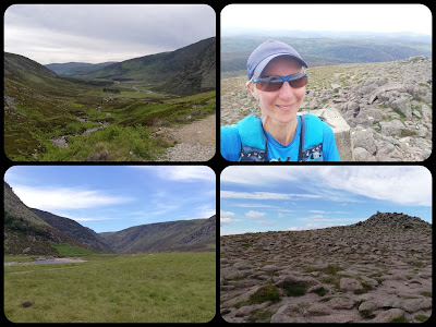
Thursday 17 June
The Sow of Atholl (803m), Sgairneach Mhor (991m), Beinn Udlamain (1011m) and A'Mharconaich (975m) (1 Corbett, 3 Munros, with the Corbett (by definition) and two of the Munros also being Marilyns)
Distance: 20.1km; Ascent: 1100m; Weather: Overcast but dry and not too breezy
What a fabulous outing!
Probably as a result of Sunday's hill (the one where I said "Come with me; it'll be lovely!" and it turned out to be a horrible trudge on awful terrain in the rain and inside a cloud), Mick was a bit dubious when I described this circuit to him last night and suggested we go and do it today. After a bit of late night research into where we were going to park Bertie, and a run through of the key stats of distance and ascent, he agreed to come along. It was the right decision.

Layby 79 on the northbound A9 is the nearest to the start/end point, but we opted for a slightly longer walk to use the next layby along, which is set back from the road. From there the plan had been to follow the cycle path for 4km or so, down to Dalnaspidal Lodge and approach our first hill (The Sow of Atholl) via the baggers' path on its more gentle south side. As Mick drove up the A9, I looked at the map and was wavering on that plan. It only took a glance at the north side of the hill to convince me that my newly formed plan was the one to follow: we were going to head up the steeper north side, as surely the effort of the steep, pathless climb would be less than the extra distance to get around to the other side.
Fortune was on our side today. As we walked along the track that runs through the glen, we could see firstly that there was a bridge over the river, but also there was a surfaced track leading part way to our hill, followed by the line of an ATV track. The final reaches before the ATV track terminated looked, from a distance, like some sort of experiment as to how steep one can take an ATV.
The ATV track gave us easier going than would otherwise have been the case, as it led past a series of well-crafted shooting butts.Fifty vertical metres of the ascent beyond the end of the track was so steep that the map makers had only managed to fit two intermediate lines between the 50m contours, and the rest was hardly a stroll in the park either, but once we'd heaved ourselves up to the top of this Corbett we knew that the hardest work of our day was done. The subsequent round of three Munros wouldn't involve any climb so big, nor so steep, and we were sure they would all involve trodden lines too (which they did).
 |
On Sow of Atholl summit looking
|
at the rest of our routeElevenses was had in the lee of a wooden-fence-panel style shooting butt just before we started the real ascent of Sgairneach Mhor. From there (and for the day in general) the views to the naked eye were pretty good (not great air clarity, but lots of lumps and bumps were to be seen stretching off into the distance). Unfortunately the photos don't do those views justice.
Elevenses view
Not much snow lingering around here Another ATV track then took us the whole way up that next hill, where we found a Munro-bagger from Edinburgh called Ross sitting in the lee of the shelter. We joined him for our first lunch, before continuing on to Beinn Udlamain. The descent between these two hills was a springy, grassy joy to walk and the reascent on the other side was easy going too, with just a couple of hundred metres (on a trodden line) to be gained.
Second lunch was had in the shelter on that summit, during which we had a brief chat with two women who were in another section of the shelter, and also with Ross who joined us for his own second lunch just a few minutes later.
We could justifiably have omitted A'Mharconaich from our day, as I'm not specifically collecting Munros, and with just 120m of prominence, this top isn't a Marilyn. However, the fact of the lack of prominence, combined with the gentle gradient, meant it would have been silly not to nip up it, even though doing so then required a small backtrack to find a reasonable (i.e. not dangerously steep & not covered in scree) descent route.
Conservation work (presumably) atop A'Mharconaich
The downward line we chose worked well and regaining the track in the glen it was just a few easy kilometres back to Bertie.
The temperature on the tops had been cool (the forecast said 6 degrees), but the winds had been light and the forecast showers amounted to about 3 minutes of light rain soon after setting out. Admittedly, the views would have been better under glorious blue skies, but we were happy to have had a high cloud base and benign conditions. Even better, we both managed the entire outing without once sinking a foot into a bog. A triumph!


