The main objective of this trip was to bag what I refer to as the Gaick Corbetts. It was the same objective as I had when I set out from Dalwhinnie last October on the trip that met a sudden and unexpected end, but this time I was taking a different route from Dalwhinnie, was going to do the Corbetts and evening/morning excursions (rather than a whole-day circuit) and was then going to head NE for another Corbett before dropping down into Glen Feshie.


At the point where it felt like lunchtime, I started looking around for a rock to sit on, but by then there were none in the immediate vicinity. With the sky turning grey and the wind picking up, I didn’t want to go much higher before pausing, so when I saw a likely rock about 50m off the track, I yomped across to it. It promised more from a distance than it delivered; I found myself uncomfortably perched, rather than seated and it was a short break. Rejoining the track I’d only gone a couple of hundred more metres when the perfect bench of a rock appeared right on the track. Hey ho.

Easy walking across the top. Excuse my face in the way; for reasons I can’t recall I decided to send Mick a selfie from here.
On paper I’d assessed this as a harder route than the one I’d taken last time, but in reality it was easier, with the terrain linking the track and the stalker’s path to the SE being much friendlier and less peat-haggy than the ground linking the two stalkers’ paths just 3km to the NE. I did, however, make one error of judgement (with the benefit of hindsight).
When I reached this delightful burn…

…it seemed to me that walking down it would be a nicer option than ascending the other side of the burn and yomping across rough ground to pick up the stalkers’ path. That was true in its upper reaches but then I met a series of small waterfalls, only the first of which was easily bypassed, and then the burn was suddenly running much deeper through steep terrain than I’d perceived from the contour lines.

An ankle-stressing contouring activity took me over to the stalkers’ path I'd originally intended to use – another of those paths that is long out of regular use, but perfectly followable as long as you pay close attention and don’t overshoot a switchback.
Lower down the path turns E to a bridge, which wasn’t the direction I wanted to go until the morrow, so I veered off and headed for where it looked like I would find a good pitch for the tent.

When Bertie was getting lashed by the rain at Shap last week, I assume these burns were in spate, as the grass alongside was still flattened by recent flooding. However, the water was now low and there was no significant rain forecast, so I was happy to pitch where water had obviously recently rushed.


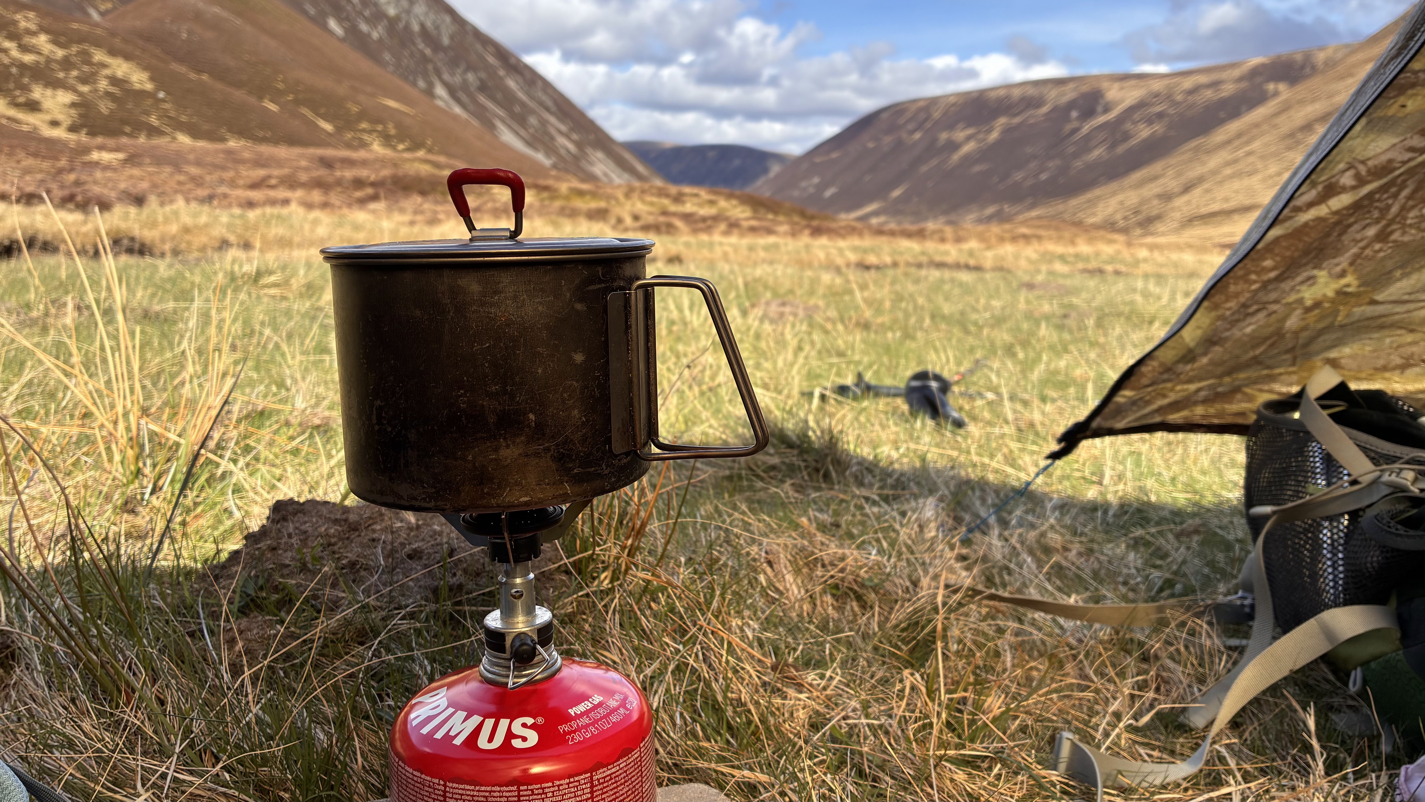
With everything set up in the tent, I took just the essentials for my late afternoon out-and-back jaunt up An Dun.

I got to the 827m spot height, which I’d expected to be the summit, to see that the ground 6/700m to the S looked higher. A quick check of hill-bagging.co.uk told me that was indeed the case, but it was an easy stroll to get there. As Marilyns/Corbetts go, I found it a disappointing viewpoint, being such a broad summit the views from the ‘top’ weren’t as good as I’ve come to expect from such hills (by ‘top’ I mean that patch of ground that’s 3cm higher than everywhere else, which happened to be somewhere in the middle of the width of the plateau). The views from the edges were, however, superb:

An hour and three quarters after leaving, I was back at the tent, ready to settle down for a less eventful night than last time I tried camping hereabouts!
No comments:
Post a Comment