
Ali (upon whose hospitality we prevail when staying in Newtonmore) was in the market for an 8-hour hilly walk this week, and mentioned Braeriach as one of her options. I’d never been up Braeriach, so I grabbed the chance to go with her.
The chosen day happened to be by far the hottest and sunniest since we arrived in Scotland, hitting 22 degrees in the afternoon. I generally do okay in the heat, but Ali’s not such a fan. Fortunately, neither of us mind an early start – although I suppose that by some standards it wasn’t that early by the time we’d driven to Coylumbridge and set out a few minutes before 8am.
Conditions were decidedly chilly as we made our way through the shade of Rothiemurchus Forest and over the Cairngorm Club Footbridge, but as we climbed towards the top edge of the forest I was finally able to remove windshirt and fleece. By the time we were at the not-quite-crossroads where the turns to Lurcher’s Crag & Braeriach leave the Lairig Ghru, I was toasty (and we encountered a cloud of midges - at altitude in April!!).
That junction used to be a crossroads, but now an engineered path, featuring lots of stone steps, has been built, leaving the Lairig Ghru path about 50m further on from the old, horribly eroded path. That engineered path continues to around 950m, making a reasonably steep ascent easier than it would previously have been.
Just before the engineered path ran out, we adjudged that for Ali to hit her 8-hour walk target, and for me to hit my summit target, I needed to shuffle on ahead. Some calculations allayed my concerns that, with an extra 8km and around 500m of ascent, I wouldn’t be able to catch back up, so off I went.
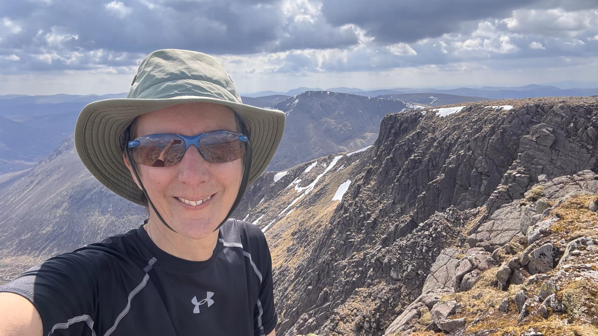
When Mick & I drove up the A9 a couple of weeks ago, we exclaimed on our first sight of big hills at how little snow there was. I’d thought there would still be some significant cornices in the Cairngorms, at 1200-1300m, but no, there’s a shocking lack of snow for the time of year.


Considering the superb weather, I was surprised at how few people were out on this hill, although, granted, it’s not the most accessible Munro in the area. A chap had passed us on the upper reaches of the engineered path, then I passed him on my way to Sron na Lairige (and again on my way down), soon after which I passed a Dutch backpacker. Other than a chap on the summit (who was camping at Derry Lodge and enjoying an unburdened day-walk), they were the only people I met until a few steps before rejoining the Lairig Ghru path.
I sat on the summit for a few minutes, having a bit of a shoe faff and liberating a sandwich for consumption on my way down, then started retracing my steps, soon realising that I had also intended to top up my water bottles (from a bladder I had in my pack) at the summit. I had to stop to do that, with water that was, by then, unpleasantly warm, having spent a few hours against my back.
There was a surprising amount of ascent on my retracing of steps (which shouldn't have been a surprise, if I'd been paying attention on the outward leg, or if I'd paid more attention to the map), and elsewhere I found the bouldery sections slower in descent than I had in ascent. Already fearing that I was being too slow and would be keeping Ali waiting, I was yet to get back to the stone steps of the engineered path.
As we’d toiled up there earlier I’d thought that it would make for a slow and arduous descent surface. I
couldn’t have been more wrong; I flew down there, reaching our rendezvous spot
just ten minutes after Ali. Liberating a second sandwich from my pack, we were
soon back on our way.
I ran out of water somewhere in the final 5km, and it didn’t seem worth stopping to filter some when we were so near to the car, where I had a cup of (cold) tea waiting for me. I probably should have taken the trouble as, on reflection, I really was quite dehydrated (i.e. I spent most of yesterday with what I can only describe as a hangover).


Climbing out of the Lairig Ghru


Rejoining the Lairig Ghru path at the end
That's a proper mountain and a good route. It reads as though there are more of those engineered paths nowadays since I did this ascent. Did Ali just wait for you while you went to the summit? I like the photo of you, on the summit I guess. I climbed this one From Glenmore via the via Chalamain Gap and Lairig Ghru, 22nd. November 2003. A long hard day I remember.
ReplyDelete