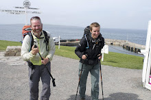
The Road goes ever on and on; Down from the door where it began;
Now far ahead the Road has gone; And I must follow, if I can;
Pursuing it with eager feet; Until it joins some larger way;
Where many paths and errands met; And whither then? I cannot say.

[JRR Tolkien, Lord of the Rings]

Tuesday, 18 June 2013

TGO Challenge 2013 (Part 3: Glen Feshie to North Water Bridge)

Following swiftly on from Part 2, here we go with Part 3, which starts with:

Day 7

After so much greyness and low cloud, it was a delight to wake up on Thursday morning to find wall-to-wall blue skies outside. I took this snap just as soon as we were out in the open, by which time some wisps were appearing. I feared that they heralded the onset of yet more greyness and I wasn’t wrong – but for the first part of the morning we enjoyed the blue skies (even if we were often in the shade of the valley).Day 7_1

I hadn’t realised what a poor picture this next one was, but it does serve to show that there was quite a bit of water in the waterfall which lies just about where our path was to leave the side of the River Feshie (which swings right around on itself at this point) and head over to pick up the Geldie Burn.

Day 7_2

As you can see, it was well and truly cloudy again by this point, and I can’t say that I was overly enamoured with the track that leads alongside the Geldie. The surroundings were perfectly pleasant, but they weren’t stunning (although I’m sure they’d look better under a blue sky!) and that track seemed to go on for ever.

Day 7_3

That night, our dining facilities were somewhat more grand than usual, as four of us sat down for dinner in the huge dining room at Mar Lodge:

Day 7_4

We did have a feeling of being watched…

Day 7_5

As Terry Pratchett would observe, those deer must have hit that wall at a hell of a speed.

Day 8 (and Rest Day)

On Day 8 we walked all the way from Mar Lodge to Braemar, taking the short scenic route (in preference to a road walk). Being shy of 5 miles, it couldn’t be considered a taxing day!

Arriving in Braemar there weren’t many already there so we had our pick of the pitches. We took a lot of time and care picking our pitch … but somehow completely failed to notice that the place we picked was in a dip. Maybe it was because we were meant to be walking out the next day and it wasn’t due to rain in that time. As it went, Mick awoke with a cold the next morning, so we stayed put. It rained very heavily and persistently on Saturday afternoon – the sort of rain where you say “I’m glad we’re not out walking in this”, so our decision to stay put was a good one, but the rain also served to prove that our pitch choice had been a bad one. By Saturday evening our tent was notable for being the one with a moat. Alas, the moat extended into the porch and under the groundsheet and hence at 8.30 on Saturday night we picked Vera up and carried her to a higher position.

Day 8_1 (2)

Day 9

Walking through Ballochbuie Forest, we had just bumped into Lindy, and were walking along, chatting about her backpack, when I saw something in the puddle at my feet:

Day 9_1

It had been quite warm walking through the forest, but it got cooler as we ascended into the cloud (which for me also served to skew any sense of distance and direction). We knew that there was a stunning view of Lochnagar over to our right at about the point where the next photo was taken, but on this day we saw nothing until we reached the top of the track, whereupon there was the tiniest glimpse of brightness.

Day 9_2

It turned out not to be just a little random hole in the cloud, but it heralded the start of a gorgeous afternoon. By the time we stopped for lunch at the picnic benches in Glen Muick we were basking – which continued as we made our way up to Shielin of Mark bothy.

Day 9_3

You may have noticed that snow featured on the track below Lochnagar, but that was nothing to the size of the bank that we encountered later:

Day 9_4

Somewhere in the vicinity of Shielin of Mark bothy was our intended night-stop and we stuck with the plan. We were a little anti-social, in that we sought a bit of not-quite-so-tussocky ground (the area around the bothy is no bowling green!), which led us up onto an island in the river a hundred yards or so upstream. It wasn’t a bad pitch (it wasn’t the fault of the pitch itself that we spent the night inside of the cloud which descended as night fell):

Day 9_5

Day 10

We didn’t take any photos on our way up and over Muckle Cairn, but then there wasn’t much to see, being enveloped in cloud as we were. The cloud had lifted by the time we got down to Stables of Lee (the group who spent the night there woke up bathed in sunshine. Grrr!). I remember taking the snap below purely because I was aware that I hadn’t taken any photos all morning:

Day 10_1

See that bench below? I took that photo about five paces from the extraordinarily uncomfortable rocks upon which we had perched for second breakfast. Obviously, I wish I’d noticed it before choosing where to stop for second breakfast!

Day 10_2

Judging by this one, it was a warm day, even if it was cloudy. Sun hat on and sleeves rolled up – that doesn’t happen just every day, you know.

Day 10_3

Oh, and Mick’s hand! He had taken a nasty fall the day before and his hand was still in the process of swelling when we reached Tarfside.

Day 10_4

Just for comparison purposes, this is how his hand looks today, now that it’s all better:

IMG_5407

Day 11

Oh dear. We really had forgotten that the cameras existed by now. Not a single photo worth sharing from the whole of Day 11, except for this ridiculous one of me at the campsite at North Water Bridge:

Day 10_5

I haven’t quite perfected the dance style that Andy Howell demonstrated on last year’s Challenge (I still titter every time I see this one!):

IMG_2242

So, we’re nearly at the coast. In fact, so close that if I had another ten minutes at my disposal right now then I would pop the other pictures in right here. As I’m lacking those ten minutes, I’ll just have to string this photo series out for one more post.

Click here for Part 4 of the Photos

Monday, 17 June 2013

TGO Challenge 2013 Photos (Part 2: Mamore Lodge to Glen Feshie)

Following on from Part 1, here we have Part 2 (you can tell that I’m going to be quite predictable in the numbering sequence of this series, but the whole purpose of that statement was really so that I could add a link back to Part 1).

Day 4

I hadn’t noticed anything odd in the sound of the rain that fell on Sunday night, so it was a surprise, when I stuck my head out of the tent on Monday morning to find that the hills had a good covering of snow (admittedly, this photo makes it look more like a dusting than a covering, but it was far more than just a dusting):

Day 4_3

The first part of the day was easy as we followed the track alongside Loch Eilde Mor and onwards towards Luibeilt. By the time stamp on the photo and the building in the background I’m deducing that this photo was taken just before we turned off that track. The blob in between Mick’s head and the snow line is Meannach bothy (which may only have one ‘n’ but the map isn’t helpful on the subject as the name on the map has far more letters than the official name of the bothy).

Day 4_4

I didn’t take many photos of the next four miles of ridiculously boggy yomping. Much of the reason for that was the inclemency of the weather, as snowy squalls kept blowing through. I did snap this one when Staoineag bothy came into view, but it’s so poor that I can only make out the bothy because I know that it’s there:

IMG_5313

It would have been good if we had arrived at the bothy ten minutes sooner, before the most violent and long-lived squall of the morning hit us, and we sat inside for a good half an hour waiting for it to let up, just so Mick could go and get some water for tea. Eventually tea was drunk and lunch eaten and it proved to be a good long break. The sun came out just before we left. Alas, it was short-lived and by the time we set out again it was snowing again.

There is a path leading down to Loch Treig, but it was awfully waterlogged on this day. The heaviest snow of the day fell as we left Loch Treig. On and on and on it went with some violence, adding even more to those white tops.

day 4_5

The length of Loch Ossian was thoroughly unexciting, although the ‘lodge’ at the north end was noteworthy, and exactly per our plan (well, the revised plan – the original plan would have seen us spending the night at Staoineag bothy) we stopped as soon after Loch Ossian as a pitch presented itself. It was rather a nice pitch too, even if the Uisge Labhair was absolutely roaring. Oooh, look – blue sky too! (Didn’t last long, mind!)

Day 4_6

Day 5

Another day, another damp, grey start. It was a deceptively strenuous start to the day as we yomped through more bogginess:

Day 5_1

Then we reached the path up to Bealach Dubh and it was a delight of a path! And the cloud was lifting and giving us sight of some tops. And I don’t think we’d even been rained on either!

Day 5_2

Down the other side of the path there was some slip-slidy snow covering the path, soon after which we found a cold chap blocking our way:

Day 5_3

The day was still reasonably fair as we arrived at Culra Lodge bothy. We’ve camped nearby before, but this was the first time we’ve been in. There are three rooms, all accessed from outside (and not interconnected inside) and picking a door at random we found ourselves joining Adrian (the maker of the snowman, who had camped by us the previous night (Adrian, not the snowman…)) inside.

Day 5_4

The day then got better and better from a weather point of view. Sunhats came out and jackets came off, so it was a shame really that we were just marching along the track alongside Loch Ericht. Our vetter had suggested that we should go over The Fara, and if it hadn’t been for my wrist and my knee, that’s exactly what we would have done. For reasons unknown, neither of us took a snap of Loch Ericht in the sunshine, so I’ll use this one of the gatehouse to Ben Alder Lodge to demonstrate the gloriousness of the sky:

Day 5_5

Day 6

Let’s start Day 6 with 3 ridiculous photos of me!

Taking advantage of our room at Dalwhinnie Bunkhouse being big enough to swing my arms around, and whilst waiting for the weather forecast to come on the telly, I had a quick look to see whether I could find the hole in my dry bag. Mick thought it was a good photo opportunity.

Day 6_1

Is it my imagination, or is the female breakfast presenter looking a bit incredulous at what I’m doing?

The walk along the aqueduct as we headed out of Dalwhinnie towards Loch Cuaich seemed very familiar. Aside from the fact that it was cold, damp and grey, I felt like I could have been in California, so I adopted a silly pose for photo-comparison purposes…

Day 6_2

…alas, it wasn’t quite the right silly pose, but spot the similarities with our walk along the Los Angeles aqueduct, as we entered the Mojave plain on last June’s jaunt on the PCT:

IMG_2300

Back to Scotland in May and on the spur of the moment, as we ate second breakfast, we decided to go up Meall Chuaich. Here’s the view back towards Loch Ericht and the Ben Alder range. Stunning! Best bit of the whole Challenge, in my opinion.

Day 6_3

And here’s Mick heading towards the summit cairn. We completely failed to take a summit photo, or indeed any piccies of the view from the summit.

Day 6_4

A couple or so hours later, we took our lives into our hands as we crossed a bridge at our own risk (albeit the sign wouldn’t have carried much legal weight if we had come a cropper, being sited at far end of the bridge):

day 6_5

Usually we see such signs attached to rickety bridges. This one was about as solid as they come (and it’s not at an angle, it was me that was at the angle):

Day 6_6

A wee while later we were supposed to be leaving the track we were following in favour of a path. The path didn’t exist, but we could see a definite line further up the hill, so up through the heather we huffed, puffed and bashed, as it was quite clearly a track. It was a lovely old track, being reclaimed by nature, with the only problem with it being that it was about 70m higher than we were supposed to be. That wouldn’t have been an issue, if it hadn’t been for the track suddenly ending just a few hundred yards after we joined it. We spent the next couple or three miles yomping through heather with our ankles at an uncomfortable angle. On the bright side, it was a lot drier up there than it would have been down by the burn:

Day 6_7

We didn’t completely escape bogginess. In fact, we ended up wading through considerable quantities of bog as we crossed a valley to join a track. After the first little while, the track was dry underfoot, which was the cue for the first shower of the day. I didn’t don overtrousers, convinced that it would pass within minutes. I was wrong. Twenty minutes later I was sufficiently wet to think that there was no longer any point in digging out my waterproofs. By the time we reached our intended night-stop the rain had stopped and walking on seemed like a good idea for a number of reasons, one of which was so that I could dry out before we camped.

Our second intended night-stop was on the near bank of the Feshie, but when we got there we thought we may as well cross as not, so that’s exactly what we did. My trousers had dried by this point, but the lower legs didn’t stay that way:

Day 6_8

And then a meal was made about finding a pitch. At the time it felt like we were ‘settling’ rather than having found something desirable, but actually, it wasn’t a bad spot at all:

Day 6_9

Click here for Part 3 of the Photos

Sunday, 16 June 2013

TGO Challenge 2013 Photos (Part 1: Acharacle to Mamore Lodge)

Having finally downloaded and looked through the photos from this year’s walk across Scotland, I thought that I would post some of them. I’ll do it in a few parts, and here’s Part 1, covering the first three days.

Day 0

Here’s a photo from the day before, taken from the window of our room in the hotel at Acharacle, as the sun went down. It was looking promising for the fine forecast for the following day to hold true.

Day 0

Day 1

Yay! The same view-from-the-window as taken the night before, with plenty of blue sky in evidence.

Day 1_1

About an hour and a quarter through the day, walking through a forest, our main objective for the first day, Beinn Resipol, came firmly into view. What happened to that lovely fine weather? I clutched at the straw that the cloud would lift before we got to the top. My optimism was severely misplaced!

Day 1_2

Fifteen minutes later, we said goodbye to easy walking on a good surface, as we set off to yomp through a boggy, tussocky break in the forest:

Day 1_3

The yomping saw us cover a mile and a half and involved a few deer fences (only one of which required a clamber), before we joined the baggers’ path which leads up to Beinn Resipol. That’s Adrian behind me, and Kirsten was ahead of us, having all arrived at the same point on the path within a minute of each other, even though different routes were taken to get there.

Day 1_4

Harrumph! So much for the cloud lifting. Not only had it descended further, but by now it was raining steadily too.

Day 1_5

After a quick (and soggy) lunch break, we made it to the top of the hill. We stayed up on the top for all of, oooh, 30 seconds, before legging it eastwards. It wasn’t an inviting place to be and I’d lost the feeling in my fingers and toes (soon restored as we got out of the wind on the very top).

Day 1_6

No doubt as a side-effect of the weather, not a single photo was taken on the seemingly-endless descent. The next time the camera made it out of the bag was when I thought about how ridiculous we must look as we all tried to dry our trousers in front of the wood-burner in the tea-room/restaurant at Ariundle.

Day 1_7

Even though we were lucky, and the rain let up for a few minutes whilst we pitched the tent (by luck, not judgement!), we completely failed to take a photo of our first of three consecutive ‘back garden’ pitches.

Day 2

It was another grey day as we headed up the River Strontian. Bit damp underfoot too, but when we’d opted to go via Glen Gour, we had known that would be the case (I had commented on the dampness in 2011, when we walked this route in the opposite direction, after 6 weeks of dry weather).

Day 2_1

We hadn’t gone very far when we got to rather a swollen side-stream. It didn’t bode well for the rest of the day, but it turned out that this was the only significant wade of the day (that’s Kirsten up to her knees, whilst I await my turn).

Day 2_2

See all of that waterlogged ground? It wasn’t a localised thing! Thank goodness the weather was quite warm, and thus it was no hardship to spend the day sploshing!

Day 2_3

There is then a huge gap in the photos. The sunny photo I took of Mick, Laura and Kirsten eating ice cream outside of the shop at Clovullin was on my phone and the next time my camera made an appearance was after we had crossed on the Corran Ferry and headed up through the forest above Inchree. We took the route I’d marked on the map, rather than the route we’d taken previously, and it was a good choice. Aside from being a path (the alternative was a forest track), it took us past some impressive waterfalls.

Day 2_4

Finally, we pitched up in the back garden of the empty farmhouse Gleann Seileach, thus continuing our accidental theme of pitching in back gardens! It was clearly raining further up the glen (the rainbow being a bit of a give-away), but I think that we escaped that particular shower.

Day 2_5

Day 3

A gentle 1-mile stroll along a forest track warmed us up for the day. Then we got down to business and took a brutal route to head out of the forest and towards Leac Mhor.

Day 3_1

Phew! The stile in the deer fence was exactly where we thought it was. Kirsten’s not fond of stiles over deer fences, and I struggled with this one (they’re not easy to climb one-handed and at this point my right hand was pretty useless to me).

Day 3_2

Up onto the open hill, it was another tussocky yomp:

Day 3_3

It was obviously the day for taking brutal lines up hills:

Day 3_4

Another big gap in the photos then occurred, with the next one being a couple of miles later, atop Mam na Gualainn (hmmm, no views from up there!). We nearly didn’t go up there, as my knee had been quite sore coming down from Tom Mheadhoin, but I really wanted to go up Beinn na Caillich and the only way that was going to happen was if we went over Mam na Gualainn first, so I opted to talk very nicely to the knee and hope that I wasn’t going to cause it any great mischief during the descent.

Day 3_5

As we stopped for lunch in the dip between Mam na Gualainn and Beinn na Caillich, the cloud drifted away (rain continued to fall, mind!) and we thought maybe we would enjoy some views on our way up. It wasn’t to be. The cloud was soon back down and even though we could appreciate what a lovely ridge it is, we saw absolutely bugger all!

Day 3_6

Finally, this isn’t technically a Day 3 photo, as it was taken on the morning of Day 4 (it was raining too much to consider leaving the tent to take a photo on the evening of Day 3, but there was no snow on the hills at that point). It doesn’t look too a bad pitch from that direction, does it, even if the wind did dictate that we couldn’t have the view of Loch Leven?

Day 4_1

The view from the other direction isn’t so pretty, but when we pitched there I was just happy to get the tent up and get out of the rain. That big tree in the left of the photo was particularly important – it meant that we were hidden from view should anyone come into the car park (not that anyone did, to the best of our knowledge).

Day 4_2

Click here for Part 2 of the Photos

Tuesday, 11 June 2013

TGOC 2014: I Have a Cunning (/Mad) Plan!

IMG_5324

I finally downloaded this year’s photos. This was a good pitch! And the blue sky belies the squally/snowy weather which had prevailed for much of the day.

Until now, I have never planned a TGO Challenge route until our entry has been made and our place secured. This year, perhaps as an antidote to my grumpiness when we arrived home, I started plotting almost the minute we walked through the door. At the time I was unsure that the route I was planning would become a Challenge route, but not only am I now certain that our application will be duly lodged in September, but I’m also very happy with the route I’ve plotted and positively looking forward to walking it.

One of my main reservations about the intended route was that it goes completely against my view of the Challenge as a social event. Starting in Torridon, ending in Fraserburgh, and staying as far north as the Challenge area permits, it’s pretty unlikely that we will meet any other Challengers after Day 2. Then I came up with a cunning/mad/genius (delete as you see fit) plan.

Putting the details of my plotted route into a spread sheet, I concluded that we could walk it in 10 days, with us arriving in Fraserburgh early on the Sunday at the start of the second week.

Having finished our Challenge so early, we will then be at leisure to get public transport down to Edzell, from where we can wander up to Tarfside, in time for the peak of people passing through, to join in with the Challenge chat and socialising that we will have missed out on during our Challenge proper.

That will still leave us a couple of days to spare before the usual festivities in Montrose, so we will fill those with walking out to the coast for the second time, hopefully getting to chat with a goodly number of people on the way.

So, we get to walk the route that I really want to walk, and we get to socialise with other Challengers for four days afterwards. Cunning, mad or genius? I don’t much care – it’s a plan that works for me.

Wednesday, 5 June 2013

Why I Didn’t Much Enjoy The TGOC 2013

IMG_2170

Be warned, this is a grumpy, maudlin post

Mick & I have now walked the breadth of Scotland five times and its length twice. Of all of those walks, the TGOC this year was by far my least favourite. Even a couple of weeks after the event, the rose-tinted glasses haven’t hit (in fact, such is my lack of enthusiasm, that I haven’t even looked at the photos yet, never mind downloaded them). I’ve now had a while to contemplate what was awry with this year’s walk and my opinions haven’t changed from those I expressed at the end of the walk. I can pinpoint two key reasons that muted the experience for me this year:

  1. I hurt my wrist on Day 1 and spent the next few days in a lot of pain and the rest of the time just in pain. It still seems incongruous to me that a poorly wrist can have such an effect on a walking trip, but it affected all sorts of things, from being wrong-footed in crossing streams with only my left walking pole, to not being able to lift my own pack onto my back to not even being able to dig my own holes.
  2. Whilst the weather wasn’t ostensibly bad, Mick hit the nail on its head when he described it as ‘dreary’. After we got over the first four days (Days 1 and 3 were just plain wet whereas Day 4 was snowy), we had very little rain. The problem was that even when it was dry we spent too much time either in cloud or mist, and thus didn’t get to enjoy many views. For me, the whole joy of walking in Scotland is the surroundings and when I couldn’t see those surroundings it just added to the gloom created by Point 1 above.

IMG_2210

Not a photo from this year’s walk, but it may as well have been

There were a couple of other contributing factors too:

  • I started the Challenge with a woeful lack of fitness, which wasn’t helped by the challenging route I’d planned. Entirely my own fault on both counts.
  • As I see the Challenge as a social event, I like to go through sociable places and if we’re going to link the same places together more than once, then I feel obligated to plan a different route between them. The problem is that there was a reason I picked the route we originally walked between those places and, when I’m standing there on the ground, I realise that I don’t want to walk this year’s convoluted route, but the one that I planned the first time around. But then I feel like a failure and a fraud for not walking the route I said we’d take … and I’m still failing to come up with an answer to that conundrum.

At the end of Day 1 (when I was having a grump associated with a particularly low moment when I discovered that my sleeping bag had wet patches and my maps were sodden) I declared that I was never going to do the Challenge again. At that point, none of the above points were factors in that rash declaration, yet my opinion hadn’t changed remarkably by the time we reached Montrose.

Of course, I’d not been home for three hours before I started looking at maps again. I’ve outlined (and gained Mick’s approval for) another route across Scotland, which I’m just in the process of plotting. It’s a route that’s a bit different from what we’ve done before, and I’m particularly looking forward to walking it. The jury’s out as to whether it will be walked as part of the Challenge or not (but if I was a betting woman, I wouldn’t bet a pint against).