The Road goes ever on and on; Down from the door where it began;
Now far ahead the Road has gone; And I must follow, if I can;
Pursuing it with eager feet; Until it joins some larger way;
Where many paths and errands met; And whither then? I cannot say.

[JRR Tolkien, Lord of the Rings]

Sunday, 15 November 2009

Canoes On The Weir

There wasn’t a great deal of activity in the house today. A-C was only able to join us for 24 hours so last night was a Good Night Out with fantastic food and a small drop of wine. Today was allocated as a lazy day. That every single one of us managed to make it out of our pyjamas (albeit it was knocking on for 3pm when that occurred) was miracle enough. There was scant chance of there being any other activity.

There was, however, much gazing out at the weir, and we did observe that the water level had dropped and that the water was not quite so brown and angry.

Then a canoeist hove into view, followed by half a dozen more. Our interest was piqued and our attention captured for ten or fifteen minutes until their manoeuvres over the weir had been completed:

Canoe comes into view; a couple of passers-by stop to watch:

 IMG_0076a

Red canoe starts to toy with going over the weir:

 IMG_0078a

More passers-by have gathered (just to add the pressure for red-canoe-chap) and he makes a move over the weir:

 IMG_0079a

Manoeuvre successful, he looks rather pleased with himself:

IMG_0080a

(all photos taken whilst wearing pyjamas and slippers, from the balcony)

In momentary denial of how cold that water must be, we did want to go and have a go ourselves.

There are intentions to be a little more lively tomorrow, so there may (weather dependent) be photos of something other than the Teme.

The View From The Balcony (Take 2)

(I seem to be having a few technical difficulties; let's try that last post again and see if the photo appears this time)
 
Vic is the queen of choosing holiday accommodation.

The attached photo is the view from the balcony, of the horseshoe weir at Ludford Bridge.

Unsurprisingly, given the weather over the last couple of days, the river is high and very churned up and muddy.

Hopefully the weather will take a turn for the better (although our bags contain lots of Paramo items, in case it doesn’t) so it will be interesting to see how the view changes as the week goes on. I wonder if those trees are usually on the edge, rather than in the middle of, the water?

Saturday, 14 November 2009

The View From The Balcony

Vic is the queen of choosing holiday accommodation.

The attached photo is the view from the balcony, of the horseshoe weir at Ludford Bridge.

Ludlow

Unsurprisingly, given the weather over the last couple of days, the river is high and very churned up and muddy.

Hopefully the weather will take a turn for the better (although our bags contain lots of Paramo items, in case it doesn’t) so it will be interesting to see how the view changes as the week goes on. I wonder if those trees are usually on the edge, rather than in the middle of, the water?

Friday, 13 November 2009

Photos a-go-go

For those who didn’t read my last post, let me just repeat the important bit: we got a new camera this week. That’s no real excuse for posting quite as many photos as appear below, but today was its first proper outing and so I took an abnormally large number of snaps.

This was the exact same walk as I took last Friday, except that I was half an hour later setting off. Once again Mick dropped me off in the next village along, right by this bridge:

 IMG_0015a

I’ve walked past and over that bridge any number of times and yet had never before noticed that there’s a big weir on the upstream side of it (probably because the pavement is on the other side, so I always look over the downstream side).

The view on the downstream side made me remember that it had rained a lot in the night. It’s not usually this high (nor so muddy):

IMG_0016a

Green lanes and enclosed paths followed for a while:

 IMG_0017a

IMG_0018a

Across the first of the open fields I had my first dog incident. Having charged at me it turned out to be friendly enough.

The next field used to house a ‘watering hole’ where I have often seen a herd of cows wallowing. This year it seems to have turned into a bit of a puddle and is rapidly reverting to being just a sunken part of the field.

 IMG_0019a

Sheep were encountered (non-killer variety):

 IMG_0024a

And then I was into a section of National Forest plantation, where I had my next dog encounter. Much to its owner’s embarrassment it ran up to me repeatedly to place its muddy paws on my trousers (it was too small to reach my jacket); even I couldn’t categorise this one as a killer.

The large man-made lake here seems also be filling in and now it looks more like a marsh than a lake, but I’m sure that it’s still a friendly place for much wildlife.
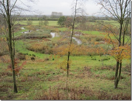
 IMG_0027a

The viewing platform was less friendly; those planks were mightily slippery in today’s damp conditions

 IMG_0028a

Onto crop fields and the path was the cause of much slipping and sliding. I reached the roadway with half a field’s worth of mud adorning my shoes.

 IMG_0030a

But first there was a real sense of deja vu when I had an exact repetition of last week’s dog-running-at-me-at-full-tilt incident (same dog, at the same point in its walk, with me at the same point in my walk, ran around me and barked, then left at the same speed with which it had arrived):

 IMG_0033a

A four-ball on the first tee caused me to pause part way across the golf course and whilst paused I looked over to the club house. Funny that I’ve walked past it so many times and yet somehow never really noticed it. I suppose I’m usually more interested in the golf course itself (particularly if there are any balls flying around)
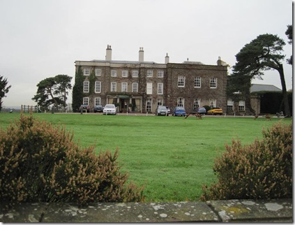
 IMG_0038a

Approaching the river/canal junction my eyes were once again drawn to this building. Every time I walk past I wonder what its history is

 IMG_0046a

Once at the canal/river junction there is a sign warning craft not to venture over the tall weir between the canal and the river

  IMG_0052a

And just to be sure there’s a barrier to prevent incidents involving people who haven’t read the sign. Until late last year that barrier was in a much worse state of repair, and during its disrepair period we did witness a narrow boat in quite a pickle there (but I was too polite at the time to take a photo of their panic and predicament)

 IMG_0050a

Mallard are starting to pair off again, but some fussy females are keeping their options open
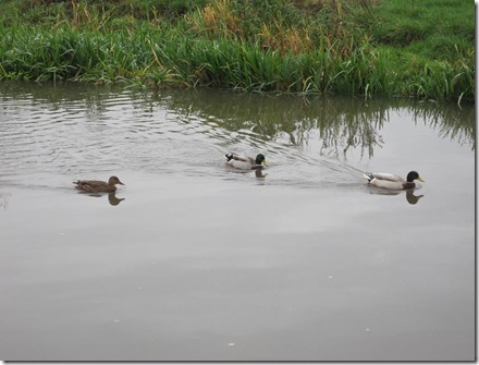
IMG_0054a

The Navigation Warning System on the lock before the river section shows that conditions are just about qualifying as ‘normal’.

 IMG_0058a

I’m sure that it will only be a short while before the ‘open as normal’ becomes ‘proceed with caution’ for much of the winter, with occasional closures (at which times the lock gates will be chained shut).

 IMG_0063a

The next mile of the canal would be nicer save for being immediately adjacent to the A38. The volume of my audiobook had to be pumped up at this point to be heard over the traffic.

This sizable residence across the other side of the road looks to be falling into disrepair

IMG_0059a

Hardly surprising when you consider the usual traffic conditions right outside of the front door

 IMG_0060a

With attention back on the canal, here’s a better version of the bridge-bridge-lock combo that I snapped with the Blackberry last week

 IMG_0061a

Last pic of the day (sigh of relief all around). Much smoke coming out of chimneys along a residential section just before I left the canal, walked up the roads, past the ponds and called Mick to beg for a lift the rest of the way home.

  IMG_0064a

Unsurprisingly the route was still 7 miles long and still featured a negligible amount of ascent. As you may have noticed the day was grey, but the rain was good enough to hold off until I got home.

Camera Troubles

At the beginning of September, at a critical moment whilst standing atop a model of a section of Hadrian’s Wall at Vindolanda, our camera’s auto-focus ceased to focus. For a couple more days it was a bit hit or miss as to whether it would play along, or whether it would whir away before coming up with a nasty blue error screen. Then it died completely.

That was disappointing indeed. I can’t say that I thought much of the picture quality that it produced, but we had only had it for 20 months and I was a long way from ready to fork out for a new one.

As much as I wasn’t impressed by the Olympus mju700 it has four benefits: 1) at 104g it’s very light (the main basis upon which I originally bought it); 2) it’s weatherproof; 3) I already own spare batteries for it; and 4) I already have the right memory cards for it. Buying a new camera would likely result in something heavier, not weatherproof, and it seemed highly unlikely that the chosen model would require the same battery or memory card.

The happy solution seemed to be to take the ‘spare camera’, which we inherited, out of the drawer and use that instead. Much chunkier and less user friendly it may have been, but it took decent snaps.

Alas, on its first outing, on Dartmoor, we came to the conclusion that the battery indicator is dicky. Sometimes it’s happy that the brand-new lithium batteries are good. Sometimes it’s convinced that they’re dead and switches off. Sometimes it takes one photo in the belief that the batteries are good, then switches itself off. Switch it back on and it may be fine again for a few more shots or it may randomly decide that it’s powerless. Add that fault to the bulk (it won’t fit in my hipbelt pocket) and it didn’t take long for me to become resigned to getting a new camera.

As much as it rankled to settle for poor picture quality again, if I could have picked up another Olympus mju700 at a reasonable price then I would have, because for my level of snap-shots the plus-points outweigh the major drawback. But I couldn’t pick one up at a price that justified that decision, so it was back to the drawing board.

The new camera arrived last Monday (Canon Ixus 95IS). My initial test shots that afternoon, around the River Crane and the outside of Twickenham Stadium, in failing light, were highly uninspiring. So when I popped out for a walk this morning I took an abnormally large number of photos.

See next post…


Monday, 9 November 2009

Shuffling Around The Block

As I set out along the track just up the road from the house this morning, I regretted not having a camera on me – not even the one on my phone. The fields were hoary, with the early fog just starting to burn off on what was setting itself up to be a glorious day. One field in particular looked particularly fine in its whiteness, and my immediate thought was to get a photo of it, but even upon realising my lack of equipment I wasn’t moved to return home to pick up a camera.

My attention was soon drawn instead to the other side of the track and, more specifically, to the most enormous bull in the field there. There is seldom a fence between that field and the one across which I was about to walk (when there is it’s a temporary electric one), and from where I was standing I could see no cows to keep the bull distracted.

There did turn out to be cows, and they did follow me, eventually breaking into a trot (the cows, not me; surprisingly I remained calm even when the trotting caught the bulls attention and he started making his way over for a look too). By then I was almost at the next gate and over its icy bars I vaulted (not out of haste, just because I know that this gate doesn’t open).

The track which I cleared of overgrowth back in February, and found out in August was practically impassable again, has benefitted from the autumn. The undergrowth has died back a little and so I was able to pick my way along without being slapped about the face or grabbed or tripped by spiky things.

There was an unusual amount of livestock on my route today (this being my bog-standard ‘shuffle around the block’ route), but fortunately the only other cows were completely uninterested in my presence as I slip-slid my way through the churned up muddiness of their field. The only other animal incident of the walk was another dog which bounded over to place it’s muddy paws on my jacket (why is it that since I stopped shrieking and hiding behind the nearest tree/person every time I see a dog they take it that I’m the friendliest person in the world and want to jump up me?!)

I would likely have walked an extra mile and a half, returning home over more farmland, except that to do so would have required a repetition of the frisky-cow-and-bull-field (or alternatively a walk along a busy lane in dubious visibility), neither of which appealed, so I cut into the village to walk back home along the road. The road walk did at least give the opportunity to see how various building projects are progressing.

P1010001a

Random hoary photo from January this year;

it looked nothing like that today!


Saturday, 7 November 2009

Little Josh

Mick holding first-born Grandson for the first time:

 STA70134a

 STA70135a

He’s five days old now (Josh that is; Mick’s a tiny bit older!), and weighing in at over 10lb at birth, is a big lad for his age.

He was declared, before our arrival, to be the “most perfect baby in the world” and having met him, we are inclined to agree.

Congratulations go to Nick and Holli (the doting parents of whom we failed to take a photo with Josh – but hopefully they’ll send some through soon).

Friday, 6 November 2009

The Trent & Mersey

Having announced that I was taking myself out for a walk this morning, Mick asked where I was going. I gave the matter some thought and reeled off four options.

A while later, as I laced my shoes and put on my jacket, I still hadn’t made a decision but surprised myself by asking Mick whether he could give me a lift down the road to the next village. A fifth option had apparently popped into my head, which would have been dismissed for the certainty of being chased by three large horses. Getting a lift 3 miles down the road would avoid the horse situation.

As I set out into the gloom a few minutes later, it occurred to me that my concern about the horses had prevented me from thinking through the rest of the route and the fact that it often features cattle, sometimes of a troublesome nature. It also passes through some areas popular with dog walkers, so killer dogs were a further danger.

Just as these thoughts were in my mind, a dog suddenly started barking ferociously about three feet away from me. Having returned to land after leaping six feet in the air, I calmed myself as I realised that the killer beast was securely behind tall palings.

Minutes later I was looking to be doomed to be a nervous wreck when I heard hooves stampeding behind me. Looking over my shoulder I identified the source of the sound as four horses, and gave myself a good talking to as, being on a narrow green-lane, it should have been quite obvious that they were safely in an adjacent field.

It seemed inevitable after such a start that I would come face-to-face with the hugest bull known to man upon entering the first field.

Happily, all of the first set of fields were empty and even more happily all of the dilapidated and missing stiles have been replaced with sturdy new ones.

The 7 miles didn’t all pass off entirely smoothly. Although the only cows I encountered were so small as to be no threat at all, I did have not one but two dogs turn from their owners and stride out at top speed towards me. Both turned out to be less threatening than their approach suggested. The second one turned out to be very friendly indeed – so much so that it left a lovely muddy paw-print on the front of my bright orange jacket.

Anyway, enough words, here are a few (poor quality) snaps:

 IMG00176

Into the misty gloom

 IMG00177

Friendly cows

 IMG00178

Swans and ducks organising themselves by colour

IMG00179

I like this bridge-bridge-lock combination on the Trent & Mersey, but I’m sure that I’ve got better photos of it

IMG00181

IMG00180

The water in all of the local ponds was remarkably low

A Touch of Disappointment

P5120103Places on the TGO Challenge were announced earlier this week, followed swiftly by much comment around t’internet as people expressed their excitement at being selected or their disappointment at being on the stand-by list. As I read all the excited postings, I found myself (rather ridiculously) in the category of ‘mildly disappointed’.

That we didn’t get a ‘You’ve got a place!’ email wasn’t a surprise, really, given that we hadn’t entered. But, now that we’ve taken part and understand the attraction of the Challenge, there was a tinge of sadness that we had chosen not to join in the fun next year.

Mick had been all for applying, and for a while I had entertained a plan whereby we worked the Challenge into our K2CW (albeit with some assistance of motorised transport).

Mick remained enthusiastic about that plan, but the more I thought about it the more I dismissed it. Amongst other issues, the biggest argument in my mind was that by delaying our progress north by over two weeks we would be putting ourselves more firmly into midge territory during midge season.

Besides, who in their right mind would incorporate a TGO Challenge into an End-to-End walk?

So in 2010 we will be enjoying the TGOC via the blogs and reports of others. And, in 10 months from now we won’t be dithering; that application will be going straight off for the 2011 Challenge.

Sunday, 1 November 2009

Step Away From The Pudding…

(This is a missing post. Typed on Friday evening, it should have preceded the last two, to explain where we were and why. It’s failure to materialise in the right order was entirely operator error (pressing ‘send’ always helps…))

"I'm going to take you away for the weekend" announced Mick a couple of weeks ago and it didn't take me too long to work out that the occasion prompting this was our wedding anniversary.

"Where?" was my natural response, but Mick maintained that it was a surprise. He wasn't even drawn in by my probing questions.

It was the apparently innocent statement of "We'll travel down on Friday" that led me to guess the location - much to Mick's consternation. It was the word "down" that did it.

"Down?" I repeated "Not up?". Mick tried to back-track. "Warren's Farm?" I asked. Mick looked sheepish. I grinned.

We discovered Warren's Farm in Yeoford (thank's to Vic's assistance at short notice) during our Big Walk last year and it maintained its 'best B&B' ranking throughout the entire trip. We not only vowed to return, but as a result of some comments in the Visitors' Book last year we quite fancied sampling one of Winnie's (the host’s) famed three course meals.

We arrived at the farm on Friday afternoon

IMG00173 and with the friendly welcome came the apparently bottomless pot of tea and warm scones. Mick's eyes lit up at the sight of the large helping of clotted cream which he knew he would enjoy all to himself.

We had a different room this time, but once again it was large, comfortable and full of character (and it had a bath in the en-suite, making me rue not having that room last year when the bath would have been even more welcome).IMG00172

The evening meal was superb, even if there was enough food to feed a family of six hungry people.IMG00155 After cream of mushroom soup with sunflower-bread, it was pheasant cooked in a delicious sauce, served with roasted parsnips and swede, broccoli, cabbage and leek and carrot, a whole head of cauli baked in cheese sauce, and potato croquettes.

We were absolutely stuffed after the main course (and yet struggling to stop eating whilst it remained in front of us, so tasty was it), and then came the dessert. With Winnie being Belgian it had seemed wrong to request anything other than the Belgian Chocolate Mousse, and it came served in two very large bowls.

I took a couple of mouthfuls and found it to be very rich indeed and declared that no-one could possibly finish a whole serving. Mick, however, was making a brave attempt, and possibly would have made it except that in the end I suggested (for his own good) that he stepped away from the pudding.

Later we reclined in bed complaining that we had eaten far too much. I wouldn’t hesitate, next time we visit Warren’s Farm (for I’m sure that there will be a next time), to have a meal here again (albeit next time I will take a bottle of wine to make use of the redundant wine glasses that were curiously part of the place setting).

A fantastic B&B, with a fantastic host and plentiful tasty food. Bliss!

(subsequent note: After Winnie’s excellent breakfast on Saturday morning I was so absolutely full that I skipped lunch and tea and didn’t suffer from any hunger until Sunday morning – almost unheard of for me!)

A Day on Dartmoor

A lengthy bumslide was certainly a quick way to descend Great Link Tor but it wasn't my intended method. What it did achieve was the deeply unpleasant experience of continuing onwards to Kitty Tor with sopping trousers slapping against my legs and a soggy sleeve where I had managed to scoop up some quantity of water. Mick was mercilessly unsympathetic.

Fortunately the mishap didn't occur too early in the walk. We had already walked from Meldon Reservoir and up Sourton Tor before pausing briefly to watch a running event pass by.

As my photo from the top of Kitty Tor showed, visibility up there wasn't great, but it was better than we got for our next objective.

Being woefully lacking in fitness our plans for the day weren't fixed and from Kitty Tor we thought it likely that we would take the easy option of tracks back in the direction whence we had come. A surprising (to me anyway) level of energy remained when we reached Kitty Tor, however, so we took the more interesting route to yomp pathlessly over to Branscombe's Loaf.

A significant amount of murkiness persisted which made the yomp all the more interesting (compass in hand, "to that tussock", "which tussock?", "that darker one" pointing in the direction of any number of tussocks of various shades).

Our navigation proved good (in contrast to earlier in the day when a brain-fart (or plain rustiness) saw me struggling to remember how to take a bearing) and after wading through much bog (oh how magic my GoreTex socks are!) we found ourselves back below the cloud, exactly where we needed to be.

Past a large herd of tiny ponies and normal-sized coos we went, then steeply down to join a path that would lead us to the path around the reservoir.

"How long does it take to walk around" a heavily necklaced woman asked as we skirted the south-east side of the reservoir. "You have just walked around, haven't you?" Well, technically we had but I don't think that our route was the one they intended. We gave them the benefit of information read from our map and they merrily continued.

Thanks to having taken a detour in the morning to buy an emergency map case (having failed to pick one up from home), we ensured that the threatened rain would hold off, and so it did.

A mighty fine walk it was too. Women in heels and necklaces, old chaps in shirts and ties, runners in skimpy shorts; sunshine, mist and murk; paths, bogs and yomping - and freakishly warm for the time of year. What more could one ask for?
Sent using BlackBerry® from Orange

Saturday, 31 October 2009

On Kitty Tor

Bit murky up here!
Sent using BlackBerry® from Orange

Sunday, 20 September 2009

K2CW: Route Outline

I will post the full itinerary separately, but here’s a rough outline of the route that we’re planning to take from Kent to Cape Wrath:

  • Saxon Shore Way (which follows the cliffs) from St Margarets to Dover
  • North Downs Way (the southern option, not going via Canterbury) from Dover to Rochester
  • Local paths and lanes to Dartford, thence to the south bank of the Thames (note Geoff: that’s the south side, so no need to sneak through the Dartford Tunnel!)
  • Thames Path to Kew
  • Grand Union Canal to Birmingham
  • More canals through Wolverhampton until we can pick up some local paths to Cannock Chase
  • Staffs Way to Rocester then the Limestone Way (with a few diversions/shortcuts on local paths) to Youlgrave (pretty much following the Cicerone End-to-End Trail route at this point)
  • Various paths to meet up with the Pennine Way at the burger van on the A635 (double egg bap and two mugs of tea for me, please), then almost immediately leaving it to go via the Kirklees Way to Marsden
  • Paths and lanes via Ripponden and Sowerby Bridge* to pick up the Calderdale Way to get us to Halifax where hopefully one of Ma-in-Law’s famous roast dinners will await us
  • Various paths and lanes get us to the Dales Way LInk via Bingley to Ilkley where we pick up the Dales Way
  • Leaving the Dales Way just before Windermere we have the bit of the route that involved the most planning and re-planning. As it stands we’re going via Helvellyn to Scales, thence to the east of Blencathra to pick up the Cumbria Way
  • Reaching Carlisle via the Cumbria Way an incredibly brief encounter is had with Hadrian’s Wall Path before we head north taking the best route I could come up with until we reach Hawick
  • Just over a day later we join up with our LEJOG route and maybe out of laziness or maybe because I couldn’t see anything more attractive, we follow that route the whole way to Kilsyth. This time I will make the time to have a go on the Falkirk Wheel, but I’m also aware that this section involves my two least-favourite days of the whole of our LEJOG walk
  • From Kilsyth it starts to get interesting as we head west as if we’re going to join the West Highland Way, but then off to follow (more or less) the route of the Highland High Way** all the way up to Fort William. We’re missing out a few of the Munros included in that route, but also adding in a couple.
  • At Fort William the Cape Wrath Trail gives us our route to our destination, which again involves a few days that we’ve seen before. I’ll be particularly interested to see whether the zig-zag through the forest above Inverlael is more obvious now that the End-to-End trail has become quite a popular route.

*If memory serves, I’ve shamelessly stolen Martin’s route, or a very close approximation thereof, to get us from Ripponden to the Dales Way

** Like the Cape Wrath Trail, the Highland High Way is not an official route but just one described in a book. That book is long out of print. Eventually I decided that I wanted a copy of it. Out of print books tend to demand quite a lot of money second-hand. Never before have I paid that much for a little guide-book!

Thursday, 17 September 2009

Kites. Red Ones. Lots of.

For the last six months I have travelled up and down the M40 an average of once per week.

As many will know, the immediate vicinity of the M40 in the Stokenchurch area is the home of a large number of Red Kites*. I can count on the fingers of one hand the number of journeys I’ve completed without seeing a single one and on a sunny day can easily see a dozen or more. They can be quite distracting too – a truly magnificent bird soaring high over you deserves a glance – but sometimes they swoop low over you too and it’s difficult to keep your eyes on the road when they’re right there in front of you with fantastic colouring and the constant balancing-wiggle of that tail.

This afternoon I could have had a real treat if there had been somewhere for me to pull over to observe (tsk – why do the hold ups occur at inconvenient times, rather than when there’s interesting stuff to look at**?), for there off to the west of the carriageway was a ‘swarm***’. I couldn’t do an accurate head count, passing at speed as I was, but I would say that there were at least 15, if not 20, of them gliding around together.

Only once before have I seen that many playing together. On the other side of the carriageway was a singleton. I wonder what that one had done to be ostracised? Or maybe it just hadn’t noticed that there was a party going on a hundred yards away?

A couple of miles further on and another singleton was spotted. Single amongst other Kites that is, as it was being mobbed by crows****. Unlike the displays of crows versus buzzards, which I’ve always witnessed to involve much ducking and diving (plus the occasional bit of retribution when the buzzard gets fed up with the attack), the Red Kite just continued soaring, apparently unmoved (or at least that’s how he appeared in the few seconds he was in my view).

The Kites do seem to have made a remarkably successful comeback, particularly in around that bit of the M40. Let’s hope that they spread further afield too, so that more people can enjoy them.

Red KiteA photo shamelessly stolen from t’internet

* For anyone who is not familiar with the bird the foolproof recognition tip that my late father (who was a bit of a birder) passed on to me was that it’s the only bird of prey with a forked tail. The ‘fingers’ of the wing feathers are also quite distinctive.

** Not entirely true. During a ‘trapped in motorway hell’ sitting-with-engine-off-for-hours incident a few weeks ago I did have a Hercules circle me quite a few times before, right in front of me, throwing half a dozen chaps out of the back who duly activated their parachutes to drift gracefully down to ground. Then I twiddled my thumbs for another hour and a half.

*** Swarm?! What is the correct collective noun for Red Kites anyway?

**** To me a ‘crow’ is anything that’s big and black. I have no clue about distinguishing a crow from a jackdaw, raven or such. Similarly birds of prey are generally BBJs***** and anything like a sparrow is a LBJ******.

*****BBJ = Big Brown Job

******* You can work LBJ out for yourself can’t you?

Wednesday, 16 September 2009

The Next Big Walk

From Kent to Cape Wrath it is - or K2CW as I’m calling it for short.

The initial seed of a plan started to form when I was watching the weather forecast shortly after returning from John O’Groats last year. Whilst Mick was looking at the bottom left and top right and thinking “That’s a long way we just walked”, I was looking at the opposite two corners and cogs were starting to turn in my head.

For a while very little serious thought was given to the route, planning and logistics, other than to look at a map and try to decide where the bottom right hand corner lies (and if there’s an officially recognised answer which varies from our start point then I would rather not know!). With it proving a bit tricky to decide exactly where the south-east corner of Britain is, I decided it was our walk so it was our prerogative to pick the point that looked to be: (a) a reasonable contender for the ‘bottom right corner’ award; and (b) reasonably easy to get to; and (c) reasonably pleasant to walk from. The winner was St Margaret’s at Cliffe, just up the coast from Dover.

A few weeks back the planning finally began. As it had taken me a year to plan our LEJOG route, and with our planned start date only a handful of months away, it seemed like time was of the essence. As it turned out the planning was much simpler than LEJOG for various reasons (but that’s a subject for a different post). Last weekend I finished tweaking and declared that we have a route and an itinerary (which isn’t to say that there won’t be changes, but with one fifty-mile exception I’m reasonably happy with the route that we have).

Here’s a rough approximation of our route (very rough – I’ve sketched it without reference to a big map with place names on it, so it’s based on the version of Britain that’s in my head):

K2CW sm The route is coming out at a smidge over 1000 miles (1017 to be precise, but based on last year’s experience it will get slightly shorter when I print the maps and realise that I’ve plotted a long way round at some point) with around 150,000 feet of ascent. A significant chunk of that hilliness is in Scotland where (weather permitting) we’re planning a good handful of adventurous days over hills.

We’ve even picked a date out of the air on which to start: 2 April 2010*.

I’ll talk about the chosen route, and will publish the itinerary, separately.

(*usual disclaimer applies: I am female and thus at liberty to bring that forward).

Tuesday, 15 September 2009

Lengths and Breadths

We never set out to walk the lengths and breadths of Britain.

On 7 July 2008, when we reached John O’Groats, our ‘lengths and breadths of Britain’ map looked like this:

LEJOG It might have stayed looking like that, except that Mick quite fancied walking Wainwright’s Coast to Coast and taking advantage of still having a modicum of fitness left over from LEJOG we popped across from St Bees to Robin Hood’s Bay in September 2008. Our map then looked like this:

coast LEJOG and C2C sm

Still we had no master plan. Then, about this time last year, I came to fill in the TGOC application form and got to the question of “Why do you want to take part in the TGO Challenge” (or some such similar wording). I gave that some thought. One reason was because quite a few people had told us that we should. Another reason was that having walked the length and breadth of England and the length of Scotland it seemed like a good addition to our collection of lengths and breadths.

So, by the end of May this year, the map was looking like this:

LEJOG C2C TGOCGradually the theme had developed and there was a job to be finished. Our attention turned to Wales.

Being gainfully employed this year, having already taken most of May off, and with the length of Wales being longer than can be squeezed into a few days, we put that one on the back-burner and instead concentrated on the easy option. Every year a mad bunch of people walk across Wales in a day, so it looked eminently achievable for us to walk across it in a long weekend. Hence in early August this year our map had gained another line:

LEJOG C2C TGOC AWW smFive lines out of a possible six completed it was inevitable that we had to set our sights on the full set and I even have a vague plan as to what our route will be (based largely on the Cambrian Way route, which will hopefully avoid significant problems with footpath upkeep issues in mid-Wales). So, it would be reasonable to think that our next sizeable walk will make the map look like this:

Done plus Cambrian smBut, no! The length of Wales is going to be kept on the back-burner for a while yet, for first there is another line that we’re going to add to our map…

…to be continued…

Wednesday, 9 September 2009

Dora's 1st Outing

It has been something of a cultural week thus far.

On Sunday we spent an uncommonly long time perusing Carlisle castle (often in the rain).

Had all gone to plan both this and Monday's itinerary would have been with Ma-in-Law, in consideration for whose interests we chose the location for our long weekend. Alas, she was taken poorly at the last minute, so it became a holiday for two - but we stuck with the planned touristy activities nevertheless.

Monday was fortuitously dry (mainly) and before opening time we were at Vindolanda waiting for another dose of culture.
Once again we proved that we have the ability to spend longer than most examining things historical - so much so that we were running out of time to visit the Roman Army Museum and having bought a joint ticket we felt obliged to go there.

The Roman Army Museum I found disappointing (if you're in the area my recommendation would be to just spend a long time at Vindolanda; preferably on a nice day as it's an outdoor attraction).

Tuesday the weather in the North West was dreadful, but that wasn't a problem as we simply spent the morning window shopping in Keswick. Any thought of walking anywhere was soon discounted, given the wind-driven lashings of rain, and so in the early afternoon it was to home that we headed

Our sojourn there was short. This morning we were on the road again, this time to Wrexham where we enjoyed a tour of Erddig house and gardens. Unlike any other visitors, we had a personal tour guide and also got to see some areas that are closed to the public. An excellent excursion to a worth-visiting National Trust property.

From Wrexham we were on the road again, this time to Barmouth.

Why in the world people come on holiday here I do not know. How the eating establishments here survive is a further mystery given the general poor quality, often hideous-datedness and dearth of customers outside of August (there is only one decent place in town and that was booked out). But we are only here for one night and with particular business to attend to. By 10am we will be on our way again.

For the first time in my history with Barmouth (I lived here for a while and thanks to a (now ex-) family property have always had a bed available to me) we are camping. The campsite isn't too shoddy and we do have sea views, albeit at the expense of a level pitch.

And purely because she hadn't enjoyed an outing in the 10 months that we've had her, Dora (our Aztec Dura) is having her first trial. She's overkill for the conditions and we thought we would never be done pegging out all of those guys, but she's very spacious and I'm sure that if we were caught by a freak storm she would cope admirably.

Tomorrow's agenda (after a trip up a hillside with a bunch of beheaded flowers) is to visit either Chirk Castle or Powis Castle. Chirk will likely win purely for the reasons that we camped within sight of it on our Big Walk last year and met a chap at the Oykel Bridge Hotel who knew it well. What better reasons for a visit could one have?
Sent using BlackBerry® from Orange

Tuesday, 1 September 2009

The Night Before

What I didn’t mention was that I set out on the Chase on Friday with something of a sore head.

Thursday night had seen a celebration.

Perhaps not everyone celebrates pending unemployment like it’s a Good Thing, but I saw the fact that Mick had resigned from his job last week (which was only supposed to be for six months from last November in any case) as a cause for opening something bubbly.

So, by Christmas at least one of us will be unemployed and will have the time again to regain some of the lost fitness and enjoy proper amounts of fresh air and exercise.

You’re Mad!

“You’re going in this weather?” Mick asked me incredulously as I bade him farewell on Friday morning to take myself for a bit of a leg-stretch on The Chase.

“It’ll have stopped by the time I get there” I said doubtfully, looking out at the dark sky and lashing rain.

“You’re mad!” said Mick.

I thanked him for the vote of confidence (I put it down to jealousy; I’m sure that if he didn’t have to work he would have happily come along with me) and dashed along the drive to the car.

Twenty minutes later I pulled up in the usual car park on The Chase and got quite damp around the edges as I conceded that waterproofs were going to be required.

It seemed that most people had been put off by the weather, as I can’t have seen more than a dozen people in the 8.5 miles that I covered, and half of those were from a distance. As it went the weather wasn’t as bad as it had threatened to be. The rain did eventually give way to showers and having learnt my lesson the week before I took to sheltering under trees rather than taking the trouble to don waterproofs only to need to take them off ten minutes later.

Everything was very green and lush, except where it was the startling purple of heather in flower, and except in the vicinity of this sign which I particularly liked for its being so precise about what was being cut:

Bilberry Cutting WarningI saw no evidence of any machinery in use, just a couple of men with gardening implements, and lots of cleared and burnt areas like this one:

Bilberry Cut and Burnt It looks like the war against Phytophthora Ramorum is still being waged, but the ‘disease control area’ signage is still woefully lacking and confusing (as I passed half a dozen ‘you are now entering a disease control area’ signs, but not a single ‘you are now leaving a disease control area’ one).

The 8.5 mile route was the usual one. I walked it anti-clockwise, because I always do. The only times it sees me in a clockwise direction is when I’ve just walked it clockwise, am after a 17-mile brain-in-neutral training walk, and can’t face walking it the same way twice in one day.

image
