The Road goes ever on and on; Down from the door where it began;
Now far ahead the Road has gone; And I must follow, if I can;
Pursuing it with eager feet; Until it joins some larger way;
Where many paths and errands met; And whither then? I cannot say.

[JRR Tolkien, Lord of the Rings]

Sunday, 18 September 2016

Finishing the Wales Coast Path – Day 1 – Into Cardigan

There’s really not a lot to say about the two miles of the Wales Coast Path (WCP) that I walked this evening, which is why it was probably a good thing to get that bit over and done with today, so I can start with (I hope!) more pleasing surroundings tomorrow.

Finding the place from which I walked north the September before last, Mick dropped me off and off I strode, soon encountering this:

20160918_180029

Definitely no sea views here!

More fields ensued, followed by the lowlight of this short section:

20160918_182406

I’m sure that tomorrow will deliver far more in terms of terrain and sea views!

Hafod Ithel, Rhos Ymryson, Frenni Fawr and Foel Cwmcerwyn

It’s been ages since I was last on the Wales Coast Path, so the time had come to fill in the gap left over from my previous trips, from Cardigan to Pembrey. Looking at the map, it also seemed sensible to visit the few Marilyns which lie near to the coastal route we would be driving to get here, so the plan for today featured three Marilyns, six miles of coast and five hours of driving.

The result was a day which was all a bit of a rush, and a revision of my plans to fit in an extra hill, but at the expense of a few miles of coast (which, now that I’ve counted up tomorrow’s mileage, isn’t a problem at all).

Hafod Ithel (SN610678; 361m)

image

I don’t think that Mick will forget the drive in to this one in a hurry. It turned out that the lane I chose (out of many options) to get to my start point has fallen out of use such that overgrown hedges and trees resulted in it being not only to be narrower than Colin in places, but also lower. A couple of times I had to get out to scramble up a steep bank and hold a branch back for Mick to inch through and there was much flinching as Colin’s flanks were scraped by other trees. We chose a different route for our exit!

As for the hill: it looked, on paper, like it might feel a bit pointless, like a few other road-side ones I’ve done. The difference, as it turned out, was that this wasn’t just a walk into a crop field, but had the feel of a proper hill (and with excellent views) – even if I was at the summit two and a half minutes after leaving Colin!

I padded it out a bit by wandering around the summit and, of course, I took photos, but I was still back within six minutes.

(less than half a mile; 30m ascent)

Rhos Ymryson (SN459500; 327m)

image

A layby right opposite the track which leads up to a covered reservoir gave quick and easy access to this one, but it was to my dismay to find that the covered reservoir was the high point, as it’s firmly locked inside a compound. Fortunately, it was Sunday lunchtime, there was no-one was about and there was a tiny weakness in the security which I exploited.

I was back at Colin before Mick had put the finishing touches on the lunch he was preparing.

(1.1 mile; 50m ascent)

Frenni Fawr (SN203348; 395m)

image

I was mildly disappointed by my approach to Frenni Fawr. On the drive in I saw a nice heather-clad lump, and that’s what it was – except for one little wedge, running right up to the summit, comprising a grassy field. It was up that wedge that I walked*, only popping out onto what felt like a real hill a handful of paces before the trig point.

It was the third hill of the day that was suitable for running down, making another quick outing.

(*Part way up I glanced back and saw Colin behind me, with a horse standing on his roof. That made me look twice! A couple of paces further up the hill and the horse moved to its real position, which was in the middle of the field behind Colin.)

(2 miles; 125m ascent)

Foel Cwmcerwyn (SN094311; 536m)

image

It occurred to me, after Frenni Fawr, that this one was close enough to make it sensible to go and do it this afternoon, rather than needing to fit it in either after tomorrow’s coastal walk, or before Tuesday’s, so off to the car park to the NW of this hill we went.

I’d read reports about the going being a bit of the soggy side for this one, and for one relatively short section it was, but it was largely good going. Thus, instead of taking me the couple of hours I expected, I was back in just over an hour, just as the drizzle (which had marred my views a little from another pleasing summit) really got going.

(3.7 miles; 130m ascent)

20160918_154111

Hill No 3. The bird above the right side of the trig point is a red kite.

It was already quarter past five, so I’d barely had time to stop the Garmin Gadget before we were off again, to try to find the place from where I’d walked north on the coast, two years since.

Sunday, 11 September 2016

Great Gable – Analysis of my GPS Track

It feels like ages ago that I was in a terrifying position on a steep scree slope on Great Gable, yet my calendar tells me that it was only 5 days ago.

I’ve just been going through all my blog posts from the recent trip and adding in map snippets showing the lines of the gpx files I recorded, and in doing so I’ve finally been able to see where things went briefly awry on Great Gable. The analysis is below and should be looked at in the context of me being in a dense cloud, so I didn’t have the benefit of being able to see any of my surroundings. It should also be noted that I didn’t have a 1:25k map with me, only 1:50k. My thinking at the time was that as long as I followed one of the two Rights of Way (as shown on the snippet below) off the summit, or was somewhere in between them, then I’d be okay; if I’d had the 1:25k map then I wouldn’t have considered following the west-most line.

image

It took me 34 minutes to go 0.6km down this slope!

1)     At this point the path on the ground (depicted by the black dashed line on the map) switches back to the north. I missed the turn and went straight on, in the process also completely veering off the bearing I had been following. I can only assume that having checked my compass quite a few times shortly after leaving the summit, I stopped checking here, because I seemed to be following a trodden line on the ground.

2)     Yikes – horrible slippery crags, which, due to steepness and drops couldn’t be bypassed! This was the first point at which I gave thought to turning back, but on closer consideration decided that if I could get past the two crags immediately below me then then things would get easier.

3)     I can’t believe I went so far off the line I was supposed to be on, but I’m guessing that I checked the GPS somewhere along the way and decided to go for the west-most Right of Way, setting a new bearing when I got there, which I followed for a short while.

4)     Ye Gads! What was I doing? I really hope I was again blindly following what appeared to be a trodden line, because there’s no other excuse for veering off that far, and I certainly didn’t want to be west of the RoW.

5)     Aaaarrrrrgggggghhhhhh! Dangerously steep scree. In amongst my analysis of: a) if I fall here what are the chances of dying? (answer: high); and b) what are the chances of falling here? (answer: high); I did feel bad about the erosion I was causing by moving buckets full of stone down the hillside with me on every step. It was in amongst all of this that I looked at the map (1:50k) and rather belatedly realised that on the line I was following there was a section where only one contour was shown between the 50 metre bold contour lines. A bit of a hint about steepness, if ever I saw one.

6)     No more contour lines! Grass! Relief! Be still my quaking knees!

7)    Ummm. Not sure what excuse I can come up with for the somewhat indirect route I took across the pass. I can’t claim to have nipped over to the edge to look at the views, as I was still in a cloud.

Wednesday, 7 September 2016

Spooky!

In ticking off the hills I visited today, in my Hill Lists App, I discovered that the last time I was up Grey Knotts and Brandreth (the only two of today's hills that I've done before) was on 7 September 2007.

Today is 7 September 2016.

It's either the obvious date for it, or quite a coincidence!

Grey Knotts, Brandreth, Green Gable, Great Gable and Kirk Fell

Wednesday 7 September

What a disappointing morning I had today. Quite terrifying at one point too.

My objectives were the Marilyns of Great Gable and Kirk Fell (with a question mark on my route sheet as to whether I would continue on to Pillar) and, having opted to start from Honister Pass the most obvious route that jumped out at me was via Grey Knotts, Brandreth and Green Gable.

Even though it was grey and cloudy as I set out at 8am, I had faith, based on the weather forecast, that the cloud would quickly lift, leaving me with a fine day.

It didn't and thus what I saw from my summits was nothing but my immediate surroundings.


The sunglasses proved overly optimistic!

A chap had been ahead of me as I set off up the attack-the-hillside path to Grey Knotts, but he peeled off. A woman was passed as I made my way up to Green Gable. They were the only people I saw until I was back at the pass below Kirk Fell, on my return leg. The last twenty minutes of my outing was not lacking in company, as I approached the Slate Mines.

As you may gather from the title, I opted not to continue on to Pillar, on the basis that the tops were still under cloud and showing no signs of clearing. I almost didn't make it to Kirk Fell either. It turns out that if, in appalling visibility, you stray slightly from the correct line off Great Gable, you can find yourself on dangerously steep scree slopes. That was an experience I hope never to repeat, and it nearly caused me to abandon the rest of my walk altogether. However, once I'd decided that onwards was going to be as easy as retreat, and once I'd reached blissfully unsloping grassiness at the pass, I thought I may as well continue at least to Kirk Fell.

My return leg, taking the Moses Trod path which skirts the hillside below my morning's tops, was straightforward and featured views. Whilst the three highest tops of my outing remained stubbornly in cloud until they were out of my sight, I did drop below it on my return.

Reaching Colin (and Mick), patiently waiting for me just below the pass, I had covered 8.4 miles. I've not yet looked at the ascent figure.

image

Tuesday, 6 September 2016

Binsey, Watch Hill, Lord’s Seat (and Barf)

It was less than a week ago that I said that the rest of this trip was going to take place in Dumfries and Galloway. I was wrong!

The day after I said that I came to the conclusion that this is not the best time of year to tackle the hills in that area, due to the long grass and dense bracken, particularly where it hides rough ground of tussocks, dips and holes. So, I decided to ditch the hills to the north of A712 (of which I’d only planned a handful for this trip anyway; it would make more sense to lump them all together on a future foray into the area), preferring instead to spend those days in the Lake District mopping up a few of my final Marilyns down here.

Having travelled down yesterday afternoon, we got going bright and early this morning for me to have a quick jaunt up:

Binsey (NY225355; 447m)


A very quick and easy hill. The lovely grassy track running up its SE side gave me a speedy and direct ascent, and an even speedier descent, as it was very runnable. With a pause on the top to admire the views (low cloud was covering the higher tops), the whole outing took less than 25 minutes, covering 1.5 miles with 180m ascent.

image

Watch Hill (NY158318; 254m)

Watch Hill gave me a shorter upward journey than I expected, as some mountain bike trails through the forest on Setmurthy Common gave me a pretty direct line up the hillside. My return became a little protracted as, even though I had good information as to the location of the highest point, it looked to me like the next lump along this low ridge was about the same height, so I nipped over to visit that spot too, then I decided to descend not to my start point, but further to the east, so as to walk to where Mick was sitting (he’d dropped me off by the 134m spot height, but the parking area there was full). However, part way down I learnt that he’d moved back to where he’d dropped me off, so back around I looped. Even with the circuitous descent, the whole outing was still only 1.6 miles, with around 130m of up.

image
Lord’s Seat (Marilyn NY204265; 552m) and Barf (Wainwright; 468m)

image

The ease of four hills visited entirely on trodden paths must have become too much for me, as having visited Barf (wherearound I got drizzled on for twenty minutes or so) and then hurried up to Lord’s Seat (where the sun shone on me), and admired the view (pretty clear in all directions but to the south where it was raining), I decided that the most obvious route down was the direct line to rejoin the path to Barf, as it entered the forest. I knew, having looked down on that terrain earlier that it would be a wet line, and so it was. But, it was quick and saved retracing of steps, not to mention having to re-ascend anything.

looking north from Barf

looking south from Barf

Incidentally, bits of the upward route, between Barf and Lord’s Seat, had been a bit squelchy too, and I witnessed six people faffing around like no-one’s business to get around those bits. Their faffing left me particularly bemused as they were all wearing boots, whereas in my mesh slippers I managed to stick to the path and get through fafflessly and dry-shod. What’s the point in wearing boots if you’re not prepared to risk getting more than the soles muddy?!

With 2.9 miles walked, around 430m of ascent and very wet feet, I arrived back at Colin at 12.30, which felt very much like lunch time (and shower time; it was hot and muggy and I looked such a state that I’m sharing none of my summit selfies today!).

Then it was off to Keswick for a little mooch around to while away the afternoon.  

Monday, 5 September 2016

Five Attempts for Two Hills!

Bainloch Hill (NX893571; 287m)

image
My records tell me that Bainloch Hill was my 307th Marilyn. It’s only a little thing too, yet it very nearly became the first one to defeat me. This is how it went:

Take 1

I had originally come up with a route using forest tracks on the south side of this hill, but having then discovered that everyone approaches from the ruined church to the east, I thought I’d go with the majority. Thus, off I set, in the rain, across a soggy field of long grass and reeds. Crossing the stream at the far side was easy enough, and I’d hit it at a point where I was able to step over the wall/fence combo the other side. Then it was a swathe of deeply waterlogged ground, followed by a bit of lovely cropped grass, before I reached another wall. Over that one I hopped too, whereupon I met bracken and fern. The former was dense, six feet tall, sodden, and getting wetter in the continuing rain.

I fought on for a while before sense got the better of me. I was only a third of the way to the top and was looking at having to fight through wet bracken for another 45 minutes if I continued, whereupon I would have to turn around and battle back down again. Or, I could come back on our way up north next May and do the route before the bracken starts to unfurl for its next season.

Arriving back at Colin I was met with an incredulous “Did you run?”. I’d covered 0.8 of a mile in total, in just over 40 minutes.

Take 2

Looking at the road atlas, I wasn’t too happy to leave this hill unclimbed, in view of the detour that would be required on any journey north in order to pick it up, so I thought I’d give my originally planned route (taken by no-one else, apparently), via Laggan, a go. That became a non-starter as I thought the track I needed to take looked far too much like someone’s drive, so Mick drove me just around the corner to take a different track instead.

There I was met with locked gates and a sign about the deer park’s opening times and entrance fees. Feeling a little uneasy as to whether the generous Scottish access laws allowed me to hop over these gates and use the track before me, I did hop the gates and made it all of fifty metres before I was met with a ‘forestry operations’ sign accompanied by a ‘no unauthorised persons beyond this point’ notice. Usually I ignore such notices, but combined with the locked gates and deer park signs, I turned back. As Mick was still at the entrance to the track, I had him drive me around the corner for:

Take 3

Back to the original plan, I figured I’d try the track-which-looked-like-a-private-drive and see what happened. Happily no-one challenged me, I found my track junction before the big house (although not without a little hesitation, as its entrance was a bit overgrown) … and a few minutes later came out on the track through the deer park!

However, I hadn’t jumped any fence, or walked past any signs denying access, so this time I was happy to continue. Or, at least I was until I reached another ‘no unauthorised persons’ sign, beyond which I could see an estate vehicle parked.

I gave up. Again.

Taking the deer park track all the way back to the road (after all, on the route I’d just taken there had been nothing to suggest I shouldn’t), my arrival at the locked gates was timed impeccably to coincide with the arrival of a Jeep, which I took to be one of the vehicles they use to give their tours. Not wanting to hop over the locked gates in front of such a person, I stood and waited for him to open them up, thinking that I could take the opportunity to ask him about access, and maybe cadge a lift to somewhere back up the track.

After a few minutes of waiting, in the rain (the rain hadn’t let up in all of this time) I decided I wasn’t going to wait around for an unknown length of time whilst he finished a phone call, so I hopped over the gate right in front of him after all.

That, I thought, was my attempts on this hill all exhausted and I trudged down the road (in the rain; did I mention the rain?) to find Mick in the local car park (a mile and a quarter covered on this attempt). Thinking I deserved a cup of tea by this time, I sat myself down and discovered a BT wifi hotspot. Making a quick visit to hill-bagging.co.uk to see if I could glean any other information, I found that someone had logged a visit to this hill just ten days ago, and had reported an unmapped track on the northwest side of the hill which gave easy access to within 300m of the summit.

Take 4

The person who had logged that route only gave two grid references in their description, but they told me everything I needed to know. Thus, in the rain (yep, still raining), I had a triumphant fourth attempt on this hill. And it really was ridiculously easy from the NW side. In fact, the track was such good going that I strode straight past the small break in the trees I needed and had to backtrack. The break didn’t involve any long grass, tussocks, bracken or bog, as these things are wont to do. No, this one was a breeze. Then, reaching the top of the forest it was just about 100m or so through heather to the summit. Needless to say, I was uncommonly happy to be there, even with the rain blowing in my face.


The total for Take 4 came in at 2.4 miles with around 200m of ascent.

Criffel (NX957618; 569m)

image

Arriving in the car park to the NW of Criffel, from where there runs a path all the way up to its summit, the sight of horizontal rain must have made Mick regret saying that he’d join me on this one.

He probably regretted it further when the excellent engineered path stopped abruptly at the edge of the forest, whereafter we trudged up the hillside where the erosion of the peaty surface was wide, and running with copious amounts of water. We were also in the cloud by now. And exposed to the wind. I really can’t say it was good conditions to be going up a hill, but as this was my final one in this area, it had to be done.


We fought our way to the cairn and sploshed our way to the trig, before splashing our way back down the horribly-waterlogged hillside. Three and a third miles had been covered, with 500m of ascent and I was glad, as I peeled off my wet layers yet again that I wouldn’t have to put them back on again today!

Sunday, 4 September 2016

ATV Tracks

I often refer to ATV tracks in my blog posts and it's occurred to me that not everyone (like my sister) will have a ready picture in their mind as to what I am referring.

When I mention just a 'track' I usually mean an engineered track (usually loose surfaced, but occasionally grass or tarmac). When I mention an All Terrain Vehicle (ATV) track I mean that there are a couple of lines through the vegetation where tyres have gone. Like this:


They vary from light use tracks that can be difficult to follow, to well established ones which make the going much easier (unless they go through wet terrain, in which case they tend to become even more waterlogged than the surrounding land). Even where tyres have only rolled once or twice, if the surroundings are tussocky, the flattening that has occurred is surprisingly helpful. What is less helpful is that people with engines don't necessarily take the most direct line, and as these tracks aren't shown on the map, I won't know where they go. Thus, I often abandon a track which seems to be heading off the wrong way, only to pick it back up later and, looking back, find that it just took an indirect route.

Bengray and Bengairn

After a couple of overcast days, and all of yesterday's rain, it was a pleasant surprise to open the blinds this morning and find barely a cloud in the sky. Whether today's hills really were superior to those of the last two days, or whether it was just a matter of being able to see my surroundings in fine weather, I know not, but I certainly did have a good time today.

Bengray (NX630598; 366m)
I look forward to downloading my GPS track for my walk up Bengray, and seeing whether my route was as indirect and winding as it felt*. I had been unsure, as I set out (from the road to the west) whether to go via the shore of Loch Whinyeon, or over Benfadyeon. The up and over of Benfadyeon looked like the better route when I was standing in front of it, although it was difficult to see anything at all, with the sun peeping over its tops and shining blindingly, straight into my eyes. It continued to do so for most of my approach to my objective, making me think that this would have been a hill better tackled in the afternoon.
 
(*Here is that track – it is a bit more wiggly than it needed to be:
image
On my way up Benfadyeon, I found an ATV track, which led me up, down and around all over the place. I did abandon it a couple of times, but always to pick it up again further on.

The view from the top was lovely, allowing me to see the tops I've visited in poorer conditions over the last few days, as well as giving me more sea views:


Downwards I didn't follow the meandering ATV track for long, preferring instead to skirt the south side if Benfadyeon, with the thought of ploughing a direct line back to the car park from which I had departed. Thankfully, that side of the hill is well grazed by cattle and sheep, so none of the bracken was difficult to get through. Even so, my direct line didn't quite work out, as some boggy looking ground, combined with the obstacles of a couple of walls, had me skirt all the way around to pick up my outward route.

The outing came in at 4.6 miles and I know not what the ascent was. There seemed to be a lot of little ups and downs on my outwards leg, so there was probably quite a bit more ascent than I'd expected, but until I download my GPS track and see exactly what line I took, I can't count it up.

Bengairn (NX770545; 391m)
My notes for Bengairn, culling snippets from people's logs on hill-bagging.co.uk, quoted the words 'wet', 'hard' and said that the path beyond the ruined farm of Foresthill may be difficult to find through the bracken.
image
I didn't encounter anything notably wet, but, even after taking a different route back down, I still have no idea where the path actually lies. As a result, I did find the 'hard'. I was up to my armpits in bracken when I received a text from Mick and was battling through heather and tussocks when I replied. For your amusement, this is the conversation which ensued:


In the grand scheme of things, the rough stuff was short-lived and I did finally find a useful path for my final approach. I took advantage of a rock, once out in the open, to deal with a hotspot on my heel, and was immediately set upon by midges. Urgh!

The summit was also a midgefest, but what views!

It was unfortunate that a layer of cloud was hiding the Lake District fells.

My return route to the ruins was longer but no better than my outward one, and from there the track sped me along, taking me back to Colin after 4.6 miles.

I would have gone on to another hill, but I arrived back to the news that the football, which Mick had thought was tomorrow, was actually today, so off we set in search of a suitable place to park with a TV signal.

Saturday, 3 September 2016

Cairnharrow, Pibble Hill and White Top of Culreoch

Saturday 3 September

As I sit and type this, Colin looks like a laundry. It has not been a nice day for walking up hills today (although it certainly could have been a whole lot worse) and I seem to have created enough wet stuff for two people.

image

Cairnharrow (NX533561; 456m)

It was dry as I set out from the end of the transmitter road which sits to the N of this hill, but even so I had done something very rare indeed: I had donned full-blown gaiters – something I usually only do in more-than-ankle-deep snow. Having managed to dry out all of my socks and shoes in yesterday afternoon’s sunshine, I was on a mission to keep my boots dry today, and I suspected that I would again be pushing through wet grass.

All three of today’s hills had in common the feature of my chosen routes involving some downhill. This one saw me head up the transmitter road for a while before dropping down 80m, knowing that I was going to have to regain that height again on my return.

With an ATV track (sometimes a bit vague) most of the way, the going was pretty easy, but views weren’t going to be a feature on this hill, as it sat with its head in the cloud. All I saw at the top were the trig point and, a little distance away, the cairn which marks the high point.

20160903_110206

My return route was almost the same as my outward one, save for where I struggled to follow the line in the grass. Only a little flailing through high bracken was had.

The rain started about a quarter of my way through the outing and reached its heaviest about three minutes before I got back to the shelter of Colin (oh, to have set out three minutes earlier, or have faffed less on the way!). I’d covered 3.8 miles with around 350m of ascent.

Pibble Hill (NX533605; 383m)

Right across the road from Cairnharrow sits Pibble Hill, so after lunch Mick threw me out to go and walk up it (I was getting far too comfortable with my book!). Deciding that Paramo was the appropriate attire for this weather, I hung up the wet stuff from earlier (including the gaiters, which I’d decided against for this one) and off I set.

Incredibly, it stayed dry for most of this one, although my trousers got wet from the grass. The ATV track proved elusive for most of the outward leg, but the tussocks weren’t a patch on those encoutered earlier in the week, so the going wasn’t too bad, although there was an incident which saw me plunge my right foot down a hole full of water. That’s the second time this week I’ve had a boot-full-of-water incident (actually, the first time I fell in a boggy wallow this week, both feet were involved; at least today it was just one) and the moment where I wished I’d worn my gaiters again after all. So much for keeping the inside of my boots dry!

The cloud was drifting in and out as I reached the top, so I did get to see some of my surroundings, which in the near distance were mainly barren moorland, and further away included Wigtown Bay.

This one came in at 3.2 miles with around 120m of up.

White Top of Culreoch (NX600633; 344m)

image

This one wasn’t originally planned for today, but there were enough hours of the afternoon left, by the time I’d finished the other two, to make me think it sensible to slot it in. A nice hill it was too (even if I did have to start by heading downhill!), striking me as very Welsh-looking. The weather was decidedly Welsh too, as my visit was accompanied by quite convincing rain.

It was another relatively easy one, as once I’d battled through a patch of high bracken as I left my approach track, I was on a good ATV track, which led me to within 200 linear metres of the top, with just 40m of ascent remaining. I chose the steep, heather-clad way up into the long-felled forest to find the cairn by a fallen tree.

20160903_154217

The rain was head-on on my way back, which wasn’t entirely pleasant, but at least was shortlived, as I was soon back at Colin, stripping off wet stuff once again and guaranteeing that his front window will be covered in condensation in the morning.

This one came in at 2.8 miles with around 260m of ascent.

Friday, 2 September 2016

Cairnsmore of Fleet (NX502671; 711m)

Yesterday featured Cairnsmore and Fell of Fleet, today it was Cairnsmore of Fleet. It’s as if there was a shortage of words available for hill names around here!

image

After a couple of days of putting my thigh muscles through their paces, I fancied a nice easy hill today and, conveniently, Cairnsmore of Fleet was nearby. It may be a bigger hill than any other that has featured recently, but it has a good path leading all the way from the car park to the summit. No high-stepping required; no pitching around falling down holes; perfect!

Alas, the weather wasn’t perfect. Particularly for a hill which screamed ‘good viewpoint!’ when viewed on the map. In fact, as we approached (I say ‘we’ but Mick only joined me for the first quarter of an hour, as he’s nursing a pulled calf) there was no hint of a hill in front of us. We could see the forest, above which was just cloud.

As I ascended, so did the cloud, and by the time I got out of the forest I could see evidence of the hill ahead of me:

20160902_095928

I may not have had any views, but it’s still an interesting summit, housing a memorial to eight aircraft which have crashed on the hill (seven during the Second World War, one in 1979)…

20160902_103724

…as well as a trig point which is looking battered around the edges:

20160902_103833

Neither of those is the high point, which is a large cairn, on which I’m standing in the snap below, even I didn’t manage to capture it in shot (you can just about make out the trig in the gloom in the middle of the snap):

20160902_103935

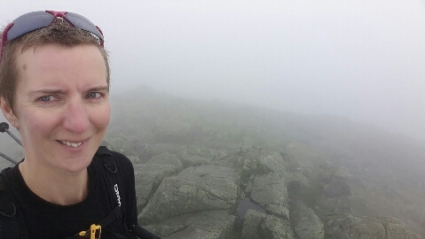
It had been bright enough to warrant sunglasses as I set out, and keeping them on meant that the state of my hair was partially masked for this photo!

Hints of brightness gave the indication that the sun would win over the cloud in due course, but I wasn’t hanging around. From being far too hot as I ascended through the forest, it was positively chilly on the summit. I made haste downwards rather than donning a layer.

The outing came in at 8 miles on the nose, with a tiny smidge under 700m of ascent. I could have gone on to visit a couple more hills, but I thought that a far better plan would be to have the afternoon off.

Mochrum Fell, Cairnsmore and Fell of Fleet

Thursday 1 September

Mochrum Fell (NX723750; 317m)
The first and least adventurous walk of the day was a 4.3-mile out-and-back up Mochrum Fell.
image
I, perhaps, could have followed forestry tracks to within a couple of hundred metres of the top, but instead of taking the risk that the gap in the track, as shown on the 1:25k map, wasn't really a gap, I followed the directions given by others and took to a narrow break in the forest. It was shorter than the potential track-based option, and wasn't a bad route, if you don't mind a quantity of ducking under trees.

I was equally tempted to try the track on the way back, but with yesterday fresh in my mind, I went for the 'better the devil you know' option and retraced my steps.

The kettle was on when I got back, which was handy as it was feeling very much like second breakfast time.

Cairnsmore (Black Craig of Dee) (NX583758; 493m)
Next came the biggest adventure of the day. Up there with yesterday's second hill, it was.

I had two options noted for this hill. Most people seem to walk in from the mast-maintenance track to the west. At best this route is described as 'rough' and one person noted that it was the worst tussocks they'd ever come across - and this was their 600th Marilyn. This option would have been 2.8 miles each way.

My second option, and the one I went for, was to attack the hill up its steepest side, having first made my way, tracklessly, through a forest plantation. That option was 1.1 miles each way, and the only description I found of the going was a single word: 'sporting'!
image

note the tight packed contour lines towards the top

Hampered from the outset by failing to find the break in the trees that I was looking for (actually, I found on my return that I had started off following it, but had missed its continuation when it veered right), a bash through the forest ensued. How many times have I sworn I'll never bash through a commercial plantation again?!

Making it out of the trees would have been cause for celebration if I wasn't now faced with a ridiculously steep ascent through some obscenely rough terrain. I gave more serious contemplation to turning back than I have ever done before, but two things stopped me: 1) I didn't want to have to negotiate the forest again; and 2) the other approach would be longer and probably just as rough, even if not as steep.

I did make it to the top and, as I had ascertained that, from above, the break through the trees, which had been so elusive from below, was perfectly obvious, I discounted the option of asking Mick to drive around to the west side.


A slightly different line was taken down, and it was every bit as hard and slow as the upwards haul had been. With boulders, tussocks and big holes completely masked by hip high grass, not to mention the ridiculous steepness, I really had to take my time and be sure of each step.

Arriving back at Colin ("You've got blue lips!" said Mick; "So many ripe bilberries!" I replied and as I was moving so slowly it was easy to keep grabbing the odd handful) I had walked 2.2 miles, with 1000' ascent at an average speed of 1.1mph, making this my slowest hill to date. It was still quicker than the longer route in would have been, though.

Fell of Fleet (NX566707; 470m)
image

I'd been undecided whether to go for this one today, due to the length of the walk in (many people drive the forest track, but I discounted that option on Colin’s behalf), but after a very long lunchbreak I resolved to go for it, hoping that it would be somewhat easier than Cairnsmore had been.

The walk in was, of course, straightforward, as was the section after leaving the forest track and taking to an old trackway. The route description I'd noted from hill-bagging.co.uk told me that the trackway would end amongst young conifers and that a path would then take me to within 0.5km of the top.

Reaching a junction on the old trackway, I was a bit flummoxed. No-one had mentioned a junction! Which way to go? I plumped for continuing on the line shown on the 1.25k map (this track doesn't appear on the 1:50k). That may have been a mistake, as I certainly didn't find any sort of a path when I struck off up the hill.

There then ensued a kilometre of hard yomping, during which I concluded that this is not a good time of year to be doing these hills, with all of the long grass hiding the tussocks and holes that lie beneath.

It was a nice summit, but I could see that the weather was closing in on me, so I didn't spend too long admiring the views before I chose a downwards line (which proved significantly wetter underfoot than my outwards one had been).

The drizzle started as I reached the forest track, whereupon my speed increased to 'as fast as my little legs can carry me without running'. Ten minutes before I got back to Colin the drizzle turned to rain. It was a soggy Gayle who pitched up on his doorstep.

The outing had come in at 8.2 miles with 1200' of ascent at an average speed of 3mph. Given how slow the yomp to the summit had been, I deduce that I really had been going some along the forest track!

Wednesday, 31 August 2016

Bogrie Hill and Fell Hill

A new day, a new location. We're down in Dumfries and Galloway now, which is where we will remain for the rest of this trip.

Bogrie Hill (NX789859; 432m)
image
I had intended to try a novel route (i.e. nobody else has been daft enough to try it) up this hill, purely for ease of access from the A702, avoiding any driving down little lanes. Then I read all of the trip reports telling of an easy ATV track from the usual start point and suddenly the little lanes seemed like a good choice after all.

The drive-in turned out not to be bad at all and as a bonus the parking place, which I hadn't even been able to see on StreetView, proved to be big enough for a Colin.

There’s not much to say about the hill. The ATV track was found exactly where I was told it would be (a good thing as, left to my own devices, I wouldn't have spotted it) and it led me all the way up to the summit.


The tyre marks through the tussocks were a little harder to follow in descent (or I just wasn't paying much attention), but I made it down regardless and on we went for my next hill, and a bit of an adventure...

Fell Hill (NX722844; 417m)
image

I had also decided to do this one from the A702, so as to save the detour along lanes to get to the usual start point. What I'd completely failed to notice until we got to my start point on the west side was that we'd been within a kilometre of the usual start (to the east) when we drove to and from Bogrie Hill. Mick offered to drive me back around there, but aerial photos had suggested that my route would go. Who knew? Perhaps I was about to find a much better way up this hill? Or maybe I was about to have an absolute 'mare. Either way, I insisted that I was going to find out.

I'd only made it about 100m from the road when I landed myself up to mid-thigh in a stinking pool of bog. It wasn't the best start (particularly as I'd worn boots; oh how I wished I'd chosen my usual mesh trail runners, which would have let the water back out). Alas, the going didn't get any better, even if it did get drier.

I was only half way up at the time I'd estimated for my arrival at the top, so duly texted Mick to convey that there was no way I was coming down the same way, whereupon he relocated himself to the other side of the hill.

The going outside of the forest was so bad (the usual rough terrain, but with monster tussocks, and reeds and grasses between hip and shoulder high) that I took to weaving my way between the trees. Contending with stuff like this...

...was much quicker and easier than the alternative wade through rough greenery.

That worked for a while but then I got to a new plantation, followed by an old but dense one, where I had no option but to fight my way up the break.

Here’s a photo looking back. What amused me was the presence of fire beaters in a place where there is no evidence that anyone has ever been daft enough to go. Except for the person who put them there, of course.

I was nearly at the top of the forest, and pitching about like a drunk, when suddenly a truck drove from left to right just above me at a speed that suggested a good driving surface. I came out on this...
...and was soon walking through a windfarm construction site.

After a few minutes I abandoned the road (not knowing where it went) for another upwards yomp, this time an easy one (as these things go) up to the summit. Gosh, I was pleased to be there!
Part of my decision to try to the west side of the hill had been based on a recollection of reports of the track on the east side being a wet approach. It turns out that it is newly upgraded, I think for forestry operations, rather than being the windfarm access. Thus, having resisted asking for a lift from the forestry man who was just leaving, getting down to the road was unexpectedly quick and easy.

It had taken me an hour and a half to get up the hill. My descent took half an hour, even though it was a little further. (4.2 miles total, with just 200m ascent.)

After all that, I decided against my third hill today!

Newtyle Hill (NO050419; 317m)

Tuesday 29 August

It was approaching 4pm by the time I got out the door for the only hill I'd put on the agenda for yesterday (and not without a great deal of indecision as to which hill alongside the A9 to choose).

image
The Visitor Centre car park at Loch of Lowes, just outside of Dunkeld, was my start point (and my intended end point too...) from where a gentle route took me, through woodland, around to Dean's Burn on the west side of the hill. An old track past a mast became a trod and then I came out onto the open hillside. Exactly as the map had suggested would be the case, the going from there was rough. Heather, bracken, reeds and bog featured.
The top was a good viewpoint and from there I considered a more direct route back, before deciding that less yomping and more track would be the more efficient route, particularly as I could run down the grass centres of the tracks.

I was merrily running along when a gate appeared before me, exactly as it had on my outward route (albeit I most definitely wasn't running on the way up!) and, as I re-fastened it, I said a brief hello to the woman loitering the other side. Then I barrelled down the hill a bit (but not much) further before it struck me that I didn't remember walking up anything of the same gradient on my outward leg. That was followed swiftly by the recollection that I was meant to turn back on myself almost immediately after the gate. I'd not been looking out for the turn and didn't notice it at all.

I could have turned back, as I can't have gone more than a couple of hundred metres adrift, but given the knowledge that both Mick and I had phone reception and that there was a road just ahead of me, I took the much quicker option: I asked Mick to meet me on the other side of the hill. And after asking, quite incredulously, how I'd managed to descend the wrong side of the hill, he willingly complied.

The stats came in at 3.9 miles with around 700' of ascent.


Always important, if you're going to have your bra strap peeking out on display, to colour co-ordinate with your sunglasses, I think!

Tuesday, 30 August 2016

Carn na Loine (NJ070361; 549m)

It’s always good to go for a walk with Louise and David. Aside from the excellent company, it means that I don’t have to put any thought into the day. Louise has never yet failed to come up with a good walk for us, and thus I only asked the scantest of information about what the plan was for yesterday (Q: “What sort of terrain?” A: “There’ll be some yomping through heather and it may be boggy”, Q: “How far” A: “Not very far” – that was sufficient information to tell me that it was a suitable outing to try out my ‘new*’ boots). The only other information I knew when we set out was that the main objective was to bag a trig point.

I recognised the first part of our journey to our start point, but after some little lanes had been involved, I confess that I didn’t really know where we were when David parked the car and we set out. Up the lane was the first direction of travel, and you may notice that Louise had (once again) organised some good weather for us:

20160829_105834

The lane was soon abandoned in favour of a track and in due course the track was abandoned in favour of a yomp, as our objective was now right before us. The boys soon scuttled on ahead, giving us useful information like “that’s a stream, not a trod”, but in general the going underfoot wasn’t more than a bit squelchy, and the heather and tussocks weren’t extreme either.

20160829_115515

Putting a bit of a sprint on, Louise and I reached trig point first and, as you can see, we were happy to be there:

20160829_122520

I didn’t take a photo over towards the Cairngorms, but it was a clear day so we did a spot of hill identification before we cooled down enough to encourage us to move on.

I’m certainly glad that we didn’t do this route in reverse, as I don’t think it would be an exaggeration to describe the tussocks on our descent route as ‘severe’. There were quite a few deep holes between them too, some of which I investigated a little too closely. Fortunately, as I keep observing, tussocks and heather in descent are much easier than in ascent, so with some contouring thrown in, we did make it over to the track we wanted, just by where it runs past Huntley’s Cave. Being gone 1330 by now, the first big rock we saw was declared to be the lunch rock.

Our afternoon was quick and easy (except for the little detour to see Hutley’s Cave; if what we think was the cave was in fact the cave then, as caves go, it wasn’t impressive!), being two kilometres gently downhill on a track.

It was a fine outing, in fine company, but the real surprise about the route didn’t come until much later in the evening. I happened to be looking at the mapping on my computer and, now knowing the name of the hill up which we had been, I looked it up, only to find that it was, in fact, a Marilyn. Bonus! And quite amusing that I’d managed to bag a Marilyn without any knowledge that I was so doing. (There was a minor panic as to whether we’d been to the true summit, but it didn’t take me many seconds to confirm that this is a hill on which the trig is at the highest point.)

Here’s the hill in question (the lump just slightly left of centre): 

20160829_143929

Thanks, as ever, go to Louise and David for all of their hospitality.

image

(*The boots aren’t new at all. I’ve had them in the wardrobe since at least 2007, and they can’t have been used more than half a dozen times before they fell out of my favour for being too big and heavy. Being the most expensive boots I’ve owned, and with all of my other boots now leaking badly, I dusted this pair off to see if I can get on with them. Yesterday’s outing indicated that they will be fine and thus the new boot purchase can be put off for a while yet.)