Monday 14 October
Distance: 13.3 miles
Ascent: 890m
Weather: dry with a few periods of sunshine. Cloud base variable but mainly above our summits.
Number of times I've written this blog post: twice. Not sure if losing all my work the first time was operator error or technical glitch.

In 2013 our TGO Challenge Route Sheet had us going over Carn na Caim. For reasons that I can't remember, and that my blog post from that day doesn't make clear, we re-routed to the north and went over Meall Cruaich instead. Carn na Caim thus went onto the 'must get around to it' list and today, just 6.5 years later, we did exactly that, adding its neighbour into the outing because if we were making the effort to get up onto the plateau it made sense to visit both Munros, even though only one of them is a Marilyn.
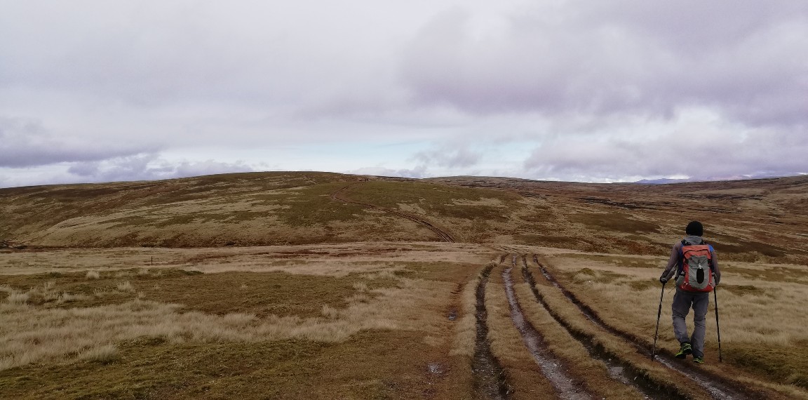
As hills of this size go, these are remarkably accessible, sitting not just alongside the A9, but also having tracks most of the way to the summits. Initially it's an engineered track that leads from the road, under the power lines and up (getting steeper as it goes) to an old quarry.
Beyond the quarry we opted to go left, to visit Carn na Caim first (being the Marilyn, that was the top of most interest to me).
 Beyond the quarry the track became unsurfaced, but still gave easy walking
Once the track ended, an obvious set of trodden lines followed the old iron fence posts of the boundary line right up to the summit.
 Mick on what appeared to be the highest ground, with a good view up the Spey valley behind him.
 Selfie at the summit cairn
Coffee and butteries on the summit, whilst admiring the views, would have been nice, but the breeze (which was barely a breath) had such a chill to it that we opted instead to defer our break for a more sheltered spot.
Steps were retraced to the top of Coire Uilleim where we sat completely out of the wind, but at the expense of having a view, before more steps were retraced until we were above the quarry again (which, incidentally is marked as such on the map, but isn't massively evident on the ground - we're not talking huge holes in the ground).

 Considering how close these hills lie to the A9, the mainline railway and the Beauly-Denny power lines, it was impressive for how much of the time the only obviously man-made thing we could see was the track upon which we were walking.
The way south to our second top was slightly less obvious than the ease of Carn na Caim, but in the good visibiilty that prevailed it presented us with no difficulties as we made our way to the trig point.
 Trig point selfie
Cloud had been tickling this summit all morning, but it had cleared by the time we arrived and, with the help of a bit of sunshine, it was warm enough up therefor lunch. Joined after a while by a couple from Edinburgh, Sam and Malcolm, our break became longer than is our norm as we chatted.
They left the top before us, but it was only a couple of minutes before we followed. Our descent was entirely a reversal of our outwards route (save for an accidental wander that you can pick out on the map snippet at the top of this post), but it was made more interesting by the company. First came a brief chat with a chap who was just ascending for the same two hills (he had very long legs, so we reckoned he would just make it to both and back down before dark), then we walked the final section back down to the A9 with Sam & Malcolm. Sam is a geologist (more precisely a volcanologist) - what an interesting and adventurous job!
We parted company at the A9 and within minutes Mick & I were back at Bertie, where I prioritised checking the weather forecast. There's another hill we were eyeing up on our way down today and it looks like tomorrow's weather will be good enough to entice us up it...
Distance: 13.3 miles
Ascent: 890m
Weather: dry with a few periods of sunshine. Cloud base variable but mainly above our summits.
Number of times I've written this blog post: twice. Not sure if losing all my work the first time was operator error or technical glitch.
I couldn't quite fit all of the route onto the screen; our start point was where the cycle path leaves the A889 just to the S of Dalwhinnie.
In 2013 our TGO Challenge Route Sheet had us going over Carn na Caim. For reasons that I can't remember, and that my blog post from that day doesn't make clear, we re-routed to the north and went over Meall Cruaich instead. Carn na Caim thus went onto the 'must get around to it' list and today, just 6.5 years later, we did exactly that, adding its neighbour into the outing because if we were making the effort to get up onto the plateau it made sense to visit both Munros, even though only one of them is a Marilyn.
As hills of this size go, these are remarkably accessible, sitting not just alongside the A9, but also having tracks most of the way to the summits. Initially it's an engineered track that leads from the road, under the power lines and up (getting steeper as it goes) to an old quarry.
Beyond the quarry we opted to go left, to visit Carn na Caim first (being the Marilyn, that was the top of most interest to me).
Once the track ended, an obvious set of trodden lines followed the old iron fence posts of the boundary line right up to the summit.


Coffee and butteries on the summit, whilst admiring the views, would have been nice, but the breeze (which was barely a breath) had such a chill to it that we opted instead to defer our break for a more sheltered spot.
Steps were retraced to the top of Coire Uilleim where we sat completely out of the wind, but at the expense of having a view, before more steps were retraced until we were above the quarry again (which, incidentally is marked as such on the map, but isn't massively evident on the ground - we're not talking huge holes in the ground).


The way south to our second top was slightly less obvious than the ease of Carn na Caim, but in the good visibiilty that prevailed it presented us with no difficulties as we made our way to the trig point.

Cloud had been tickling this summit all morning, but it had cleared by the time we arrived and, with the help of a bit of sunshine, it was warm enough up therefor lunch. Joined after a while by a couple from Edinburgh, Sam and Malcolm, our break became longer than is our norm as we chatted.
They left the top before us, but it was only a couple of minutes before we followed. Our descent was entirely a reversal of our outwards route (save for an accidental wander that you can pick out on the map snippet at the top of this post), but it was made more interesting by the company. First came a brief chat with a chap who was just ascending for the same two hills (he had very long legs, so we reckoned he would just make it to both and back down before dark), then we walked the final section back down to the A9 with Sam & Malcolm. Sam is a geologist (more precisely a volcanologist) - what an interesting and adventurous job!
We parted company at the A9 and within minutes Mick & I were back at Bertie, where I prioritised checking the weather forecast. There's another hill we were eyeing up on our way down today and it looks like tomorrow's weather will be good enough to entice us up it...


I do remember those two Munros but not in any great detail - a quick dash from the A9. What are butteries as opposed to butties? I'm off to the next section of Wainwright's Way tomorrow with BC to take us to Troutbeck. After that it will be over Hgh Street and down to Patterdale. More hills will follow finishing on Haystacks where AW's ashes were scattered.
ReplyDeleteMy best description of butteries is that they are a cross between a flat bread roll and a croissant, but slightly salty. I believe that they originate in the NE of Scotland, where they were developed for the fishing industry. Traditionally they're very high in fat, so would keep well for days at sea without going stale. These days the version you can buy in supermarkets and bakers are a poor excuse for the real thing (but also far less calorific, which is often a good thing!), but every now and then we do bake some authentic ones at home.
DeleteI've had these two *on the list for a while. They've just been shunted up a bit.
ReplyDelete*The Easily Accessible List. There are other lists 😆
I find that with hills that are easily accessed from a road that we drive repeatedly, I tend to dismiss them on the basis of 'I can go up there next time'. I've a couple in England that are suffering the same fate.
Delete