Marilyn: Ettrick Pen (NT 200 076; 692m)
Start Point: Turning circle opposite minor road, at NT 109 046
Distance and Ascent: 19.3km, 1000m
Weather: sunny intervals, dry save for one hail shower. Cool (max 10) but feeling warm when in sun and out of wind.
My original intention had been a quick overnight, on Wednesday 16th, from our usual park-up just off the M6 near Shap, and the obvious choice from there would have been somewhere near Mosedale Cottage. Then I remembered that I still had one Marilyn to visit in the vicinity of Moffat, where we would be passing today, and that seemed a much more fruitful idea*. I was glad for the change of plan when Bertie spent last night by Shap getting bashed by the wind and lashed by the rain.
I wasn't in the market for an early start so on arrival at Moffat I tarried a while and had an early lunch, before I set out at noon, leaving Mick to go and take up the booking I'd made for him at Moffat Camping & Caravanning Club site.
My route was straightforward: the Southern Upland Way to Ettrick Head, the boundary line to Ettrick Pen, then down to Over Phawhope bothy.
I'd plotted taking the high level SUW alternative over Gateshaw Rig and Croft Head, but we did that route in 2015 so today I took the low level route instead. That involved an old path through the forest where storm damage, both old and new, was evident. A whole section of trees has been snapped half way up their trunks some time ago, and more recently others had been wind-felled across the path. Someone had been out with a saw and made the path passable - just - but it involved hands and knees at times.


Obstacles across the path

Lovely path other than the blow-down-obstacles
The only other obstacle was a short section of very wet peat hags as I struck off from the SUW at Ettrick Head. Had there been anyone around to witness, I'm sure my antics there would have provided amusement.
Having negotiated the soggy bit and gained a bit of height, I looked back and recognised the hillside opposite. We'd ascended that side (to Capel Fell) in 2015.
There are three little nobbles on the ridge leading to Ettrick Pen, but the minor effort of going over them was rewarded by the views. I do like this area.
Between Hopetoun Craig and Ettrick Pen I went from plenty warm enough in my short sleeves and windshirt to feeling quite cool in my Paramo jacket and Bufallo mitts. Then a hail shower came along. It had passed by the time I reached the summit, but the brisk wind up there was biting.
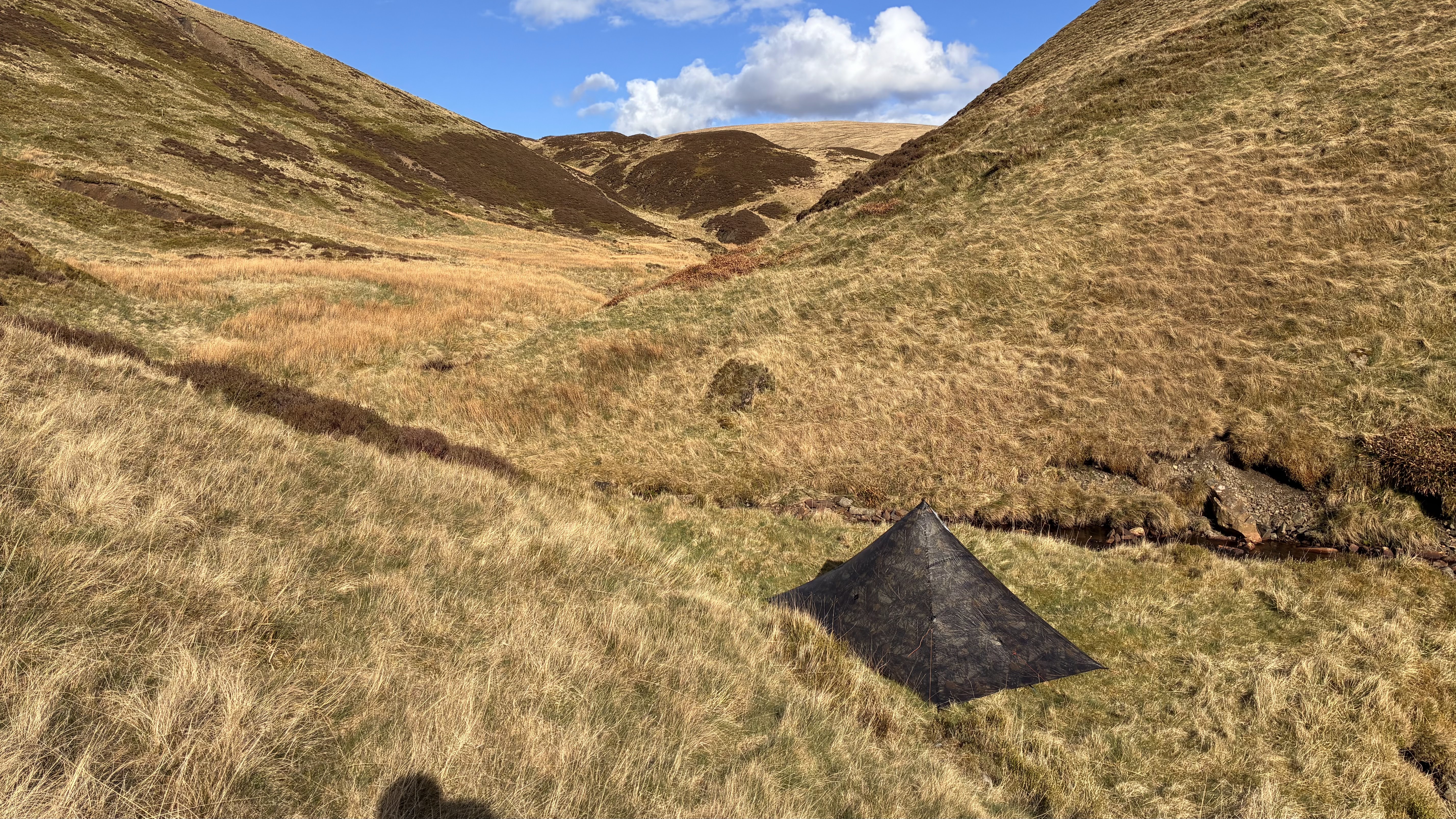
My descent was to Over Phawhope bothy, where there was a very slim chance that I may have chosen to spend the night. I opted against (the Thursday of a bank holiday weekend and a vehicle track running right by - too much risk of unwelcome company) and didn't even pop my head in. I'd only seen one good-looking pitch on my way in and being just 3.5km distant, that is to where I headed.
The section of SUW between Over Phawhope and Ettrick Head is currently being clear cut and my goodness, they've made a mess of that track. I trudged through unpleasant sloppy mud, finally making my shoes look other than brand new (the first time those shoes stepped outside was 4 hours earlier).
It wasn't much further, along a lovely grassy path, until I reached my pitch and, with relief, saw that nobody else had nabbed it. Given that I'd only seen one group since I set out, and they were in the first ten minutes, It was an unlikely scenario. (Talking of the first ten minutes after setting off - a farm dog tried hard to bite me. He was foiled by my walking poles. Not what I expect on a National Trail.)
...later: between 7-9pm I reckon eight people passed my pitch. I was facing away from the path and didn't trouble myself to look out, so my count was based on voices (there could have been more, passing in silence). Surely heading in to the bothy at that time of day?


(*It also seemed fitting, in that I was going to be using a late friend's tent in hills with which he was so familiar. I felt he would have approved of my choice (tent and location).)


Wow! I was happily chugging along in Wales then selected "Newer Post" and was transported with anticipation to Shap, and then, not complaining, ended up north of the border. Not a bad trip.
ReplyDeleteFor me Wales and Scotland were 11 days apart - I've just been tardy with the previous posting.
Delete