16 July
Start Point: junction of A479 and minor road at Waun Fach (no parking - I got dropped off)
End Point: Dinas Castell Inn car park (£5)
Distance and Ascent: 11.1km, 630m
Weather: Warm and sunny

The red dotted line is the route I'd plotted (taking in these two hills, plus Waun Fach). I opted to only do the west-most two today, and the blue route is what I did.
Because I'm lazy at heart, I opted not to start at the layby slightly further S, but to cut a bit of distance by getting dropped off at the end of the minor road at Waun Fach (the settlement, not the nearby hill of the same name). On paper this should have worked nicely, using one of the various paths that head up Mynydd Llangorse from that minor road.
Here's a closer look at that bit of my recorded route:

It looks like I just missed where the bridleway left the road end, but that wasn't the case. There was a finger-post, a waymark, and a clear line of the ground. The problem was that within a dozen paces that line disappeared into bracken. I pushed through it for a very short while, but when I got to the point that it was over my head height and I couldn't see where the path went anymore, and nor could I easily push through it, I wrote that route off as a bad job.

The bridleway follows the fence line
So, I decided to see if I could pick up my intended route further S. As you can see, I got close to it, but between me and it lay a barbed wire fence, and over the fence I could see no sign of a feasible path through the bracken. Perhaps I should have continued the extra few hundred metres SE along the byway to the next path junction, but I was so pessimistic about finding any way through the bracken on this side of the hill, I decided to follow the path that would lead me N to the col between my two hills. From there I would decide whether to omit this first hill, or backtrack to it.
Here's a photo and a 7-second video of how the next 2km went:

The key deciding factor as to whether I backtracked to the first hill was whether I could contact Mick before I got to the road that runs between the two hills. He thought I'd set out on a 5km outing (turns out I'd read the wrong number and it was supposed to be 8km), and I'd spent so long fighting bracken that I was going to be a lot longer than he expected. He's very good at thinking "She's been delayed" rather than panicking that "She's dead in a ditch!", but surely if I was 3 hours on a 5km outing, even Mick would worry?
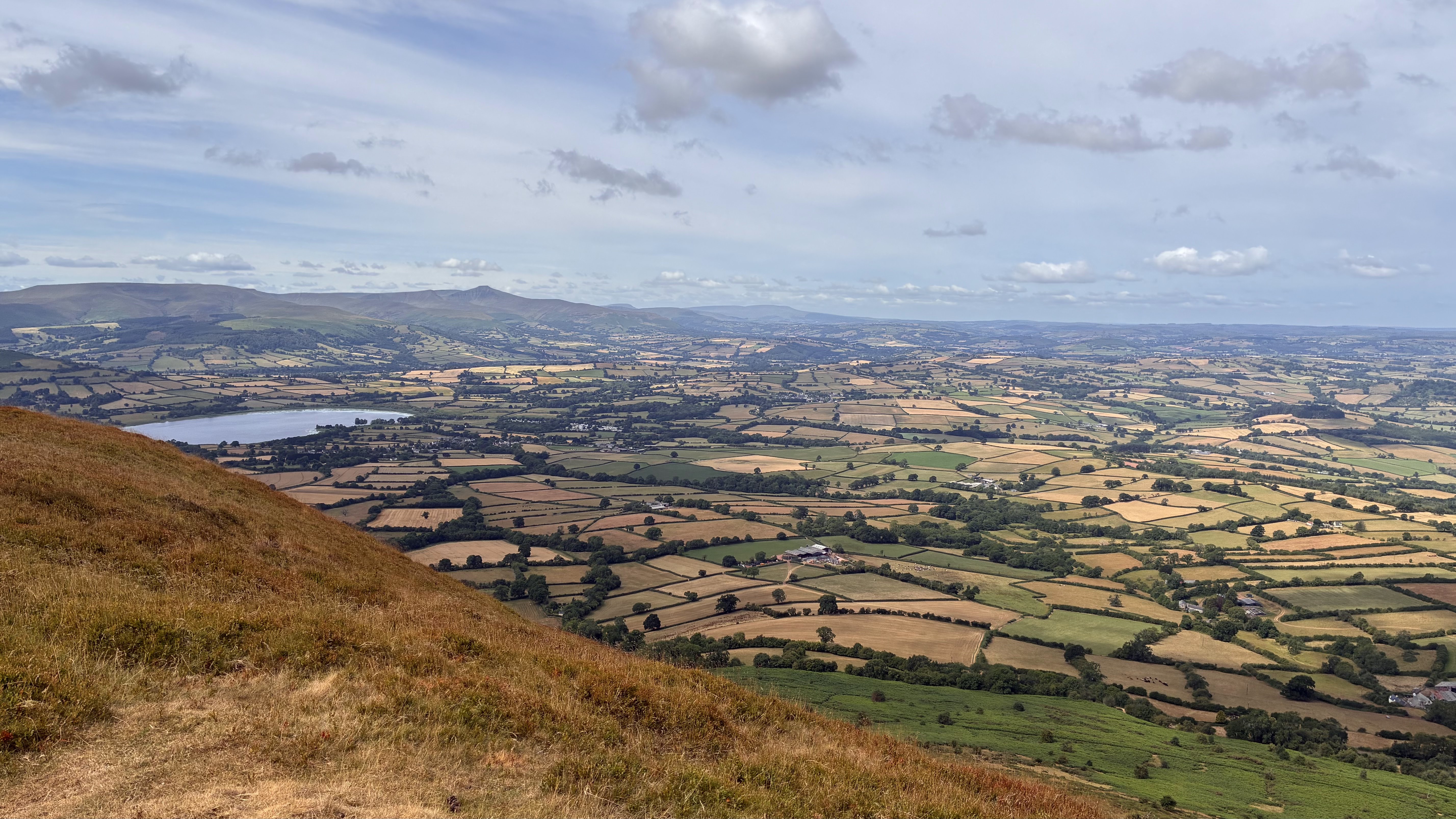
Eventually, as I reached the road, I got a phone signal. I also got a view of the motorways that run up these hills from this location:

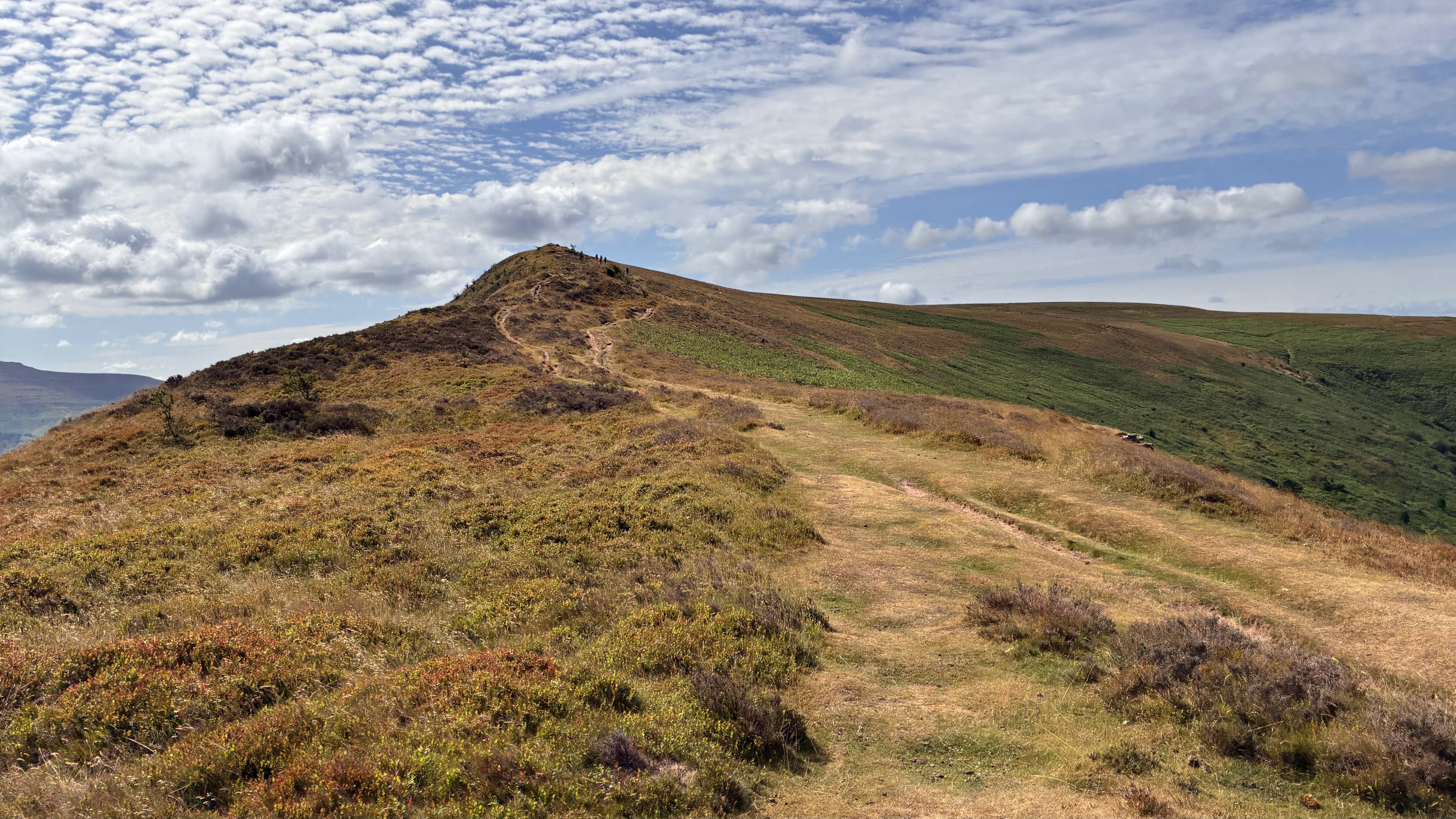
I take my hat off to them for how long they managed to stay pretty close to me, but: 1) they eventually conceded defeat; and 2) goodness, it was hard work doing that pace up that incline! (Incidentally the rearmost pair of that group were not having fun. I passed them again on my way down at which point is covered around 2.4k since I'd first passed them and they'd covered about 500m.)
Once I'd recovered and the ridge had flattened, I jogged along to my objective, visited both apparent high points, then jogged back to the steep bit, that I descended much more steadily and in a slalom manner.


Mynydd Troed was a much quieter hill. A runner set out up the path just ahead of me and he eventually disappeared from my sight, then there was a chap at the top just setting a camera up on the trig point before disappearing off to sit some distance away. That was rather inconvenient from my point of view, so whilst he no doubt has footage of me walking in front of his camera, I didn't take my usual trig point selfie.


Mick would have seen me coming down the spur, if it hadn't been for an aberration convinced him that I was on the other side of the valley and thus hidden by trees. The car park he was in was by now full and he explained that every single other person had headed up the hill behind him, so he'd assumed, without thought, that's where I was too. I was almost down before he noticed that the sun was in the wrong place and re-orientated himself.
That hill behind the car park is Waun Fach, which I also need to visit. I had time to do it today too, however, with my left shin still only just forgiving me for my 24 hour race 3.5 weeks ago, I didn't want to push my luck with a 500m descent and set it back in its recovery. I've got other hills nearby, so I can pick it up on a return visit.


That first one sounds like one of my misadventures. I don't envy the head high bracken, watch out for ticks.
ReplyDeleteBack to a previous post re bargain price for 2 versus 1. I HATE HATE HATE that. They do it Booth's supermarket, especially with fruit. As a single person I feel victimised by being excluded from a bargain, or alternatively being manipulated to buy extra fruit that goes off before I can use it. I have often ranted to many others about this, but generally they seem puzzled at what they seem to think is my my excessive castigation and that makes me even more annoyed.