The Road goes ever on and on; Down from the door where it began;
Now far ahead the Road has gone; And I must follow, if I can;
Pursuing it with eager feet; Until it joins some larger way;
Where many paths and errands met; And whither then? I cannot say.

[JRR Tolkien, Lord of the Rings]

Sunday, 31 July 2011

The Roaches

Sitting in the comfort of the living room on Thursday night, pondering where to go for a walk on Friday morning, I decided that there was little point in re-inventing the wheel. Martin’s blog was bound to reveal a good handful of walks, reasonably close to home, from which we could choose, and so it did. We selected ‘The Roaches’ walk which Martin (& others) did in early March this year. A flick though his photos suggested that it would provide lots of interesting things to see, and after a glance at his route map I copied a rough approximation of it onto my map. We were all set to go.

The Roaches aren’t very far from us, but experience has now told us that if you get behind a quarry lorry going up one of the long hills between here and there, the journey can be slow indeed. We got there in the end though and being just past 9am we had the pick of the parking spaces.

Progress was initially slow, as I was particularly taken with our surroundings and had to keep stopping to ponder the boulders, the views, the shapely rocks and such.

 IMG_1615

“Careful now!” I cried; there’s a big old drop off the side of that rockIMG_1616

Looking back towards Hen Cloud, as you can see, this was the overcast day in amongst a run of good weather. The views became more curtailed as the day went on, but at least it was dry. IMG_1618

Attracted by the chalk marks, Mick checks out some bouldering movesIMG_1619

Big, tumbled boulders

Only one other person was met on the outward leg of our walk. In fact, we didn’t see anyone else until we reached the Hanging Stone, well into the return leg. Then we got to the path to Lud’s Church and suddenly there were people aplenty. Quite rightly so too, as it is a natural spectacle that we both enjoyed.

IMG_1631Mick atop the Hanging Stone. We had lunch on the overhanging bit. Whilst we were there another chap came along and crawled up to where Mick’s standing in this photo. His wife declined to even set foot on the stone. We deduced that neither of them had a head for heights!

 IMG_1633 IMG_1641

Lots of photos were taken of Lud’s Church. None of them does it justice.

Regaining the ridge path we made our way back to Roach End, where the cross-over point of our figure-of-eight route should have been. When we got there (where it was a positive hive of activity with people setting off in all directions) a change of plan was had. We decided that we’d liked walk over The Roaches so much that it was worth walking it again in the other direction, rather than taking lower level paths.

IMG_1645It was worth returning the way we’d come for these rocks alone. We’d missed them on the outward journey, but spent some time pondering them on the way back 

Surprisingly, once we were a few hundred yards away from the road, we were on our own again, save for some climbers and one family seen right at the other end of the ridge.

IMG_1646Three chaps staring down from the edge and one looking rather bored. 

I had wanted to walk over Hen Cloud on the way back, but by the time we were approaching the end of The Roaches my right knee was feeling decidedly disgruntled. In fear of doing some damage that would take weeks to heal, we cut short.

Still, I’d enjoyed immensely what we had done and highly recommend this a walk if you find yourself in the area.

The stats were that 10 miles were covered, with somewhere around 2500 feet of ascent (maybe more if you believe the Garmin Gadget over Anquet). We didn’t get a reading on Mick’s altimeter as it went blank and started emitting a continuous high-pitched noise within the first ten minutes of the walk which got so annoying that after a while the watch got wrapped in my jacket and hidden in the middle of my rucksack. It was still beeping when we got home, but a new battery has sorted it out.

Just a couple more (sheepy) photos from the day:


IMG_1624

J99 EWE, J999 EWE, J999 TUP = a sheep farmer with a sense of humour!

IMG_1625

Some friendly sheep

Here’s the route we took:

image

Wednesday, 27 July 2011

People On Journeys

You may have noticed that there’s not an awful lot of walking going on around here at the moment. My intention of getting in a 3-day backpacking trip every fortnight has, of necessity, had to go by the wayside for this summer. There are, however, plenty of other people out there at the moment whose adventures I have been enjoying:

- Jack is a chap from Arizona who is now just a couple of weeks away from the end of his LEJOG. He came to stay with us when he was in our neck of the woods and would have you believe that I made him walk really fast on the day that I walked with him. I would claim that it was the fact that I didn’t have to pause to navigate (having walked that section of the Staffs Way plenty of times before) which caused us to speed from Cannock Chase up to Abbott’s Bromley. His blog can be found at lejogjack.wordpress.com

- Another American chap is Ken (from California) who is a few weeks behind Jack. Circumstances meant that we weren’t able to have him come and stay and it was third-time-lucky in trying to catch up with him too. We finally walked (albeit just for an hour and a half) with him as he passed through Dovedale. He’s now up on the top half of the Pennine Way. His blog is at my1200milesummer.blogspot.com

-Talking of the Pennine Way, Jade and Becks are two girls who are currently walking JOGLE and are somewhere on the south end of the Pennine Way at the moment, although their blog is a little behind (they tend to update it in chunks). I take my hat off to them. They’re young, not dreadfully experienced, and have been fighting injury, but are still cheerfully trucking along. I really hope to catch up with them as they pass by here. Their blog is at jadeandbecksbigwalk.blogspot.com

- Walking rather further than LEJOG is Charlie who is currently walking all eight points of the compass around the British mainland in a single, 2000-mile walk. Sensible people would split such a walk into three separate walks :-)  Charlie has previously walked LEJOG and with my memory for ridiculously trivial detail I remembered the name (actually it was the mention of drinking real ale that jogged the memory) and I confirmed that it is in fact the same Charlie who Alan Sloman bumped into during his LEJOG in 2007. She obviously caught a walking bug! Her blog can be found at 8pointsbritain.com

-Continuing with the walking theme but slightly further afield, Hassbackwards are currently just 270 miles from the end of the Appalachian Trail and are struggling with injury. With 1900 miles down and so few to go that must be a truly dreadful position to be in. You can find out how they get on at hassbackwards.com

- Continuing with the North American walking thing, Erin is solo-walking the Pacific Crest Trail (albeit she’s been in company much of the time so far). To me (for whom walking something like the PCT is a completely alien thing), her blog is an excellent and interesting read. Add in adversity with the snow and water levels this year (hopefully she’s beyond the worst of both now) and with an old ankle problem that’s causing her problems, I’m hooked. You can find her at erinspctjournal.blogspot.com

-We’ll stay in the Americas for the next one, but this time by bicycle and in South America. Nathan is now well over a year into a journey from the top to the bottom of the American continent. He’s not doing it quickly; he’s doing it interestingly. Some of his stealth camps in North America were quite audacious and he’s not afraid of taking side trips or short days to enhance the enjoyment of his trip. From the look of his bicycle, he’s not having a lightweight trip either! You’ll find him at velofreedom.wordpress.com

(At this point I realise quite how many long journeys I’m following at the moment! Thank goodness for all these good people to keep me sane.)

- On an equally big scale, but with a different mode of transport, Roz Savage is currently rowing the Indian Ocean and in doing so is seeking to become only the second female to achieve a solo row of it. She was also the first female to solo-row the South Pacific. It was during that row that I first came across her, and immediately set about devouring her experiences on her first (Atlantic) row. Her earlier rows were perhaps more interesting from a blogging point of view, but I still like to have my daily fix from her from the middle of an ocean (even though, on this one, for fear of pirates, she’s not publishing her progress). You’ll find Roz at www.rozsavage.com.

- Sarah Outen is quite simply amazing. She was just 23 years old when she became the first female to solo-row the Indian Ocean in 2009 and with her enthusiastic blogging about it I was hooked as soon as I found her. Not satisfied with an adventure that big, she decided that her next big trip would be ‘London to London, via the World’, an entirely human-powered trip out on which she set in April. She’s currently in China, having kayaked the English Channel and cycled the rest of the way from London. When she reaches an ocean she will row across it. One of those oceans is the North Pacific. If I remember correctly, when I followed two chaps who rowed the North Atlantic a couple of years ago, they were the first to achieve the feat (and there were a couple of edge-of-your-seat moments even then). And Sarah’s going to do it solo. Gulp. She may not be blogging regularly on this trip, but she’s certainly one to follow. She’s at www.sarahouten.com

- Not strictly on a big trip right now, but so often on one that she’s always worth keeping an eye on, is Christine the ‘German Tourist’. She’s just finished (although not completed – she’s very bitter about that) a canoe trip down the Yukon and later this year intends to tackle JOGLE. Her annual mileages make my efforts look like baby steps. Another very well written blog which you’ll find at christine-on-big-walk.blogspot.com

-And finally there’s Martin. He’s also not on a trip right now but is out and about so often that his life is one big walking (and sometimes cycling) adventure. Every few days he’ll have something well-written to keep me entertained (not to mention a little green with envy). Martin’s at phreerunner.blogspot.com

(Pity I didn’t write this post a few weeks ago, as if I had I could have included Ron’s big 70th birthday adventure in the list, but I’ve left it too late as he’s finished his cycling trip. He may be enjoying the end of his nomadic lifestyle, but for me the end is a shame, as it was another excellent journey to follow.)

I’m sure that there are many other excellent adventures going on out there and being reported by the marvels of modern technology, but I think that’s probably enough to keep me entertained for now!


Wednesday, 13 July 2011

Vango Eos 350 - The Photo Compilation

Well that was a bit of a trial! It's a long time since I compiled a group of photos into a video snippet and I'd forgotten the details of how to do it. I got there in the end though.

Can't claim that it's exciting. It's just a bunch of still photos (mainly taken by my sister) of the half-hour process that was the pitching, admiring and de-pitching of the Vango Eos 350 (about which I wrote in the post below).

Here it is - all 2 minutes of it:

Tuesday, 12 July 2011

Vango Eos 350 3-man Tent - First Look

A couple of weeks ago Go Outdoors asked us to pick a tent up to a stated budget, and we chose the Vango Eos 350: a 3-man tunnel tent. Go Outdoors lists this as a backpacking tent, but at 6.2kg that’s not a use to which we’ll be putting it (although I did see a D of E group using either this or another very similar Vango model a few weeks back).

Despite Go Outdoors being prompt in getting the tent despatched, it took us over a week to get our hands on it (entirely our fault for not being able to guarantee being at home for a full day in the intervening period). Still, we got it in the end, and I was itching to go and pitch it so as to get a proper look at it.

Following a couple of days of showery weather, it was Sunday before it first came out of its bag, and Sunday coincided with some family visiting. My 89-year-old gran was somewhat bemused when we arrived at her house and immediately set about putting a tent up in her garden!

The set-up was sufficiently obvious that, without a glance at the instructions, it took us 10.5 minutes from unzipping the bag to having a pitched tent. Admittedly, we didn’t put out the guy lines (grandmother might have objected to us trampling her flower beds to achieve that), but it did include the attaching of the inner tent (which was the most time-consuming part of the whole pitching process). The inner has, however, been left in place, so in future we will pitch as one and I don’t expect that it will take longer than 10 minutes even with all of the guy-lines.

IMG_1589

Once pitched it proved to have a sleeping area that looked perfectly big enough for three people – or in our case, an excellent size for two people and a couple of bags. The porch area is also looks to be big enough to store a car-camping stove, a box of stuff' and still have enough room for a couple of chairs. Head room clearly isn’t enough to stand up, but at 145cm in the porch area it’s enough to sit on a chair inside.

Access is via doors on either side of the porch. Much discussion was had about the merits of a door on either side versus a single door on the front of the tunnel, and the conclusion we reached was that it’s swings and roundabouts. However, the lack of a mesh door on the outer means that you could be forced into the inner tent on a midgey evening.

Retreating to the inner tent I then came to notice that there wasn’t a full mesh door there either, although I did find the mesh flap at the top of the door. Combining the dark colour of the outer, the green inner and the lack of a full mesh door, it’s pretty dull in the inner (a good thing for 5am on a summer’s morning; not so good on a midgey evening).

IMG_1595My sister helps me illustrate the mesh panel at the top of the inner door

The light levels are better in the porch, with a couple of windows on the front of the tunnel. My gran was particularly taken with the windows. Actually, she was pretty taken with the whole tent. Things have changed a bit since her camping days!

Taking the tent back down took 4.5 minutes and that was to the point of having it zipped inside of its bag. It was nice to find that the bag was big enough to fit the tent back in on the first attempt.

Obviously, I can’t say anything for durability at this stage; the quality didn’t look obviously dodgy, but one of the elastics that hold the clips that connect the ground sheet to the fly did snap on first pitching. At the moment I’m putting that down to a one-off fault, and thanks to a good spares-kit it took me but a matter of seconds to pull out a new bungey and tie it on.

Our verdict on first pitching was that this is a tent that would suit our needs for a car-camping trip. And for the price (it was £89 when I chose it) it looks good value for money to me. Given that, as I type this, it’s been reduced to an incredible £54 (with a Go Outdoors discount card), if you’re in the market for a tent of this type and size, then I don’t think that you could go wrong in buying one.

Go Outdoors currently stocks a range of 96 tents, all the way from cheap tents designed for the festival market (although from our observations on campsites around the country, equally based on useable for campsites) right up to big family tents. They’ve even got a few bivi bags (starting at £25) in the range.

(I gave my sister the camera for most of the pitching/de-pitching exercise. She took plenty of photos. I’ve been trying to compile them into a little video snippet, but Windows Movie Maker has got the better of me tonight (in that it keeps locking up). I’ll post it tomorrow night if Movie Maker lets me finish it.)

Sunday, 3 July 2011

The First Six Months

I haven’t posted any graphs since The Gratuitous Graphs of February and said then that I wouldn’t post any more until the end of May. Incredibly, I managed to resist even then, but with the first half of the year having passed I thought it was time to see how things are progressing against this year’s target. Here’s how the year’s going so far:


The Miles per Month chart is looking quite healthy so far. The second half of the year never looks so good, and I anticipate that things will drop of sharply in July and August as a couple of things are going to hamper my walking activities:

image

The next one isn’t really relevant as I don’t have any ascent based targets and have never compared my ascent figures year-on-year, but I thought I’d include the graph anyway:

image

My target for the year is to average 5 miles per day. There will now be a sharp drop off back down towards the pink line, but with only 380ish miles left to walk over the next six months it looks to be achievable:

image

Considering that we generally had such fantastic weather for the East to West Walk, it’s surprising that wet weather (whether rain, showers or drizzle) takes up such a large part of the weather pie chart (but I suppose that it has rained on almost every walk I’ve taken since 9th May!):

image

Monday, 27 June 2011

Petzl Tikkina 2 Head Torch

When Go Outdoors offered me an item from its range of camping equipment I asked for two small items: the Hi-Gear Blaze Titanium Stove, about which I’ve already written (here and here), and also a head torch.

I was sent the Petzl Tikkina 2 head torch, which is the lower end of the Petzl range, offering a beam distance (on new batteries) of 23 metres, weighing in at 80g and costing a very reasonable £16.

I’m not quite sure what I was thinking, volunteering to test a head torch in June. The nights don’t tend to be dreadfully dark at this time of year; as I noticed when I was lying awake on the Kinder Plateau in the middle of the night a few weeks ago, even if I had felt like going for a walk, it wasn’t dark enough to have needed a torch.

Based on what little use I have made of it, here are my initial observations and thoughts:

  • Considering that it only has 2 LEDs, it does give a good level of light on the highest setting. There are two settings on this torch, high and low. On the low setting the lamp claims to have a battery life of 190 hours. Previous experience of Petzl head torches suggests that I’m never going to know whether that is accurate. Every couple of years I change the batteries in my torch, and I’ve never had it give out on me yet.
  • The battery compartment clip is easier to use than my previous torch (which was the original model of Petzl Tikka Plus). Given my comment above about only changing the batteries every couple of years, this may seem to be irrelevant, but there was an incident a few years ago where I found myself stealing the batteries out of my head torch to put in the GPS to find out where I was at 5 o’clock one morning!
  • The on/off switch is also easier to operate, as it’s bigger and not as recessed as my previous torch. However, this isn’t necessarily entirely a good thing. In the limited time that I’ve carried this torch (eight days of backpacking) I’ve not had it turn on accidentally in my pack, but it strikes me that the switch design would make accidental operation more likely. Personally, even with gloves on, I didn’t find the smaller and more recessed switch difficult to use.
  • Based on my experience of the Petzl Tikka Plus (which on the original model had a similar light output spec to the Tikkina 2), if you want a torch for night walking (rather than for just using around camp and for emergency or occasional night walking use) then you’d be better with something with a higher light output (say the Petzl Tikka XP2). Conversely, if you’re only after a torch for using around camp then, personally, I would look to save weight and would go for the Petzl eLite (28g, rather than 80g). That all assumes that money is no object, as both alternatives that I’ve given there are more expensive. If budget is a key consideration, then, in my opinion you’re not going to go too far wrong with the the Petzl Tikkina 2; for your £16 you’re going to have a reliable, useable torch from a reputable brand.

image  I could have taken my own photo, but it wouldn’t have shown anything different to this stock photo!

Sunday, 26 June 2011

Hi-Gear Blaze Titanium Stove – 2nd Review

You may recall that a couple of weeks ago Go Outdoors supplied me with a Hi-Gear Blaze Titanium Stove from their range of camping equipment and, having used it on my trip in the Peak District , I gave my initial thoughts on it (click here to go to that review).

To recap: the feature that attracted me to this stove was its incredible light weight, at just 48g, which represented a 30g weight saving over our previous stove, but I also had a couple of concerns about it.

We took the Blaze with us last week for our five day Pennine Way trip, during which I formed the following opinions:

- There’s too fine a line on this stove between over-tightening the screw thread (bearing in mind that the shape of the stove means that there’s nothing to stop you doing so) and not tightening it enough. A few times now I’ve thought that I’ve tightened it as tight as was advisable, only to then later notice the smell of gas.  Aside from the unpleasant smell, and the potential dangers of having a gas leak, it seems counter-productive to save 30g on the weight of your stove, only to find yourself wasting valuable gas.The result was that every time I’d finished with the stove, I detached it from the canister, which is far from ideal.

- Despite the positive results of the (rather noddy) test that I carried out, I feel that this stove is more fuel hungry than my previous one. We almost emptied a 250 canister in four days, boiling on average 7 cups of water a day (which is our typical usage). I’ve never had a canister last fewer than 6 days before and our record is 10 days at this usage level. I see little value in saving 30g on the weight of my stove if we’re then going to need to either carry more gas or resupply more regularly.

So, even though there are things that I like about the Blaze, after just eight days use I’ve concluded that we’re going to revert to the Coleman F1 Lite. It may be 30g heavier, but it’s sturdy, has proved to be reliable, gives fuel efficiency that I’m happy with, and has returned excellent value for money (we paid £17 for it six years ago; I see that Go Outdoors are currently selling it for £22.50).

Friday, 24 June 2011

Friday - to Horton-in-Ribblesdale

Friday 24 June (0650-1200)
Distance: 14 miles
Weather: sunshine and showers
Number of faffs in first mile of the day: 7

Today we beat yesterday's record, by stopping for our first waterproofs-faff within five minutes of setting off. I'm sure that the rain didn't get so much as a mention on the weather forecast, but it was certainly the reality.

In spite of the passing showers, the cloud base was high, which was a big bonus as we didn't see anything of this leg of the walk in 2008. We had ascended into the cloud a short way after Horton and, if I remember correctly, we didn't come out of that cloud until after we left Gayle the next day.

The map had suggested to us then that we had missed some good scenery and good views and so it turned out to be. Quite how we missed the two separare pot holes, with streams falling down into them, last time, I don't know as they are so close to the path*. Today we had time on our side (having been overly conservative in our timings needed to get us to Horton in time for our train) and so both were investigated.

In contrast to the solitude of most of this week's walking, lots of other walkers were seen, particularly on the last leg down to Horton, by which time the sun was winning the weather battle and the day was warming up nicely.

Lunch at the cafe in Horton filled the rest of our available time nicely and now here we are on a train trundling back to Leeds.

The weather hasn't been great (and certainly not fitting for the time of year) but as always, we've enjoyed the trip. Of course, now I've set a precedent. Last year I did Horton to Edale; this year Dufton to Horton. It would be remiss not to finish the final leg from Kirk Yetholm sometime!

(*now I think about it, it's massively wetter underfoot at the moment than it was in 2008, so maybe those streams weren't crashing quite so dramatically into their pot holes to draw our attention to them back then.)
Sent using BlackBerry® from Orange

Thursday, 23 June 2011

Thursday - to Gayle

Thursday 23 June (0805-1220)
Distance: 13 miles
Weather: decidedly wet for first 3.5 hours

"I wonder how far we'll get before we stop to put our overtrousers on?" Mick pondered as we set out this morning. After the three hours of solid rain which followed our arrival in Keld yesterday, it had rained on and off ever since.

The answer was that we made it a whole ten minutes along the Way, and the rain that hit us then stayed with us for the rest of the morning.

Soon after leaving Thwaite, as the Way started climbing up to Great Shunner Fell, we went up into the cloud and before long visibility was down to a few dozen yards. Without the ability to see what was to come, and with my watch hidden under gloves and overgloves, I lost track of how far we had gone, and so kept expecting each flattening out of the path to be the summit. Repeatedly the summit shelter didn't appear and up the path would go again.

Squelch and splash were the sounds of the morning as we waded our way up the submerged path, until eventually the shelter did appear out of the gloom. Despite the advertised 360 views (which were in evidence during our visit there in 2008) extending only to the immediate vicinity of the summit, we did pause there for second breakfast.

Five other walkers agreed that it was "A bit damp!" as we splashed our way down the submerged path towards Hardraw, but as one of them pointed out: "At least you've got the wind behind you". They were right, and it was a blessing we had already noted.

Had the rain not cleared by the time we got to Hawes then I think that we may have jumped straight on a bus to the nearest railway station ("Quitters!" I hear you cry). However, we were mostly dry by the time we entered the town, and over a fish & chip lunch we discovered that tomorrow's forecast is much better. So, we are now pitched at Gayle (in the sunshine!), looking forward to the final installment of this trip tomorrow.

(Sorry, no photo again today. My phone has been tucked safely away inside a plastic bag, inside a dry-bag, inside my pack. Not that the weather was conducive to taking photos anyway.)
Sent using BlackBerry® from Orange

Wednesday - to Keld

Wednesday 22 June (0740-1335)
Distance: 14 miles
Weather: sunny intervals, a couple of short showers
Number of slugs that Mick carried all day: 1

Last night's camping won favour for hospitality and facilities. On the downside it turned out to be both a midge-fest and a slug-fest. There was something of a disturbance too, when shooting started at 11.45pm and continued until just before 1am. Why they (presumably neighbouring farmers) decided to go out shooting in the middle of the night in the pouring rain, I know not, but aside from the sound of their quad bikes, some of those shots were disturbingly close to us. I knew that we were perfectly safe where we were, but it didn't stop me jumping every time a particularly loud bang went off.

Even with the disturbance, we were still rested enough to spring out of our sleeping bags bright and early this morning, to do the face-slapping midge dance as we packed away. Our expectation based on the forecast was a day of heavy rain, so a sunny start was considered something of a bonus.

It didn't stay continuously sunny, but remained dry as we made our way over Cotherstone Moor to God's Bridge. There was water flowing under God's Bridge (which is a natural bridge) and plenty of it. I'll have to check my photos from 2008, but my recollection was that it was all but dry then.

Sleighthome Moor was also damper than I remember it being. The last mile, in particular, involved some impressive bog-wading. We emerged from the moor at Tan Hill Inn, both liberally covered in bog up to the knees.

With a view of all of the rain passing to the north of us, it felt like we were on borrowed time, so rather than stopping in at the Inn, on we pushed to Keld.

Keld became our night-stop when Mick vetoed my suggestion of pushing on to condense the rest of the distance down to Horton into 2 days. I concede that it was a good call; the rain started about five minutes after the tent was pitched and turned out to be quite persistent. Far more so than the edges of the two showers that hit us earlier on.

As for the slug (a big black one) that Mick carried all day, its hide-away was in his left Croc. I found it when I put my bare foot into said Croc. Mick said that my reaction was a bit melodramatic - but I challenge you to put your bare foot unexpectedly on top of a big black slug and not make any sort of an exclamation!


Sent using BlackBerry® from Orange

Wednesday, 22 June 2011

Tuesday - to Baldersdale

Tuesday 21 June (0740-1750)
Distance: 22 miles
Weather: rain for first 3.5 hours, then decreasing brief showers
Number of "ooohs"* in last 24 hours: 4

In the last 24 hours we have walked past High Cup Nick, Cauldron Snout, High Force and Low Force, not to mention having passed by and through any number of glorious hay meadows in tip-top condition, full of wild flowers. The bird life was plentiful too, with lapwings, curlews, oystercatchers, in particular, making themselves vocally apparent. As for the grouse, there were far more fledglings seen than adults; it must be the time of year for it.

It was a bit of a mar on all of this loveliness that it rained on us continuously for the first few hours of the day. I don't think the weather actually changed even then; it was just that we walked out of the rain. Every time we had a view back to where we'd been this morning, it was raining back there.

Mick was begging for lunch by half past noon, but I managed to fob him off with a banana and the promise that upon reaching Middleton we would divert for a cup of tea and a cooked lunch. And, so we did. Our departure was timed nicely to coincide with the next shower.

More people were seen over the next four miles than we'd seen all day (save for in the immediate vicinity of High Force). Cheery greetings were exchanged, but no-one (including us, I suppose) seemed to want to stop to chat. Maybe it was the sogginess of the terrain that did it; if we'd stopped we might have sunk!

Arriving at Clove Lodge it looked for a while like we were going to have to walk on to camp on the moor (as we did in 2008), as we failed for quite a while to rouse anyone from within the house. Mick wasn't happy at the prospect, his feet feeling the 22 miles we'd already covered. More by chance than anything, we did finally find someone at home. Even better, having shown us where to pitch and where the facilities were she uttered those magic words: "Would you like a cup of tea?". With the tea came cake and biscuits. I became an immediate fan of this place!

(* An "oooh" can be any natural feature that causes on-lookers to go "oooh" upon catching sight of it)

Sent using BlackBerry® from Orange

Monday - Appleby to High Cup Nick

Monday 20 June (1735-2020)
Distance: 7.5 miles
Weather: mainly dry
Number of hares seen: 3
Number of near-burning-down-of-tent incidents: 1

It was sunny when we got off the train in Appleby. It was also 40 minutes later than it should have been, thanks to a 'mechanical issue' that caused us to have to await a replacement train in Skipton. It was always going to be an unreasonably late start (surely it's more normal to be stopping rather than starting at 1700?), but the delay made it more so. It also meant that we finished in the rain.

Field paths and tracks, all of which were easy to follow, took us from Appleby to pick up the Pennine Way east of Dufton. We could, of course, have diverted to Dufton and spent the night there, but we stuck to the plan - to see High Cup Nick in today's fine weather.

It had clouded in by the time we reached its head, and even though I'd seen it before (albeit in pretty awful weather) I was still awed at how spectacular it is. We considered how cheeky it would be to pitch on the edge, looking down its length. The time of day would suggest that it was unlikely anyone would see us, but we resisted the temptation. Maize Beck and a much more discreet pitch was only half a mile away.

We had barely got twenty paces when the first spots of rain were felt and furtive glances over our shoulders confirmed that some significant rain was on its way. We had timed our view of High Cup Nick well to enjoy it before it became obscured by the weather - but if only we had been 10 minutes ahead of ourselves!

The rain was really setting in by the time the tent was up and as I type this, whilst waiting for my tea to rehydrate, there is still a pitter-pattering.

In such weather it could have been extra-disasterous if I had burnt down the tent. Fortunately, I noticed that I'd set the J-cloth on fire (by virtue of the fact that it was burning my fingers) before the flames spread to our nylon home! Ooops!

(Those who have walked past the head of High Cup Nick and seen this stunning half-pipe shaped valley will appreciate that the phone-camera snapshot above doesn't even start to do it justice.)

Sent using BlackBerry® from Orange

Monday, 13 June 2011

Hi-Gear Blaze Titanium Stove

When Go Outdoors asked if I wanted to review an item from its range of camping equipment it didn’t take me many seconds to shoot back a ‘yes please!’ sort of a response.

When you have a poke around amongst their camping accessories you find that there are quite a few things worthy of including in a lightweight backpack. Indeed, the store has a whole backpacking stoves section, and I was particularly interested to try out the Hi-Gear Blaze Titanium Stove, which is currently being sold for a rather enticing £25.99.

Despite missing the delivery on the first attempt, I did get the item into my hands in time for my Edale jaunt, and wasted no time in ripping into the packaging.

IMG_3158 I didn’t consider our current stove (a Coleman F1 Lite) to be heavy or bulky at 78g, but this one is an incredible 48g. How ever have they managed that? Well, apart from the fact that it’s made from titanium, you’ll see from the photo that it’s not got the wide base designed to sit on top of the strongest part of the gas canister. As such, all stress is put onto the screw part of the canister and there’s nothing to stop you over-tightening the thread. Looking at a few other makes of similar lightweight stoves, I can’t see any other that doesn’t have any sort of a cross-ways stabilisation mechanism.

As you’ll also see in the photo, the stove comes in a plastic container, and at a glance you might think that would be a convenient place to keep it in your pack. Think again! The case weighs almost as much as the stove, so it was quickly discarded in favour of the little stuff-sack that came with my previous stove.

As to the other features of the stove (and let’s face it that lightweight gas stoves like this don’t have or need many features), the pot supports (which fold inwards for storage, and have no locking mechanism when folded out) are pretty much the same size as on my previous stove, so they are the right size to fit the bottom of my MSR Titan Kettle, and the control knob is long and big enough so that it can be used with heavily gloved hands.

IMG_3188

Having given it a 10-second test in the kitchen before I went, it was the only stove that I took with me to Edale and so the first time I put it to proper use was on Tuesday night on the Kinder plateau. Not just on that first use, but the following day too, it seemed to boil my water quickly considering that the gas canister was far from full. On the third day, with the remaining gas getting very low, it took an age.

“It seemed to boil quickly” and “It seemed to boil slowly, but probably no slower than my old stove” isn’t very scientific, so I couldn’t resist a slightly more controlled experiment. Conveniently, I happened to Linkhave another two half-full canisters of gas at home (6g more gas in the one than the other), so I placed one stove on top of each and boiled 400ml of tap water.

The result was that both stoves boiled the water within five seconds of each other, at around 2 minutes and 40 seconds. Both had used 4g of gas. My only other observation is that the Blaze has a wide flame pattern that goes beyond the edge of the pan, which explains why the handles got so hot (with my old stove I could still pick the pan up by the handles after it had boiled).

As it stands, I’m not just happy but impressed with this stove. Of course, three days use doesn’t tell us anything about the durability of it. We will continue to use it and if anything should prove to be amiss with it then I’ll come back to this review to note it accordingly.

Update: I didn't remain quite so impressed by this stove! Read my second review here.

Sunday, 12 June 2011

Thursday – Back to Edale

Thursday 9 June (0800-12.15)

Distance: 11.5 miles

Weather: Sunshine and showers

A good night’s sleep was had, despite the late chatting of the occupants of the tent next door (I was the only tent when I arrived; predictably the next people, when faced with the whole of the rest of the tenting field to choose from, opted to pitch next to me). It was Jane Austen on audio book which came to the rescue again. The rain probably helped too.

My plan for Thursday had been a jaunt over Stanage Edge before dropping down to Grindleford, but as I’d looked over the map the previous evening it struck me that there was now only one section of the perimeter of the Kinder plateau that I hadn’t walked, whereas I’ve been over Stanage Edge a number of times. The plan therefore became a return to Kinder before dropping down to Edale, even though that meant that Bamford hadn’t been the most sensible place to stay the night before (a backtrack was going to be required for my intended route).

A rainy start to the day didn’t entice me out of my sleeping bag at an early hour and as the rain continued I did ponder whether to put into action my repeated threats of becoming a fair weather walker and just go home. After a bit of a debate with myself, going for a walk was the hands-down winner, so I pulled all my stuff together and out I strode into the …. sunshine!

IMG_3231Ladybower Dam: That’s some plug-hole! 

With five and a half hours available to me before the train I was intending to catch, I didn’t take the shortest possible route, and when I got to by Win Hill I decided I may as well take a bit of a detour to get to the top. From there I could see most of the places I’d been over the last couple of days – and I could also see rain coming at me.

IMG_3238 Looking to the trig point atop Win Hill – and the rain in the distance

Half an hour later I was all for abandoning my Kinder plan. It was grey and wet and I was struggling to think of a good reason to continue up to the top when I could just cut down to Edale via a lower level route and catch an earlier train.

Then the sun came out again, with vast patches of blue sky. Suddenly everywhere looked stunning again and I surprised myself by not turning left towards Edale after all.

 IMG_3239 IMG_3240

I timed my walk ill. My intention was to descend from Ringing Roger, but if I had gone straight down to Edale from there I would have had at least an hour and a half to kill before my train. Equally, I thought that continuing around to the next obvious path down (Grindsbrook) was likely to leave me rushing (which wasn’t an appealing option given that I was completely out of food so needed to sort myself out with some lunch before getting on the train). What to do?

IMG_3243 I’m not a trig-point bagger, but decided that a visit to the nearby trig was probably a more worthwhile use of my time than sitting on the platform at Edale Station, so that’s exactly what I did. Having spent three weeks in the rain in Scotland last month, I keep forgetting that much of the rest of the country has been unusually dry, but the walk to the trig was a reminder; I’m sure that the peat bogs are usually far gloopier and leg-consuming than I found them.

With people now streaming up onto Kinder, I made my way down and after a quick lunch in Cooper’s Cafe off to the station I went.

One and two-half days, 43 miles, and rather more showers than I would have liked, but good fun all the same. Kept me out of mischief too (unless you count unlawful camping as mischief!). I predict an early return to the area with Mick* – I’ve raved about the Alport Valley and know that he’ll like it as much as I did.

(*I don’t think I said why Mick wasn’t with me. That was because he fell temporarily back into employment as soon as we got home from Scotland.)


Saturday, 11 June 2011

Wednesday – To Bamford

Wednesday 8 June (0720 – 1600)

Distance: 20 miles

Weather: Sunshine and showers

Number of times the waterproofs went on and came off: 5

It was a bit parky in the night up at 2000 feet and the expected warming morning sun didn’t materialise. The reason for that became apparent when I unzipped and found myself to be in the cloud.

The cloud soon lifted (and my feet warmed up for the first time in 11 hours) as I continued along the north edge of the plateau to join the Pennine Way down to the Snake Road and then up towards Bleaklow.

Over breakfast I had considered the map again. The route I’d plotted on Monday night had me going over Bleaklow then over Howden Moor to Margery Hill (highest point in South Yorkshire – see I was paying attention last year Phil!). The problem with that plan was that, having stopped six miles short on Tuesday night, following that route would have given me a too-short day to find somewhere discreet to wild camp, or a too-long day to get to Bamford or Hathersage. I came up with a revised plan: I would cut down the River Alport and up to Alport Castles.

That turned out to be a decision with which I was very pleased indeed. The Alport valley is incredibly pretty! And, probably thanks to there being no path marked on the map, it is also unspoilt.

IMG_3206IMG_3211 IMG_3208 IMG_3209 IMG_3210

I snapped quite a few photos of the loveliness!

With the lack of a path marked on the map, I had expected a yomp of a couple of miles to get myself from the Pennine Way to the trig point above Alport Castles, but when I got to the top of the valley I found there to be a narrow path all the way down the left side of the river, meaning I just had a bit of a scrabble up the steep valley-side to get up to the top of the moor just before Alport Castles.

Getting up onto the moor did, of course, give me a good view all around, and within that view was an obviously-heavy shower heading towards me. I pre-empted it by getting back into my waterproofs for the fourth time.

Well, that was one ferocious shower! For about twenty minutes I was lashed with wind-powered stinging rain and OUCH!-inducing hail. It was quite unpleasant!

Given that it was still raining when I passed the bird hide on Alport Castles, and given that I was beyond the point where I needed to turn my map over, I don’t know why I didn’t pop in for a bit of shelter. Instead I carried on, and twenty minutes later the day was (temporarily) glorious:

IMG_3220I took advantage of the shelter of the wall in this photo to pause for lunch. In the sun and out of the wind it was rather nice.

In contrast to a morning of solitude, things got busy again once I got down to Ladybower Reservoir, where I cut across below the impressive Derwent dam:

IMG_3221

Couldn’t quite fit both towers on the dam into the photo!

The waterproofs did another cycle of off and on as I walked along the edge of Ladybower (and whilst the waterproofs were off, there was another period of blue-skiedness, which set off the reservoir nicely).

IMG_3225

It was nearly enough to convince me that the walk over Derwent Edge and Hathersage Edge and then down to North Lees was a good idea, but after a bit of dithering at the path junction I concluded that I really was quite tired and that a shorter, flatter walk would be preferable. Probably the best decision as by the time I reached the end of the reservoir rain had set in that didn’t stop until after I reached the campsite at Bamford.

It was 1600, and with 20 miles walked on very little sleep I wasn’t ruling out a bit of a doze before teatime…

Tuesday Night

As I mentioned when I posted a couple of photos on Wednesday, I didn’t have a very good night’s sleep on Tuesday night. In fact, I think it’s right up there in ‘my top five worst nights of sleep in a tent ever’.

Thankfully it wasn’t a fear of mad axe murderers that kept me from my slumber; there was no lying there is a state of terror – in fact, I was pretty relaxed. This is roughly how it went:

7pm – pitch tent

7.09pm – admire my handiwork.

7.10pm – make an exclamation of “You stupid cow!”.

7.11pm – re-pitch tent, this time with the door away from the wind (well, it is a year since I’d used that tent last and, being used to a tent where it’s simply a case of ‘stick the tail into the wind’, I’d forgotten that it does matter which way around the Competition goes)

8pm – wind drops completely. It’s looking good for a peaceful night.

8.30pm – a sheep is eating the grass immediately behind the tent. It’s amazing how much noise a sheep chomping on grass can make when you’re in close proximity!

9.15pm – The wildlife really is conspiring to try to make me leap out of my skin. This time it’s a grouse which cackles from just a few feet away from my left ear.

10.30pm – Time to put my book down and get some sleep, even though I don’t feel especially sleepy.

10.40pm – the wind suddenly picks up again, but from a different direction. The tent is flapping like a flappy thing. I can happily sleep through rain on a tent, whereas a flapping fly tends to keep me awake.

12.15am – In spite of the flapping, I’m finally dozing nicely when I’m rudely disturbed by what sounds like a large plane about to land on my head. I’m under the flight path of Manchester Airport, but earlier the planes hadn’t been too loud and they’d all but stopped just after 9pm. This one seemed to be taking off and sounded like it was only just above my head.

12.40am – Still wide awake from the previous disturbance when another plane comes over. The lights are strobing into the tent, so it must be pretty low.

1am – I start pondering possible tents that don’t weigh very much and wouldn’t be so flappity in the wind (I miss Wendy Warmlite at times like this; a breeze like that wouldn’t have worried her pretty flanks).

1.30am – Okay, I really do need to get some sleep. I want to walk quite a long way tomorrow and my thoughts are now turning to needing to shorten the day. When my thoughts turn to just going home in the morning to go to bed, I resort to my audio book. A bit of Jane Austen usually sends me to sleep nicely, and it would have the double bonus of blocking out some of the sound of flapping nylon - and so it did, on both counts.

5.40am – Wake up with the audio book still playing. I’d woken at least once an hour since 1.30 , but I felt refreshed enough to think that a decent day’s walking could be had. It would definitely be a bonus if I could pitch somewhere more sheltered tonight though!


Friday, 10 June 2011

Tuesday – From Edale

Tuesday 7 June (1300-1900)

Distance: 12 miles (plus a few detours to look for a pitch)

Weather: sunny intervals, one heavy shower

Number of hares seen: 5

The timings of the trains on which I could use an off-peak ticket gave me a late start out of Edale (although with buses and trains not being conveniently timed it was an early start at home). That seemed, at the time, to be a bit of a shame, because the route I’d plotted (in something of a rush at gone 9pm on Monday night) was based on setting out much earlier. Eighteen miles with a 1300 start always looked rather too ambitious. As it turned out, I’m rather glad that things worked out as they did.

I could have lost some miles off the start of my route, but I’ve never headed south out of Edale before, so that’s what I did, up to Lose Hill via Hollins Cross. The ‘360 degree viewpoint’ symbols on the map combined with the ease of accessibility suggested that solitude wasn’t going to be on the cards. Four D of E groups were amongst those that I encountered up there, but the views were indeed excellent (albeit very poorly captured in my snapshots).

IMG_3163

Not obvious in the photo, but there are lots of people on their way up this craggy lump

IMG_3164Looking back the way I’d come – where the clouds are gathering and rapidly approaching

IMG_3166

Looking up to the head of the valley

Dropping down off Lose Hill, where the wind had been brisk and chilly, I saw that the sunny spell that had been with me since the outset was about to come to an end. The rain hit with violence, which saw me scrambling for my jacket. Seeing that the shower wasn’t going to last dreadfully long, I opted to just let my legs get wet. And so they did; very wet indeed.

Striding down the hill I wasn’t thinking about the fact that wet grass can be slippery, so it was a complete surprise when out shot my left leg from under me on one of the steeper bits. It happened so fast that I didn’t have time to flail, nor to utter my customary girly ‘oooh’ as I fell. Of course, with lots of other people around I did the customary thing in such a situation: I sprang straight back up and walked nonchalantly away as if nothing had happened. My shoulder and elbow would probably have preferred me to stay on the ground and feel sorry for them for a few minutes.

Ten minutes later I passed the last people I was to see all day. Yep, not a single person in the last nine miles. Quite incredible considering how many I had encountered to that point.

My plan for the rest of the day was a simple one: up the track to Crookstone Hill and then around the north edge of the Kinder Plateau. It was made all the better by the weather being fine and by having it all to myself.

IMG_3172 As I looked out at this view I didn’t realise how much of it I was going to be visiting over the next couple of days (mainly because much of it wasn’t on the planned route…)

Past fantastic weather-eroded grit stone I went, enjoying my surroundings greatly, until tiredness and hunger struck and I started to keep an eye open for a likely looking pitch. That meant wandering a way off the path, hence I spent quite a bit of time investigating, dithering and discounting the first couple of places I looked.

IMG_3189 IMG_3196

IMG_3197

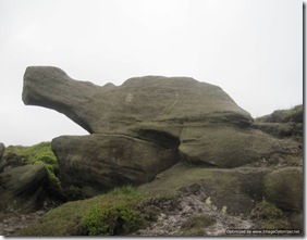
Shapely rocks. Is that bottom one an elephant or a turtle?!

By the time 1900 was approaching I’d reached the point of “I am going to pitch somewhere over there no matter what it’s like”. As it goes, it wasn’t bad at all. A nice pitch of short grass, with a little bit of shelter from the keen wind (well, until the wind shifted about 3 hours later). If it wasn’t for the wind dictating the direction in which I had to pitch, then I would have had a bit of a view too.

Obviously (or maybe not so obvious if you’re not familiar with Kinder during dry weather), there was no running water nearby, but I took the precaution of collecting some from the only stream I found running after leaving the valley. Peaty it was, but I’ve had peatier.

IMG_3179

I’m not sure whether this stream was completely dry or whether it’s where I got the water. There certainly wasn’t a lot of water, even in the one stream that was running. IMG_3185Well pitched tent, even if I do say so myself!

After giving the new (incredibly light (48g!)) stove its first test (a post on which is to follow in the next few days) and considered my options for Wednesday’s route (the original plan being out the window due to Day 1 ending six miles short of its target due to the late start), I settled down for a nice peaceful night…

…to be continued

Wednesday, 8 June 2011

TGO Challenge 2011 - Index


The 2011 TGO Challenge was generally acknowledged to be wet and windy, although for me it is the wind rather than the rain that has particularly stuck in my mind. We certainly had less wet weather than many (even though waterproofs were worn on every day bar one), but breeziness was a constant theme, and one which kept us from some of our planned high level days.

As usual, I blogged every day as we went, or at least I did until The Day Of The Storm, which was when my phone suffered a bit of a drowning incident. The final three days were written up on the train on the way home.

I've not edited the original blog posts in any way, and to make reading them easier for anyone visiting in the future, here's an index of those posts:

Day 0: Strathcarron

Day 1: to Gleann Innis an Loichel

Day 2: to Eskdale Moor

Day 3: to Drumnadrochit

Day 4: to River Findhorn

Day 5: to Coylumbridge


Day 6: to Corrour Bothy

Day 6 Side Trip: to Devil's Point

Day 7: to Mar Lodge

Day 8: To Braemar

Day 8a: Still in Braemar

Day 9: to Stables of Lee

Day 10: to Tarfside

Day 11: to North Water Bridge

Day 12: to St Cyrus

Finish Photo


Tuesday, 7 June 2011

Holding Post

So sound asleep was I when the alarm went off this morning that I spent a good few moments lying there trying to recall, from the depths of my sleepy mind, why it was that I’d set it for such an early hour*.

Finally I recalled that late last night I’d more-or-less packed my backpack, and the fact that I had a bus and two trains to catch this morning.

The start would have been a lot earlier had I stuck with Plan A (a chunk of the Pennine Way between Horton and Appleby), but late yesterday I decided that time and money would be saved if I stayed closer to home. So, to the Peak District I go.

All that wittering wasn’t the purpose of this post, though. I just wanted to hold this spot for a few reflections on this year’s TGO Challenge. I may even get really organised and create an index!

(*Actually, in the real world, it wasn’t an early hour at all; it’s just that I’ve been particularly lazy over the last week and a half since we got home.)