The Road goes ever on and on; Down from the door where it began;
Now far ahead the Road has gone; And I must follow, if I can;
Pursuing it with eager feet; Until it joins some larger way;
Where many paths and errands met; And whither then? I cannot say.

[JRR Tolkien, Lord of the Rings]

Monday 29 July 2024

Aborted Lakeland Backpack

Start/End Point: Coniston 
Distance and ascent: 29.9km, 1400m
Weather: Sunny intervals and warm rather than hot.

Another week, another backpacking trip. I’d originally been minded to go out for 2 nights, but if we were going to be in Coniston on Lakeland 100 weekend then I didn’t want to miss all of the goings-on, so I opted for another one-nighter, with the intention of being back in Coniston by the time the first L100 runner crossed the finish line on Saturday afternoon.

I’d also originally intended to try out various different bits of kit on this trip, but having contemplated the options, I stuck with what I’d taken last time, with the exception of the backpack itself. This time I went for the heaviest of my (small) collection: an Osprey Exos. It has been my pack of choice for the last thirteen years, so, I fully expected to find it the most comfortable with the best array of pockets.

With a plan settled (the first 30km of the Lakeland 100 route on Friday, before taking a detour up Mosedale (the near-Wasdale one) to camp, then a backtrack to Wasdale Head to cut over to Langdale to pick up the last 20k of the L100 route), we travelled up to Torver on Thursday, thence to Coniston on Friday morning. It was just before 11am when I set out.

The pull up from Coniston Village to the Walna Scar car park hasn’t got any less steep than it was last year, and I’m sure someone snuck some extra ascent into the rest of the Walna Scar Road (WSR). This wasn’t helped by a temporary loss of ability to read the map, so I thought I was almost at the top 15 minutes prematurely.


WSR wasn’t as busy as one might expect on a Friday in school holidays, and after I crested the top I saw not a single person to speak to until … well, let’s not have a spoiler*.

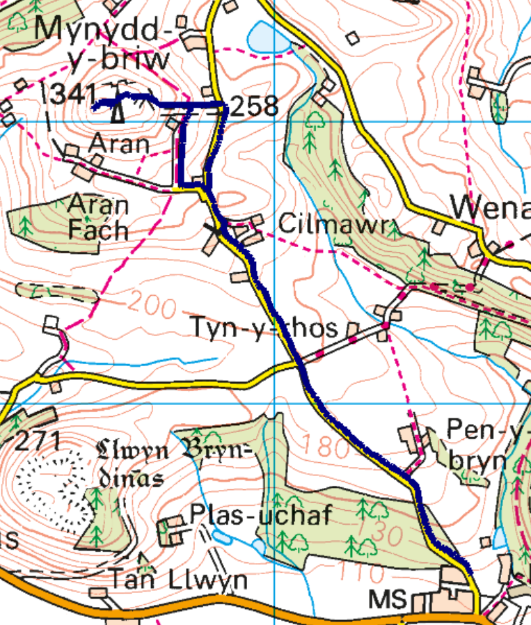
I’d not before followed the route down into Seathwaite nor the next 3km towards Hardknott Forest, and the last time I did the next section to Boot it was something silly like -4 degrees and frozen solid. Mick had warned me what a bogfest it would be, so I was surprised at how much good path there was. In fact, the bog didn’t start much before the place I’d met Mick when he was recceing the route and I’d walked out from Boot to meet him last spring.


It was certainly wet in places!

Taking time and care (which the L100 runners, coming through in around 6 hours’ time, wouldn’t have time for) it was possible to keep my feet mainly dry.

Out the other side of the forest, where it was also rather squelchy for the end of July, I managed to get a message out to Mick to let him know my location and that I was having a change of plan. At some point early in the outing I’d tweaked something on the left of my lower back (I’m being vague because I remember thinking ‘oooh, that’s sore’ but have no recollection what I did or exactly where I was when I did it), and whilst it wasn’t too painful to walk, it didn’t want to bend or twist. As it wasn’t easing off, it seemed somewhat imprudent to continue such that I would end the day on the opposite side of the Lake District, possibly wake in an even worse state on the morrow, and have no easy way of getting back to my start point. So, I would cut the route short, camping somewhere near the top of the River Esk, and go via Esk Hause in the morning to rejoin my route.  

A brief chat with Mick got cut off when the signal wandered off, and I then had another rethink. Surely, I thought, the most sensible thing to do would be to just turn around, retrace my steps, and find somewhere to camp at the top of the WSR. Then, if I was suffering in the morning, I would only have 5km downhill to get me back to Coniston.

As I started the retracing I did a few calculations. It had taken me 4 hours to do the first 16km (including breaks and faffs). If I could get back in the same timescale then I could attend the evening talk in the L100 marquee. Which would I prefer: to spend the night out or to enjoy the L100 weekend? I decided on the latter, so put a bit of a pace on and took a shortcut around Seathwaite (it took me through some lovely old woodland and involved stepping stones with a wire to hold on to).


Stepping stones with wire handrail 

By the time I got to the point where the WSR becomes an unsurfaced road, my back wasn’t bothering me at all, making me think I should have continued my outward route per plan. Then I stopped to filter some water. Yep, it still *really* didn’t like bending or twisting. A night in a tent would have been painful.

As I ascended back to Walna Scar, I had an eye on the clock, hoping that I would make it off the WSR before the 600+ runners came stampeding at me. As I crested the pass (which was the first opportunity I had to let Mick know to expect me back), I realised that if I really put a pace on I could make it back in time to see the L100 start.  

I made it with 12 minutes to spare and even beat Mick to the pavement outside the petrol station, which was our chosen viewing point.

Looking at the positives, I had a nice 30k outing with a full pack and plenty of ascent, and still had enough energy to walk over to the main event field and stand in a marquee for an hour after inhaling a suitable amount of food and drink.

As for the back, it was still sore this morning (Saturday), then suddenly it was okay again (i.e. no major pain on bending). Let’s hope whatever I did to it isn’t going to become a recurrent problem!

As for the Osprey Exos backpack – I think it was less comfortable than the OMM, and it felt heavier than the extra weight of the pack itself (and everything inside was the same as last week). It may be a while before my next trip, but I’ll have to do some more experiments with those two packs.  

 (*After leaving Walna Scar on the outward leg, the next people I saw close enough to talk to were at Walna Scar on my way back.)


Saturday 20 July 2024

Mynydd-y-Briw (SJ 174 260; 341m)

Thursday 18 July
Start point: Llangedwyn
Distance and ascent: 5km, 220m
Weather: warm with some sunshine


I couldn’t see a pleasing way to include this top within the backpacking trip of the previous two days, but it was easily gettable on the drive home. Had we been in Erica-the-Campervan it could have been as quick and easy as they come, requiring just 0.5km each way on a mast access track. However, we were in Bertie-the-Motorhome, who isn't so fond of tiny lanes, so Mick dropped me in Llangedwyn.

That gave me a longer distance to cover, but entirely on road and track, so you’d think that it was an uneventful outing. So it would have been, if I hadn’t opted to take the track that runs W of, and parallel to, the road on the outward leg.

There’s a bungalow that sits along that track, and as I got there I saw a sizeable black dog. The dog barked, but made no move towards me, so no problem … until it’s mate, an equally large but light coloured one, came running at me. It stopped uncomfortably close up and proceeded to snarl and lunge in between its barks. I talked to it nicely, but every time I twitched a muscle it lunged again and clearly wasn’t going to let me move from the spot. Oh, to have my poles with me (not to hit it; I find that holding the pointy ends towards a dog discourages them from coming too close)!

Eventually (by which I mean 'three minutes later', but it felt much longer), the owner came out to see what the commotion was about, and thus released me. I entered not into communication with her, but made my escape, soon pursued again by the dog, but by then I was the other side of a gate. It then pursued me up the boundary, on the other side of the fence.

The mast access track is steep, but short, and even through there is no public right of way to the summit, beyond the masts (actually, there’s no RoW up the mast access track either), there’s such a formal stile over the fence that one has to deduce that access is tolerated. On that basis I spent longer on the summit than I would, had I felt unwelcome. The views were excellent (except when looking back at the mast).

Unsurprisingly, I opted to use the entirety of the mast access track to return to the road, rather than taking the bridleway past the bungalow, and I jogged back down to Bertie.


Friday 19 July 2024

Welsh Marilyn Backpack Day 2

Wednesday 17 July - Llyn Lluncaws to Llangynog
Marilyn visited: Foel Cedig (SH 981 283; 667m)
Distance and ascent: 26.1km, 630m
Weather: Sunny and warm!


Short version: A really tough day of really hard-going terrain, but I did it!

Long version:
Compared with my backpacking trip on the Pennine Way a couple of weeks ago, when I barely slept at all, I slept reasonably well on this trip. All relative though, and it’s easy to do something ‘well’ when the benchmark is so low!

I didn’t set an alarm, deciding that I would wake up whenever I woke up. It turned out that was 4am and after half an hour of listening to my book, I thought I may as well make a move. It was a leisurely move, seeing me set out at just before 6am.

I made it about 100m before I found a much better pitch. Predictable, really.

Having opted to skirt the W side of the llyn, my intention had been to continue to the path that leads up the spur to Moel Sych. Part way there, I looked up the steep side of the bowl above me, and pondered whether to just head straight on up. It’s exactly what I would do if I was on some obscure Marilyn without a path. So, that’s what I did. It probably took the same time and the same effort as going the easier way around.

The path that then hugs the rim of the bowl is narrow, close to the edge and with a drop so long and precipitous that a trip in the wrong direction would certainly ruin your day, and likely kill you.

Not at all illustrative of the steepness with which the ground drops away. See those four sheep? I herded them quite a way.


By the time I got to the top, the cloud had burnt off from the summit, even if not from the valleys.

I then had a 5.8km walk, mainly downhill, which I’d expected to be reasonably speedy, but I found myself slowed by the waterlogged terrain:

Not the sign of a good summer when the bogs are this wet in July!

That 5.8k ended up taking me just over an hour and a half (slightly slower than the same distance had taken me going uphill yesterday). As it turned out, that was the easy and speedy part of the day!

The surroundings remained superb, and far more wild than yesterday, but I can emphatically say that if you’re on a mission to bag Foel Cedig, then there are far better ways of doing it than using the approach that I took (just use the perfectly good track from the W, that leads to within 120m of the summit – that would be far more sensible).

Good view, before it all got Very Hard Indeed.

This tractor had a mower on the back. I was soon most grateful that the farmer had so recently used this.

This track is not at all track-ish! Don’t be fooled by the suggestion of a trod.

Phew, now grateful for that mower and the mowing farmer. (The actual line of the alleged track is in the dip just to the right.)

Then I got to the heather, where there was a narrow, but good, trod, but it didn’t half wiggle around.

A few sections of hideous bog, and a few incidents of losing the line, but by and by I reached the high point of the ‘path’ where I was to turn off for just over 2km of pathlessness. There is no grazing up here, thus the heather is old, woody and knee-high (hiding the holes nicely) and there are no trods. I did find an ATV line for a short while, but then it reached a fence and stopped.

I can’t have gone very far before I started to question my route choice for this hill. Serious consideration was given to turning back – which probably would have been the wise choice given that the next 0.5km took me twenty minutes!

No hint of a trodden line and vegetation far deeper than it looks.

During that time Mick phoned and we had a chat that included a hiatus when I plunged one leg down a peaty-bog filled hole, straight up to my knee. Mick had the pleasure of listening to me repeating a certain naughty word until I pulled myself out of the hole and explained that I was rehearsing the script for the opening scenes of Four Weddings and a Funeral what had happened. We decided that maybe I should concentrate on what I was doing, rather than chatting to him.

There were recently felled pine trees dotted around this hillside, so why were there no ATV tracks anywhere near them? Did a group of tree fellers parachute in with chainsaws?! How did they get out?!

Do you see what I see over there? Seldom have I been so delighted to see a track (even if it was only going to be useful to me for 1km).

Hmmm. I hope this path hasn’t come a long way, and I just missed it! (Subsequent research suggests that, no, it only leads to nearby Yr Groes Fagl)

Despite all my moaning, the views were superb…

…and I still mustered a smile for the camera.

The summit of this Marilyn was moved a few years ago from nearby Cyrniau Nod, which I wanted to visit too, just for insurance against it being moved back in the future. First, though, I sat atop Foel Cedig with my shoes and socks off and wished that I had more food with me (I thought I’d had plenty, but had woken so hungry at half past midnight that I’d prematurely eaten second breakfast by way of a midnight feast). As I sat there, I contemplated again: to backtrack along the track before taking the high ground to Cyrniau Nod, or to just deadhead towards it? I opted for the latter.

The relief on reaching Cyrniau Nod (all downhill from here! There’s always a trod next to a fence!) was misplaced. It wasn’t all downhill, there were no trods and, what do you know – it was also rather boggy.

Still excellent views!

Three and a half kilometres (and over an hour) later, and I reached the track alongside Llyn y Mynydd, which was a veritable cause for celebration...

 ...the whole of the rest of the route was on good surfaces. I was also undoubtedly only minutes away from running water. The day was hot, I’d finished the litre I’d started out with, and I’d not passed a stream since just after I crossed the road some hours earlier.

I’d like to say that I had a good lunch break when I got to that water, but as I filtered myself another litre, I flicked a massive tick off one leg and removed an embedded one from the other leg. So, rather than having a lunchbreak amongst the ticks, I ate as I walked. There was no pudding; the tin of fish and two oatcakes was the very last of my food – lessons will be learnt from this!

The descent through the forest made me feel like I was Danny the Champion of the World. I don’t think I have ever seen so many pheasants. I even took a couple of videos of how they were emerging from the embankment to my left as I passed, and I constantly had a whole flock of them running ahead of me on the track.

When Mick had asked me earlier in the day if I wanted a lift from Llangynog, rather than walking 6km along the minor road, or 4.5km along the B road, I’d jumped at the chance. The problem then arose that I lost signal on both of my phones as I descended and never got it back. I thus pinned my hopes on finding Bertie-the-Motorhome sitting in the car park when I got there.

He wasn’t there, but at least there was a phone box, and phone boxes in locations with no phone signal usually still have a phone in them – as this one proved to have. Unfortunately, it hadn’t entered the 21st century and didn’t accept credit/debit cards and a furtle through my pockets proved that the £2 coin I had in my hipbelt pocket two weeks ago hadn’t been transferred to this week’s pack.

So, I sat on the wall in the car park and waited until I got bored of waiting (which admittedly was probably only a few minutes), at which point I thought I may as well start walking. It would take me less than an hour to walk to the campsite, but I had every confidence that Mick would appear along that road before long, and I had equal confidence that he wouldn’t take the minor back road.

Sure enough, within a few minutes Bertie trundled into sight (Mick would have been there sooner, but the SatNav had initially taken him down the little back road. Thank goodness he realised it wasn’t the best way and turned around, or I could have found myself at the campsite in Penybontfawr whilst he was waiting in the car park in Llangynog. At least he would have had coins for the phone box). I jumped in and headed straight for the fridge. The cold, alcohol-free beer I retrieved therefrom barely hit the sides.

Despite my grumbling about how hard the terrain had been (it really was; I can think of other hills I’ve done with equally tough terrain, but not for such a long distance, and certainly not whilst carrying a backpack … although clearly the distance was entirely my fault for choosing that route), it was satisfying to complete the route* and the hardness of Day 2 didn’t detract from how perfect Day 1 had been and what a wonderful area this is for a backpacking trip.  (*except the final little road walk, but if the campsite in Llangynog had been cheaper, that’s where Bertie would have been and where my walk would have ended anyway).

Thursday 18 July 2024

Welsh Marilyn Backpack – Day 1

Tuesday 16 July - Llansilin to Llyn Lluncaws
Marilyns: Gyrn Moelfre (SJ 184 293; 524m) and Cadair Berwyn (SJ 071 323; 832m)
Distance and Ascent: 27.5km, 1300m
Weather: mainly overcast with just one shower

What an excellent day I had! I can wax lyrical about this route (even if that is self-congratulatory in that it was of my own design). With lovely immediate surroundings, great views and interesting buildings (particularly the chapels, from a little quaint one, to a big abandoned one in an unlikely location), it made me a very happy backpacker. Even being chased by a dog shortly after setting out, at the only farm I passed through, didn’t dampen my spirits (the dog barked and chased; it didn’t snarl and lunge). 

Day 1, Part 1 (couldn't fit it in one screenshot)
Day 1, Part 2

I shall narrate via the photos:

Just after passing through the farm of the chasing dog, and off road onto my first track of the day:

Just out of frame to the left of the photo above was all manner of farm equipment. Amateur, as farm dumping grounds go:

View N from Gyrn Moelfre – the quaint tiny chapel is nestled in the trees just right of centre:

Proof that I was there taking these snaps:


Bit of a random snap. Placing an online order last week, I was £2.03 short of getting free postage (otherwise £5) , so I bought a high protein snack bar for £2.09 (purely because it was the cheapest item I could find on the website in question). I don’t know who positively chooses to buy these, but it certainly didn’t suit my tastes. I can only assume it was so incredibly sweet to take the mind off the pasty texture.

Looking from the summit I’d decided it was almost certainly feasible to drop down the N side of the hill, but I didn’t prove the point because I had no interest in cutting 1.5km off my route. Descending to the E took me onto this nice grassy track.

The most recent OS mapping still shows the route continuing along the track, through this gate, but the signage tells of a permanent official path diversion. The revised route is to the detriment of the walker (moreover horse and bike riders) to such an extent that I spent the length of the diversion mentally writing a letter of complaint (that will never make it onto paper) to the council.

The diversion gave me an onwards choice between two tracks, and I opted for the one that didn’t go between farm buildings. When I got to this bit, and had to wade the last puddle, I wondered if I’d made the right choice.

Now that’s a farm dumping ground! There is more than one car in that stack.

Then it rained…

…and these cows celebrated my visit by repeatedly stampeding right up to the fence, before stampeding back across the field:

What to do when you find a bench at lunchtime, but only 700m before you hope to find a pub? Clearly, my decision was to avail myself of the bench for first lunch.

Interesting design of church tower/spire, I thought:

Hmmm. That pub is definitely not open, is it?

 
(There was a bar/restaurant across the road but it had a ‘Michelin Listed’ sticker in the window and a bowl of soup was £9. I looked myself up and down and decided not to inflict my muddy state on the lunchtime clientelle.)

That’s a big old (now abandoned) chapel 3km up a 4km-long dead-end road:

Had I taken the footpaths on the other side of the river, rather than pounding the tarmac, this is where I would have emerged. Looking every bit as nettley and overgrown as I’d expected, it bore out my decision to stick to the road.

Let’s hope that’s for motor vehicles only!

A remarkably easy ascent on a gently ascending track, but after Monday’s rain it was in various states of river-esque:

The reason for the ‘road’ closure I assume:

I’d seen ‘shooting hut’ on the map and envisaged nice cropped grass outside where I could enjoy afternoon tea. I also intended to pick up water, as this was the last place where the map suggested I came close to running water (the map didn't know that the tracks had temporarily turned into streams). Clearly the tea break notion was out of the window, and aside from the fact that the river was such a deep brown colour, I decided that diverting to find water later was preferable to carrying it for the next 8km.

Looking back the way I’d come:

Turning left onto the Berwyn ridge at the top of the track, it was a narrow, and very wet, path that took me onwards. I imagine it’s usually quite dry most years in July.

Ooooh, duck boards! A nice dry-footed interlude:

View along the ridge. My earmarked camp spot was above the top corner of the far (mainly felled) forest.

Cadair Berwyn selfie. Need to look at my phone settings and see if I can stop it from blurring the background in summit selfies.

I could easily have pitched up on the ridge if: a) it hadn’t been so windy; and b) I had opted to carry water from the shooting hut. There was water everywhere up there, but in the manner of bog and murky pools, so ‘water water everywhere, not a drop to drink’. So I descended towards my earmarked spot and found some good pitches, but no nearby water (you can see on my gpx line on the map snippet at the top that I took a little detour down to the N, but not being able to hear any tinkling or babbling, I reascended for a rethink).

There’s definitely water down there, but from this vantage point the ground surrounding the llyn doesn’t look great for camping.

Unexpected! I took a little detour to make sure there wasn’t a farmer lying dead or injured alongside, but up close I could see it had been there for some time:

Far from an ideal pitch, but not the worst I’ve ever had:

I was pitched, with the kettle on by 1730, so rather earlier than I had hoped, but I’d not seen anyone since lunchtime, and only seen one set of footprints on the ridge, so figured it was unlikely anyone was going to happen along.