The Road goes ever on and on; Down from the door where it began;
Now far ahead the Road has gone; And I must follow, if I can;
Pursuing it with eager feet; Until it joins some larger way;
Where many paths and errands met; And whither then? I cannot say.

[JRR Tolkien, Lord of the Rings]

Friday, 16 July 2010

Dales High Way Photos

The weather wasn’t great for a non-photographer to take passable shots, but here are the pick of a (mainly bad) bunch:

Day 1

On Draughton Moor, heading towards Skipton:IMG_1728a Looking down to Skipton (and looking forward to a cup of tea):

IMG_1729a Popping over a well-built (and quite tall) stile (on Day 3 of the trip we climbed over what felt like dozens of ladder stiles, which had superseded adjacent wall stiles; most of those ladder stiles were too narrow to allow a person with a backpack to turn around to descend backwards. Not a problem for me, as I usually descend forwards or sideways – but it caused a few tights shuffles for Mick):

IMG_1731aThat pimple on the landscape ahead is Sharp Haw, up which we’re headed just as four other groups are on their ways back to their cars:

IMG_1733aThe near lump is Rough Haw, taken from the top of Sharp Haw. That’s the direction in which we’re headed next:

IMG_1736a

Low water in Winterburn Reservoir. That boat house (on the right) isn’t going to be much use just now:

IMG_1739aToptastic campsite location at Gordale Scar, albeit the toilet facilities and yard area could do with a bit of a clean-up. It seems that no rubbish left by a camper has ever been thrown away, it’s just all been stacked and hoarded.

IMG_1744a

Day 2:

After a series of multi-faffs, which saw the first mile take the best part of an hour, we finally got into our stride and up onto Ewe Moor, giving good views (even though the photo doesn’t illustrate it well!) back to Malham Tarn: IMG_1746aAlong this By-Way the National Park is filling in troughs in the ground by dumping loose aggregate into them. Didn’t strike me as a sympathetic way of rectifying erosion, but then it’s not a subject about which I know anything, so I’ll trust that the National Park knows what its doing:

IMG_1747a Great Scar, Settle Scar and Attermire Scar, just before Settle:

IMG_1750aHeading down to Settle. It was about this point that we started to hear a pot of tea calling our names:

IMG_1751aHaving dragged ourselves away from the food and drink of Settle, we reached Stainforth Force, where Mick posed for a picture:

IMG_1752aSo did I, although what I first notice from this photo isn’t the waterfall or the bridge, but the bad hair day I seem to be having!

IMG_1754a

Day 3:

Not great weather as we cross the Clapper Bridge beyond Wharfe. Apparently it’s a popular spot, but not that early on a grey day:

IMG_1756aTwo trees stand in the vast limestone pavement (in the pissing rain), just below Ingleborough. Again, the snapshot doesn’t come close to doing it justice:

IMG_1758a

Not long afterwards the decision was made to make the mad dash for the early train, and with the weather being decidedly wet during the descent, and with us being in such a rush, the camera didn’t see the light of day again on this trip.

Thursday, 15 July 2010

Little Stainforth to Horton

Thurs 15 July
Distance: 8.5 miles

We're thinking of rebranding ourselves: 'Fair Weather Walkers Am We'...

It was another wet and blustery night, but once again the rain obliged us by stopping shortly before we depitched, and just before 7am we were striding in the direction of Feizor.

Feizor boasts a tea room which is, apparently, open 7 days a week, but 7.30 was a bit early for it. That might have been quite upsetting had I not managed to wring just enough gas out of our failing canister to make 2 cups before we set out.

Onwards to Wharfe we went on obvious paths and tracks, and from the hamlet a nice walled track was picked up. Overgrown in places, it gave our legs a bit of a soaking, but it was so warm that the dampness was not uncomfortable.

A significant multi-faff (all mine) at Clapper Bridge (of which I should have taken a photo with my phone, but didn't think of it at the time), allowed us to cool down a bit before we started the next bit of ascent: over the limestone pavements to Ingleborough.

The rain started as we crossed those pavements, but even in the damp conditions we could appreciate the impressive geological features. It's definitely worth taking that route.

With rain still falling, and with the top of Ingleborough heavily clad in cloud, I gave Mick 2 options: 1) go up Ingleborough, as he's never been to the top; or 2) leave the top and the rest of the route for a better day and hot-foot it down to Horton for the 10.30 train.

Mick opted for the latter, even though we knew we were cutting it rather fine for the train.

The path was much trickier in the wet than it had been when I flew down it 3 weeks ago, and a pause was had for Mick to don waterproofs when the heavems really opened, but with some serious dedication to pace we made it to the station with a whole 2 minutes to spare (phew - it would have been a 3 hour wait for the next train).

And who, by coincidence, should we find on the platform, but Trentham Walker (who, you may recall, I bumped into in Malham when I passed through a month ago). I'm not sure if he's stalking me or the other way around!

So, our trip ended slightly prematurely (the intention had been to reach Dent on this outing), but as it goes we've split the entire route nicely. Another time we can return to Horton and spend another 3 days reaching the end of the route at Appleby.
Sent using BlackBerry® from Orange

Wednesday, 14 July 2010

Gordale Scar to Little Stainforth

Wednesday 14 July
Distance: 10.5 miles

It was a wet and blustery night, but aside from vaguely waking occasionally when the tent was shaking violently, a good night's sleep was had (a comfortable one too, on my newly acquired POE Insul Mat Max Thermo).

By the time we had succumbed to a lazy lie-in this morning, the rain had stopped and there was even blue to be seen in the sky. Slowly we pulled ourselves together, but by the time we were ready for the off, at 8.30, the sky was again looking rather dull and rain laden.

On Ewe Moor we caught up with 4 of the large group of army chaps who had been at the campsite in the Orange Tent City. After a bit of chat, Mick asked whether their packs were heavy. "Yes" they all said, and one added "35". "Thirty-five pounds?" said Mick. "No, kilos" said the army chap "so about 70lbs". We stood open mouthed. Mick asked if he could try to lift one. Continuing on our way a while later I asked him how monstrously heavy it was. "About 15 kilos, maybe 20" he said.

Having enjoyed excellent views back to Malham Tarn as we made our way over the moor, we started to approach the various Scars to the east of Settle and our already leisurely progress was slowed further. Some sheep gathering was going on ahead of us and not wanting to get in the way and accidentally scatter the sheep, we happily stood and watched for 20 minutes as the couple and the single dog brought in an entire flock off the moor. The dog was exhausted by the end of it, and seemed quite pleased when it wasn't made to chase the single lamb which made a bolt for freedom at the last minute.

Some refuelling took place in Settle, and Mick parted with some cash in exchange for Sorbothane foot beds, which he cut to pieces before even leaving the shop, then it was onwards, up the River Ribble.

Past Stainforth Force we went (perhaps it's just me, but I have real trouble saying Stainforth Force and getting 'forth' and 'force' in the right places!), and to the campsite just a handful of paces further on. It's not where we'd originally intended to stay tonight. We should have walked further, but I really wanted a nice shower, which was available here but not at our planned destination.

It was a good decision. The rain, which had held off the whole time we had been walking, struck the moment we had the tent up. Excellent timing for the second day in a row. This luck can't last, can it?

(Carol, JJ, LIAF - thanks for the confirmations that I wasn't making up words!)
Sent using BlackBerry® from Orange

Ilkley to Gordale Scar

Tuesday 13 July
Distance: 20.5 miles

Two late changes were made to my plan for this trip, one following from the other. Based on Saturday's weather forecast for the upcoming week, I voiced the possibility of delaying my departure by a day so as to get the best of a not-great looking week's weather. Mick in turn decided that if I delayed the trip until Tuesday, then he could come along.

And so it was the two of us that strode out of Ilkley train station this morning, after an early start, to walk a chunk of the Dales High Way.

It wasn't a bad day for it. Cloudy it was, but pleasantly warm and only a moderate breeze. However, we knew that we had quite a distance to go, and that rain was forecast from about 4pm, so we wasted no time heading off towards Skipton.

The track from Addingham to Skipton was pleasing, being well defined and having sufficient elevation to give a good view, and arriving in Skipton it seemed reasonable to seek out a tea room. We went in the first we found, which was right at the far end of the town, and then found after we left that there are five more within ten paces after that.

Four sets of people were met coming down off the lump-in-the-landscape that is Sharp Haw as we made our way up at just after 1pm. It was a false representation of how busy our route was as not another person was then seen until we passed the almost-empty Winterburn Reservoir where three mothers with babies strapped to them were heading the other way.

The climb up to the second trig point of the day, atop The Weets, seemed never ending, so long and gentle was it. The descent was somewhat faster, thanks to its knee-killing steepness.

By this time there was rain to the west and to the south of us and we were clearly on borrowed time until it hit.

We were lucky. It was about 200 yards before the campsite when it started to drizzle, and the worst of the shower held off until the tent was up.

Our position on the campsite was decided by the presence of two groups here, one of which is rather a big one with lots of matching orange ridge tents. We've pitched about as far away as we can get, alongside the families, and so far from the facilities that most people with a car would probably drive to them.

The benefit of being so far up the campsite is that we're almost in Gordale Scar, which is a mighty fine natural feature indeed. From the point of view of picturesqueness*, there are certainly worse places to camp.

(*made up word alert)
Sent using BlackBerry® from Orange

Thursday, 8 July 2010

Rain

I thought that I had jinxed summer this week, by taking delivery of a pair of shorts that not only fit me but seem to be made out of a decent fabric (the pair that I knocked together a couple of weeks ago had the flaw of becoming more uncomfortable the stickier I got).

Buying summer clothes has always put an immediate stop to good weather before, and sure enough, within 24 hours after taking delivery the forecast was for a considerable lump of rain to pass over the area.

About three drops fell.

The cracks in the ground on one of my routes are now so big that I fear that I may disappear down one of them:

 IMG_1724

IMG_1725

And yet, despite ground so dry that it seems that there is not an ounce of water left in it, the nettles still continue to thrive. I had to make my way through these, measuring up to six feet high (with great care, I even avoided being stung):

 IMG_1723

Today I made even greater efforts to provoke rain. Before I walked into town, I took my jacket out of my bag. And, it did rain, but it was so warm and the rain so light, that the ground didn’t even get vaguely damp.

So, one final attempt to cause an end to the dry spell has been made. I’ve plotted a route. I’ve worked out logistics. Next week I’m off on another little solo jaunt. After what feels like months of gorgeous weather, it’s bound to rain, isn’t it?

Tuesday, 6 July 2010

From Yarm to Hurworth-on-Tees

A chunk of the Teesdale Way, between Yarm and Hurworth, may seem like a bit of an odd choice for a day walk for Midlands-dwelling people, but that is where we walked yesterday, with our purpose being to meet up with Conrad, who is currently walking from Lowestoft to St. Bees.

A good evening had been spent in Conrad’s company on Sunday night, having picked him up at the end of his day’s walking and whisked him off to the nearest campsite, and then bright and early yesterday morning, I deposited the chaps back in Yarm. Leaving them to start walking, off I tootled to find a suitable place to leave the car for the day, before hot-footing it back to the Tees to loiter on a bridge, which gave a good opportunity to admire the adjacent viaduct:

IMG_1712Once Conrad and Mick had surprised me by emerging from a direction other than the one I expected, onto the Teesdale Way we went, at first finding it to be a well-trodden path (courtesy of local dog-walkers, I imagine).

Beyond the boundary of dog-walkers’ territory, the path became a little less distinct, but still not bad:

IMG_1714Then things all became a little more difficult as the undergrowth got more and more overgrown, finally descending into the realms of farce as we found ourselves wading through monstrously tall green stuff including nettles and giant hogweed (which I can confirm deserves the ‘giant’ bit of its name).

With the unpleasantness of nettle-rash, and the dire warning posters about the dangers of touching giant hogweed, progress was slowed as we wended our way through in single-file:

IMG_1718It transpired that we were a day early in tackling one of the more overgrown sections; as we reached the end of the field eight chaps in Personal Protective Equipment and wielding strimmers emerged from the woodland and made their way towards us. They warned us that we still had one overgrown section to go – and they weren’t wrong.

Some of the greenery was festooned with spiky black caterpillars:

IMG_1716

The trials of monster plants did finally abate, and the rest of the walk was pleasant indeed, with farmland, the edge of a few villages and all nice easy walking. What was particularly notable, though, was that for a walk that mainly follows a river, in the section we walked we barely had a glimpse of the water as it was hidden variously by a bank, by trees or by monster plantage.

At Lower Dinsdale none of us felt inclined to take large three-sides-of-a-square loop of the Teesdale Way, so after lunch in front of the village church:

IMG_1720 it was to tarmac that we took for the last chunk of the day.

Chatting away, it seemed like no time had passed before we got into Hurworth, from where we were to part company with Conrad. He was to head further towards St Bees; we were to take some field-paths up to Darlington to catch a train back to the car.

We didn’t take to those field-paths. A bus stop was spotted and the timetable told us that the next bus was only ten minutes hence.

With no thanks to the bus driver, who promised to tell us when we needed to get off his bus and then completely forgot, forty-five minutes later we had successfully trotted back across Darlington, negotiated our way onto and off the right train and were striding back towards the car for our journey home.

It was great to catch up with Conrad (who we first met, 2 years ago, in a field with awful stiles, somewhere in Somerset, as we were all making our ways from Land’s End to John O’Groats), and we look forward to keeping track with what is left of his walk.

The stats for my day were 12.5 miles walked (Mick walked further, having started in Yarm) with (allegedly) 1000 feet of upness (I remember one small bank and a few minor undulations; not sure where the rest of that ascent occurred)


Sunday, 27 June 2010

Prickle, Scratch, Sting

It has become an increasing problem of late that so many of our local paths (and no doubt similar paths over farmland nationwide) are overgrown with, amongst other things, five-feet tall stinging nettles, and long snaking brambles.

With that in mind, today’s outing was folly.

Even greater folly was choosing to wear shorts (the first time in eight years that I’ve walked in shorts; eight years ago I got put off by an encounter with nettles…). I didn’t even own a pair of shorts until half an hour before we left the house, when an old pair of walking trousers succumbed to an assault with scissors and WonderWeb.

The inspiration for today’s walk was, once again, the football (or to be precise, more Football Avoidance). A barbecue had been enjoyed with eldest step-son and family, and when everyone then settled down to watch the football, I strode off in the direction of home.

Eight million cows in a small field was the first obstacle, followed swiftly by nettles, brambles, thistles, broken stiles, barbed wire, nettles, brambles, thistles, electric fences, waist high grass, nettles, brambles, thistles, knee high grass, nettles, brambles, thistles, woefully lacking waymarking and, just for good measure, a few more nettles.

I didn’t make it the whole way home. Just as I had overcome the last obstacle and was set for an easy stroll through the last 3-miles, I spoke to Mick and he was just heading home himself. I’d had enough of my outing. “Wait ten minutes, then meet me at the bridge” I said.

I climbed into the car a while later with bloody scratches and nettle rash all over my lower legs. They’re still tingling now. I’ll think more carefully about wearing shorts in future. And I’ll certainly not be taking that route again!

 IMG_1708

 An ex-woodland sort of a pond

IMG_1710

Overgrown nightmare – fortunately this one easy to by-pass

IMG_1709

If I’d battled through the nettles here, I would have been faced with wheat planted right up to the field boundary. I took my chances with the cows in the adjacent field.

The stats were 7 miles walked, with a tiny handful of ascent.

National Memorial Arboretum

The route for yesterday’s fresh air and exercise was based entirely on some reasonably local Geocaches, and gave the added bonus that it would take us to a couple of local areas that we have not before visited.

It also took us to the National Memorial Arboretum at Alrewas. We’ve been there a few times, and always seem to find ourselves visiting on unusually busy days. That yesterday was National Armed Forces Day had slipped my mind until we saw how many people were around (many in uniform).

Our route only took us around the edge, but there seem to have been a few changes/additions since we were there last, so I was put in mind to return on a sunny weekday to have another proper look around (and if you ever happen to find yourself driving up or down the A38 past Alrewas, I would recommend pausing to take a look around the place yourself). Here are a few snaps of the bits we passed:

 IMG_1699 IMG_1700 IMG_1701 IMG_1702 IMG_1706

Leaving the Arboretum, Croxall Lakes was our objective, and more particularly the Noon Pole there. Apparently, there are a series of these poles located throughout the National Forest, their feature being that for 10-15 minutes at ‘true noon’ on Midsummer and Midwinter’s days, light will shine through the slit in the pole (true noon being 1306 in summer in this neck of the woods). This one is made of English Oak:

IMG_1705

By coincidence rather than by design, by the time we had found the Geocache we were seeking, and sat and had a spot of lunch, it was 1pm, so we hung around for a while. Finally, at 1.16 the light shone through, then the sun promptly went behind a big cloud and off we set for our return leg.

A smidge over 9 miles were walked in total. Being the land of flatness, most of our ascent was created by going over bridges!

Tuesday, 22 June 2010

Tuesday 22 June: Yorkshire 3 Peaks

Summary:

A 23.9 mile route* taking in the summits of Pen-y-ghent, Whernside and Ingleborough, completed in 8 hours and 15 minutes.

Prologue:

As I climbed up the side of Pen-y-Ghent last Monday, it struck me that (to my recollection) I’ve never been up Whernside or Ingleborough, and I thought it was about time that I righted that omission. Meeting Mick at the end of my walk last week, I asked how he fancied tackling the two of them this week. He reminded me that he has a poorly back at the moment that is precluding him from such activities.

The subject went from my mind until the following morning. In the process of waking up on Saturday morning, the thought suddenly jumped into my head that having walked 24.5 miles last Wednesday, with 4500 feet of ascent, with a full pack, and in hot weather, I was probably in a fit state to have a crack at the full Yorkshire 3 Peaks route.

Mick woke up to be greeted by a request to be my support for the day. He’s a nice chap is Mick, and he readily agreed.

Today was the day in question (well, no point in hanging around once you’ve decided to do these things!).

Today:

With the day forecast to be rather on the warm side for walking up hills at speed, I adjudged that an early start was probably wise, and so it was that at 0610 I left the car park in Horton in Ribblesdale, telling Mick I would see him in three hours time by Ribble Viaduct.

My departure was hot on the heels of a group of five women and a little ahead of them was a singleton chap (all of whom had been seen as we drove up to the car park). I’ve no idea what route the women took to get out of Horton, but it certainly wasn’t the most obvious or the most efficient, as only about ten minutes in I saw them walking towards me, as we all headed to the same turning, and a few moments later I was striding on ahead.

It was 0705 when I arrived on the summit of Pen-y-Ghent on the most glorious of glorious mornings, although the brisk breeze up there did make positioning the camera for a self-photo a little tricky (near to the edge of the trig point the camera wanted to blow off), hence the following ill-framed photo, with a big chunk of trig-point in the foreground:

IMG_1669

Soon, on my way down the other side, with excellent views of my next two objectives,

IMG_1672

I was braced for the man-eating bogs that are renowned on the route. There was indeed evidence of bog-sites (the following one scattered with pieces of wood to act as stepping stones and bridges), but today all but a couple of areas were bone dry:

IMG_1676

My first pause of the day was had when I came across a man in pain with a knee that was conspiring against his 3 Peaks attempt. Despite his encouragement for me to carry on as he insisted that ‘the clock is ticking’, I had some painkillers and he didn’t, so I dug them out of my pack, cut a couple off the strip and wished him luck before I toddled off down the last bit of the hillside and along the B-road.

Mick was waiting at the parking area by Ribblehead Viaduct when I got there at 0910,

IMG_1681

and there I paused for a banana and to top up my water, but with half of my mind on wanting to make sure that I completed the round in the traditional 12 hours (actually, I was rather hoping to achieve 10 hours), it was only ten minutes later when I bade Mick farewell again and strode off to walk up Whernside at a pace that has never before been witnessed when I’ve been walking uphill.

The top was in and out of cloud by the time I got there at 1043 (it was the saviour of the day; contrary to the hot weather forecast, it was actually rather cool on both the way up and the way down), shortly before which I had paused for a chat with a chap and his two young children near the top, but still managed to find myself with the trig-point to myself, so it was another self-timed photo:

IMG_1685

I soon dropped below the cloud:

IMG_1686

but, my goodness, that first bit of the steep descent is a bit of a killer on the knees!

Having been only marginally waylaid by a couple of chaps who wanted to know about my experience of walking with two poles, the descent took me three quarters of an hour (so not actually as slow as it seemed at the time), and reaching the road it was back into the car for another break and some lunch.

At this point, I was struggling to comprehend that I was already two-thirds of the way through the walk, but that it wasn’t even noon. As fresh as I still felt (something else that also surprised me at this point), I felt sure that my pace would slow considerably on the last hill – particularly as the map seemed to indicate that a couple of sections near the top were going to be quite steep.

Those steep bits were powered by Jelly Babies, but even so, it felt like I was barely making any upwards progress. Perhaps all I really needed was a brief pause to catch my breath, as after a chat with a local couple things didn’t seem quite so bad, and I got onto the summit plateau just as all of its occupants (including 30 school children, their chaperones, and four other walkers) were leaving it.

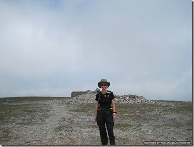
As well as the weather finally clearing a bit, I seemed to be getting better at the self-timed photos:
IMG_1693

A look at the map and a quick calculation told me that, having reached the final summit at 1300, it really was in my grasp to get back to Horton within 9 hours of setting out. Any notion of taking in my surroundings was forgotten as I got all competitive with myself and positively flew past the hoards who were descending (they really must have wondered about my sanity).

With the sun now firmly out and the wind having dropped, it was getting uncomfortably warm, but I was a girl on a mission. More Jelly Babies fuelled an even bigger burst of speed when I passed the ‘Horton 2.75 miles’ marker and realised that, at a push, 8.5 hours was achievable.

IMG_1695 Pen-y-Ghent back in view

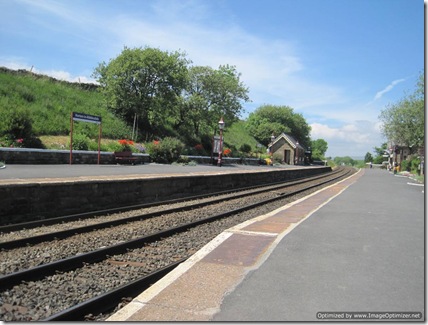
‘Last Half Mile Syndrome’ was kicking in, and my knees were starting to ache, as I crossed the railway at the uncommonly well-kept Horton Station:
IMG_1698

from where it was but a few hops, a few skips and a few jumps back to my start point. I ploughed on, going as fast as my little legs could carry me without running.

It was 1425 as I walked across the car park in Horton, with Mick doing a double take when he saw me coming. He was my one-man cheering squad as I walked past my start point.

After

I can’t say that I would ordinarily go for walking over hills at such pace. It’s always nice to be able to take the time to look around and take in the views (not to mention to take the time to cool down on hot days). That said, it was good fun to have a bit of a challenge, and I was chuffed to bits with the end result**.

I was even more chuffed to get out of the car when we got home and find that I could still walk!

(*I wore the GPS all day to record my route and stats, and so that I could keep an eye on my pace. It told me that I was stationary for 53 minutes of the 8.25 hours I had been out. The distance covered was 23.9 miles, but that did include a minor navigational blip (I saw a stile and assumed I needed to go over it, without paying any attention to where I was going – Doh!), and the small detours to meet Mick for elevenses and lunch.

**Undoubtedly the dry underfoot conditions and mainly-excellent visibility helped speed me around.)

Friday, 18 June 2010

Contrasts: Black Hill

When Mick and I tootled up the Pennine Way in 2008 (22/5/08) Black Hill was very black, albeit sprinkled with white pellets of fertiliser as part of a re-greening project. This is how it looked:

Black Hill

What a contrast it is now. This photo was taken yesterday (17/6/10). It seems that the re-greening has been successful:

Black Hll It’s rather pretty now. And you can’t fault that sky, can you?

Bleaklow to Upper Booth

Distance: 11.5 miles

Weather: overcast

Number of mountain hares: 3

Number of lizardy things: 1 (could have been 2, depending on whether other tail I saw disappearing under a rock was a lizardy thing or a snake)

It was just gone a quarter past six this morning (rather earlier than my usual hour) when I left my camping spot and took to the trail again. The weather was decidedly overcast, but still warm enough for most of the walk to be completed in my short sleeves*.

Heat was also being generated by my speed. I was on a mission! Mick had very kindly offered to come and pick me up from Edale, and I had given a ridiculously early estimated time of arrival. I could have revised my estimate, but I was up for a challenge, so along I sped to see how close to that time I could get.

IMG_1645 Approaching Wain Stones (I’d deviated from the Pennine Way to camp, and rejoined it just after Wain Stones)

I still had time to look around me though, and to take a few photos (although the weather conditions weren’t really ideal for getting good views), and I passed a few minutes with a chap who had also opted for an early start, but was heading the other way on his first day of the Way.

IMG_1655 About to hit a layer of low-level cloud, on my way to the Snake Road

At Kinder Downfall (not boasting much liquid falling down today) time was taken for second breakfast and to don an extra layer. The day was still reasonably warm, but there was quite a brisk wind, so as soon as I stopped I cooled quickly.

IMG_1661 The rather dry river bed, looking upstream from Kinder Downfall

I was soon on the go again, and only five minutes later I saw someone else coming towards me, and who should it be but Mick? Perhaps at that point I could have slowed down, as the ETA was irrelevant, but uttering “I want to see if I can make it to Jacob’s Ladder by 10”, I barely broke stride as Mick did an about turn and we trotted along together (me chatting incessantly, but Mick probably expected that!).

We did make it to Jacob’s Ladder by 10, and by 11 we were at Barber Booth, which is where Mick had parked. Given that my objective for the walk was to reach Glossop, I didn’t feel obligated to walk the final couple of miles over to Edale to consider my walk complete, and so without further ado** into the car we got. Ten minutes later, on our way home, it started to rain. Excellent timing, I thought.

And so my FAT*** was over. Excellent fun it was too (I think the weather helped). I rather liked the Pennine Way when we walked it as part of our LEJOG in 2008, but had forgotten quite how nice it is, and that section between Horton and Edale does boast an excellent selection of scenery.

(*Actually, when I say ‘my short sleeves’, I mean Mick’s, because I accidentally picked up Mick’s black short sleeved Icebreaker rather than my own. It’s the problem of having Howard & Hilda kit. As it happens, I found the baggy fit much more comfortable in the conditions.

**That’s not strictly true. If you must know, before I got into the car I looked around to check there was no-one in the immediate vicinity, and dropped my trousers. “Urgh” said Mick. I knew that the bites on my right leg were quite large, but my reaction to them seemed to have increased ten fold since last night. Don’t know what it was that bit me on that leg, but my body doesn’t seem to object so much to whatever bit me on the left leg. That’ll teach me to close my leg vents before sitting on the grass for lunch!

***Football Avoidance Trip)

Thursday, 17 June 2010

Standedge to Bleaklow

Distance: 14.5 miles
Weather: another glorious day!

A less waffly post today - I have a dwindling battery supply and need to make sure I have enough power left to facilitate a lift home tomorrow!

It was a leisurely start to the day, before meeting up with Martin & Sue (www.phreerunner.blogspot.com) at 9.30 for the walk over to Crowden. I knew that Crowden was where I was going to stop because I distinctly remember saying so to Martin earlier in the week...

It was Martin who pointed out the possibility of going straight on at Black Moss Reservoir. It was an alternative to repeating a bit of route I've done before so that's what we did, approaching Black Hill from the NW (with only a small amount of yomping required - glad the weather's been dry).

Black Hill was noticeably greener than it was 2 years ago, when it was scattered with seed.

Between Black Hill and Laddow Rocks an exceptionally tasty lunch was had (huge thanks go to Martin and Sue for said tasty lunch - it was very much appreciated). Then we had our feet filmed (wonder what that footage is going to be used for?!) as we passed by the scene of a mountain rescue incident. Helicopter personnel were already on the scene, and over the next half an hour many MRT chaps passed us, rushing to the rescue.

Arriving at the foot of Laddow Rocks, my mind was made up that I couldn't face and entire afternoon sitting in the tent at what is, by reputation, a very midgey campsite. It was only 3pm and that gave a lot of hours to sit in a hot tent on a sunny day.

I would instead continue to Glossop - another long day - and end my walk there.

The plan changed when I spotted a lovely grassy area alongside a lovely stream a few miles later.

So, it was a short day today after all, but ending in a much more pleasing place than Crowden Campsite. Another day of excellent scenery too, under more stunning skies, and made better still by good company.

Definitely a short day tomorrow. I'm not walking beyond Edale!
Sent using BlackBerry® from Orange

Wednesday, 16 June 2010

Colden to Standedge

Distance: 18ish miles
Weather: as sunny as sunny can be
Number of killer poodles: 1 (standard, not toy!)
Number of overly inquisitive sheep: 10 (6+2+2)
Number of comedy falls: 1

It's unsurprising, after yesterday's efforts, that I slept well last night, disturbed only by some yobs chanting at full voice (thankfully some distance away) between 1.30 and 2am. Maybe they went on longer - I slept the rest of the night with my audio book blocking out other noises.

"How can it be morning already" I wondered as my alarm went off, but I managed to drag myself out of bed, finding that my muslces had recovered overnight and I felt fine. The feeling fine lasted until I nipped behind the tent to take a photo of it with Stoodley Pike in the distance, and fell over the end guy in a true comedy style (straight down - no arms out to break the fall). A rather bruised knee ensued.

The eight tents unlawfully pitched beside Golden Water, together with the remains of a number of bbqs and a very large scattering of beer bottles, cans and general rubbish may have been the explanation of last night's disturbance, but all was quiet as I walked through. Perhaps I should have treated them to a few football chants of my own?

The walk up to Stoodley Pike was delightful, being mainly shaded, and it was at the monument that Steve caught up with me. We first met when we were pitched next to each other at Gargrave and since have been doing a hare and tortoise act. My natural pace is a tiny bit quicker than Steve's, but he doesn't stop or faff. So, every time I'm just picking my pack up after a break, Steve catches up with me and we walk together a while until my pace picks back up again.

A sign-post saying "White House 2 3/4 miles" saw me put an extra spurt on, as it made me hear a pint of shandy calling my name, and today I was blessed with the pub not only still being in business, but also being open. Oh that drink tasted good and cool interior of the pub was a nice break for my rather pink arms.

The scariest two minutes of my entire walking career came a while later. I had no idea that motorway foot bridges, which are terrifying at the best of times become so much more terrifying when you haven't got someone with you ridiculing your terror. It probably didn't help that the bridge in question is about a thousand feet high and about eight miles long, and the cars underneath are doing about 300 miles an hour ... or at least that's how it seemed for those 2 minutes.
I recovered my senses with oat cakes and sardines half way up White Hill, finding that once again the stop in the hot conditions had caused all of my energy to desert me.

I did, of course, eventually drag myself back to my feet and the rest of the afternoon was just as superb as the morning, with stunningly clear views and even more reservoirs with dwindling water levels.

Powered by chocolate, the kilometre along the verge of the A62 was completed, and now I'm at The Carriage House, where after last year's experience I didn't think I would return. I'm hoping that a Wednesday in June will prove to be more peaceful than a Saturday in July!

So, another excellent day completed. Tomorrow's just a short one.


Sent using BlackBerry® from Orange

Tuesday, 15 June 2010

Gargrave to Colden

Distance: 24.5 miles
Weather: glorious and stupidly hot to be walking that far!
Number of other PW walkers seen: 6

Whatever possessed me to walk that far on a day as hot as today?! I'm not sure that's a question that can be answered, but here's how it happened:

The day started quite normally really. By 7.15 I was walking and I wasn't even delayed much by the Co-op, choosing my groceries in record time, so without much ado I left Gargrave.

The early morning was a game of 'spot the stile' as farmland was the theme - a contrast to yesterday's spectacular scenery, but pleasing nevertheless. Chats were had with any number of cows which I needed to move from my path.

Farmland gave way to more open land, making the way-finding easier, and after a vast amount of upness (or so it felt) the hour was gone noon and so I found the shade of a tree next to a stream to have a good lunch break.

The afternoon didn't start with promise. It seemed that someone had snuck lead weights in each of my shoes whilst I'd had them off at lunch. And I was tired - so very tired that it was sorely tempting to just lie down at the side of the path for a snooze.

Over the moor-of-the-sheds-with-chimney-breasts I went (wish I'd taken a photo with my phone; I'll add one when I get home) at a remarkably slow pace - not helped by the fact that 90% of that moor is uphill (or so it seemed).

When finally I did start to descend, a decision was made: I was low on water, I was tired and I was moving too slowly - the only sensible thing to do was to stop at Ponden House for the night.

With only a short distance left to go, I dawdled some more; I even stopped a few times.

Then I ran out of water, which was perplexing, because my bag was awfully heavy if I'd drunk all of my water (a kink in my water tube was the answer, as I later found).

And then after all of that time-wasting, I got to Ponden House to find that it was only 2.30. I couldn't quite bring myself to stop at such an early hour and from somewhere (perhaps the sugary flapjack I'd just eaten) I found the energy to think that I could make it to Colden, just outside Hedben Bridge - another 8.5 miles.

With sweat still pouring off me and the sun still beating down, I started to question my sanity. Moreover when bits of me really started to protest. By then, I didn't have much option: I didn't have enough water to camp and none of the murky-brown streams were enticing me to use them.

At 1745 I rejoiced to find myself outside of High Gate Farm in Colden (free camping and a spectacular little shop), where an ice cream revived me enough to pitch the tent.

Later I may find the energy to walk back across to the shop (thirty paces away, at most), to buy some supplies for the next 3 days.

As for tomorrow, having completed half of the journey in the first two days, I can say with certainty that it will be shorter than today!


Sent using BlackBerry® from Orange