
Sent using BlackBerry® from Orange
Sunday, 1 May 2011

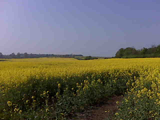
Day 35 Photo

Sent using BlackBerry® from Orange
Day 35 - E of Muthill to S of Loch Lednock
Sunday 1 May (0740-1555)
Distance: 18.25 miles (Tot: 616)
Weather: A couple of lenticular clouds in the distance didn't hinder the wall-to-wall sunshine. Hot.
Number of too-small kissing gates encountered in the space of 2 miles: 15
Number of damned-cuckoos heard: 1 (first of the year)
Distance: 18.25 miles (Tot: 616)
Weather: A couple of lenticular clouds in the distance didn't hinder the wall-to-wall sunshine. Hot.
Number of too-small kissing gates encountered in the space of 2 miles: 15
Number of damned-cuckoos heard: 1 (first of the year)
The sun did its work before we got on our way this morning: the frost had melted and the tent had almost dried. The grass was sopping, mind, so I was glad for my Goretex socks.
Our luck with the disused railway line expired less than half a mile into the day. Industrial buildings blocked the way and after a bit of an exploratory back and forth (with a security guard watching us) there was no way through. We resigned ourselves to a road-walk into Crieff.
A while later, at the very point where I had planned for us to take to the roads as I knew that the bridge over the river no longer existed, there was a footpath sign, pointing along the rly bed, saying 'Crieff 2.5 miles'. Curious, we thought, but we believed the sign and so followed it.
It turns out that there's a path (absolutely festooned with kissing gates that are too small to get through with a backpack) running alongside the river, right the way into Crieff. It was infinitely nicer than the road would have been.
The other side of Crieff what should we find but another road-avoiding path. Things were looking good and to put the icing on the cake all of the views were set off spectacularly by the sky which, today, was the most perfect blue.
The was a small interlude in the good paths, when we found ourselves tackling an assault course of fallen trees along one completely disused section of the old track bed. We broke that section up as, at noon, we decided that as we'd missed second breakfast (I'd been shopping at second breakfast time; Mick was bag-minding), we would skip elevenses too and have an early lunch. So, we settled down beside the river and watched fish jumping as we ate.
Passing rocks painted variously as a whale, a cow, a frog and an elephant, a little road took us off into rugged openess where jaws were agape at the gorgeous surroundings under that perfect sky. The only fly in the ointment was hearing a cuckoo, but (unusually) it didn't follow us to become the bane of our day.
Our vague aim for the end of the day was Loch Lednock Reservoir (from beyond which great plumes of smoke have been rising all afternoon), but when, at nearly 4pm, we saw a flat spot next to a lovely babbling stream we decided to call it a day just under a mile short. Other people have obviously stayed here before as there's a big fire ring alongside us, but we certainly won't be adding to it.
We've now got a reasonably short walk into Killin tomorrow. We would, perhaps, choose to walk on further to shorten Tuesday's walk, except that we have a parcel to pick up from Killin Post Office and tomorrow is a Bank Holiday (bit of an oversight in my planning - and it's the very first time that we've used the Post Restante service). So, we will have to stay in Killin until Tuesday morning and, in the absence of a campsite in easy reach, I feel a bed coming on.
(Conrad: I hope that you'd either already eaten your tea or have a spare spoon with you!
Maike: the poles are looking forward to getting acquainted with a new section on 10 May. The most recent breakage has been my bank card, which apparently 'cannot be read'. Looks like I'm spending Mick's money for the rest of the trip!
Louise: Ah - picture texts - my SIM doesn't do them (no idea why) and rather than sending a text minus the picture it sends me nothing at all.)
Sent using BlackBerry® from Orange
Brrrrr!
My goodness, that was a cold night!
After frosty nights for the first couple of weeks of this walk we've been spoilt by having positive temperatures at night too.
So, it was a bit of surprise, when I got up at 0230 to use the en-suite, to find that the tent was all icy.
We've now woken to an extensive hard frost. But, the worst bit of the day is over for me (I've bared my flesh and am now dressed; Mick's still snuggled, dreading the same process) and the kettle is on. I think it's going to be a fine day.
(I would attach a photo of the frosty tent, but there's no way I'm going to get my fingers and toes cold by venturing out sooner than necessary.)
Sent using BlackBerry® from Orange
After frosty nights for the first couple of weeks of this walk we've been spoilt by having positive temperatures at night too.
So, it was a bit of surprise, when I got up at 0230 to use the en-suite, to find that the tent was all icy.
We've now woken to an extensive hard frost. But, the worst bit of the day is over for me (I've bared my flesh and am now dressed; Mick's still snuggled, dreading the same process) and the kettle is on. I think it's going to be a fine day.
(I would attach a photo of the frosty tent, but there's no way I'm going to get my fingers and toes cold by venturing out sooner than necessary.)
Sent using BlackBerry® from Orange
Saturday, 30 April 2011
Day 34 - Dollarfield to E of Muthill

Distance: 18 miles (Tot: 597.75)
Weather: Sunshine except for one fluffy little cloud which covered the sun for about 30 seconds
Number of tadpoles seen: 2 puddles full (incredibly, the first we've seen; we didn't see any frogspawn this year)
What a pretty walk it is out of Dollar and over to Glen Dover! A perfect stream, complete with tumbles, falls and rifts (I'll overlook the intrusion of the man-made walkways that give access to otherwise inaccessible bits) leads up to a castle, from where fantastic views can seen back the way we came yesterday. Through a bit of forestry we got shelter from the brisk NE wind, but also lost the warmth of the sun. Once out the other side we were warm again and we felt an 'oooh' coming on. Sure enough as we popped through the pass, the view down to Glenquey Reservoir below was indeed oooh-worthy.
A perfect pitch was found on the way down, but Mick protested that we couldn't stop for the day after just 3.5 miles, and I suppose he had a good point.
The other side of Glendevon another climb gave equal rewards, and many an exclamation was made about the prettiness of it all. I'm sure that the perfect blue skies helped. Again, more good pitches were spotted on the way down to Auchterarder, but working on the principle of 'better to walk further today and shorter tomorrow*' we continued down through Auchterarder and out the other side.
Then came the bit of the walk that, when I looked at it on the map last night, I had no idea why I thought we could walk that way. I had plotted us following a disused railway line, but past experience has shown that the presence of such a line marked on the map doesn't mean that it's walkable. I've been saying for years now that I really ought to make notes when I'm planning routes as to what research I did, and whether it's a bit on the dodgy side. Later it came back to me that I had studied aerial maps before I had concluded that the route looked doable.
Of course, aerial maps are only so much good. They didn't show the fallen trees, right across the old track bed, within yards of joining the route, but we managed to get around those with some clambering, and the next mile was reasonably uneventful. Then we found the way barred by a big bank, and having clambered up that found that the old track the other side had been commandeered as a garden (and a very well kept garden too).
If I disclosed that there was a road running parallel to the ex-railway, and not very far away, you may wonder why we didn't just walk along that road (and we did, just to get around the 'that's someone's garden' issue). The thing was that we were hoping to find somewhere reasonably discreet to camp and our chances seemed better on the ex-rly than on the road.
Sure enough, we did find somewhere. We're hoping that if the farmer comes along he doesn't mind us being on the margin of his field. We had intended to pitch on the riverside, the other side of the fence, but the field was much less lumpy.
After a small handful of miles tomorrow we'll pass through Crieff and a few miles after that we should clear this most-inhabited band of Scotland and be out in the sticks a bit more.
(*unless it's awful weather today and forecast good tomorrow)
(Ron: glad the tip was of use! I've been following the preparations for your upcoming trip and am looking forward to following your progess too. Hope everything goes well, with unseasonably fair weather, for you.
Louise: didn't get your text but hopefully you got mine.)
Sent using BlackBerry® from Orange
Friday, 29 April 2011
Day 33 - Dulloch Hamlet to Dollarfield

Distance: 20 miles (Tot: 579.75)
Weather: mainly sunny
Number of friendly cyclists encountered: dozens
I said yesterday that today would be more interesting (on the basis of it being longer than 15 minutes). As it turned out, it was the least interesting day of the walk so far - and every step of the way was on tarmac.
Our first task of the day was to get through Dunfermline. I always find it a bit tricky navigating through a big town with only a 1:50k map, but it was made trickier for us today by virtue of a massive amount of building having gone on since the date of my map. In spite of all the development, we negotiated most of the town succesfully, until the point where the cycle path we wanted had been obliterated by a new estate. Backtracking a little, we took an alley, which seemed to be going the right way; it brought us out just up the road from where we'd been ten minutes before...
Back on track, another minor detour was taken, intentionally, as we realised that second breakfast time was upon us and that the longer route gave scope for a second breakfast involving bacon/egg baps and cups of tea.
Finally leaving Dunfermline, our way along a disused railway line that is now part of cycle route 764 (and is, unfortunately, both tarmacked and largely uninspiring), which sped us along for 8 miles.
Things did get more interesting as we left the ex-rly line; suddenly before us there were proper rough lumpy bits (of 2000' and more) not too far distant.
We're now camped just a stone's throw from those lumps. By late morning tomorrow we should be the other side of them.
(Maike - there are two questions there: a) how far are we capable of walking in a day; and b) how far would we want to walk in a day. To answer the second question: with my full backpack on, my current mental cut-off point is 25 miles (assuming reasonable terrain and not too much upness).)
Sent using BlackBerry® from Orange
Thursday, 28 April 2011
Day 32a - Inverkeithing to Dulloch

Distance: 0.75 miles (Tot: 559.75)
Weather: wall-to-wall sunshine
We're back in our proper place - inside Susie - after a journey that went smoothly from a train point of view. Our bus breaking down just as it got to our bus stop could have caused a tiny bit of a panic, but we had enough time in hand to put Plan B into effect (i.e. trot down into the village for the other bus service).
There's nothing to report about today's walk, as I'm sure you'll appreciate from the stats above! Tomorrow should be more slightly more interesting - but perhaps hard on the feet as we walk 19 miles along roads and cycle-paths.
'Interesting' campsite tonight (or 'rustic' according to the owner). Very pretty, but perched on the edge of the M90, with no running water and composting toilets (and £12 for the pleasure)...
Sent using BlackBerry® from Orange
Wednesday, 27 April 2011
Random Thoughts

Random photo: sunset from the campsite at North Berwick
How has a week passed already? Okay, so I did spend three days of it walking the Missing Days, but the rest seems to have disappeared in a rather mysterious way. Tomorrow we’ll be heading back up to Inverkeithing for Part 2 of our adventure.
Miles
A couple of evenings ago I re-plotted, on Anquet, the section of the route that we’ve walked so far, to reflect the route that we actually took (on-the-ground variations to the plotted route are common; one day in particularly we barely followed any of the intended route). I was very surprised by the results, as I would have reckoned that more often than not our amendments cut corners, rather than adding mileage on.
What I found was:
- According to the originally plotted route, we should have walked 553 miles to Inverkeithing
- According to the tally on the blog, we have walked 556 miles
- According to the re-plotted route, we have walked 559 miles
So, not any great variance at all.
Kit
The Royal Mail has not been kind to us over the last week. Things that were put in the post in time to arrive before we leave tomorrow (even taking the Bank Holidays into account) have failed to arrive. Mick’s going to be setting back out without his merino wool short-sleeved t-shirt; Susie’s going to set out with a leaky seam (which hasn’t been an issue so far on this trip, but even with our weather luck to date I do feel like we’re living on borrowed time); and I’m setting out still without a tip on one of my Pacerpoles.
I did receive the replacement tip for my pole, but the old tip is proving very reluctant to part company with its companion of four years. So, after a chat with Heather and Alan at Pacerpole yesterday they kindly put another new section in the post to me in the hope that it would arrive today. It didn’t, so there’s now another section going in the post to meet me in Fort William. That will be the fourth pole section they’ve sent me so far this trip. (Mick is suggesting that we should rename the trip accordingly: from ‘E to W’ to ‘from pole to pole’.)
Shoes
I’m struggling with shoe decisions this year. My last minute change before we set out in March didn’t turn out well and even though I’m pretty sure that the blame lay with the footbeds, I’m not risking returning to that pair. I then switched to some XA Pros, which have been superbly comfy, but (a) they haven’t got enough life in them to finish the trip; and (b) they’re not best suited to traipsing over Scottish lumpiness. Last weekend I tried out my Salomon Elios Mids (I used a pair extensively in 2008 with great comfort), but they didn’t work out either. So, here I am, 12 hours from the off and I still don’t know what shoes to wear. Guess a final decision will be made sometime before I get on that train…
Backpack
I very nearly switched to my OMM Villain for the rest of the trip. I got as far as packing it today. The problem with the Villain is that for a long trip like this, with a few days food on board, I find that it’s full to the gunwales. The issue is even worse this year as I’m using a Thermarest NeoAir, so I can’t use my sleep-mat to double up as a back-pad, which means more space is being taken up in the pack. Everything did fit, but it fits a whole lot more easily (and more accessibly) into the Exos. So, the Exos will remain the pack of choice for this trip – even though it’s heavier and bulkier.
Lofty Down
On the vast majority of camping mornings on a long trip we get up early, pack our sleeping bags away and aim to be walking by between 7.30 and 8. The problem that presents is that the sleeping bags don’t get a chance to air. Add in a few long days, and we’ll find ourselves pitching in the evening and very soon we’re sitting in our sleeping bags. Even though I do try to air them when possible (when we camp early on a nice day; when we’re in a B&B), there is inevitably a build-up of moisture which can affect them. Last year Mick’s bag suffered particularly badly. I think that he must have had a sweaty night early on (which is quite astounding considering how cold the weather was; there was probably an incident involving him falling asleep fully clothed…), and his bag went all clumpy and stayed that way until the end of the trip when we had it professionally cleaned. Obviously, clumpiness caused a big drop in warmth. And none of our shaking and teasing of the down in warm B&B rooms served to restore it.
This year the moisture hasn’t taken its toll too badly, except around the hood areas. Presumably when the hoods have been done up tight there are times when we accidentally breathe into them in the night.
I would have thought that the only remedy would be having them cleaned, but last week I stumbled across the tip that as an alternative to a full wash you can pop them into the tumble dryer with a damp towel, the theory being that the moisture from the towel is enough to separate the down as it dries. Worth a try, I thought (obviously, it was worth a try on Mick’s bag first, just in case it went horribly wrong).
Well, what a revelation! Wish I’d known that tip last year! The bags are de-clumped and lofty once again. Even better, it’s something that can easily be done at a campsite that has a laundry.
Other down loftiness
Mick’s jacket is all lofty again too. And it doesn’t smell any more. I think that four years without a wash may have been pushing it just a little bit…
Sunday, 24 April 2011
Day 14 – Brantingham to by Shiptonthorpe
Easter Sunday, 24 April (0810-1305)
Distance: 14 miles
Weather: high cloud, a few sunny intervals, warm again
Number of weasels/stoats seen: 1
This was the day that Mick described as being ‘much lumpier’ and he wasn’t wrong. My goodness, some of those early lumps were quite violent! They were fine lumps though, which gave stunning views and, although the day was again hazy, it was not nearly as hazy as yesterday so the views were there to be enjoyed. The sun wasn’t blazing down as it was yesterday either, although it was still warm, especially as I huffed and puffed up those uphill bits.
Being on a National Trail navigation wasn’t an issue. The paths were obvious and the white acorns and prominent sign posts were at just about every point where you might possibly think “I wonder which way I need to go?”. So, without my head in the map I enjoyed farmland and views – and I positively sped along.
Ridiculously, I was disappointed when 1pm came and I hadn’t arrived at my destination. Ma-in-Law (with whom I stayed last night) had asked at what time I expected to finish the walk and I had said 1pm. I was out by 4 minutes (and I didn’t half march though that last half a mile!).
Mick was waiting for me in the lay-by where his brother had dropped us off a few weeks ago, and he laughed and called me an obsessive as I walked past the car. I wanted to be absolutely sure that I didn’t miss a single step of the walk, so I’d walked past him so that I could be certain that I had overlapped with the point from where I’d restarted on Day 15.
So, there we go. I’m all caught up, even if a little out of order. A few more days of rest and chores are now in order before we set back out for Inverkeithing later in the week for Part 2 of the walk.

(Stats for the day: 14 miles, 4 hours moving, 55 minutes stationary)
Saturday, 23 April 2011
Day 13 - Barnetby to Brantingham


Distance: 24.5 miles
Weather: wall-to-wall sunshine, v hazy, no wind, ridiculously warm
Number of people encountered on west walkway of Humber Bridge: 75 (yes, I did count them)
With a day of indeterminate length ahead of me I thought that I may as well get an early start. Theoretically that would also allow me to enjoy the cool of the morning, but it was a coolness that was short-lived. Before eight o'clock I was in short sleeves and obviously in for a hot one.
The morning was much like yesterday afternoon: lots of pretty yellow, but otherwise unremarkable farmland. A good handful of miles in the surroundings changed and as I popped over a rise the land fell away below me, presumably to the River Humber below, but I couldn't see it due to the haze. I also felt sure that I would ordinarily be able to see the Humber Bridge from there, but without being able even to see the river just below me I stood no chance of making out any part of the bridge, a few miles downstream.
My first glimpse of the bridge was from about a mile and a half away, and soon afterwards I was climbing the steps to the west walkway (I recalled that Mick had taken the east walkway, so I thought I'd take the west). I got onto the bridge smack on noon, and during the next 30 minutes, until I left the bridge at the other end, I encountered 75 people (in contrast, three weeks ago Mick met only 1 other person). It seems that if you want to take your family out for a walk in the Humber area on a sunny Saturday then the bridge is the place to go.
Seeing people eating ice creams as I left the bridge I deduced that there was an ice cream vendor nearby. A few minutes later I had gone marginally out of my way but was sitting with an ice cream and a cold can of pop. Bliss!
Having told Mick, during my break, that I was going to aim to reach South Cave and that I would be there in 3.5 to 4 hours time, I thought I'd better get back on my feet and onto the Wolds Way I went.
All was going well until I met a dual carriageway that, according to my map, didn't exist (although it took me a little while to realise anything was amiss, as I was expecting to meet such a road so I didn't immediately notice that this was a different (and very new) one). That was the start of my decline. The heat of the day was taking its toll such that I was struggling to even remember my own name and having to put my brain into gear to work out where I was and what this non-existent road* was doing there was not a welcome intrusion. Having got myself to where I needed to be (turned out I hadn't gone off course, I was just confused by the new road), I put my brain into gear again just enough to look at the map and decide that the sensible thing to do was to finish the day a mile and a half sooner, at Brantingham. The decision to stop was made easier by the fact that Mick had phoned to say he had arrived in South Cave, and I didn't want to make him wait too long (that was my excuse anyway).
At exactly four o'clock I found Mick loitering in a pub car park, and dragged him inside for a glass of cold pop. I'd run out of water (which had been horribly tepid for most of the day) just before I'd reached the village, so that pop barely touched the sides.
Stats for the day: 24.5 miles; 7 hrs 10 moving; 1 hour 45 stationary.
(*we've had quite a few 'that's not what it says on this map' moments on this trip. Things change over the years. Time to update my digital maps, methinks.)
Sent using BlackBerry® from Orange
Friday, 22 April 2011
Day 12 - Market Rasen to Barnetby le Wold
Distance: 17.75 miles
Weather: wall-to-wall sunshine; hazy; nice cooling breeze
Number of long-tailed black flying insect-things encountered in the lee of hedgerows: 5.3 million
What a stunning day for a walk! With it being a public holiday too I would have expected half the world to be out walking, and maybe they were, but not on the Viking Way.
Three trains, which ran nicely to time (something of a relief what with a 5-minute connection to make at Lincoln), had me in Market Rasen by 10.45, to fill in the gap in my journey from 3 weeks ago.
Three miles of road walking got me onto the Viking Way at Walesby, and soon I was huffing my way onto a ridge that would have commanded superb views over the flatness below, had the weather been clearer. I may have missed the view that Mick had of Lincoln Cathedral, but I can't really complain about a bit of haziness given the perfection of all other aspects of the weather.
What goes up must come down, and it was a long downward trend into Caistor, which presumably isn't always as quiet a town as it was today. I arrived there having covered 10 miles in under 3 hours (I blame it on having only a light pack on!). I did then start to take things more gently, or at least to stop more. A can of ice cold pop gave me cause for a break in Caistor, but with nowhere attractive to sit without backtracking from the shop to the town square, I carried on another half a mile before pausing for lunch.
From lunchtime, the afternoon had two distinct trends: yellow and the -by suffix.
I was walking through lush farmland where the main crop (or maybe just the most noticeable crop) was rape, which is currently in full bloom. Mick had noted one particular field where the path was very narrow and had said that I would be covered in yellow pollen when I passed through. Looking at the photo he took, the rape was so short that I dismissed the notion that it would have grown so much as to cover the path within 3 weeks. I now appreciate that rape grows quickly - it was up to shoulder height and above, and in full bloom. I didn't get covered in pollen, though; a wider path has been recently mown through.
The -by suffix was the other notable theme. During the last six miles, before reaching Barnetby, I passed through Clixby, Grasby, Owmby, Searby, Somerby and Bigsby. They were mainly tiny villages, and in most cases I just crossed the main street from one bit of farmland to another, but I couldn't help but notice that all bar one of these -by villages had impressive little churches.
Barnetby is a bigger village than the ones that came before it, but it seems to be lacking in interesting features. Still, it had everything that I needed on arrival: a shop selling ice creams, and the guest house where I'm staying tonight.
Tomorrow, the Humber Bridge (a surfeit of big bridges - it was only two days ago that I crossed the Forth).
(Note: without the need for most of my kit, and with access to plug sockets, I brought my Garmin Forerunner GPS with me to record some stats, mainly to see how the actual distances compare to the distance measured on the map. I can therefore report that I covered 17.8 miles today with 5 hours 5 minutes spent moving and 1 hour 10 minutes spent stopped.)
Sent using BlackBerry® from Orange
Thursday, 21 April 2011
Things Breaking
During the week of Wet Highland Washout trip in October 2008 we went through an unprecedented (and, thankfully, thus far unrepeated) spate of things springing leaks (Mick’s trousers, all of our dry bags, a flysheet seam, the entire tent floor).
During this trip we’ve gone through an equally surprising spate of things breaking.
I didn’t think that spate would continue once we got home. However, when we got in the car this morning to go on a new-kit-collection-mission, we found that something was quite noticeably wrong. At first I thought that one of the front brakes was jammed (which was odd, because my sister reports that all was fine when she used it just five days ago, and a front brake shouldn’t jam on when not in use), so off came the tyre and I worked to free it. The disk was spinning freely, so back on went the tyre. It wouldn’t move. Back off came the tyre* and then I noticed the blazingly obvious – the suspension spring had snapped, had dropped down, and was pressed against the tyre. Oh dear. And coming into a Bank Holiday weekend when places are likely to be closed. And with me needing a lift to the station in the morning so I can return to Market Rasen to walk the missing three days, not to mention needing a lift home from Shiptonthorpe on Sunday night.
My usual garage couldn’t fix it until next Thursday. The Ford garage couldn’t fix it till next Thursday and wanted a price that would have required us to mortgage at least three of the tents. Kwik Fit wouldn’t quote a price unless I took it in (I still don’t understand why, particularly as I’d explained that the car wasn’t driveable*). ATS said ‘we can do it now’ and with the added benefit of charging a quarter of what the Ford Garage wanted. Three hours later and the car was fixed.
Can that please be the end of things breaking?!
(*top tip: when you need to start crawling around under your car and taking bits off it, first go and change out of your just-laundered clothes and into some scruffs. That’s really what I should have done…
**it turned out that the car was driveable, albeit only gently; it was Mick’s genius that suggested putting the space-saver spare tyre on, which just gave enough clearance, and fortunately it’s a pretty straight route from here to ATS!)
Wednesday, 20 April 2011
End of Part 1...
...there will now be a short intermission.
We're sitting on a train heading south. Fear not! Nothing has gone awry. Those who have had sight of the itinerary will appreciate that the plan was always that we would pop home for Easter (the only variation on the plan being that, as we got ahead of ourselves, we walked one day further and left two days earlier than planned).
The journey will continue from Inverkeithing on 29 April. In the meantime there will be a little bit of blogging going on as during the next week I intend to return to Market Rasen and walk the three days that I missed up to Shiptonthorpe.
Sent using BlackBerry® from Orange
We're sitting on a train heading south. Fear not! Nothing has gone awry. Those who have had sight of the itinerary will appreciate that the plan was always that we would pop home for Easter (the only variation on the plan being that, as we got ahead of ourselves, we walked one day further and left two days earlier than planned).
The journey will continue from Inverkeithing on 29 April. In the meantime there will be a little bit of blogging going on as during the next week I intend to return to Market Rasen and walk the three days that I missed up to Shiptonthorpe.
Sent using BlackBerry® from Orange
Day 32 - Edinburgh to Inverkeithing

Distance: 13 miles (Tot: 556)
Weather: fog
With only two tents in a camping field (sitting on opposite sides of that field), what are the chances of an occupant of each getting up to use the facilities at exactly 2.24am? He apparently didn't see me leave the tent, though, and when we both left the toilet block at the same time and I found myself following him, he kept looking back over his shoulder, apparently nervous of this shifty looking person who was following him into an almost empty field. I suppose that dressed as I was, in black trousers, a black top and with a black beanie pulled down low, I possibly did look a bit threatening on a dark night.
Just a few hours later we were getting an early start to our day as we wanted to be in Inverkeithing by just gone noon, and so at a quarter to seven we were heading out of the campsite in quite dense fog. At that point I hadn't much contemplated the implications of that fog on the day's walk, other than to think that there wasn't much value in taking the coast route for the first couple of miles of the day. Instead, we took a cycle route slightly inland, which took us through the suburb of Barnton. Well, there must be a lot of noughts on the values of the houses around there! We oggled massive houses on massive plots as we went by. I rather like oggling houses in such neighbourhoods, so I was happy.
Having crossed the River Almond we reverted to the coastal route when we entered the Dalmeny Estate. An information board talked of excellent views. We'll have to take their word for it - although the weather had cleared enough to see a very short way off-shore for the last couple of miles. (Incidentally, had I thought that there would be so many campable spots on the Dalmeny Estate then we would have walked on yesterday - but, in the absence of prior knowledge, I hadn't thought we would be able to discreetly tuck away so close to the city.)
The implications of the weather only really struck me as bits of the Forth Rail Bridge came vaguely into sight (as shown in the photo above). What an absolute shame that of all the good weather days we've had, we had awful visibility today and thus didn't get to appreciate the engineering magnificence of these bridges.
Even pausing at a cafe for tea and second breakfast just before we got to the road bridge didn't prompt the fog to lift, so when we found that we were obliged to use the west-side walkway on the road bridge it was no great loss. The rail bridge wouldn't have been visible even if we had been on the right side of the road bridge for it.
Inverkeithing only lies just over a mile the other side of the bridge and there was nothing exciting about that last mile and a bit other than the fact that there was a train station at the end of it, and that was our walking destination of the day...
(Chris: what a shame to have been stuck in the office on such a glorious evening! It would have been good to meet you.
Maria/Hannah: after days of awful photos (or that's how they looked on the little screen of my phone) it was nice to get some pretty ones yesterday.
David: you're not wrong - it's been a fantastic stretch of coastal walking. So much nicer and prettier than I would have imagined. I can't believe we've been so lucky with the weather for it too - at least until today.
Maike - we've not run out of dehydrated food (you'll not be surprised that the food is all organised and set out on a spreadsheet for the entire journey!). But, those meals are only for the evening. We also have to get breakfast, 2nd breakfast, elevenses, lunch, afternoon snack and after-tea snack. After a month of walking, hunger can verge on being a constant companion, hence the fixation on food!
Sent using BlackBerry® from Orange
Tuesday, 19 April 2011
Day 31 - Musselburgh to Edinburgh


Distance: 13 miles (Tot: 543)
Weather: rain in night! Day: high cloud clearing to wall-to-wall hazy sunshine
I didn't expect the walk into Edinburgh to feature passing through a beachy sea-side resort; it was yet another pleasant surprise that this walk has given me.
The day started on rather a more industrial note as we passed the 'ash lagoons' followed by the current ash mounds. In the 1960s, Cockenzie Power Station started dumping its ash in this area and whilst the older dumping grounds have now been landscaped with large ponds and wooded areas, beyond the green haven there are fresh mountains of grey.
A few miles later, second breakfast was had a tad earlier than would ordinarily been the case. We'd stopped at some immaculate toilets, sporting many 'Loo of the Year' certificates (but no fresh flowers...), and what should we find next door but a snack wagon. The queue suggested that it was a good one, and so it was. The bacon and egg baps went down a treat.
And then we were walking along the promenade at Portobello with a big sandy beach to our right. That was the bit I didn't expect. All it was missing was candy floss and ice cream vendors (the obligatory amusement arcades were eventually found, but they were quite subtle compared to other places). The views across the forth were also missing due to a heavy haze, but on our side of the estuary all was very pleasing.
Things didn't stay quite so fantastic all day. I would have been mightily shocked if they had, given that we were skirting such a big city. But, it was only a couple of miles of unattractive walking before we passed the Port of Leith, where modern developments (including the Scottish Exec building) gave the place a fresh and up-market look. There were harbours sporting mill-pond water reflecting the moored yachts too, which looked even prettier with the blue-skied backdrop.
A small trog through an industrial estate took us onto another wide esplanade, where our first proper glimpse was seen through the haze of the Forth Bridge. We'll be crossing over the road bridge tomorrow (although not before we come to it).
Based on the distance we had to go at 1pm, my estimate was that we would arrive at the campsite by 2. Usually my estimates are reasonably accurate, but not today. That we stopped for lunch overlooking Cramond Island was one delaying factor (as it struck us that a picnic there would be far nicer than lunch in a camping field), but more significant was that we overshot our destination by a quarter of a mile and had to walk back. Sack the navigator, I say. At least it was a nice day for an extra bit of a walk!
Sent using BlackBerry® from Orange

Day 30 - North Berwick to Musselburgh

Distance: 18.75 (Tot: 530)
Weather: sunny intervals with high level cloud, turning to heavier cloud later
Number of golf courses passed: 43 (I may be exaggerating slightly)
Yesterday was a day of three parts, and today was a day of two halves. The first half (using the term loosely, in that it comprised the first 14 miles) was from North Berwick to Longniddry and was absolutely superb. It made me very glad to have picked the longest of the three potential routes I'd plotted to get us to Edinburgh.
Getting out of North Berwick was a little bit of a tour of the streets (although we weren't fooled where someone had pointed the JMW sign in the wrong direction), but it was a worthwhile street-tour. North Berwick is obviously a place with money and being able to gawk at so many big old houses was a joy.
The path then took us around and about a bit, but it was a pleasing route, with sea views, a blue sky and the links.
Second breakfast came at Dirleton, on a fantastic village green overlooking the castle (or at least it would have been had it not been for the big trees obscuring the view) and with the sun beating down it would have been easy to sit there for a long while.
But we went on, passing more and more golf courses, which being so well-kept was a pretty sight. Even prettier was the town of Gullane when viewed from across a particularly busy course.
Great lumps of concrete confounded us as to their purpose for a while, until we popped out of some woodland onto the sea shore and Mick came up with the theory that they were anti-landing defences from the second world war. The concrete lumps only went on so far, but we followed the coast all the way into Port Seton, sometimes shaping our ankles in deep sand in the dunes.
Although the day was warm when moving, it didn't strike us as being warm enough to jump in the sea, but there were children paddling on the beach where we stopped for lunch, and at Cockenzie they were jumping in off the harbour wall. It made me shiver just to think of it (obviously, spoken as a nesh southerner).
From Port Seton the day became more of a road walk (even where the path left the road it was a hard surface running behind houses rather than in front of them), and the surroundings far less enticing. Still, you can't go for a walk of this length and expect every minute of every day to be pretty, and even through these towns, when on the waterside, we had the views (albeit very hazy) to the lumps on the other side of the forth.
A good turn was completed right at the end of the day when an old dear requested help to catch her dog, and then we had arrived (the campsite being up the only hill of the day).
Pitched and showered, we were soon off out again, to investigate the local bus service and to go and have dinner with TVPS. An excellent evening was had (thank you once again TVPS - very much appreciated; you are still a star of the first order!), but we did feel like naughty stop-outs as we returned to our tent in the pitch dark.
(Note 1: we weren't as late setting off as the timings above suggest. We actually left the campsite at 0740, but only went a few hundred yards up the road to Tesco where, somehow, I managed to spend so long buying a few provisions that it was 0825 when we got going again.
Note 2: I'm not doing very well with blog photos am I? Of all the things worthy of photographing today I failed to get the phone out, so you'll have to make do with another rather uninspiring snap of not much)
Sent using BlackBerry® from Orange
Sunday, 17 April 2011
Day 29 - Below Lothian Edge to North Berwick

Distance: 13.75 miles (Tot: 511.25)
Weather: a few high whispy hints of cloud in a glorious blue sky
Number of seconds it took me to exit the tent when I mistakenly thought there was a bee inside with me: 0.3 (and in quite a comedy way)
It was a day of three parts. Under glorious blue skies, but a wind that was keeping it cold, we walked the first two miles of the day until, at Pitcox, we came across a chap known as TVPS (aka 'the trail angel') sitting at the side of the road. Out came deckchairs and a picnic for us and before we knew it over an hour and a half had passed. Bidding TVPS farewell until tomorrow night, on we went clutching the very useful map (a cycling map, as it happens) he'd lent us. If we'd had that map yesterday our passage through the windfarm would have been much smoother!
Just before East Linton we picked up the John Muir Way (JMW), and along the river into East Linton it went. It isn't a particularly big place, but somehow we were there for an hour. I think the main factors were that it was a sunny day (and by noon it was warm too, with the wind having dropped) and we didn't have very far to walk - two things that always cause us to spin out even short days to feel like long ones.
We did finally get going again, for the last five miles into North Berwick. Or was it 6 miles? Or 7.5? Depends which sign post you looked at, or whether you believed the route plotted on my map.
We actually walked further than the route plotted on my map, as with the benefit of a more up-to-date and more detailed map we found that the JMW takes paths that don't appear on my map, and in doing so wiggles around a bit. A few wiggles are preferable to road walking though.
The views coming into North Berwick were set off beautifully under the blue skies, with the two main features being 'The Law' (a 187m pimple which towers above the surrounding flatness) and Bass Rock, a big rock island just out to sea that looks completely out of place. I was sorely tempted to pop up 'The Law', to enjoy the panorama, but as Mick wasn't so keen on a side-trip, straight to the campsite we came. On reflection, we chose the campsite which probably made least sense from a positional point of view, but it's got stunning views (including the one at the top of this post, which was taken from the site). More seaside will feature tomorrow...
(Maike - I thoroughly recommend it as a past-time - particularly in the stunning surroundings of Scotland. Moreover if you get this lucky with the weather.
TVPS - big thank you for this morning's picnic and company!)
Sent using BlackBerry® from Orange
Saturday, 16 April 2011
Day 28 - NE of Lauder to below Lothian Edge


Distance: 19 (Tot: 497.5)
Weather: cloudy start, then sunny intervals, clearing late on to mainly blue sky; windy
Number of inches away from a grouse Mick got before it flew away: 2
Number of mountain hares: 2
Leaving our lovely pitch after a leisurely start to the day, the SUW sped us along for the first five miles until, upon a ridge, it turned SE and we yomped off through heather and bog to the NW, before dropping down into the next valley.
It was in that next valley that we encountered eleven D of E-ers, and where we came across the notice, per the photo above, which told us which mobile phone networks served that spot! A bizarre notice in such a location but explained by the fact that we were on a construction site. The track that runs along that valley is currently a newly-constructed scar as it is undergoing widening work to bring it up to about motorway width.
The second yomping section of the day (my sections being defined as the bits in between where we crossed roads or major tracks) saw us follow the exact line that we wanted to follow, although I did feel that we achieved that as much by luck than by navigational skill.
The next section of the day culminated in us lunching in the sun overlooking Whiteadder Reservoir (there's a picture of it attached to this post). We tarried a while knowing that our afternoon was only about 3.5 miles long.
Then we came upon Crystal Rig wind-farm, a development of some 85 wind-turbines. As we entered (where signs told us to follow the red posts for the right of way; we saw a total of two posts, a mile apart) I looked at the map and scratched my head. There should have been a massive forest about a kilometre away, but not only was there no forest visible, there were not the stumps of an ex-forest either. We were definitely in the right place though, so through the wind-farm we went. A while later I noticed all the wood debris on the floor around us. Part of the wind-farm had been sited on the ex-forest, which had been mown so thoroughly that no stumps remained, just lots of jumbo wood-chips and some small branches.
The lack of consistent waymarking, and the fact that the multitude of wind-farm tracks bore no resemblence at all to the few forest tracks on my map made the next half a mile trickier than it ought to have been. Worse, we had realised that both of our potential pitch sites were inside the wind-farm. We were clearly going to have to walk on.
On reflection, what we should have done (particularly as I voiced doubt that the other streams on our route would be reliable) was to pick up some water at one of the streams next to which I had intended to camp. I kicked myself for that omission as, when we got to Lothian Edge and saw the view out to sea (which was far prettier than I would have imagined), it would have been nice to have popped the tent up and enjoyed that view all evening.
But, we had no water and the nearest stream was dry, so after many 'what are our options' faffs, we continued on down. The problem that presented was that we were entering farmland which was going to limit our ability to pitch.
We did, of course, find running water in the end, and by wandering off our route by a quarter of a mile or so we found somewhere that seemed sufficiently discreet to pitch. It's got a bit of a view albeit not of the sea - but it's a pity that it's in a wind funnel!
(Note: I realised that I'd made an error a few days back in the cumulative mileage. I'd managed to add 16 to 431 and come up with 427 - doh! I've (hopefully) now put it right.
Theo: 'fraid I've had to abandon the wind-farm count. I completely lost track today as to whether we saw 4, 5 or 6. As for around the coast, I'm afraid that I don't much fancy that as a continuous walk. I do have another potential walk up my sleeve, though...)
Sent using BlackBerry® from Orange
Day 27 - Melrose to NE of Lauder


Distance: 14 miles
Weather: cloudy, one brief drizzly shower
Number of killer cows: 1
Number of windfarms: 3 (Tot: 6)*
It was a leisurely start to the day. A big breakfast and the purchase of pies featured before we bounced over the suspension bridge to take us north out of Melrose. It seems that barely a day of this trip has gone past (if indeed one has at all) without us being on one named Way or another, and today it was the turn of the Southern Upland Way (SUW).
It was pretty easy and fast walking too, with much of the day being on tracks (old drove roads, it seemed by appearance). Being a National Trail it was also, as you would expect, extensively waymarked meaning that we didn't have to pay much attention to the map.
Not very far into the day we met two women who are section-hiking the SUW, one of whom we caused to be re-united with her walking pole, which she'd left two gates back. Chatting to her we learnt that it was her third pole, the previous two having met the same fate.
Even with all of the named Ways that we've touched along our route, we've seen scant few other walkers, and these two ladies were the only SUW-ers we saw all day.
Having bade the ladies a good trip, we'd not walked many paces into the next field when a cow looked up from its grazing and promptly ran straight at us. Unusual behaviour, I thought, but looking around we realised that her calf was the other side of the fence and that we were about to walk between her and it. A quick change of path saw us avoid over-stressing the cow, not to mention a trampling.
Having stopped for a cup of tea in Lauder, and then for lunch a mile later, overlooking the castle (a lunch of the very tasty pies from the butcher in Melrose; Dauphinoise in my case which was a splendid change from fish and crackers) we were debating where to end our day. On the itinerary, I had us walking 20.5 miles, but Mick held a suspicion (admittedly one based on precedent) that if we walked that far today then I would push for us running the next two days together. So, when we reached a perfect camping spot 14 miles through the day I was happy to stop. Aside from the eminent suitability of the ground I pointed out that it would remove any possible notion of reaching North Berwick tomorrow. Plus, the map didn't show the likelihood of anywhere so good further on.
With the joys of being in Scotland now, there were no concerns when the farmer drove his sheep through the field above us just after we pitched. We enjoyed watching his excellently executed drive, and got a friendly wave from him as he moved on.
Now we sit here, cups of tea in hand, enjoying the babble of the stream/river next to which we are pitched. It's our favourite sort of pitch.
(Maike: we certainly did get lots of snaps of the otters, plus a little video snippet. I'll post them over Easter)
(*it's really difficult counting the windfarms; I keep losing track of which ones I've already seen from a distance)
Sent using BlackBerry® from Orange
Subscribe to:
Posts (Atom)


