The Road goes ever on and on; Down from the door where it began;
Now far ahead the Road has gone; And I must follow, if I can;
Pursuing it with eager feet; Until it joins some larger way;
Where many paths and errands met; And whither then? I cannot say.

[JRR Tolkien, Lord of the Rings]

Sunday, 16 October 2011

East to West Photos: Day 41

Sat 7 May (0740-1530) (Glen Gour to Resipole)
Distance: 16.5 miles (Tot: 720.5)
Weather: overcast morning, sunny afternoon until about 10 minutes after pitching, when thundery showers started

Glen Gour is a soggy place underfoot, but does have the virtue of a very attractive river, complete with gushing falls:

IMG_2897

And gushing narrows:

IMG_2898

Other bits of it were just a wide river. Looking at this photo it looks fordable at this point, but by the fact that it’s still on our right we obviously decided that it wasn’t, as we really wanted to be on the other side.

IMG_2899

We did eventually get to the other side:

IMG_1395

This is me demonstrating how to do it without falling in. Mick didn’t follow my example.

IMG_1397

By the time we reached the nature reserve on the way into Strontian, I was almost jogging to keep up with Mick. I’d mentioned that there was a Visitor Centre marked on the map and Mick obviously got the thought of a bacon sandwich into his head. It’s usually Mick who complains that I walk too fast.

IMG_2902

From Strontian the rest of our day was a road walk, although it did boast some reasonable sights.

IMG_2906

If you were to click just here you’d find my original the blog post that I typed whilst sitting in the laundry of the campsite at Resipole. We were trapped in that laundry for ages by the rain that had started absolutely lashing down some time after we put the laundry on and that didn’t let up for hours.

Thursday, 13 October 2011

East to West Photos: Day 40

Friday 6 May (0810-1715; 1835-1915) (Kinlochleven to Glen Gour)
Distance: 16.5 (Tot: 704 miles)
Weather: Dry! Sunny intervals

The rain that had (apparently) persisted throughout the night magically let up as we crawled out of the tent in the morning and although the sky was still heavy, it didn’t leak on us. Having gained a bit of height, a good view was to be had down to Glen Coe…

IMG_2864

…and up Loch Leven. Once again, my snaps completely fail to do it justice. It was absolutely stunning.

IMG_2865

Then we left all trace of trodden paths and were intending to head down through the forest you can see in the photo below to the bottom of the valley. It was during this yomp that we met a chap called Mick, wearing running vest and tights, who had just come up through the forest and was out for a round of four Marilyns. Of all the places to meet another person, this pathless hillside wasn’t where I would have expected.

IMG_2872

The walk through the forest was ‘interesting’ and a little bit too steep in places.

IMG_2875

Thankfully a great swathe had been felled, so we didn’t have to battle through branches (which is always the vision Mick gets when he notices that I’ve plotted a route through a conifer plantation; he’s still scarred from the experience on Day 62 of LEJOG)

IMG_2876

We came out exactly where we wanted to, next to this remote house (with not even a track for access)

IMG_2877

I’d thought we would have to wade the river, but Mick (no, not my Mick, the Mick we’d met on the hillside) told us there was a bridge, and so there was. Two, in fact. We opted to use the new one.

IMG_1385

A stroll through the forest brought us down to Loch Linnhe, although first we had to cross the A82 where someone had parked in an less-than-conventional manner:

IMG_2881

Considering that I’m on a ferry, I look reasonably relaxed about the experience:

IMG_1387

Perhaps it was the view that distracted me from the mode of transport. Talking of views, here’s what it looked like looking up Loch Linnhe as we made our way to Glen Gour.

IMG_2886

The bottom of Glen Gour used to be dammed, but the dam is now in disrepair:

IMG_2889

Which meant that the old boat house looked a bit out of place as we passed along the track on the water-ward side of it:

IMG_2891

This was the day of ants, ticks and three different pitches for the tent. I’m not sure whether this was the first or the second pitch, but it’s certainly not where we spent the night:

IMG_2892

This is where we spent the night:

IMG_2895

No ants, no ticks, just a rotting dead deer in the stream, just in front of that tree…

If you fancy reading my original thoughts on this day, you’ll find them here.

Wednesday, 12 October 2011

East to West Photos: Day 39

Thursday 5 May (0745-1405; 1550-1745) (NW of Corrour Station to 5 miles beyond Kinlochleven)
Distance: 18 miles (Tot: 687.5)
Weather: showery. Probably as much wet as dry, but mainly light rain

I’ve said it before and I’ll say it again: if we hadn’t popped home for a week at Easter then we would have walked for six weeks in stunning weather, with only afternoon of significant rain the whole way. However, we did pop home for a week and some rainy weather was well overdue. In 42 days of walking, this was the first of two rainy days.

IMG_1377

We had considered continuing on to Loch Treig the previous day, but when we got there we were glad we hadn’t as the two obviously good pitches were both taken (the blue tent in this photo was quite a sizeable car-camping sort of a job):

IMG_2836

It all looked grey and moody looking the other way too, although I think that the rain had eased up a bit by this point:

IMG_2837

It’s a pity that I didn’t take a photo of the front of Loch Chiarain bothy, although this snap does show that it’s in quite a nice location. As an added bonus, someone had left half a canister of gas in one of the upstairs rooms, so we got to enjoy a ‘free’ cup of tea whilst we took a break there.

IMG_2842

The rain hadn’t been falling for long enough to make the waterfalls spectacular. In fact, many of the falls were dry. There was a bit of a trickle here though:

IMG_2847

The path from Blackwater dam down towards Kinlochleven was horrible. Stony and slow-going, without any views to distract us.

IMG_2848

Having stopped for a late lunch and a long break in Kinlochleven, during which time we saw hoards of West Highland Way walkers arrive, it was dry as we left. The next hour and a half of drizzle wasn’t enough to get us wet, but the rain started again in earnest just as we were looking for a pitch. Foolishly I didn’t don my waterproof trousers, thinking that we’d have the tent up within moments. We made a meal about choosing a pitch, so by the time the tent was up I was soaked.

IMG_2856

I did a quick tot up in my head at the time and said that it was only the second time we had pitched the tent in proper rain in over 170 nights, spanning the previous 3 and a bit years. I’ve now checked my records and can confirm that I wasn’t far out. It was actually the second time in 179 tent-nights. Considering the British weather, and that on long walks you don’t get to choose the weather, I don’t think that’s a bad record. All things must average out in the end, and I’m not expecting that record to persist!

My original take on the day can be found here.

Tuesday, 11 October 2011

East to West Photos: Day 38

Wed 4 May (0735-1650) (S of W edge of Rannoch Forest to NW of Corrour Station)
Distance: 20 miles (Tot: 669.5)
Weather: wall-to-wall sunshine


I knew it was going to be another nice day as soon as I set about making a cup of tea. Ice in the water in May is a sure sign of clear skies. As the hat and gloves suggest, it was a bit of a nippy morning, although the first mile of the day did its best to warm us up. That ground may look reasonably easy-going in the photo, but I can assure you that it was not. Tussocks, bogs and oozing peat hags that caused great detours meant that we walked far further than a mile to cover the first linear mile.
IMG_1356
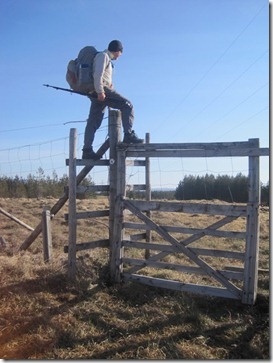
As you might expect, we had to cross a deer fence to get into Rannoch Forest, but at least this one had a crossing-aid (I think it’s a bit generous to call this style of crossing-point a ‘stile’). As is usually the case, there was equal evidence of deer on both sides of the fence.
IMG_2801
Mick crossed it far more elegantly than I did!
IMG_1357
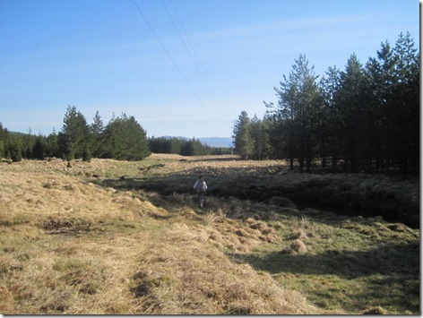
I had expected our passage through the forest to be a narrow track hemmed in by trees, so the first three-quarters of a mile, before we reached the forest track, was surprisingly pleasant (if you overlook the bogginess):
IMG_2803
I didn’t feel it necessary to take any photos within the forest, not even when we left the forest track and joined an old long-disused track which nature was reclaiming. I didn’t photograph the bit where we ran out of track and carried on through a bit of a break to get out the other side either. Get out the other side we did and after a short while we managed to work out where it was that we’d popped out. This body of water was a bit of a clue.
IMG_2806
To get there we had to cross over a brand new deer fence, and one without a stile. It was going to take another half dozen of these crossings before I concluded that they’re much easier without the chest pouch on. Until I came to that realisation I bruised my forearms a lot and uttered (or maybe shouted) many words that my mother-in-law would be surprised to find within my vocabulary.
IMG_1360
Once over the deer fence there was a river to ford. Mick unzipped his legs, donned his crocks, and went first.
IMG_2808
I don’t have zip-offs so, to Mick’s great amusement, I took my trousers off to save getting them wet:
IMG_1365
There were plenty of rocks to choose from on the other side for us to take a comfortable seat whilst we dried out in the warm sunshine and took the opportunity for another snack.
IMG_2810
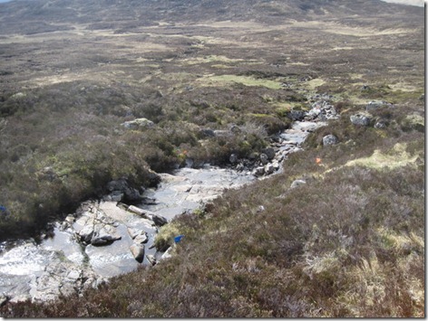
Heading past Corrour Old Lodge towards Loch Ossian we came across the first evidence we’d seen of the Scottish Six Day Trials, which were taking place at the time, in the form of these orange and blue flags alongside this burn:
IMG_1374
With the end of Loch Ossian in view we could see the attraction of staying at the Youth Hostel there. What an idyllic location! (I know you can’t really see it in this photo; see the next one for a closer view.) We would undoubtedly have stayed there if there’d been a girl’s bed available. As it went, there was only room in the boy’s dorm, so we walked on.
IMG_2823
Here’s a snap where you can actually see the hostel.
IMG_2824
and here’s the view from slightly further up the glen. Superb!
IMG_1375
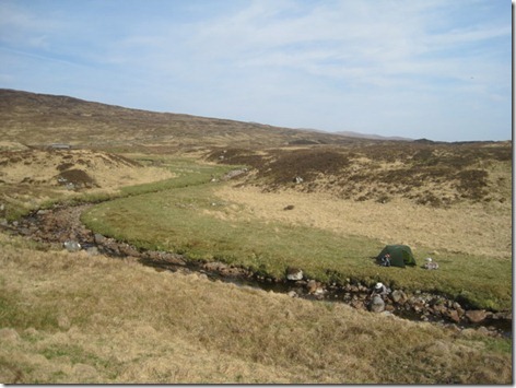
Having carried on another couple of miles we found some (apparently) flat grass alongside the Allt a’ Chamabhreac and then wandered on another hundred yards or so constantly thinking that the area five yards hence looked a bit flatter. Eventually we decided that it was all a bit lumpy and just set about finding the flattest of what was available. What we ended up with was a perfectly level and comfortable pitch, with any slight lumps nicely ironed out by the Thermarest NeoAirs. As well as their other virtues, I have to praise those mats for being very forgiving on lumpy pitches.
IMG_2826
Here’s another evening shot of the pitch. What neither photo shows is the railway track thirty paces to the north of us, but there aren’t many trains a day running along that line. Of the three or four that we did see one of them was comprised of vintage carriages.
IMG_2827
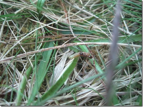
Some of the evening entertainment was provided by this ant who spent quite a while transporting a caterpillar of twice his own length across our porch.
IMG_2831
More about the day (including the fortuitous finding of a chunky KitKat!) can be found here.

Monday, 10 October 2011

East to West Photos: Day 37

Tuesday 3 May (0840-1550) (Killin to S of the W edge of Rannoch Forest)
Distance: 20.5 miles (Tot: 649.5)
Weather: mainly sunny; 4 oktas of cloud early on, clearing as the day went on. Hardly any of them obscured the sun

Is it just me, or does there seem to be something missing from in front of that front door? Like a flight of steps…

IMG_1333

That was on the way out of Killin. It takes a while to really get out of Killin as it’s a strung out place. On the way we passed the Killin Hotel, where we had dined the evening before, and I was tempted to detour and loiter outside so as to use their wifi to download a new reading book to my iTouch. Having already had a late start, I didn’t want to disrupt our stride again so early in the day, so I didn’t take the time, and it wasn’t until we got to Fort William, after we’d finished the East to West, that I finally found another wifi signal where I could get a new book. That’s a bit of a digression though, and nothing to do with this next photo, which was Mick modelling how far his beard had progressed over the course of the walk.

IMG_2773

Although there were a few more clouds today, they were high and fluffy, giving us some good views:

IMG_1338

I particularly like this photo looking down Glen Lyon from in front of the dam. Perhaps I like it so much because it was my random choice of photo for my wallpaper when I got a new laptop a while ago, so it’s a photo I look at almost every day.

IMG_1344

And here’s the dam. This photo was taken from almost the exact spot where we camped during the TGO Challenge in 2009. We had lunch at that spot this year.

IMG_2781

I couldn’t help myself. I took photo after photo:

IMG_1345

Remember that boulder on the path on day 21; the boulder that hadn’t long fallen from the cliff above? This one looked similarly fresh. Was someone going just ahead of us and dislodging them?

IMG_2783

Another one of Loch Lyon looking particularly fine:

IMG_2784

Then we left the loch to head over to Rannoch Forest. There was no path, but I can’t really describe it as a yomp. With short grass and firm ground, it was an easy walk up an attractive valley.

IMG_1346

Once again there was a plentiful supply of good-looking pitches and at some of them we dithered over whether to cut short or whether to carry on. Each time we carried on I muttered about “there’d best be somewhere good down by the forest’. I had a foreboding that we would get to our destination to find that it was all bog and tussock without a campable pitch to be found.

IMG_1350

On the way down there was a gorgeous stream, running over rock and complete with clear pools:

IMG_2793

Happily, when we did get down into the valley there wasn’t a lack of river-side pitches, although not quite as bowling-green smooth as those we’d seen earlier. It was at this pitch where I got most worried about wild-fires, as we could see yet more great plumes of smoke not massively far away from us. Fortunately the wind was blowing away from us, although I do confess to having been a tad nervous as to the possibility of the wind shifting and us finding a fire heading towards us. It was at this point that I decided that as lovely as the dry weather of the previous 5.5 weeks had been, we were in desperate need of some rain.

IMG_2794

As per our routine, once camped we needed to sort out the following day’s drinking water. I never filter water for cooking or for cups of tea, but I do filter my drinking water. That turned out to be something of a trial on this trip, as I didn’t get on at all well with the Delios water filter. It caused me a few grumpy episodes* and much, much cursing. One of the only ways I could get water through the damned thing was to use my knees. I have since found that using the bottle it came with makes it massively easier; I also cursed myself roundly for not testing it both with its own bottle and with a Platty before we left home.

IMG_1354

(*and when I say ‘grumpy’ I mean *really* grumpy. Grumpiness right up there with that caused by the scaling of deer fences)

If you should feel inclined to read more about this day, you’ll find the original blog post here.
