The Road goes ever on and on; Down from the door where it began;
Now far ahead the Road has gone; And I must follow, if I can;
Pursuing it with eager feet; Until it joins some larger way;
Where many paths and errands met; And whither then? I cannot say.

[JRR Tolkien, Lord of the Rings]

Saturday, 15 February 2014

Inner City Marilyn Bagging

Straight after our jaunt up Cairn Gorm yesterday, down to Edinburgh we headed for a few days around the city. Although I’ve been to Edinburgh a couple of times on business and passed through it a couple of other times (including during our E to W walk in 2011), I’ve never really explored the place, and the obvious objective for the first day was a walk up Arthur’s Seat.

It hadn’t even occurred to me that a hill in a city would quality for a tick on a list, but an email from Conrad last night put me right on that point, and thus we didn’t just have a walk up a hill today - we bagged a Marilyn.

Alas, the weather wasn’t being kind for our outing. The forecast had been for a dry, overcast morning. The reality was steady rain right through till noon. Thus, it was a soggy walk up to the summit, where plenty of other people had braved the weather:

IMG_5813

Those wet, worn-to-a-shine rocks and my not-good-on-wet-slippery-rock shoes were not a good combination!

Things were rather quieter (in that we didn’t meet a soul) on the little prominence off to the north east, which gave a good view back to where we had been:

IMG_5822

It also gave another good view over Edinburgh, but such was the greyness that none of my photos look at all enticing.

Having picked our way back down the hill to the main path, back through the city we passed, taking a minor detour to the National Gallery on our way. Whereas we had taken the bus into the city, our return was undertaken on foot (and in much brighter conditions than the morning had seen), which mean that our outing (ignoring the gallery diversion) came in at 9.2 miles, with 1200’ of ascent (some of which resulted from the not-entirely-sensible route we took to the base of Arthur’s Seat).

Friday, 14 February 2014

February - Mid-point Review

Here we are, right in the middle of the month, and this is how it’s looking so far compared with Februaries past:

image

The ascent for the month won’t be startling, but it’s looking healthier than last month:

image

And the daily average is looking quite promising at this early stage when compared with my modest target of an average of 3 miles per day:

image

Hmmm, I need to do a bit of work on the format of that graph, don’t I?

Cairn Gorm

With a lull in the windy weather being forecast for this morning, before the next weather system moved in this afternoon, we made haste up to the Coire Cas car park for a circuit taking in Cairn Lochan.

Not far up the road to the ski centre, my breath had been taken away as the view of the hills opened up before us. All of the tops were clear of cloud and they looked absolutely splendid. About half an hour later, my breath was taken away again, although this time it was more to do with the ascent.

Lots of snow has fallen over the last couple of days, but most of our walk wasn’t a trudge. The strong winds and low temperatures had left icy scoured areas or a nice thick crust, so the going was (mainly) easier than it might have been as we headed up to the Fiacaill a’ Coire Chas ridge.

IMG_5787

Alas, part way up, cloud came in, and by the time we got up to the cairn at the top of the ridge, it was far murkier than this photo makes it look:

IMG_5790

I think this photo was taken in the same place (albeit looking in a different direction) last February:

IMG_2801

The lack of visibility led us to change our minds about where we were going. Cairn Gorm is navigationally easy even in the appalling visibility in which we found ourselves, and so that’s where we went instead. That was quite a contrast to last year too. Here’s today’s view looking south back to the weather station:

IMG_5797

The two people in this photo were the hares in our hare and tortoise race today. They almost sprinted past us twice on the way up, but our slow plodding saw us just pip them to the top.

And here’s last February’s view of the weather station from the north side:

IMG_5166

We may not have had any views, and it was bitingly cold up there, but incredibly the fastest wind speed I recorded as we tarried by the weather station was 2mph! (As forecast, the calm didn’t last for long; by the end of our descent it was decidedly breezy again.)

The old joke of “Two blond women walked into a building; you’d have thought one of them would have seen it” came to mind as we headed down to the Ptarmigan Hut as I began to believe that we would walk into the building before we saw it. It did, of course, reveal itself before we made impact, but not by many dozen yards.

It took quite a while to drop back down below the cloud, and it was very welcome when we did. In common with most (sane) people, I’d much rather be on a hill with good visibility.

The entire outing was only a little one, covering about 4.75 miles with around 2000’ of ascent, but (even with the lack of visibility) it was good fun and quite hard work what with a heavier pack than is my norm, and with heavy boots and crampons weighing down my feet.

Thursday, 13 February 2014

Not a Big Hill Day (#2)

If yesterday morning was a marginal decision, today there was absolutely no doubt that it was not a day to be up a big hill. In fact, as it turned out, it wasn’t much of a day for a low-level walk through a forest either, but as we didn’t know that at the time, we set out for an intended 11-mile circuit taking in Loch Morlich and the Glenmore Cafe.

It had variously rained, sleeted and snowed through the night, but it was dry as we set out – a dryness which lasted about two minutes. Before we’d even cleared the campsite boundary, heavy wet snow was falling again.

Even without the falling snow, the underfoot conditions were horribly slip-slidey as we trudged through a layer of slushy snow.

Within the first fifteen minutes I was pondering whether a circuit to take us to a cafe in Aviemore would be the better choice for the day, but we continued on our way until, less than 3 miles into our walk we mutually agreed on an abandonment.

IMG_5770

The turning point

Around we turned, retraced our steps to just beyond the Cairngorm Club Footbridge, then took a different route back to our start point. The underfoot conditions didn’t get any better, but as noon struck the day did temporarily brighten, giving a glimpse of snow on hills which were almost snow-free last we saw them a couple of days ago.

IMG_5775

Sitting, book in one hand, cup of tea in the other, blanket on the lap, seemed to me to be a much better way to spend the afternoon. Hopefully, tomorrow’s weather will be better.

We still managed just shy of 6 miles, with a small modicum of ascent.

IMG_5771

Wednesday, 12 February 2014

Not a Big Hill Day

We had good intentions yesterday to be up early this morning to go up to the ski centre for a walk up a hill. This morning, having peeked out of the window at the white world, I had a re-think. The forecast was for a fair morning, but horribly windy and snowy conditions this afternoon, and we could already hear gusts of wind as we lay in bed contemplating the day.

A walk into Aviemore, a poke around the gear-shops and a walk back via a circuitous route, was the alternative for which we opted, although I nearly had a change of heart when I went outside a while later and found that there was a clear blue sky. The reality, however, was that we were too late to head up (in view of the forecast bad weather coming in early afternoon), so down to Aviemore we went.

IMG_3723

Mick had the opportunity to choose something from one of the gear shops by way of a birthday present, but there was nothing that caught his fancy, so instead we repaired to the cafe above Cairngorm Mountain Sports. Had there been anyone in the queue ahead of us, we probably wouldn’t have waited, but after a five minute wait we were seated … and I’m so glad that we did wait, because we had an excellent, good-value lunch there. By the time we left, the queue extended all the way down the stairs and across the shop – if I’d known, we wouldn’t have hogged our table for quite so long!

The cafe boasts panoramic views over the Cairngorms, and with our window seats we watched the weather change, quickly convincing ourselves that it wasn’t a day to have gone high.

By the time we made our way back up the road, the signs were telling us that the ski road was closed due to snow and high winds. It was also snowing where we were, and continued gently to do so as we walked the section of path around Loch an Eilein that we didn’t walk yesterday. By the time we got back into Rothiemurchus Forest, the light snow had become heavy, with great big clumps falling. It was, however, very wet snow so we got back to our start point absolutely dripping.

IMG_3726

The final decision of the day was that we were glad not to have gone high.

In total, eight and three quarter miles were clocked up (which doesn’t include the ambling around Aviemore), with a surprising 750’ of ascent.

Tuesday, 11 February 2014

Loch an Eilein and Loch Gamhna

Having not arrived at Coylumbridge until late afternoon yesterday, there wasn’t a huge amount of daylight remaining, so we made do with a quick stretch of the legs which took us from the Rothiemurchus campsite up to the Cairngorm Club Footbridge and back. Along the way we met a chap, with an enormous pack, who asked us directions to said bridge. Meeting him again on our way back, by which time the light was fading, we asked him to where he was headed. Corrour Bothy was his answer. We thought about him later and again this morning and pondered how long that walk would have taken him in the prevailing conditions and in the dark. At least the skies were clear as darkness fell and there was a bit of a moon.

The clear skies didn’t last all night, as we awoke to a dusting of snow this morning and, after no small amount of faffing, we shunned the hills and headed off for a low level walk around Loch an Eilein.

image

I’d seen ‘Castle (Rems of)’ marked on the map, but had assumed that would be the building marked on the shore, to the left of the words; I hadn’t noticed that the island marked nearby was strangely square (in a building-like way). So, I hadn’t expected to see this:

IMG_3712

It’s all a bit blurred and muted as it was snowing at the time.

The snow was only passing showers, and a while later, as we enjoyed the lovely views of the loch (and after we had made a half-hearted, and soon abandoned, move towards the Marilyn of Ord Ban) there were signs that the sun may come out.

IMG_3716

By the time we stopped for elevensies beside Loch Gamhna, it was a glorious day, staying that way all the way through lunchtime and a good chunk into the afternoon.

IMG_3717

A full circuit of Loch an Eilein wasn’t performed, as that would have limited the options for a return journey without repetition. Instead, we headed off east to Rothiemurchus Forest, giving us good views of the snowy tops of the Cairngorms (unfortunately, I didn’t snap one of the better views, so you’ll have to make do with this one):

IMG_3719

As the day was still young, we detoured over to the Cairngorm Club Footbridge rather than taking the most direct route back. That little detour gave time for the clouds to roll in and by the time we reached the rear of the campsite, snow was falling quite convincingly. I suspect that we may wake to somewhere between a dusting and a thin blanket tomorrow.

The stats for the day were 9.6 miles walked, with a modest 650’ of ascent.

Monday, 10 February 2014

Darnaway Forest and the Findhorn

Louise outdid herself today, having planned a truly lovely route which took us out through various types of woodland and back along a glorious path which runs above the River Findhorn. Not only that, but she’d put in an order for good weather, hence the rain that had fallen overnight and into the morning had been replaced by high clouds and sunny intervals by the time we reached the parking area within Darnaway Forest.

To look at the route on paper just doesn’t do it justice (and, in all honesty, this may not be exactly the route we took; I forgot to pick up the Garmin Gadget before we set out and I haven’t got any internet as I type this to retrieve the GPX file Louise has sent to me):image

We started out under remarkably fine skies, but on a reasonably unremarkable forest track…

IMG_3670

Mick does his cormorant impression to catch a few rays

…before turning off onto a lovely green grassy track, lined with gorse in amongst the lower conifer branches.

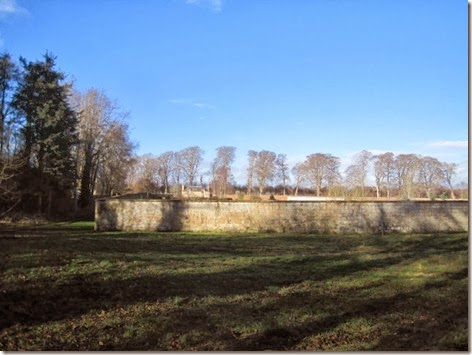
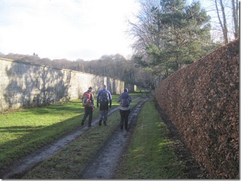
Having passed through a farm, and decided that the ‘No access. Residents only.’ sign opposite only applied to motor vehicles, along a driveway past some estate buildings we went, before reaching a substantially walled garden (that is to say, it was a substantial wall around a substantial garden):
IMG_3673

Just look at that sky!

IMG_3675

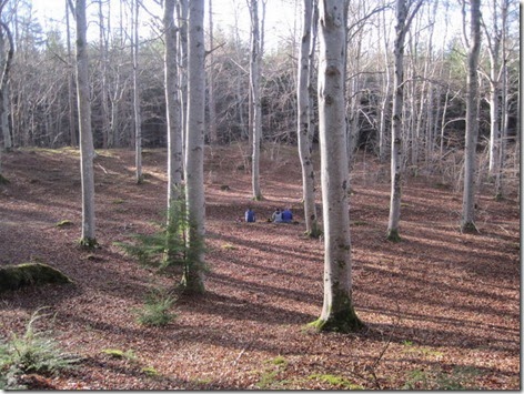
Next came some delightful beech woodland, bisected by a wall so heavily moss-covered that, if viewed as just a small section, could be mistaken for a moss-covered pile of logs:

IMG_3676

It was within the woodland that lunch was called, and whilst we sat there consuming sandwiches, cake and tea, the passing wildlife included three deer, a woodpecker, a buzzard and an owl. Later, down by the river a tree creeper was seen.
IMG_3677

As so often happens when you’ve found yourself a perch for lunch, you only go a short while further before finding a proper bench with an excellent view. On this occasion it was a particularly sturdy, well-crafted bench too, with a fine view down to the river (of which I was unable to take a decent photo because of the camera focussing on the trees, rather than on the water beyond). Later river photos failed due to the position of the sun, so you’ll have to take my word for it that it was stunning.

IMG_3679

Just along the river a grand fishing ‘hut’ was in an enviable position, boasting one of the best views of the river:

IMG_3682IMG_3683

It was one of three huts we passed, although the second two were more basic, one-roomed big-shed affairs.

Oooh, it turns out that I have got a passable picture of the river:

IMG_3684

The path along the river was another delight. It was various widths of single-file the whole way (the photo below is one of the wider sections), sometimes with precipitous drops down to the river such that you wouldn’t want to slip or trip at an inopportune moment!

IMG_3693

The biggest adventure of the day came with a little side burn we had to cross. The crossing itself wasn’t too tricky, as the burn was neither deep nor wide, and stones were conveniently situated to help us across. The descent down to the burn, and the ascent back up t’other side, however, were slip-slidey muddy steep things making it surprising that four of us made it across with the seats of our trousers mud-free.

IMG_3697

Very few people were out walking (and, in fact, the only other walker we did pass turned out to be an ex-colleague of Mick). More people were seen down on the river, where three canoeists passed by with a wave in our direction.

IMG_3700

Having run out of river-hugging path, onto a forestry track we landed where a hop and skip (and a huff and a puff as we pulled back up the hill) took us back to our start point.

Neither the photos nor the words have done justice to what a fine and varied walk this was. I would recommend it for an outing if you were to find yourself in the area. The official stats were 8.25 miles walked (I think; it may have been 8.5) with something like 1100’ of ascent. There’s certainly more ascent than the map suggests, as that path alongside the river does undulate its way along.

Thanks go to Louise (and David) for planning two very good outings for us (not to mention for their hospitality and the kind use of their driveway).

Saturday, 8 February 2014

Romach Loch

Having given the route-planning task to Louise, and having not asked any questions, we had no idea where we were walking today. We didn’t even ask how far it was, for which reason Louise didn’t need to confess when she opted for a short cut; we would never have known!

It was a fine morning as we drove to the start of our outing, although it didn’t stay that way for long as a light shower hit us (us being Louise, David, Mick and me) just as we finished the car-boot-faff and set off up the road. The shower can’t have lasted long, as by the time we had entered the forest and and gained a little height, there was blue above us and fine views out to the coast (not that you can really make them out in this snap):

IMG_3662

The main feature of the outing was Romach Loch, where we declared it to be lunch time. I’ve never been there before, so can make no comparisons, but it seemed from the witness marks that the water level was rather low. Apparently, it’s not been as wet up in these parts as it has down south.

IMG_3663

It was a good lunch spot, but the day was much colder than it looked and by the time food had been eaten and flasks drained, I was glad of the pull uphill to get the blood pumping again. It turned out, as we went gained the viewpoint, that the loch went around the corner.

IMG_3666

More coast views were seen as we descended back down from that hill, but again, I failed to take a decent photo (although I did manage a completely accidental one of the sky, but I’ll save you from that!).

IMG_3668

We recognised the Dava Way as we reached it at a bridge which has featured in a couple of previous walks, but I found myself completely surprised when I realised that we had formed the full circle and returned to our start point.

image

The little bit missing is where I forgot to turn the Garmin Gadget on before we set out.

We’d not been in the car for more than 30 seconds when it started to rain again. Good timing! And a good outing, taking us a smidge over 9 miles with 1300’ of ascent.

Thursday, 6 February 2014

Anagach Woods and Revack Lodge

As tempting as it was to take advantage of the weather bearing no resemblance to the forecast yesterday morning, we didn’t opt for my suggestion of prolonging our stay in the Lakes so that we could make a third attempt on The Old Man. Instead we stuck with the plan and continued on our way to Scotland, arriving in Grantown-on-Spey after what felt like an inordinately long journey. Contrary to the forecast of heavy rain for almost the whole day through, the reality was that we saw more sunshine than rain (and the hills to the east of the Drumochter Pass, and the Cairngorms, looked splendid in their winter coats).

This morning dawned clear and frosty and we should have made haste to be on our way before any cloud had the chance to roll in, but haste wasn’t made and it was our usual lazy-holiday hour of 10am by the time we stepped out of the door.

Today’s objective was a simple stroll around Anagach Woods. I must have omitted to use the word ‘stroll’ when telling Mick our plan, as he was clearly out for a ‘fast stride’. My little legs worked hard to keep up as we passed through the lovely woods, picking up the Speyside Way to take us to Cromdale Bridge, before heading back upstream alongside the Spey. The fine weather was lasting well:

IMG_3654

Blue sky, and the river running high

The rain that fell in the night had obviously been snow on the Cromdale Hills, which were sporting a good dusting, although I couldn’t get a snap to really do them justice:

IMG_3653

It may have been a snowy night and a frosty morning, but sitting in the sunshine on the riverbank for an early lunch, it was unseasonably warm.

The pace we’d set was such that if we’d only completed the circuit we had intended, our outing would have been too short, so rather than turning right at Spey Bridge, we turned left and headed south on the Speyside Way, with the thought of a cup of tea at Revack Lodge, where it was surprisingly busy (with the type of lunchers who made us look decidedly under-dressed).

We arrived back at our start point having covered just over 11 miles with 700’ of ascent. It’s a very pleasant walk, but we went poorly equipped and thus had to break the advertised rules:

IMG_3657

Tuesday, 4 February 2014

Thrashing Around On The Old Man

Having aborted our trip up The Old Man of Coniston yesterday, and made do with just a trip over Dow Crag, The Old Man seemed like a good objective for today instead.

That idea nearly got abandoned about half a mile in, when we caught sight of quite how low the cloud was. I’m generally a fair weather hill-goer, preferring to see something if I’m going to slog up a hill, so I suggested that we should drop back down and just take a stroll around Tarn Hows instead.

For reasons I now can’t quite recall, we didn’t loop around back into the valley, but continued our route, which was to take us over Little Arrow Moor onto The Old Man.

Perhaps we should have taken one of the main paths up, because we were soon not only in the snow, but also in thick cloud. This snap was taken just a handful of steps before we lost the trodden line entirely:

IMG_5755

We thrashed around a bit looking for a sensible line to take, and considered just heading straight up, but the combination of such poor visibility, the snow and the presence of crags/slagheaps in the area suggested it wasn’t a wise plan. Back down we went, as far as the fenced-off deep quarry we had left a wee while before, but instead of retreating from there we looked at the map and decided to see if we could contour around the hill to pick up the main path to the north. The obvious obstacle in our way was another quarry, but we hoped we would be able to pass above it.

Mine workings just before the quarry gave good shelter for elevenses (time was flying; elevenses turned out to be at half past twelve!). As you can see, visibility was still poor:

IMG_5756

Alas, when we reached the next deep quarry, we found ourselves thrashing around again. The lack of visibility meant that we couldn’t see whether it was feasible to make our way around it on the uphill side. Neither did an exploration down the hill reveal an obvious way around in that direction, and we didn’t want to risk a ridiculous move which saw us both plunging to our deaths, so we did the sensible thing and turned back. Quite literally, we retraced our steps (handy thing about snow!), or at least we did until Little Arrow Moor where (having dropped below the snow line) I missed a turn and took us a far more ‘interesting’ route back down to the Walna Scar Road.

So, our objective was missed for the second day in a row. But, do you know, I reckon today’s outing was far more interesting than a trip up to the hill-top would have been. Had we simply followed a path it would have been a plod in the cloud with nothing to see. As it went, we saw some interesting relics of the old mining activities and frequently had to stop to think. It may not have been what we intended, but it was a good day out.

With a trip into Coniston on our way back, our outing was 8.6 miles long with around 2400 feet of ascent.

Monday, 3 February 2014

Breezy and Snowy on Dow Crags

This stop-off, on our way north in Colin, came about because I had a sudden urge (with no apparent trigger) to go and walk up The Old Man of Coniston. We’ve been up there before, but it was so many years ago that I couldn’t even say what year it was. It was certainly before records began.

So, off we set this morning from Park Coppice Caravan Site to walk a circuit over Brown Pike, Buck Pike, Dow Crags and The Old Man.

Visibility wasn’t great, but most of the time it wasn’t as bad as this snap makes it look:

IMG_5740

Most of the route also wasn’t as snowy as this snap makes it look:

IMG_5744

The exception was the top and north side of Dow Crag where it was quite wintry. It made the scramble up the top quite interesting, but not as interesting as the first bit of the descent. From there we were just yomping on through soft-but-not-too-soft snowiness which persisted all the way down to the col above Goat’s Water.

By the time we were heading down to that col we’d decided we would omit The Old Man after all, and just head down via Goat’s Water. It wasn’t the snow that was putting us off, and visibility was now pretty good; it was the wind. Forty-five miles per hour was the highest reading I got on my little anemometer, but I’m sure there were some gusts that would have read higher.

The problem was that The Old Man looked so close and the summit was free from cloud, and it seemed such a shame to be so close and not go up so up we headed.

Rumbling stomachs got the better of us not far into the ascent and some craggy bits offered us shelter for lunch, which is our resolve waivered. Listening to the wind howl and watching the little stream in front of us getting whipped up hill, and with painfully cold fingers and toes, I didn’t put up any resistance when Mick suggested we retreat and go via Goat’s Water after all. And so that’s what we did:

IMG_5745

Our only encounter with the Walna Scar Road on the way back was to cross it, as a glance at the map suggested we could achieve a figure of eight rather than repeating any of our outward route. Our unplanned path took us past an attractive flooded old quarry (complete with very noisy waterfall), but otherwise it was a reasonably unremarkable route.

IMG_5748

The Garmin Gadget told us that we walked 9 miles with 2700’ of up. Our weary bodies told us that we need to work on our endurance!

Friday, 31 January 2014

Week 4 (+3 days)

Having had such a flying start to the month, there was never a possibility that I could carry on as a started. This was the week (and a bit) in which the incredible run of walks stumbled.

Before I get into the ‘Walks Wot I Went On’ bit, here’s the final comparison chart, showing that I convincingly beat all previous records for January:

image

Just 26 miles were walked in the final week and a half of the month, bringing the total for the month to 175.9.

That graph only counts the times when I went out for a walk. The Fitbit goes further than this and counts all of my steps, whether I’m out for a walk or just pootling around. It tells me that I actually walked 208 miles this month (which I know to be an understatement because I haven’t quite got around to changing my step length settings to something more accurate yet).

image

The more memorable bits about the last week-and-a-bit of the month:

- On the first day of the fourth week, I didn’t go for a walk! (Yep, the Fitbit graph above shows that I walked nearly 5 miles, but I achieved this without doing anything that qualifies to go on my walking log.) It was the first of only 2 days in January that I didn’t go out. On this occasion it was because I’d pulled a muscle in my leg (by cutting out a sewing pattern, of all things!) and after a few days of walking on it, without it getting any better, I decided a rest day was in order.

- On Friday Mick and I arrived home (Mick from work; me from a walk) at exactly the same time and Mick immediately questioned my sanity, as the weather was somewhat on the inclement side. I defended my sanity: I had gone out within ten minutes of getting home from work myself and my drive home had been entirely dry. By the time I stepped back out of the door, it was drizzling. By the time I reached the canal, it was raining. By the time I reached the ponds it was raining quite heavily. If I’d known it was going to be damp, I probably would have worn something a little more waterproof!

- On Saturday I took a path I’d never walked before and discovered an underpass under the dual-carriageway that I never knew existed (not that I’ll be taking it again – I’d rather pick my way across the roundabout at the junction above the road than go through a wee-smelling creepy underpass by myself). The view from the path I’d never walked before is one of the better ones in the immediate vicinity:

Water Park

- Things then got rather busy. Another day passed without a walk being taken, and the other days saw various flavours of very short local strolls.

- Which brought us to the final day of the month (i.e. today) when the rain fell, the wind blew and the temperature barely got above freezing. I procrastinated and procrastinated some more until, at 2pm, I had to bite the bullet. Last Friday Mick had questioned my sanity and today I questioned it myself. In fact, I nearly turned around and came home within the first five minutes (the outward leg of my circuit was the leg that was into the (very wet) wind). I can’t claim that it was the happiest walk I’ve ever been on, but I stayed dry (and, 3 miles in, I even started to warm up) and managed to cover just over 6 miles. I would have taken a photo of the flooding down by the river, or maybe the white horses on the pond, except that there was no way that I was going to take a glove off and get an electronic gadget out in that weather.

So, onwards to February…