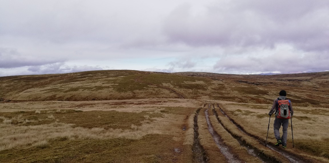
The Road goes ever on and on; Down from the door where it began;
Now far ahead the Road has gone; And I must follow, if I can;
Pursuing it with eager feet; Until it joins some larger way;
Where many paths and errands met; And whither then? I cannot say.

[JRR Tolkien, Lord of the Rings]

Wednesday, 16 October 2019

The Fara (NN598842; 911m)

Tuesday 15 October
Distance: 8.6 miles
Ascent: 570m
Weather: Overcast start, sunny intervals later. A bit of mizzle as we were up in the cloud on the summit.

In 2013 The Fara appeared on our TGO Challenge Route Sheet. In fact, we were supposed to go over it the day before we didn't go over Carn na Caim (but went over Meall Cruaich instead - see Monday's post). Unlike Carn na Caim, it didn't go onto my 'must get around to going up there' list and barely did I think of the hill over the next 6.5 years. Then on Monday, as we descended from Carn na Caim and its neighbour, we had The Fara in front of us and suddenly it seemed like a jolly good idea to stay around Dalwhinnie for an extra night and nip up it.

The plan was cemented not only by an acceptable weather forecast, but when I saw that there's another Marilyn next door (Meall nan Eagan) that could be combined into a pleasing-looking lollipop of a walk.

Read on to find out what happened to the lollipop plan and the second hill. 
Leaving Bertie just to the north of Dalwhinnie, a road walk took us to the track that runs along the Allt an t-Sluic, half a kilometre or so along which we bore off onto a track that doesn't appear on my 2010 map, but that we could see would take us a significant distance towards our ridge.


Bottom left you can see a ford at the start of our ascent track (snap taken on the return leg, hence the blue sky). We didn't get wet feet, opting instead to detour 100m downstream to a simple, non-permanent bridge that's currently in place.

We gained height quickly, which gave us a good vantage point to observe a group of tweed-clad chaps heading out from the lodge and up the glen - in the direction of our second hill.

The track wiggling its way up the hill. Our second summit is on the right of the snap.

Initially we knew not where they may be heading, but that question was broadly answered as we walked past a group of beaters working their way through the heather in between our ascending track and the one running along the glen. It was at this point that we decided that our second hill was being taken off the agenda. We accidentally walked through a shoot once before and it's no fun scurrying up a hill with shots being fired nearby.

That still gave us The Fara as an objective and after a relatively easy walk (first on the track then on firm, short vegetation up the ridge) we arrived at its summit only about a quarter of an hour after pausing for elevenses in the lee of some convenient little crags. The wind was biting up there and shelter was a fundamental requirement of any break.

Our arrival at the summit was only just in time...
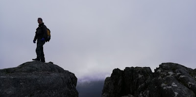
Looking a bit grey as Mick snapped me atop the summit tor

I snapped Mick from a higher vantage point, so captured the views too


...for as we stood at the high point, the cloud descended. It had been brushing the top earlier, but this was undoubtedly the lowest level it reached all day. It was at 800m that we dropped below it (or it rose above us, or a combination of the two) as we retraced our steps. We had given thought to forming a circuit by dropping off the east side of the ridge, but were deterred by the visible sogginess of the ground down there.

As we descended we could see the beaters now working on the other side of the glen, seemingly confirming the merit of our decision not to continue on to Meall nan Eagan. Had we not stopped for lunch, we would thus have gone away happy. As it was, as we reached the ford the vehicles of the tweed-brigade all drove back out to the road. Harrumph! We not only could have done our second hill, but we would have had good weather for it. The cloud that had descended whilst we were on The Fara was the last hurrah of the grey skies and from then on the day only got sunnier.

Ne'er mind. There's another Marilyn just up the road, so at some point in the future I'll combine Meall nan Eagan with that one.

Tuesday, 15 October 2019

Creag Dhubh (NN823997; 445m; classification: sub-HUMP)

Saturday 12 October
Distance: 5.7 miles
Ascent: 240m
Weather: Dry with sunny intervals

We went anti-clockwise

We happened (by careful arrangement) to find ourselves in the same car park, in Inshriach Forest, as Louise and David on Saturday morning. As we don't get to see them very often the day got off to a chatty start, including a good period of admiration of their campervan Ellie, who we'd not met before. By then it was elevenses time and it would be negligent to go out for a walk without elevenses when elevenses time has passed. With a bit more chatting we then found that lunchtime was upon us, but with iron resolve managed to get out of the door with our lunches untouched in our bags.

The late start was of no matter on this occasion as the walk we had planned wasn't a long one. Somehow I had been nominated as 'responsible adult' so I had plotted the route (using Open Street Maps, so as to take advantage of paths not shown on my aged OS maps) and was in charge of keeping us on course. Mick forewarned everyone that when I say 'We need to turn right' it's wise to check whether I mean 'right' or 'the other right' (and vice versa). If you look carefully at the map snippet above you may spot a couple of minor backtracks that occurred when everyone was too polite to heed Mick's advice.

A pleasant walk past a large pond and variously through forest and cleared forest took us on tracks up to the trig point that was our objective*, where it appears that Mick and David were camera shy, but I got a nice snap (if you ignore the shadow, from my phone-holding arm, across my face) of the female half of the group:

A Vanessa Trig Point. Not an overly common design.

Being surrounded by trees, views were lacking, but the stones around the trig gave reasonable seating so we sat ourselves down for lunch. Am I right in recalling that a few drops of rain fell on us? If they did, it didn't amount to anything.

A fat-bike had come past whilst we were eating, but no alarm bells rang. Another bike came past shortly after we set back off (we watched him fall off about 20m before he reached us, and he admitted that he was watching us stepping well off the path, rather than where he was going). It was still a while later before I observed that the way our path was wiggling through the trees, it was clearly a mountain bike trail, rather than a walkers' path. Fortunately the evidence of our first 5 minutes on it proved to be atypical; we didn't meet a single other bike as we wiggled around all over t'shop to get back to the main forest tracks which took us back to Bertie and Ellie.

Walking down the mountain bike trail. See, Mick & David were present!


Views where the trees opened up

One of three ponds in the forest

It may not have been a long outing, but it was in good company, in pleasant surroundings and on the nicest day yet of the Scottish leg of our trip.

(*A check of lists of Relative Hills tells me that this summit has been demoted from HUMP to sub-HUMP as it is now known to only have 96m of prominence. For the avoidance of doubt I've not become a bagger of *really* obscure hills - it just looked a nice walk with the bonus of visiting a trig point.)


Monday, 14 October 2019

Carn na Caim (940m) and A'Bhuidheanach Beag (936m)

Monday 14 October
Distance: 13.3 miles
Ascent: 890m
Weather: dry with a few periods of sunshine. Cloud base variable but mainly above our summits.
Number of times I've written this blog post: twice. Not sure if losing all my work the first time was operator error or technical glitch.

I couldn't quite fit all of the route onto the screen; our start point was where the cycle path leaves the A889 just to the S of Dalwhinnie.

In 2013 our TGO Challenge Route Sheet had us going over Carn na Caim. For reasons that I can't remember, and that my blog post from that day doesn't make clear, we re-routed to the north and went over Meall Cruaich instead. Carn na Caim thus went onto the 'must get around to it' list and today, just 6.5 years later, we did exactly that, adding its neighbour into the outing because if we were making the effort to get up onto the plateau it made sense to visit both Munros, even though only one of them is a Marilyn.

As hills of this size go, these are remarkably accessible, sitting not just alongside the A9, but also having tracks most of the way to the summits. Initially it's an engineered track that leads from the road, under the power lines and up (getting steeper as it goes) to an old quarry.

Beyond the quarry we opted to go left, to visit Carn na Caim first (being the Marilyn, that was the top of most interest to me).

Beyond the quarry the track became unsurfaced, but still gave easy walking

Once the track ended, an obvious set of trodden lines followed the old iron fence posts of the boundary line right up to the summit.

Mick on what appeared to be the highest ground, with a good view up the Spey valley behind him.

Selfie at the summit cairn

Coffee and butteries on the summit, whilst admiring the views, would have been nice, but the breeze (which was barely a breath) had such a chill to it that we opted instead to defer our break for a more sheltered spot.

Steps were retraced to the top of Coire Uilleim where we sat completely out of the wind, but at the expense of having a view, before more steps were retraced until we were above the quarry again (which, incidentally is marked as such on the map, but isn't massively evident on the ground - we're not talking huge holes in the ground).


Considering how close these hills lie to the A9, the mainline railway and the Beauly-Denny power lines, it was impressive for how much of the time the only obviously man-made thing we could see was the track upon which we were walking.

The way south to our second top was slightly less obvious than the ease of Carn na Caim, but in the good visibiilty that prevailed it presented us with no difficulties as we made our way to the trig point.

Trig point selfie

Cloud had been tickling this summit all morning, but it had cleared by the time we arrived and, with the help of a bit of sunshine, it was warm enough up therefor lunch. Joined after a while by a couple from Edinburgh, Sam and Malcolm, our break became longer than is our norm as we chatted.

They left the top before us, but it was only a couple of minutes before we followed. Our descent was entirely a reversal of our outwards route (save for an accidental wander that you can pick out on the map snippet at the top of this post), but it was made more interesting by the company. First came a brief chat with a chap who was just ascending for the same two hills (he had very long legs, so we reckoned he would just make it to both and back down before dark), then we walked the final section back down to the A9 with Sam & Malcolm. Sam is a geologist (more precisely a volcanologist) - what an interesting and adventurous job!

We parted company at the A9 and within minutes Mick & I were back at Bertie, where I prioritised checking the weather forecast. There's another hill we were eyeing up on our way down today and it looks like tomorrow's weather will be good enough to entice us up it...

Tuesday, 8 October 2019

Creag Liath (NH663007; 743m)

I've mentioned before on this blog that my shin muscles have very short memories. I only have to take my eye off the hills for five minutes and the next time I go up (or, more accurately, come down) a hill, they'll spend the next few days sorely protesting.

We thus found ourselves at the road end above Newtonmore yesterday afternoon, with the hill I wanted to go up looking like this...

The one under the orange arrow

...but with my shins too sore to contemplate the outing. Probably a good thing as not long after I took this photo one heck of a squall came through (one of a succession, interspersed with sunshine), battering Bertie with wind and rain. I was glad not to be out in that. The drowned rats who returned to the vehicle next to us later in the day probably wished they hadn't been either.

Today's forecast was generally worse than yesterday's, but there was a window of 'not too bad' due between 8 and 11am. I set the alarm for 6.30.

The alarm sounded and Mick groaned. It was early, dark and raining (as it had been all night). I quickly reassured him that he didn't have to come with me if he didn't want to and he didn't take any persuading to stay in bed whilst I breakfasted and threw some things into a bag.

The sun was a long way from making it over the hills to the east as I made my way along the River Calder.

I went anticlockwise


You can see from the map snippet above that I'd not gone far along the track when I took a detour. This was the obstacle:

A poor snap of an unexpected ford (taken on the way back)

There's been a lot of rain since Saturday afternoon and what would otherwise be an innocuous trickle down the hillside had created a sizeable ford. In hindsight, I should have just splashed straight through, as I ended up wading further upstream anyway. Or maybe I should have tippy-toed across a couple of rocks just downstream of the ford, as I did on my way back.

As I approached the fork in the track a while later, I conteplated my options: out and back via the shortest route, or to walk significantly further to make a lollipop of it? Surveying the hill from that vantage point, I opted for the easier (but further) ascent route so splashed my way up a rough track that was doing a good impression of a river.

I'd not gone very far when I started doubting my belief that there was a bridge at the far end of the track. With so much water in such a tearing hurry to reach the sea, in the absence of a bridge I would be turning back with my hill unbagged.

I was thus happy when this came into sight...


...although in my efforts not to get my phone wet (a light shower was passing at this point) I completely failed to capture the roiling water directly underneath the bridge.

Leaving a sodden ATV track at a point that was probably a couple of hundred yards later than the optimum point, the going up to the summit was pretty easy. However, this was the point where I started to wonder whether mesh trail runners had been the right choice, as my toes temporarily turned into blocks of ice following their plunging into so many pools of cold water. (Hindsight: yep, they were a perfectly good choice. The cold toes only lasted a few minutes before they warmed back up).

A few wisps of cloud were tickling the summit when I got there and I could see rain approaching. I stayed long enough to snap photos...

Summit selfie

Summit view

... and have a quick text message chat with Mick (who could see me atop my summit without having to move from his seat in Bertie), then I popped my waterproof gloves back on and set off down the more direct descent route.

It was rough, steep* and sodden, confirming that although it probably would have been faster to go up that way, it wouldn't have been as enjoyable. (*A slightly different line would have made it less steep, but with the rain coming down and my hands encased in chunky mittens, and with visibility being good, I opted not to navigate from the map but to just go in the right direction, which put me on steeper ground than was strictly necessary.)

Making my way back along the track towards Bertie I thought I was going to be able to dry off a little in the final half-mile, but the pause in the rain was brief. I couldn't complain too much - I'd had rain for maybe a third of the time I'd been out and the vast majority had been on my descent, when it had been on my back. The wind had been nowhere near as fierce as predicted either.

I made it back to Bertie at 10.35 and, as forecast, at around 11 the pattering on the roof increased noticeably. It hasn't yet stopped and isn't forecast to let up until midnight.

The stats were:
- 7.6 miles walked with around 460m ascent (2hrs45)
- Number of deer seen: dozens, all in small groups
- Number of stags heard bellowing: lots, including one standing on a prominent rock on the skyline and one at relatively close quarters as it chased three hinds.
- Number of hare seen: 7
- Number of frogs nearly trodden on: 1
- Number of frogs actually trodden on: none, I hope.

Monday, 7 October 2019

Cruban Beag (NN668924; 590m)

All has been quiet on this blog for a few months, which have been spent mainly in Germany. There’s been plenty of running, but no walking worthy of note here. We’re now in Scotland and hopefully I’ll have a few things to report between now and when we return home.

The purpose of our visit to Newtonmore this weekend was the TGO Challenge Scottish Reunion, attended by (amongst many others) Martin & Sue. Martin had sent an email a couple of weeks ago suggesting Aviemore parkrun on Saturday morning, followed by a Marilyn afterwards, which I agreed sounded like an excellent way to spend a day.

I only had two unbagged Marilyns in the vicinity of Newtonmore and the first plan, made over dinner on Friday evening, was to visit Creag Liath. It was only later when I measured the route that I realised the distance was a little too ambitious for the time available (taking into account a 9.30am parkrun and post-run coffee). We headed to Cruban Beag instead, a smaller hill sitting closer to a road.
I never expect to meet anyone on obscure little Marilyns, but we arrived at the chosen start location to find a car already parked in the one-car slot. Whatever was someone else doing on our hill?!

As it transpired, we didn’t have to backtrack to take the second-choice approach route, as another parking opportunity presented itself slightly further along the tiny lane.

Another person on an obscure little hill! He was doing a round of six Dodds. I’ve no idea, without looking it up, what a Dodd is.

A deer fence had to be crossed twice. There was a hole in it at the point shown in the snap below (good view along the glen beyond the fence too!), through which we took turns in contorting ourselves. Later we found a whole section that was down, so were able to cross again. We stayed on the other side on the return leg, which only required one crossing of a low fence.


Various trods were used for the majority of the distance from road to summit, making the going fairly easy. Relatively dry conditions underfoot, as well as from above, helped too. And our route avoided all of the crags which protect the summit from most approaches.


Four happy hikers on the windy summit

Summit view

Lunch would have been had whilst enjoying the views from the summit had it not been so windy. Instead a suitable rock was chosen in a sheltered spot on our descent, although we still cooled down quickly when not moving, in spite of donning extra layers. A bit of sunshine would have gone a long way, but at least the rain held off for us.

Our retracing of steps saw us back at the car having walked a modest 2.6ish miles with around 260m ascent.

Thanks go to Martin & Sue for both the company and the transport :-) 

Sunday, 8 September 2019

Lichfield 10k Road Race


(I’m a bit tardy writing this up. It’s now 15 December and I’m referring back to a run that took place on 8 September. Just before this run I searched all the resources I could think of to find out when I last ran a 10k event (unfortunately, at some point in the last 10 years I decided I didn’t need all of my pre-2008 running logs, so no longer have those records). I eventually found the answer in this blog (October 2006), although unfortunately with no reference to the time I achieved. That highlighted the value of posting such stuff even if it doesn’t appear to sit happily with the real subject matter of this blog. So here it is. Better late than never.)

In the middle of August, whilst I was clocking up a string of my best ever 5k running times at various parkruns in Germany, I became curious as to how fast I could run a 10k these days.  The following day it occurred to me that the Lichfield 10k would be taking place in September and without hesitation I entered both myself and Mick.

I then read the course description…


…hmmm, undulations and hills? That didn’t sound like the sort of course on which I would be able to achieve anything faster than I was managing each week on my regular runs on the nice flat cycle paths of Germany, but I’d entered by then, so I immediately wrote it off in terms of my original objective and instead put it into the mental bucket of ‘a fun morning out with bonus t-shirt’.

We only arrived home a few days in advance and theoretically had time to make a running recce of the route – except that we found it to be on roads we wouldn’t want to tackle without the road closures that would be in place for the event itself. So, our familiarisation consisted of driving twice around the course. It didn’t seem too hilly, but then inclines never do when you’re in motorised transport.

The day of the event quickly came around and as we made our way to the start line, along with just over 1000 others, we were happy to see that there were pacers. A quick tactical chat and we decided that, based on the course description, the sensible thing to do would be to start just in front of the 60 minute pacer but stay behind the 55 minute chap.

We started out together, quickly gaining on the 55 minute pacer. Not knowing how the hills would take it out of us, we stuck with the plan and stayed behind him until (to the best of my recollection) just after the 6k marker where, with only 4k to go and feeling fine, it seemed silly not to trot on past. At around 7.5km Mick went on ahead of me. About a kilometre later I decided that I could bear a mile of effort, and put a spurt on myself.

The course

The first and last 1km of the course were along a main road, which for the return leg had been reopened to traffic, leaving the runners with the pavement and a narrow (1-person) margin between the kerb and a row of cones. With everyone thinned out by then, that would have been fine, if it hadn’t been for all the people running abreast, meaning I had to keep darting out into the road between cars to overtake. I overtook a lot of people in that last mile. In fact, I put such a spurt on that Mick only finished 20 seconds ahead of me (Mick: 54.02, me: 54.22).
The undulations per my recorded track. I think that classing any of them as 'hills' is a slight exaggeration.

The most pleasing thing about the result was that I’d not hated the running. Experience tells me that if I don’t hate it in the moment* then I could have gone quite a bit faster. Maybe next summer I’ll find a nice flat 10k to really test myself, but we’ll also happily enter the Lichfield 10k again – it’s very well organised. 

Those t-shirts are a lot brighter than this photo makes them look. Proper 'highlighter pen' orange.
Not a flailing arm - I'm waving at the photographer!

 Straying out into the road in the last kilometre

(*To me running events (except for parkrun, but that’s different) are Type 2 fun. It took me four days after the half marathon I ran last year to get from ‘hated every second’ to ‘actually that was okay!’.)


Wednesday, 26 June 2019

TGO Challenge 2019 Reflections: Weather

Immediately after the TGO Challenge this year I had good intentions of writing two blog posts, mainly as an aide memoire for my future self. Here I am just over a month later with the first one, on the subject of the weather.

Upon reaching Montrose early on the morning of Tuesday 21 May (the time and date are relevant to this post), I was of the belief that we had previously had a TGO Challenge that was equally dry. I remembered writing a post about it on the train home that year, but on looking it up I found my memory to be defective; what we had in 2012 was weather that wasn't as dreadful as most other Challengers described - we still had our waterproofs on at some point on most days. Further checking of my electronic memory tells me that our general experience of walking west to east across Scotland in May has been damp.

Things didn't get off to a promising start this year, when rain came in just minutes before we left the Dornie Hotel. However, it was light and it was around an hour before it seeped through to our skin, at which point we donned waterproof jackets. We left our legs unprotected, and they never got uncomfortably wet. The same was repeated as we made our way up the Falls of Glomach.

The only heavy rain that day came at around 5pm, after we had pitched the tent for the night. "Glad we're not out in that" we agreed!

After a few hours, the rain cleared and the sky with it. In the morning we woke up to a frozen world, including our shoes, socks and water bottles. A 'character building' sort of a morning...

Day 2 was showery, but every time rain hit it looked like it would pass quickly. We therefore decided to adopt the strategy of only waterproofing-up if we starting getting properly wet (i.e. rain onto skin through whatever layers we were wearing). Thus during every rainy spell we found ourselves overtaking others who had paused to apply waterproofs, whilst we walked on. We never did get wet. It was another cold night, but not as cold as the first (i.e. only a hint of ice in water bottles).

Days 3, 4, 5, 6 and 7 were sunny and either warm or hot. Day 8 was still fine once the early morning cloud had cleared, but the temperature had plummeted. I recall marvelling at how light my bag was on Day 8 as, after days of carrying all of my layers, I was now wearing them.

Day 9 was when the weather broke. For the first time since leaving Dornie, out came the waterproof trousers. There were some substantial dry spells in the afternoon, but none long or warm enough to entice us out of those waterproofs, thus we wore them all day. Still, one day of waterproofs in 9 is a pretty good record in Scotland, isn't it?

Day 10 was a little bit drizzly in the morning, but nothing that got us wet. Day 11 was showery, but none heavy or long enough to trouble us to wear more than our jackets.

Day 12 is where the weather truly broke and we walked the whole of the rest of the Challenge in waterproofs. Fortunately for us, 'the whole of the rest of the Challenge' was under 3 hours and that whole period was fully togged up in Paramo and GoreTex.

The rest of the second week continued showery, but for us that was irrelevant. We had walked across Scotland in weather that only required our waterproof trousers for one day and three hours. Incredible!

Tuesday, 21 May 2019

TGO Challenge Day 12 - North Water Bridge to Montrose

Tuesday 21 May (0615-0835)
Distance: around 8 miles*
Weather: rainy start, dry finish

The kit failures continue. After a night of rain, we woke up with the floor of our tent masquerading as a paddling pool this morning. Poor Vera Voyager has had a long and hard life and as well as her seams not being as well taped as they once were, it seems her floor may have become porous too. We've been happy with our gear for many years and have no interest in buying new stuff for the sake of it. The downside is that everything is getting old and has been very well used, so we're suffering a glut of things reaching the end of their lives.

Looking on the bright side, at least we've had a dry crossing. Had we had the weather of, say, 2009 (rain for 9 days of our 13 day crossing), the leakiness of the tent would have been a problem. As it goes, we slept well last night and didn't notice the ingress until we came to pack away.

It was raining as we packed and as we set out (requiring waterproof overtrousers for only the second time of the trip) but with hints in the distance that it would stop. It did, eventually, but with barely a breath of wind, the fairer sky took a long time to reach us.

In view of the weather, my good intentions of taking a slightly indirect route, using some of the Core Path network, to Montrose were abandoned and I opted for the shorter and faster option of the road.

Meanwhile, Mick nearly opted for a different finish point. Before I left him in my wake, just after crossing the A90 dual carriageway (his poorly ankle couldn't take the pace and I had a train to catch), he was contemplating going to St Cyrus, but after talking through the pros and cons, he trailed me to Montrose.

Ahead of me was Byron, who I caught up at Hillside, walking into Montrose with him until the point where he turned towards the coast and I went via a shop for a few supplies for the rest of the day.

Before 9am, both Mick and I were sitting in Challenge Control at the Park Hotel, with Mick now officially a Leg End Legend for having completed 10 TGO Challenges. It was an excellent, fun crossing for his tenth too, only marred in the latter stages by Mick's poorly ankle (this isn't the Achiles issue, although that is also still paining him. He twisted his other ankle a few days back. I'm sure it'll soon be fine now he can stop using it).

For today he is loitering in the Park Hotel, where I stayed only long enough for a cup of tea and a shower. As I type this, I'm on a train to retrieve Bertie-the-Motorhome from his storage location. Having arrived in Montrose earlier than planned, it will be handy to have our own accommodation for the rest of the week.

(*During those 8ish miles I managed to cover, according to the road signs, 3 miles in 20 minutes. Three road signs in the space of a mile reported the distance to Montrose as 9, 7 and 6 miles. My measurement concurred only with the last sign (which came only a few hundred yards after the 7 mile marker). The 9 mile one was so far out that I wonder how it has never been challenged and changed.)

TGO Challenge Day 11 - Tarfside to North Water Bridge

Monday 21 May (from 0800 to a time that neither of us can remember! Maybe 1530?)
Distance: 15.5 miles??
Weather: showery

St Drostans Lodge at Tarfside is a religious retreat hostel that is available to rent. For a few days every May it is taken by previous Challengers (or even current - as I said in my last post, two of this year's volunteers had walked across Scotland in a week, so they could man Tarfside in Week 2) who offer food, drink and accommodation, with profits going to charity. There were only four Challengers in the hostel on Sunday night (plus one camping) but even so, the volunteers were all up and in the kitchen before 7am on Monday morning to cook breakfast for Mick and Byron.

We would have been away not long after 7.30 if our next kit failure hadn't occurred: Mick put his arm through the fabric of his windshirt. We'd been saying for a while that it was getting a bit thin, and finally it had given up. The repair kit was dug out for the second time in 24 hours and I sat myself in a comfy chair by a window with a needle and thread to effect a functional, if not neat, repair.

The walking that then followed was a complete contrast to Sunday, being slow and leisurely with ad hoc breaks.

With the Buskhead Bridge at Tarfside still out of action, it was a trudge down tarmac to the next available bridge. I say a trudge, but Mick's poorly tendon is much preferring road at the moment, and if it could be dead flat road that would be perfect. Downhills are paining him most.

Taken from Dalhastnie Bridge

Once across the bridge it was tracks that we have both walked before, Mick more than me, to Edzell.

No track just before Edzell - the farmer had ploughed right to the margin. It wasn't nice.

The usual Challenge haunt of the Tuck Inn was closed, but Sinclair's Pantry across the road was open and there we found Byron. My greeting was to come very close to throwing his coffee over him. By accident, not design.

I'm not sure a warm goat's cheese salad can reasonably be called thus when it is served with only five salad leaves, but what it lacked in quantity it made up for in taste. Mick's sandwich was more substantial.

North Water Bridge turned out not to be as distant from Edzell as my memory suggested, but when we finally joined the B-road on the other side of the river (having taken parallel tracks for a while), that road seemed to go on for weeks. Happily every vehicle bar one gave us a politely wide berth.

It had been raining as we left Edzell and it was still going when we reached the campsite and pitched the tent. It hadn't been heavy enough for us to don waterproof legwear, but we were a bit soggy on arrival.

No matter. Our clothes had made it all bar 9 miles across Scotland without a wash, so my first priority was to get a load of laundry done so that I wouldn't be so offensive to the noses of other passengers on the train tomorrow.

By the end of the evening there were just three tents (all Challengers - us, Byron and Peter A) in the camping area. It will no doubt become a tent town, then a tent city over the next couple of nights.

Monday, 20 May 2019

TGO Challenge Day 10 - Gelder Shiel Bothy to Tarfside

Sunday 19 May (0625-1455)
Distance: 19.3 miles
Ascent: around 750m
Weather: foggy start, but with sunny intervals later. A couple of drizzly periods.

A few days ago I mentioned that my Thermarest had developed a small leak. It hasn't been overly troublesome, just requiring me to give it a puff of breath a couple or three times a night. At just before 4 this morning I woke up with my hips on the ground and contemplated whether I could be bothered moving off my mat to reinflate it. Knowing the cold patch would likely keep me awake if I didn't, I did the shuffle-blow-shuffle. Putting my weight back onto the mat there was a pop and a sudden gush of escaping air. The valve had parted company with the mat and as NeoAirs rely on the air to provide the insulation, that was a catastrophic failure. 

The black plastic valve on the left is supposed to be firmly affixed inside of the black plastic hole on the right. 

Mick, of course, immediately moved over so I could use part of his mat, but they really aren't big enough for two people. I thus lay awake for the next hour before deciding we may as well get up and walk - hence the early start.

Murky start to the day

We had already decided we were walking to Tarfside today, but the imperative had now become to get there as early as possible. Plan A was to get a bed there, with the fallback being that immediately upon arrival I would glue the valve back into place and hope that the glue would have cured adequately by bedtime. The earlier we arrived, the more chance we had of a bed and, failing a bed, the longer the glue would have to cure.

Cutting the day up into chunks, we made it through the fog to Spittal of Glenmuick by second breakfast time (in the circumstances, it pained me not at all to bypass the hill that I had, until the NeoAir incident, intended to run up and down on our way). We'd encountered two Munroists (with whom we passed a few minutes) and two fell runners (who smelt very clean, but I bet that didn't last long) en-route.

Our break for second breakfast lasted 8 minutes - which is swift even by our standards, then we were on to Stage 2: up to Shielin of Mark Bothy. Previously we've approached that Bothy by the longer route of handrailing the burns. Today we went the shorter (but rougher) route of up-and-over. I'm not convinced that the longer route isn't the more efficient option.

A Bothy that looks much nicer from outside than it is inside. 

We must have been a good ten minutes over elevenses at Shielin of Mark, and then only made it to the other side of the river before we had to pause again. I'd rock-hopped across the water without incident. Mick chose a slightly different course that involved a huge sturdy-looking boulder. Turned out it wasn't sturdy. It rolled and he submerged a foot - hence the pause whilst he removed his boot, emptied out the water and wrang out his sock.

The going up to Muckle Cairn felt slow, although it was undoubtedly faster than the last twice we went that way, in the days before smartphone mapping, when we had to manually navigate our way. By the time we topped out at 730m the cloud base had risen to around 750m.

Once we'd picked up the track down the other side, I left Mick behind. I can descend quicker than Mick so it made sense for me to get a shift on to Stables of Lee to get the kettle on before he arrived.

Alas, the room next to the stables, with chairs and a table, is now comprehensively locked up, so we had to make do with sitting on the floor of the stable, which was preferable to being outside as lunch coincided with the wettest bit of drizzle of the day (the first drizzly spell lasted but a few minutes).

Mick's tendinitis was troubling him by now, but exactly 30 minutes after he arrived he was off, leaving me to pack away the stove and catch him up further down the hill.

Looking back along Loch Lee

We arrived at Tarfside just before 3pm to the excellent news that they did indeed have plenty of beds available - Sunday not being a busy day. The volunteers (two of whom completed this year's Challenge in a week, before coming to man the hostel) even sorted out the issue we had realised in the last half an hour of our walk: a double quilt that splits horizontally across the middle is pretty useless in a bunk-bed scenario when you need to provide your own bedding.

As I sit here and type this (after consuming a pot of tea and an egg bap, and having enjoyed a hot shower) I have my Thermarest next to me with the valve glued back into place and I've a reasonable level of confidence that the repair will hold for tomorrow night. Perhaps even long-term as, looking closely at the valve assembly, it appears that it only ever had glue on one side of it, meaning I've been using the thing for years with the valve not properly affixed.

Funnily enough, the last time we came this route to Tarfside we spent the night outside Stables of Lee where we were able to lend this very Thermarest to a Challenger-in-need, because Mick & I happened to find ourselves walking across Scotland with three NeoAirs between us (yep, there's a story behind that; can't remember if it's recounted on the blog post for that day, but I doubt it got much of a mention as it was about that time I drowned my Blackberry and was unable to blog until it recovered a few days later).