Friday 11 June
Millfore (NX478754; 656m)
Start: Black Loch Car Park
Distance:12.1km (just 1km shorter than my plotted circuit of both Craignell (visited yesterday (8.5km)) and Millfore; this was not an efficient way to tackle these hills!)* Around 9.5km
Ascent: 600m
Weather: low cloud and windy.
Awake at 0530, I thought I may as well get up and get on with it, as Mick had declined to join me on this morning's hill, and thus it was only just gone 0630 when I stepped out of Bertie into the murk.
My original plan (as I said yesterday) had been a circuit of Craignell and Millfore, which would have taken us over Munwhul then up Millfore, skirting south of its line of crags ('Buckdas of Cairnbaber'), then retracing steps off Millfore to pick up the forest track that would lead us efficiently back to Black Loch. My first thought had been to do the same out-and-back approach from the east, reaching that point via the forest track. Then I noticed that after Poultrybuie Hill the forest track descended/reascended 50m, and there was a clear alternative to approach from the SE, via Kirkloch.

Millfore (NX478754; 656m)
Start: Black Loch Car Park
Distance:
Ascent: 600m
Weather: low cloud and windy.
Awake at 0530, I thought I may as well get up and get on with it, as Mick had declined to join me on this morning's hill, and thus it was only just gone 0630 when I stepped out of Bertie into the murk.
My original plan (as I said yesterday) had been a circuit of Craignell and Millfore, which would have taken us over Munwhul then up Millfore, skirting south of its line of crags ('Buckdas of Cairnbaber'), then retracing steps off Millfore to pick up the forest track that would lead us efficiently back to Black Loch. My first thought had been to do the same out-and-back approach from the east, reaching that point via the forest track. Then I noticed that after Poultrybuie Hill the forest track descended/reascended 50m, and there was a clear alternative to approach from the SE, via Kirkloch.
Which would be better: to go a longer route via the track, with its descent/reascent, so as to minimise the cross-country yomp (the orange dotted line on the map snippet above), or to take a shorter overall route, but with twice the length of yomp (the solid blue line)? I hadn't reached a conclusion as I left, deferring the decision until I reached Poultrybuie Hill - not that I expected to be able to make much of an informed decision at that point, with visibility being every bit as bad as it had been yesterday.
Fording the burn twice in the space of the first few minutes (I discovered on the return leg that I could have followed a trod that kept to the south bank, which avoided both the fords and the subsequent bash across long-felled forest), I followed the same long-abandoned track as yesterday, but in the opposite direction, until it hit a modern motorway-esque track. That sped me to the decision point where a small cairn and an ATV track (i.e. tyre lines through the bog and tussocks) persuaded me that was the way to go.
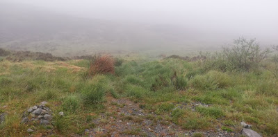
Fording the burn twice in the space of the first few minutes (I discovered on the return leg that I could have followed a trod that kept to the south bank, which avoided both the fords and the subsequent bash across long-felled forest), I followed the same long-abandoned track as yesterday, but in the opposite direction, until it hit a modern motorway-esque track. That sped me to the decision point where a small cairn and an ATV track (i.e. tyre lines through the bog and tussocks) persuaded me that was the way to go.

Cairn and ATV track = good way to go
I *think* it was a good decision. The ATV track ended abruptly at a fence after about half a kilometre, but the going from there wasn't dreadful. What was dreadful was the visibility. There was no chance, in the fog, of following the line of the high ground, in this complicated landscape, by sight, so it was a navigation exercise (assisted very much by technology, but still making great use of the compass) to get up to the summit.
The wind had been increasing (as you would expect) as I ascended, and by the time I was within 300m (linear) of the top my audiobook had been drowned out and I was, in any case, fed up of the wind whipping my earbud out of my ear (should have used my wireless running earphones). I fought the wind to take a couple of selfies at the top...

This snap makes the ground behind the trig look much higher. It wasn't.
... enjoyed the two seconds when the sun threatened to burst through and I could temporarily see a bit of my surroundings, then I made haste downwards. Even more compass work was employed on the descent, it being so tempting to just head 'down' and thus wandering off the bearing. I've not yet seen my recorded track, but I suspect that it wiggles around quite a bit.
I managed to hit the hole in the fence at the end-of-ATV-track, then with just a few unwelcome undulations (which I hadn't much noticed on the outward leg) I was back on the forest motorway and trotting back towards Bertie.

Being not yet 9am, we packed away and turned Bertie's nose towards my next set of hills...
Lamachan (NX435769; 717m)
Start: Car Park just before end of public road in Glen Trool
Distance: 12km*
Ascent: 760m
Weather: Overcast but cloud-free tops.
I managed to hit the hole in the fence at the end-of-ATV-track, then with just a few unwelcome undulations (which I hadn't much noticed on the outward leg) I was back on the forest motorway and trotting back towards Bertie.

Spot Bertie
Mick's estimate was that I would be gone for 4 hours, and I don't think that it would be overstating his reaction to say that he was taken aback to see me only two hours and twenty minutes after setting out. His intention to go for a walk around Black Loch had been thwarted, as it turned out he'd only been out of bed (after falling back asleep once I'd left) for a few minutes.Being not yet 9am, we packed away and turned Bertie's nose towards my next set of hills...
Lamachan (NX435769; 717m)
Start: Car Park just before end of public road in Glen Trool
Distance: 12km*
Ascent: 760m
Weather: Overcast but cloud-free tops.

An excessively noisy GPS track. I didn't wander around that much! Bizarrely, even though the recorded line wanders, the recorded distance looks about right.
Yet more plans not being followed! I'd intended to visit Lamachan as the first summit in a circuit taking in three Marilyns, but based on this morning's exertions that circuit was going to be too much and take too long, so I decided to just visit the one top this afternoon, as an out-and-back.
Mick walked out the first mile or so along the track with me, having opted out of doing the hill. In hindsight, a wise decision as he certainly would have hated this one. That terrain was HARD!
The track was, of course, easy going, even if it did involve far more descent than I would prefer in an outward route, then I reached the point where I had plotted to leave the track and yomp upwards.

My route was to the left of the stream. It looked pretty innocuous from below.
Oh my! The trod that I initially followed soon disappeared, leaving me with knee-high tussocks, surrounded by last year's dead grass, with plenty of heather and bog to contend with too. Back and forth I weaved, trying to find a good line that, apparently, did not exist. This wasn't helped by the knowledge that it was still 2km to my summit, and still worse, I was crawling along with the worry pushing to the front of my mind that I hadn't agreed a 'worry if I'm not back by' time with Mick, and there was the danger that he was going to be expect me to be faster than the terrain would allow.As I got higher, the going did get easier and, by that simple process of putting one foot in front of the other, the top was reached, with a view worth the expenditure of some effort. Running past it, along a line of old fence posts, was a good trodden line. Unfortunately for my purposes, the direction of that line wasn't useful (particularly as there was no boundary marked on my map, so I could only guess where the fence line went), so it was another retracing of steps.


Goodness, that tussock-fest low down was nearly as bad in descent as it had been going up. I was mightily glad to finally get back to the track.
I got back to Bertie after just over three hours and ten minutes - over 50 minutes slower than this morning's outing of the same length. Fortunately, Mick hadn't been swayed by my speed this morning and reported that he expected me to be 3hr30, so at least he wasn't worrying.
Now it's time for some rest to see if I can recover enough for the big day I have planned for the morrow.
(*having now (3 days later) uploaded my recorded tracks, I realise I had my watch in 'ultratrac' mode which is great for battery life but at the cost of accuracy in tracking. There's a lot of GPS wander in that mode, so I suspect the true length of these outings was 10-11km each.)


No comments:
Post a Comment