The Road goes ever on and on; Down from the door where it began;
Now far ahead the Road has gone; And I must follow, if I can;
Pursuing it with eager feet; Until it joins some larger way;
Where many paths and errands met; And whither then? I cannot say.

[JRR Tolkien, Lord of the Rings]

Friday 28 February 2014

How February Compared

I’m sorry! I’m about to overshare again. It’s for my own benefit – so feel free to look away now.

The first key stat about February is that on the 22nd of the month my blog hit 7 years old, during which time I have wittered my way through 1251 posts. I haven’t counted the words…

As for the year-to-date stats: from a ‘miles covered’ point of view, February went very well indeed, with 181 miles covered. This is how it looked in comparison with all previous Februaries since records began:

image

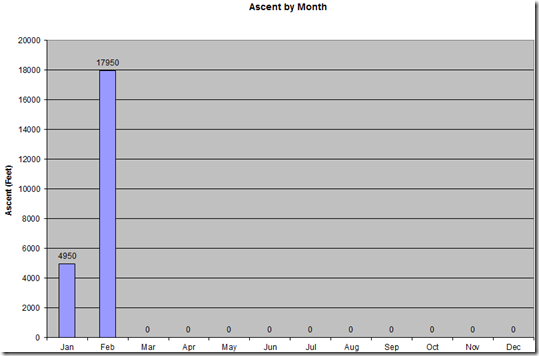
I haven’t got an equivalent yearly comparison graph for ascent, but (perhaps unsurprisingly, with a trip to lumpier parts of the country having featured in the month), February looked rather more healthy than January from an ‘upness’ point of view:

image

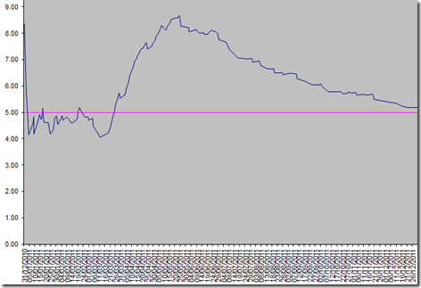
My current ‘best year’ was 2011, when (across the entire year) I covered 1891 miles compared with a target of 1825. That year the running progress of the daily average mileage looked like this:

image

You can’t possibly read the dates across the bottom, but what it tells me is that I didn’t convincingly break through the target 5-miles-per-day average until 25 March (which was 5 days into our East to West walk).

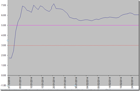
This year I broke through the five-mile average on 4 January and (to my amazement) I haven’t yet gone back below it. I have my doubts that I’ll manage to maintain such an average through March.

image

Yep, I still need to sort out the format of that one!

The red dotted line is the target. The pink line is the aspiration. The blue line is the reality.

I’m certain not to break any records in March, as two previous Big Walks have begun in March, and next month’s plans can’t possibly compete with a Big Walk.

Monday 24 February 2014

Around Bamburgh

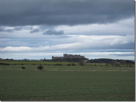
Bamburgh Castle is huge. Therefore, it’s a landmark that’s visible from quite a distance. We got our first glimpse of it when we were on Holy Island, and now that we’re staying nearby, it is very often within our sights. In fact, it would be in my sight right now, from my seat inside of Colin, if it wasn’t for the facts that: 1) I’m facing the wrong direction; 2) the curtains are closed; and 3) some inconsiderate* people went and pitched a caravan next to us, removing our view in that direction.

It was there in our view as we set out across farmland this morning**…

IMG_5962

… although we did lose it for the middle third of our outing.

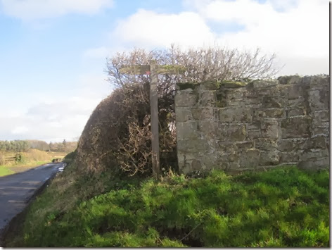
I don’t think many people walk the middle third of our route, or at least they don’t take the field paths, judging by the overgrown stiles and lack of trodden lines across the crops. Most of the paths were well signed, although (approaching from the opposite direction to which I took this photo) we did miss this one masquerading as a protruding bit of hedgerow:

IMG_5964

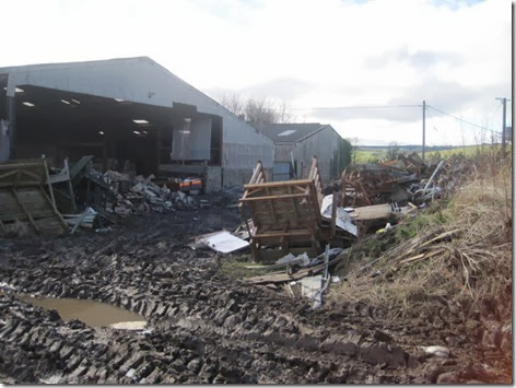
That obscured sign heralded the worst 100 yards of our entire holiday, as it took us through a farmyard which (along with the bit of track that led away from it) was an absolute disgrace to be seen. Fortunately, we were soon back in nice clean fields.

IMG_5965

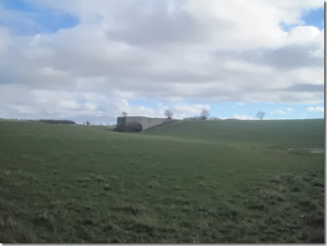
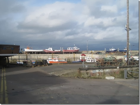
If I’d paid more attention to the information sign at Seahouses harbour yesterday, I would be able to tell you more about the era of lime production in these parts. Even though I can’t remember the key details about when it started and when it ended, I did recognise the two instances of evidence of the activity that we passed:

IMG_5968

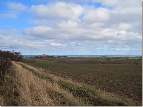
By and by, the Northumberland Coast Path was joined, but once again, we were on a section that wasn’t in close proximity to the coast. This time, however, it did take us to sea views (and of course Bamburgh Castle views), and for a while it even took us along the coast.

IMG_5969

Quite a bit of time was spent on or next to Bamburgh Castle Golf Course (excellent way-marking, by the way) where five paces of trespass took us to a sheltered bench with an excellent sea view. It wasn’t a moment too soon, either, as it was a late lunch today.

IMG_5971

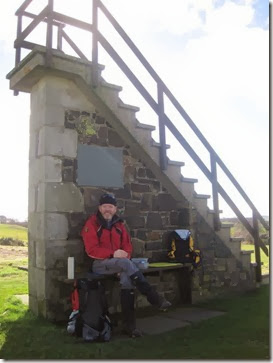
For anyone not familiar with one of these structures, it’s so the people about to play from the adjacent tee can gain a bit of height to check that there’s no-one on the out-of-sight fairway or green ahead.

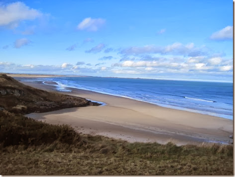
The path around the golf course had us walking right above the beach, and it was quite lovely:IMG_5975

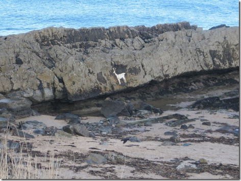
By then we were on the approach to Bamburgh, although we didn’t visit the village itself. Just after passing a deer on the rocks…

IMG_5977

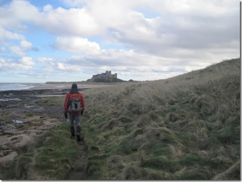
…the coast path would have had us leave the coast, but we didn’t follow it. Instead, we opted for the longer (but more pleasing) walk along the beach:

IMG_5982

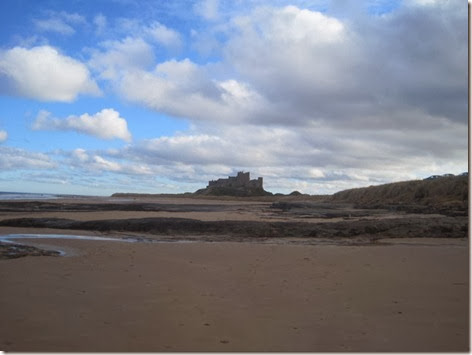
Can I get away with just one more snap of the castle? I took quite a few…

IMG_5983

A surprising number of people were on the beach outside of the castle (considering that it’s a Monday in February), but once we rounded the corner we couldn’t believe the solitude afforded to us:

IMG_5988

It was a 10.2 mile outing, with somewhere around 750’ of up and in decidedly spring-like weather.

(*It may be a little unreasonable to refer to our neighbours as being inconsiderate. They are on a perfectly legitimate pitch.

**It was only just morning. Our day started with an impressive oversleeping incident.)

Sunday 23 February 2014

Seahouses

At times it felt like I was aboard a ship last night, as Colin swayed and bounced in the wind. At about 6am, as I listened to it howling outside, it occurred to me that we wouldn’t even be walking the shorter version of today’s intended route. Instead, a very lazy morning was had with many cups of tea and much reading of books.

Even though the weather showed no signs of calming down, with the afternoon upon us, out we went, heading south on the Coast Path (which runs across fields and not on the coast) so that we would be against the wind for the outward leg of our route. It was a bit of a battle, which made it all the better when we reached Seahouses and found a few pockets of shelter. I can’t imagine it was much fun for the golfers on the exposed course on the headland at Seahouses.

IMG_5949

After  taking a turn around the harbour and headland at Seahouses…

IMG_5953

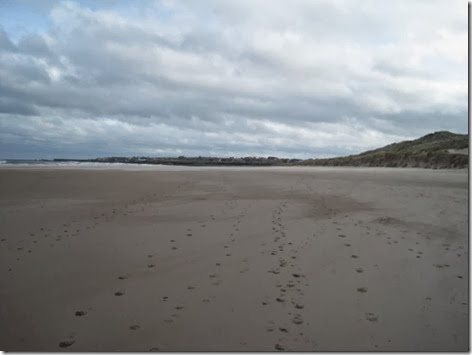
…back along the beach we went – which was far nicer than the (inland) Coast Path of our outward route. Of course, the beach was only a feasible route because the tide was out (but I had checked that it would be before we went).

IMG_5956

The dry sand from the dunes rushed seawards across the beach all around us, but now the wind was mainly behind or across us. It didn’t look such fun for the people heading the other way (not that there were many people out today). I imagine they were crunching much more of the flying sand than I was.

The final turn back towards our starting point put us back into the wind, timed nicely just as a shower came through too. But soon we were back in the dry (albeit still rocking) Colin, having covered 6.5 miles with just a small modicum of up.

Hopefully this weather will calm down by tomorrow (our last day of walking for this holiday), so that we can go and walk the route we had originally intended for today.

Saturday 22 February 2014

St Cuthbert’s Cave, Greensheen Hill and Dick’s Oldwalls

The disappointment of the first half of yesterday’s walk was eradicated today by a walk that thoroughly exceeded my expectations.

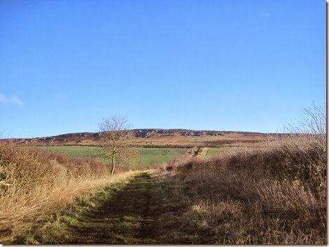
Having manoeuvred Colin through the small gateway into the muddy field, which constitutes the National Trust’s car park at Holburn Grange, up a green lane we headed, with Greensheen Hill dead ahead, under glorious skies:

IMG_5913

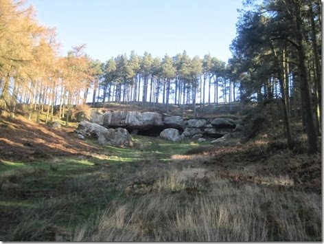
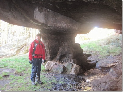
The hill wasn’t our first objective though, as we thought we may as well take a bit of a detour to see St Cuthbert’s cave (a detour that turned out unnecessary, as we ended up returning past it too, but we didn’t go many paces out of our way):

IMG_5915

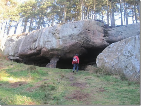
As natural-overhanging-rocks-where-historic-figures-have-sheltered go, it was impressive.

IMG_5916

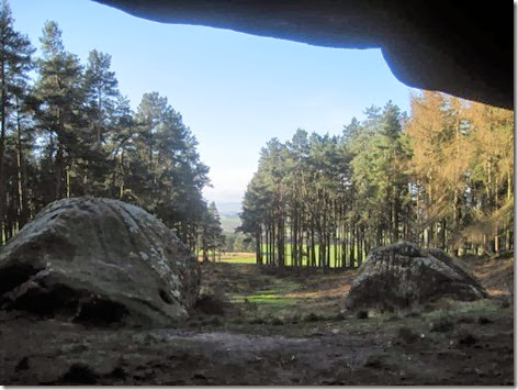
Quite a nice vista from inside too, although you can’t quite see the Cheviot Hills (at least, not in this snap):

IMG_5917

The ceiling of the ‘cave’ is higher than it may appear in the photo two-above too; quite roomy in there, in fact:

IMG_5918

With the cave explored, Greensheen Hill was next on the agenda. Glorious views and jolly windy! Fifty miles per hour, said the anemometer. “Let’s drop down for some shelter” said I.

IMG_5926

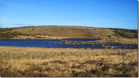
More water featured on the route than the map had suggested. The pond below was shown:

IMG_5928

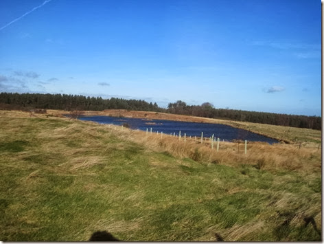
But this one apparently doesn’t exist. (As an aside, it was just as we passed this one that I nearly jumped out of my skin when I glanced down and saw that I was about to step on a deer’s head. There was no deer, just a perfectly intact head.)

IMG_5932

The views out to sea were far better than my equipment and skills can show:

IMG_5933

And then, just after elevensies (over which we lingered, in a sunny sheltered spot), another water feature appeared:

IMG_5935

The only less-than-appealing bit of the entire route was the grassy track through the forest after Dick’s Oldwalls (great name!), where forest machinery had left huge muddy ruts where a few months ago it would have been a lovely grassy surface. I’m sure it will be back to its proper state in another few months.

We were soon beyond the range of the forest machinery, and back onto a firm grassy surface, which took us past more craggy bits (lots of crags on this route) which looked like they may also have some caves, but we didn’t detour to explore.

IMG_5936

By the time we passed St Cuthbert’s Cave for the second time we could see rain heading in our direction, so haste was made back to our starting point – and a full car park, in contrast to Colin being the only vehicle when we set out. image

It was a truly lovely route, with great diversity, covering just a few paces shy of 8 miles, with around 1000’ of ascent. I’m sure that all of the ascent was into a headwind!

Fast forward a few hours, and there was a rugby match on telly, which Mick wanted to watch, leaving me at a loose end. So, off I took myself to explore a little of our new surroundings (we’ve moved a few miles down the coast today and are now just outside of Bamburgh), by wandering down to the beach, along it a short way and then back along St Oswald’s Way. That was another 2.7 miles with only about 150’ of up.

IMG_5940

Friday 21 February 2014

Northumberland Coast Path

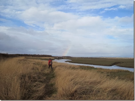
The first half of today’s outing up the Northumberland Coast Path, to the north of Beal, was rather disappointing for its lack of coastalness. It started with promise as we slip-slid our way alongside the North Low river/drain.

IMG_5899

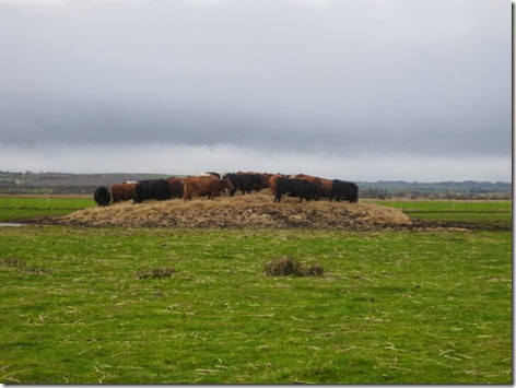
Within the next mile there were just a couple of moments where we had glimpses of the beach and the retreating sea, and soon we were heading slightly inland, from where the only hint we had that we were near the sea was the presence of dunes a distance away off to our right. Ignoring the sand dunes, we could have been walking through farmland anywhere, although there were some points of interest, such as this enormous pile of hay, topped by a herd of cows:

IMG_5905

And these early lambs sheltering from the keen, cold wind:IMG_5906

Having walked through Berwick-on-Tweed (Goswick) Golf Club (which was incredibly busy), and taken the path’s ridiculously circuitous path around the driving range, we reached a little dead-end lane, just a kilometre or so south of where we were due to turn inland to take field-paths back to our start point.

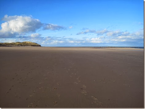
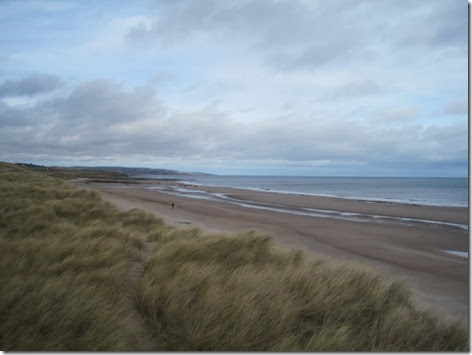
The little dead-end lane, with a trodden line into the dunes, gave me the notion that we could continue on our way along the dunes, rather than along the coastal-path-with-no-coastal-view. So, seaward we headed and from the vantage point of a tall dune a splendid view opened up of miles of sand. Immediately, the further notion entered my head that instead of walking through non-descript farmland, we could simply turn at this point and walk back along the beach.

IMG_5907

We didn’t go that way, but I didn’t take a photo in the other direction.

It was a much more pleasing return route, with the added spice of needing to cross a rather large (and in places deep) stream, complete with surprise areas of quick-sand.

The wind really picked up whilst we were paused on the beach for lunch (the cake, in particular, had a crunch to it that shouldn’t have been there) so, in common with yesterday, the final bit of the outing was a bit of a battle.

The final stats (including my detour up the road to a post box) were 12.1 miles walked with probably not much more than 150’ of ascent.

Thursday 20 February 2014

The Holy Island of Lindisfarne

When we are backpacking, it takes us an hour and a half to wake up, get up, have breakfast and a cup of tea, pack everything away and get walking. The walking day usually starts at 7.30.

Staying in Colin and day-walking is a far lazier business, with the morning routine (which always involves two cups of tea in bed) usually taking two and a half hours. As well as breakfast, it involves reading books, making lunch and (sometimes) putting the evening meal in the slow cooker before we go out.

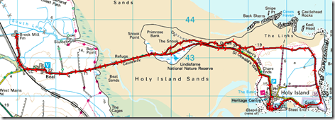
Today’s walk required an earlier start and a curtailed amount of lazing, as the road over to Holy Island is a tidal causeway, and (not knowing how long we would be on the island) we thought it best to maximise the time available to us by crossing at the earliest available time (which was 0855 today – and our starting point was a couple of miles away from the crossing).

It took us a couple of hours to get to the priory, which lies right at the furthest side of the island, and it was there, behind St Mary’s Church, that we declared an early elevensies. A sheltered spot would have been nice, but the wind was such that it seemed to be whipping even into corners that should have afforded shelter.

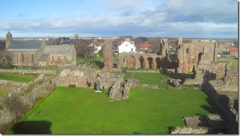
We didn’t go inside of the priory, but did enjoy a view down onto it from the old coastguard lookout station (the photo’s a bit fuzzy, because it was taken through salt-streaked double glazing).
IMG_5879

It was obvious that the wind had really picked up whilst we were in the lookout, and for the next half an hour or so it became difficult to walk in a straight line, never mind hold a camera still, as we walked over to the castle.
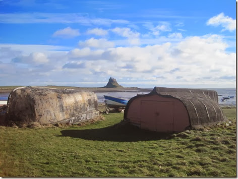
IMG_5888

Upturned boat hulls, repurposed as storage units

The castle looks rather impressive from the front (and that’s not a bad coloured sky, is it?):
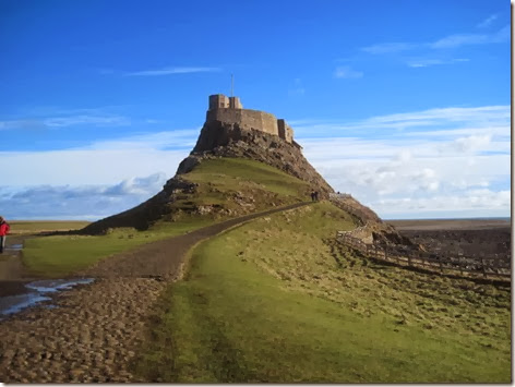
IMG_5889

It’s rather less attractive from the back, which is where we headed next, although my resolve to do a circuit of the island was wavering given the windy conditions. However, by the time we were behind the castle, it was going to be difficult to battle the wind to get back whether we did an about turn there, or whether we continued with the planned route, so continue we did – now battling mud as well as a side-wind.

From the priory to the castle we were amongst throngs of people. There were quite a few around for the next kilometre beyond that too, but as we continued the numbers tailed off until, beyond the advertised ‘nature trail’ walk, we saw no-one bar a dog-walker at The Snook car park.

Contrary to my original thought that we would have to walk back along the road, it was perfectly possible to find a way through the dunes.
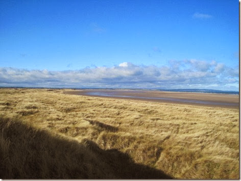
IMG_5893

It added a bit of ascent to the day and saw us wiggle around quite a bit as we relied on following our noses rather than using any meaningful method of navigation. It did the job nicely, though, as we popped back out on the road just a matter of paces away from the causeway.
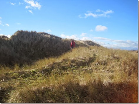
IMG_5895

Well, the wind! We were head-on into it as we walked back over to the mainland. Moreover, the wind had blown water onto the road and was whipping the splashes from passing cars straight across to our side of the road, causing a few power-marches to get past the most flooded areas before cars came.
image

It was a lovely outing in increasingly fine weather (bar the wind). It came out at smack on 14 miles with a known couple of hundred feet of ascent, but an unknown amount of dune-climbing to add to that.

Wednesday 19 February 2014

Finally! North Berwick Law

After further consideration, I’ve now concluded that it was a good thing that I didn’t pop up to the top of North Berwick Law when we passed within feet of its base in 2011. Aside from the fact that it became a future objective (indeed, an objective that has contributed to us visiting the east coast on this trip), it became a hill which I was greatly looking forward to climbing.

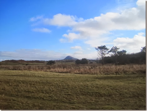
Looking forward to today’s walk so much, and having planned it for the day with the best weather forecast of the week, it was disappointing to wake up to the sound of rain. Happily, the wetness soon dried up, although blueness didn’t break through until we were on the return leg of our walk, when I finally remembered to take a photo of the pimple-in-a-land-of-flat, which is North Berwick Law:

IMG_5865

We could have just parked at the base of the Law and been up and down, including a cup of tea and a slice of cake on the top, in well under an hour, but that wasn’t my plan. Instead, we parked a few miles up the road, spanning the trip into a morning-long outing featuring a lovely bit of coastline too.

At only just over 600’ tall, it’s not a big hill but even so, I was surprised at how soon on our ascent we rounded a bend and saw the top before us.

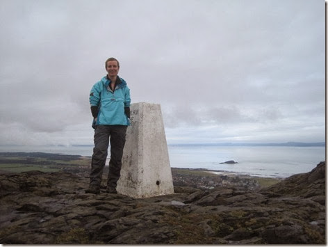
IMG_5856

Grinning – disproportionately pleased to have reached the top

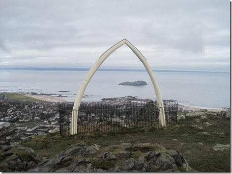
It’s quite a cluttered place for such a small hill, housing a trig point, a topograph, a ruined building, a wartime lookout building and a fenced-off area containing this:

IMG_5860

I wasn’t overly taken with the ‘work of art’, which is a replica of a whale jaw bone. Perhaps there’s a story behind its purpose in being there?

I had originally plotted a circular walk, but quickly dismissed it as I considered a retracing of steps, in this location, to be preferable to pavementless lanes. The route was just as pleasant on the return.

The stats for the outing were 8.2 miles walked, with 750’ of ascent and with one more tick on the Marilyn list.

Tuesday 18 February 2014

Dirleton

We would have had a longer walk today except that, last night (perhaps in a fit of laziness) I decided that I could get away without doing laundry, even though it would be our last day of this trip on which we would have laundry facilities. This morning, I changed my mind, thus a chunk of time, when we should have been travelling, was spent laundering.

So, by the time we had travelled to Dirleton (just north of North Berwick), parked, lunched and drunk tea, it was 1pm, which didn’t give long enough to do my originally intended walk, although there was plenty of time to some variant of coastal walk.

As it went, I erred too much on the side of caution (having not measured anything), and we could have gone a few miles further, but what we did do was very pleasant, save for the light rain that fell on us for the last mile.

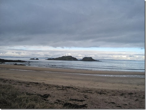
Having walked the short distance from the Yellowcraig car park to the beach, west was the direction we chose and for a while we had a good view of this island:

IMG_5842

The tiny snap doesn’t really show the lighthouse, nor the natural archway in the rock

For ease of progress the grassy path through the dunes was taken, rather than walking along the beach – until we missed the continuation of the dune path and found ourselves on the beach. It was certainly ankle shaping, and quite stunning too.

IMG_5845

Having not gone far enough (as I now realise) we headed inland and picked up a track that bears no resemblance, in its route, to that shown on the map. I did comment, as we made our way across a golf course (it’s hard to go for a walk in these parts without crossing a golf course!) that in a couple of days time we will lose the liberty to ‘just cut across to…’ like this, as tomorrow night will see us back in England.

Dirleton is a place we passed through on our East to West walk. I remember it well - we stopped for second breakfast on the green overlooking the castle. Mick didn’t remember it at all until we were leaving at he looked back from the viewpoint we would have had when we originally entered. It’s an incredibly well kept place with a distinct lack of ugly or out-of-place buildings.

IMG_5847

The stats were that we walked almost precisely 5 miles with around 350’ of ascent. Tomorrow we will get up early enough (and faff little enough) to be able to get in a slightly longer walk. I hope the weather’s good, because it’s a walk I’ve been waiting to do for almost 3 years.

(Note to TVPS, if you happen to be reading: we would have got in touch to see if you were open for tea-drinking visitors today, but it seems that when I replaced my phone 18 months ago, I didn’t get very far in copying my address book across to my new phone. Sorry!)

Sunday 16 February 2014

Not Taking a Dip

It was a glorious frosty morning today, with not a single cloud in the sky, and earlier than is our custom during a lazy holiday, we were to be found, wrapped up warm, on Portobello beach.

IMG_5833

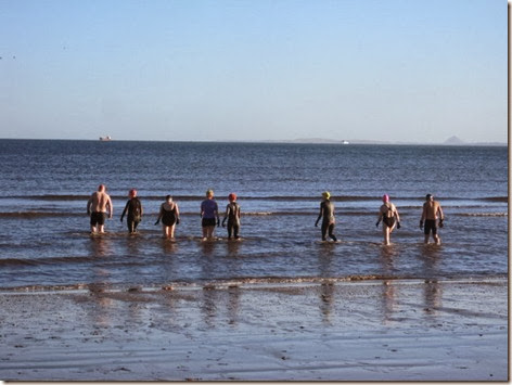
We did find ourselves a little over-dressed, considering the other ten people we met there:

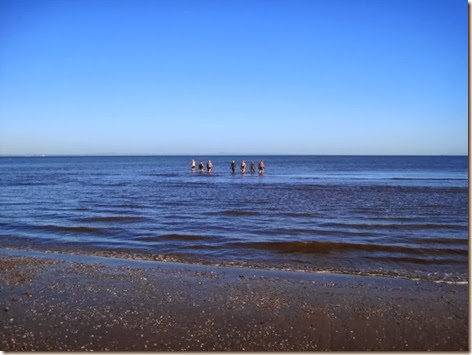
IMG_5828

I know that there aren’t ten people in that photo, but there were ten in total, only three of whom were wearing wet-suits.

IMG_5829

Much further in, but still not deep

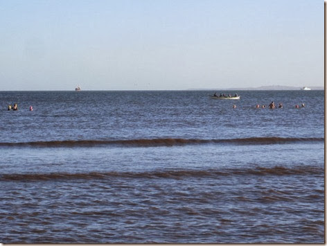
IMG_5834

A long way in – so much so you probably can’t see them in this reduced-size snap. they’re just in front of the rowing boat which looks like a little white slash, to the right of centre

IMG_5835

Here’s a zoom of that last shot

It wasn’t a coincidental meeting, as amongst the group was Alice who we met in Kervaig Bothy (along with her brother Martin, with whom she was cycle-touring) on the day we finished our Kent to Cape Wrath walk in 2010. Alice now lives in Edinburgh, and as we were making arrangements to catch up over a cup of tea whilst we are in the area, she mentioned that she was joining her swimming group this morning, so we thought we’d go along and meet her there. Not that I had any intention of going in the water (couldn’t – haven’t got my costume with me…), but whilst I’ve heard of year-around sea swimmers, I’ve never witnessed the spectacle. Apparently, the water was around 4.5 degrees Celsius this morning (doesn’t it make you shiver just to think about it?).

Seems like madness to me, although those we talked to all seemed completely sane during passing conversation.

Our own exercise for the day was in no way comparable. Wrapped up warm against the biting wind, even though the day had warmed up considerably since this morning, we took just a little turn (a modest 3.5 miles) along the coast this afternoon, where plenty of other people were met also enjoying the sunshine.