The Road goes ever on and on; Down from the door where it began;
Now far ahead the Road has gone; And I must follow, if I can;
Pursuing it with eager feet; Until it joins some larger way;
Where many paths and errands met; And whither then? I cannot say.

[JRR Tolkien, Lord of the Rings]

Friday 22 February 2019

Friday 22 February - Silves

We've been in Silves for a few days now, and whilst there doesn't seem to be much by way of walking options around here, I did find a local circuit on wikiloc.com, so today we went to take a look at it.

It didn't start with promise, being on a wide dirt road with nothing much of interest around us. Fortunately, it improved greatly as it went on. 

I'm not sure how much of the walk was within a nature reserve, but signs told us that thousands of trees had been planted. Given that there doesn't seem to be any other significant use for this type of arid land, it is something of a mystery to me why there are quite so many tracks criss-crossing the land. Thank goodness for electronic navigation tools, otherwise huge concentration would have been needed to keep on the right line! Here's just a small snippet of the map, by way of illustration:

Here are a few snaps:

A watering hole in the planted area:

Looking back from the same spot:


This is the first time, whilst walking in the Porguguese countryside, that we have come across a bench (contrast with Germany, where we were almost tripping over them at every turn, and Spain which is very partial to picnic areas in obscure locations). It was the bench beside the track that we saw first, before the full picnic area below came into view. It was just a shame that today was the one occasion that we went out with neither a flask of coffee nor a snackette. There didn't seem much point on such a short walk when there was no chance of there being a convenient bench... 

I think this one illustrates quite how barren the landscape can be around here:

The sun was in the wrong place for the photo, but as we started to descent back towards Silves, we rounded a bend to see a windmill ahead of us. The track leading up there was incredibly steep! 

A bit closer to (and using the HDR camera function to counteract the sun being in the wrong place):

The air has been a bit smoky and hazy this week, which robbed us of a good view of the large castle at Silves (we visited it yesterday - more of which here):

It was around 5.5 miles with around 600' of ascent. 

Saturday 16 February 2019

Monday 11 February - PR1 at Ameixial

Last Monday's walk was always going to be a short one, with the PR1 being only around 3 miles long. It turned out to be even shorter than expected when four loose dogs prevented our passage through a farmyard. Our initial thought was that after a bit of a backtrack, we could take an on-road detour to get back on route, but that plan was abandoned when we realised that the road led us straight past the other side of the farmyard, where we would be accosted again (potentially not as aggressively, as we wouldn't have been within their territory, but we didn't venture to find out).

Here are the main features of the bit of the walk we did manage:

The first bit of the route was on a path that was well waymarked, but not well trodden:

Having dropped very steeply down to the river (whereupon I decided this was not a suitable running route!) we climbed all the way back up to the village, and then up a bit more to look down on it:

It was from that high path that something in a field below us caught our attention:

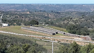
What were we looking at? Wood piles? Very deep stone walls with no apparent purpose? I zoomed in for a shot, but we really couldn't work it out:

It turned out that our route took us right past the high-security (high fences, CCTV) field in question and finally we had our answer - neat stacks of bark harvested from cork oaks:

It was just after this that we aborted the outing, walked back past the cork stacks and down the road back into the village, to complete an outing that was perfectly pleasant, but rather short.

Saturday 9 February 2019

Saturday 9 February - PR4 at Pereiro

Until yesterday we have pretty well been hugging the water around the extreme SE corner of Portugal, firstly along the coast then up the River Guardiana, which forms the border between Spain and Portugal. Yesteray we moved properly inland, albeit only by 15km, to the small village of Periero.

At first glance, as we pulled into the motorhome parking area, there didn't seem to be anything nearby that would hold our attention for longer than a lunchstop. Then the map told me of a village just a few hundred metres walk away. By the time we'd whiled away the afternoon, variously wandering and sitting, we'd decided that we would stay over and take a stroll around the local PR walking route today.

We found the terrain near to the Spanish border to be formed of countless little lumps of hills, stretching out into the distance. Here we are at a higher altitude and the undulations are much longer and gentler. That didn't make the first part of our walk massively interesting. The land hereabouts isn't suitable for agriculture, or, well anything really. So, it's just a whole lot of stunted scrub clinging to those long, gentle undulations.
This pond was the first break in the monotony of the scrubland and I wondered whether it was going to be the most interesting thing we saw today.
A while later I spied what appeared to be the remains of either a hamlet or large farm in the distance. We later found ourselves over there and it was indeed completely abandoned.

Thing did improve. Whereas the routes we've walked to date have all been on tracks and dirt roads, this one suddenly took us off piste, for a climb out of a valley up a moderately-steep grassy slope:

There was either a failure of waymarking or a failure of attention (but we think the former), thus we missed a turn somewhere up that slope and found ourselves faced with a fence at the top. A quick hop over and a couple of minutes along the road and we were back on track ... and being snarled at by a rather aggressive dog, which was soon retrieved by its owner.

Waymarks were a bit lacking on the next section too, and it wasn't until we reached the bottom of this walled green lane that we found a marker confirming we had been right to go down it in the first place:

Thinking about it, missing or unobvious waymarks became a bit of a theme, as we missed a turn at the ruined farm/hamlet (see photo 2 above) too. That may have been a good thing, as we could see that the track beyond was being maintained by some heavy machinery, so probably best to keep out of their way. We got ourselves back on track at the next opportunity, and took a little detour to see if a nearby ruin was indeed an ex-windmill:
Yes, was the conclusion we reached.
View down to the village of Pereiro from the ruined windmill

We were soon down in the village having coffee outside of the one and only cafe there, in the company of the cafe's very handsome dog (pointer/dalmation cross was our uneducated guess; should have taken a photo).

Around 6.4 miles were walked with somewhere between 150-200m ascent.

Thursday 7 February 2019

Thursday 7 February - by Alcoutim

We arrived in Alcoutim yesterday, me on foot from our previous nightstop, Mick in Bertie. After a couple of hilly runs this one looked easier, being downhill overall, but it had enough undulations that I was happy to take a micro-breather for a quick photo when I got my first view of the village of Sanlucar, with its prominent castle, just across the water from Alcoutim:
The water in question, the River Guardiana, forms the border between Spain and Portugal; Alcoutim is in Portugal, Sanlucar in Spain.

Today I rested my running legs by going for a walk. The signed Petite Randonée route in Alcoutim didn't look particularly interesting, so instead I chose a route I'd downloaded from Wikiloc.com, which turned out to use sections of the PR2, the GR15 and the GR13, as well as some forest tracks that aren't on any marked trails.

Here are a few snaps:
Looking downriver on our outward leg. Alcoutim is on the right bank, Sanlucar on the left.
Trying and failing to capture the extent of the green lumpiness of the landscape and how it contains a whole lot of nothing.
Apparently we were following in the footsteps of smugglers during at least part of our outing.
This info sign, located in the town, gives a bit of history relating to that smuggling.
After the wide tracks and dirt roads of the GR15 then the GR13 we took to lesser used tracks, some more overgrown and eroded than others. This one was very slightly narrowed by overgrowth, but had a good surface.
In the foreground are the scant remains of Alcoutim's old castle. Beyond is Sanlucar's castle. It's a pity there's not a position from which one can capture both of these and Alcoutim's 'new' (14th century?) castle.

The outing came in at 6.3 miles with 850' of ascent - short enough to be back in time for lunch, but long enough to justify our break half way for elevenses.

(Conrad: a bit of an aside, but I think you would have been as entertained as we have been by the German caravanner that arrived this afternoon and who has spent a good two hours trying to find the absolute ideal position for his caravan, finally setting everything up completely in one spot only then to decide that six feet to his left looked better and to restart the whole exercise over again. The drama when something went awry with the positioning of a wheel chock was something to behold!)

Monday 4 February 2019

Sunday/Monday 3/4 February - PR4 by Odeleite

In my last post I mentioned the PR4* which runs close to where we are currently parked, a few kilometres away from the village of Odeleite. I've now almost covered the ground of that route twice and, between those two outings have covered its entirety once.

Yesterday, before the sun had started to pour warmth into the day, I donned running gear and set off along it at a trot. This is not a flat area and we are parked on top of a hill. I was thus a bit alarmed to see quite how much height I dropped in the first 3 kilometres, and by the time I started hitting the riverside undulations on the path I'd hoped would be flat, I was wondering if I'd bitten off more than I could chew. The route was a few miles shorter than I'd intended to run yesterday, but I'm not accustomed to tackling hills at more than a walk. However, I surprised myself and only had to walk a couple of minutes of the biggest and longest incline.

The one bit of the route I didn't see yesterday was the tour it takes of the village of Odeleite, which I omitted purely because I thought the chance of dog encounters would be lower if I skirted the village (there are dogs *everywhere*; most are tethered or behind fences, but two got their paws (but fortunately not teeth) onto me as I ran).

Mick, still struggling with his long-term calf injury, wasn't able to join me, although he did run a shorter circuit later in the day. It would have been a shame for him to miss out on what is a very pleasant route, so today we approached it at a brisk walk, omitting a short distance at the beginning (because we'd already covered it during a previous stroll) and adding on the bit through Odeleite that I'd missed yesterday. We encountered no loose dogs, but also encountered no good reason to climb right up to the top of the village to then descend all the way back down the other side.

Here are a few snaps taken across the two outings, which came in at 10km with around 250m ascent:


(*Petite Randonée - a French walking route classification which has been adopted by Spain, Portugal and quite probably other European countries.)

Saturday 2 February 2019

Occasional Iberian Relics (1)

I can't really claim that this afternoon's walk was A Walk. We just went out for a little look around our new surroundings and found ourselves walking three miles or so on a loop using the GR15 and the local PR4.

We will likely see more of the local tracks over the next few days, but for now I'll just leave you with a couple of snaps.

The downside (quite literally!) of being parked on top of a hill is that any walk involves quite a bit of downhill, followed by equal amounts of up. This was a section of the down. We turned back towards our start point just before we got to the village.

They're hiding behind one another, but there were two 2CVs and two Renault 4s in various states of decay in this small holding. Seemingly the owner was a fan of French cars in the 1970/80s!