The Road goes ever on and on; Down from the door where it began;
Now far ahead the Road has gone; And I must follow, if I can;
Pursuing it with eager feet; Until it joins some larger way;
Where many paths and errands met; And whither then? I cannot say.

[JRR Tolkien, Lord of the Rings]

Monday 31 August 2015

Cold Fell

Sunday 30 August

Cold Fell (SE of Brampton – NY606556)

image

The RSPB car park at Clesketts isn’t designed for 6m long vehicles, but by holding a branch out of the way and reversing Colin into a bush we managed to squeeze in so as not to cause an obstruction. So, bright and early on Sunday morning off we set in the direction of Cold Fell, hoping that by the time we got there the low cloud would have lifted.

IMG_9677-001

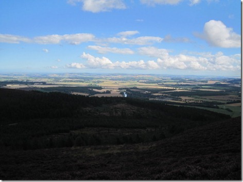
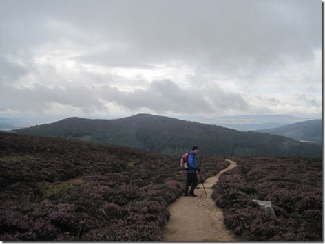
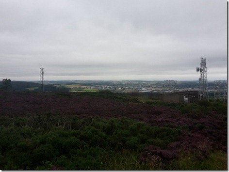
Taken on our way back. That’s the way we’d been, but Cold Fell is out of sight from this vantage point.

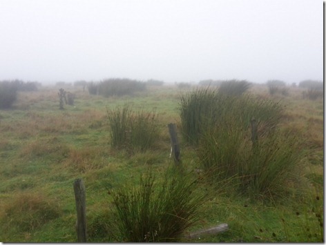
The way up was soggy underfoot and a little longer than expected, as we opted to follow the trodden line (which skirted around the far side of the hill for a while before turning towards the summit) rather than yomping through heather, but it was straightforward and by the time we got to the top the cloud base was a short way above us:

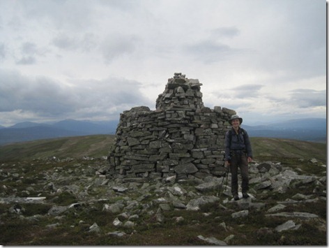
IMG_9675-001

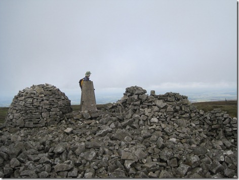
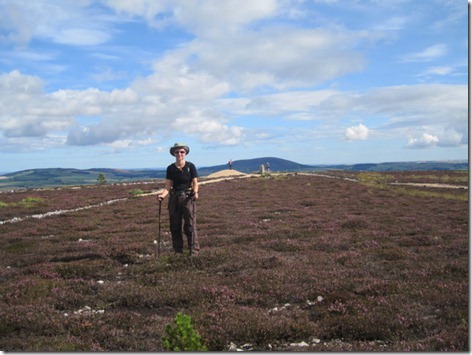
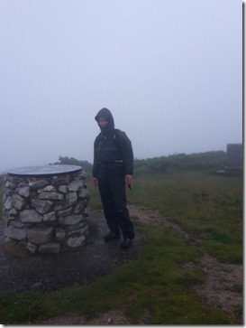
I read a trip log which described the cairn as being the shape of an American Hard Gum. A pretty accurate description, I’d say.

The last butteries of the trip were eaten in the excellent shelter (to the right of the trig in the snap above; notable for boasting better-than-average seating arrangements), before we started back down.

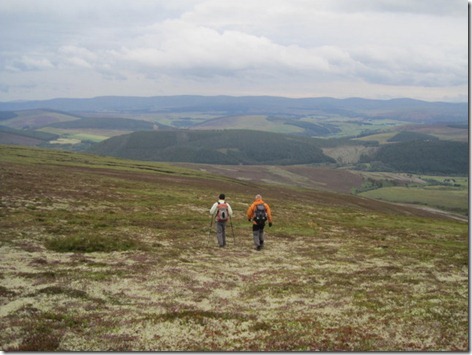
With the cloud now considerably lifted, the large cairns further along the ridge called to me, so we took a bit of a detour to include them in our route. What a soggy bit of ridge that was – and after I’d managed the previous couple of hills in dry boots.

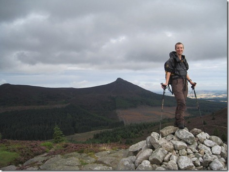
They certainly like their large cairns in these parts:

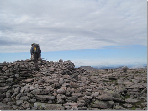
IMG_9676-001

We arrived back in the car park just as people were arriving for the day, thus as I made a bee-line for the kettle Mick dived behind the wheel and suggested that we needed to leave immediately, pointing out that if another car arrived then we’d struggle to manoeuvre out of our tight space. 

Five point eight miles were covered in this final outing of the trip, with 1300’ of up. And then (via a layby for that omitted coffee and the final slice of homemade cake (no idea how we managed to make that last the best part of 3 weeks!)) we went home after a good and successful trip during which (on the whole) we enjoyed surprisingly good weather.

Sunday 30 August 2015

Dumyat

Saturday 29 August

Dumyat (just NE of Stirling)

image

“You dumb yat!”. “What a dumb yat!”. Yep, it definitely sounds like an insult. It struck me as an odd name for a hill. Odd or not, it’s a modestly sized hill (418m) and has an approach which was in keeping with the direction of today’s keen wind, so it’s the objective I chose to break up our journey south.

Cups of tea in the car park allowed a couple of showers to pass such that it was in warm sunshine that we set out. Surprisingly (considering the regularity at which rain had been hitting us as we drove), the showers we saw approaching all skirted us and we had a fine outing, with pretty good air clarity and thus good views.

IMG_9670

Admiring the views to the SE

It seems an obvious hill for locals to visit on a Saturday afternoon, and there were a few other people around (mainly family groups, which is always nice to see), but it wasn’t at all crowded.

IMG_9671

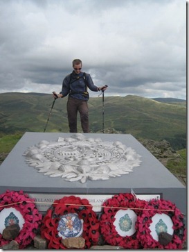
I paused to read the inscription on the military memorial – but can’t now remember what it was marking, except for the detail that it dates back to 1967 and was replaced by a new memorial in 2014.

Our return route was very similar to our outward one, having not the time available for the larger circuit I had plotted when I originally looked at this hill last October. On the way down we received the news from a passing runner, who we had first met shortly after leaving the car park, that the dog which had been following her for the previous twenty minutes had been reunited with its owner. I’ll bet that was the chap, who wasn’t wearing running gear, who positively careered past us early into our ascent.

The stats were 4.1 miles walked with (apparently) 1100’ of ascent.

Saturday 29 August 2015

Knock Hill and Meikle Balloch Hill

Friday 28 August

Knock Hill (NE of Keith, Moray)

image

If you were to ask a child to draw a hill, then Knock Hill is likely what they would produce. It’s a heather-clad, oversized molehill which protrudes 230m above the surrounding land, making it clearly visible for miles around (in fact, it was negligent of me not to get a snap of it from afar).

A lane so small that we overshot on the first pass, mistaking it for a driveway, with one of the worst surfaces we’ve driven on this trip, took us to a good parking area just a few paces from the start of the ascent path.

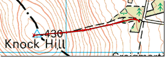
That was an ascent to get the body going (/complaining loudly) first thing in the morning! The total distance to the top was 0.7 miles, about 0.6 miles of which was uphill, during which distance we ascended 750’. For once, I think I’ve managed to capture the gradient in this snap:

IMG_9656

The slope angle combined with the peaty ground and footfall has, over time, allowed rain water to do its work, leading to some severe erosion of the trodden line. That made the going more huff-and-puff-worthy than the gradient deserved, such that it took us half an hour to reach the top (I say ‘us’, but I’m sure that if Mick had been on his own he would have been up there significantly faster).

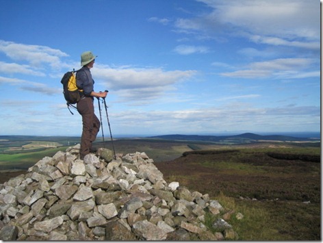
What a fine morning it was for it, with no hint of waterproofs being required:

IMG_9657

Then off we strode, back to our start point, and onwards to the next hill (via a prolonged coffee break in Keith – we were on a very relaxed schedule today).

Meikle Balloch Hill (just E of Keith, Moray)

imageMeikle Balloch Hill, sitting only just outside of the town of Keith, looks far less interesting than Knock Hill from a distance, although with these parts being relatively flat, it is another one that stands out in the landscape, shouting “I’m a Marilyn” as you approach it.

A couple of miles of little lane took us to a parking area behind the water works, where I was impressed with the visual representation of the available waymarked routes. The information sign only half in shot confirmed that we wanted the light blue route (“Good job” said Mick, “as we don’t have a horse with us”).

IMG_9661

Until we got to the top our path was a well-surfaced one and, by all appearances, the peaty path across the summit plateau will soon be surfaced too (note the pile of stone chunks to the left of the trig, upon which a woman is standing in the snap below; the surfaced path currently ends just left of my right hand):

IMG_9662

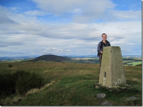
Apparently the highest point of this hill lies 5m off the path, in between a cairn and the trig point. This spot where I am in the snap above was my best guess as to its position.

There have been a lot of out-and-back walks this week, but today the blue route provided us with a pleasant circuit. They got the distance wrong on the sign, at least according to my GPS, which recorded it as 2.1 miles with 500’ of ascent.

Back at Colin before lunchtime, there would have been plenty of time to go and visit either Ben Aigin or the two Conval hills (just outside of Dufftown), but I decided that the afternoon would be far better drinking tea with a friend instead, not to mention catching up with blogging and watching a film*.

(*I failed in the latter. Faffing with GPS tracks, my stats spreadsheet and photos, then stringing together sentences for a blog post can take a surprisingly long time. Unfortunately these days it takes longer than my aging laptop battery lasts, which is why the last few days posts have been delayed. I’ve had plenty of internet access, but no electricity.)

Friday 28 August 2015

Hill of Tillymorgan, Hill of Foudland, Fourman Hill

Thursday 27 August

Hill of Tillymorgan (SE of Huntly)

image

My original plan had been to tackle both Hill of Tillymorgan and Hill of Foudland from the layby outside of the graveyard at Kirkton of Culsalmond (hoping that there wasn’t going to be a funeral; given how small and old a graveyard it is, it would have been awfully bad luck to hit such a day), and that is from where we set out for this first hill.

Up past the ruins of the old church and past a sign that suggested that our hilltop was two-miles hence, through a forest we went, soon overheating in the sunshine.

Nearly at the end of the forest, the track took an unexpected turn (the map didn’t show any track going that way), which looked like it would be helpful to us and then an obvious trodden line took us through more trees, then over slag heaps, before finally petering out at a fence.

A missing section of the top strand of barbed wire allowed us to get safely to the other side, from where easy grass took us to the high-point:

IMG_9645

Despite appearances, that slag heap isn’t the highest point; it’s at the trig point which lies beyond, which really isn’t visible on this small snap.

The air clarity was superb, giving good views back to Bennachie:

IMG_9646

Our next objective was pretty close too – it’s the lump behind me in this photo:

IMG_9647

Returning back the way we had come, 3.5 miles had been covered with 800’ of ascent.

Hill of Foudland

image

As mentioned above, I had originally intended to tackle this hill from the same start point as the last, but the length of the lane-walk which would have been required in both directions (not to mention a small bit of the A96) were off-putting. So, instead I thought we’d see if we could park at the bottom of the track which leads up to the summit, even though I hadn’t looked on Streetview to see how feasible that would be…

…or so I thought. As we approached Jericho, suddenly it all looked familiar and I realised that a) I had journeyed along there on Streetview; and b) the reason I hadn’t put it as our start point was because the road actually ends at Jericho (it becomes a track from that point – something which isn’t apparent from the OS map), and there’s nowhere to leave a Colin-sized vehicle there.

Mick, kind chap that he is, again volunteered to stay with Colin, to cover the slim chance that someone would want to access the field to which we were blocking the gateway, and I, in turn, said I’d get up and down as fast as I could.

The weather helped speed me along. I may be wearing a sunhat and sunglasses in this (appallingly framed) summit selfie, but it had been raining on me for the last ten minutes and it continued to do so for the whole of the descent.

20150827_114026

It wasn’t a particularly enjoyable walk either, with some unpleasant tracks, so Mick didn’t miss much.

I was back within an hour and twenty minutes, with 4.2 miles covered involving 950’ of huffing and puffing.

Fourman Hill (NE of Huntly)

image

Another hill and another bouncy journey in Colin down a very little lane, this time with fingers crossed that there would be somewhere to turn around at the end (I don’t usually take us beyond the last obvious turnaround point). There was indeed somewhere to turn, which also provided somewhere to park, but Mick was concerned that our position would cause a problem if another large vehicle wanted to turn, so he stayed put whilst I toddled off.

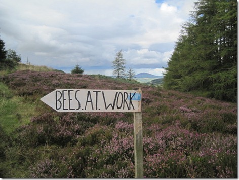
It was a shorter and simpler outing than expected, thanks to a track (not shown on the map) which took me the whole way to the top, through glorious flowering heather. A fine smell it was too, and I think the bees (of which there were lots, all very hard at work) agreed:

IMG_9654

Opposite the sign were four hives

IMG_9650

Equally lovely in appearance and aroma: heather in bloom around the trig point

Seeing a shower approaching as I loitered briefly at the trig, I would have run down this one if I’d been wearing more appropriate footwear (my old Scarpa ZG65 boots, which I’m desperate to wear out so I can finally justify throwing away the uncomfortable things, have been worn for all of this trip), but even without any trotting, I was back at Colin 33 minutes after leaving, as the outing was only 1.6 miles, with a very modest 400’ of ascent.

Cairn William

Wednesday 26 August

My morning forest-track-internet-hot-spot had told me that my intended start point for this walk was viable, and so it proved to be, with parking enough for three Colin-sized vehicles. As we were the only people there, we had our pick.

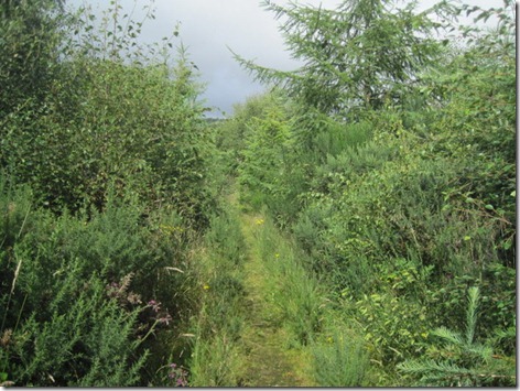
A sore foot caused Mick to sit this one out, which was a shame, as he missed an outing that I enjoyed greatly. It didn’t start with great promise; on the map the path shown in the snap below is represented as a forest track. I think it’s a long time since it was passable by a vehicle, being heavily overgrown (mainly with broom and gorse) and very soggy underfoot:

IMG_9636

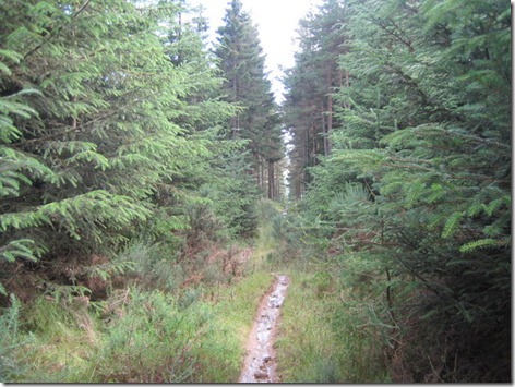
That led me to a track of the type I expect when I see a forest track on a map, which in turn took me to an informal mountain bike trail leading up the hill. That was a bit soggy too, but not too muddy, and not overgrown:

IMG_9637

The informal mountain bike trail led on to a formal one, which gave an incredibly easy walk to the top, but at the expense of being direct. Just look at the size of those switchbacks!

image

A sharp shower hit me as I approached the top, leading to a waterproofs faff. A further waterproofs faff was had at the top to remove them, by which time the weather looked like this to the south…

IMG_9640

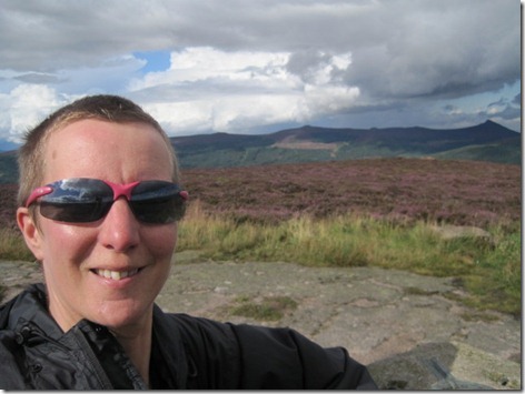
… although it was a bit dark over Bennachie (behind me in this summit selfie):

IMG_9642

You may have noticed as you scrolled past that map shot a few pictures ago that I took a rather more direct descent route. I wouldn’t have wanted to ascend through that deep heather, but exactly as someone had noted in their trip log on hill-bagging.co.uk, it’s very easy to yomp down through the heather, then through the well-spaced trees of that bit of forest. The only impediment was a fight with a short section of six-feet-high bracken.

My upward route had been 2.5 miles long and had taken one hour and one minute. My downward route was 1.2 miles long and took just under 25 minutes. The total upness was 1100’.

Did I mention that I rather enjoyed that one?

Mither Tap, Bennachie (Oxen Craig) and Millstone Hill

Wednesday 26 August

Mither Tap, Bennachie (Oxen Craig) and Millstone Hill (NW of Aberdeen)

image

What a disappointment to look out this morning to see that we were in a cloud! There was a brief period of an inversion below us, but by the time we set out we were back in that cloud again. Mither Tap/Bennachie is such a good looking hill, and it looked awfully like we weren’t going to see anything of our walk over the tops.

Out into the mizzle we headed (which was occasionally interspersed with real rain), and up the motorwayesque path to Mither Tap. Given the weather, I was willing to omit this top, but Mick voted to visit it anyway and he was absolutely right in that decision. As hill forts go, this one was impressive even in the murk. Unfortunately, it wasn’t really the weather to take any photos to illustrate the point, although I did snap Mick at the top:

20150826_092124

These hills are liberally scattered with signposts, which would be very handy if you knew the names of all of the car parks and their locations. Even so, that’s no excuse for me choosing the wrong turn at one of those signposts and heading off down the wrong side of the hill (yep, that’s twice I’ve done that in the murk in the space of the last three hills!). There was nothing for it but to backtrack (back up the steep bit we’d just come down).

IMG_9630

Interesting rocks on our way up Oxen Craig

Whilst Mither Tap is the most interesting bit of this ridge (I say having seen it from other vantage points in better weather than this morning’s!), the high point is Oxen Craig, so that’s where we headed next. As you can see, we were still suffering rather poor visibility:

20150826_100937

Handily, where I had expected to be yomping through heather, there’s a path that doesn’t exist on my map, and it sped us on to the Gordon Trail, where finally holes started to appear in the gloom. Indeed, we even had some sunny periods. It wasn’t long before our next hill (Millstone Hill) was visible ahead of us:

IMG_9631

And, by the time we got there, our morning’s work was clearly visible behind us:

IMG_9632

Millstone Hill was a little out-and-back detour in what was otherwise a circular walk, which saw us return via the Bennachie Visitor Centre (or, at least, we passed within 100m of it) and the Turnpike Track. Having passed dozens of signposts throughout the rest of our walk, they suddenly disappeared on the Turnpike, even though it’s one of the walks marked on the Visitor Centre maps, and even though there was only one confusing junction. I was confused, at any rate, and we did take a brief foray up the wrong track before putting ourselves back right.

I’ve noted quite consistently that almost every house in the north of Scotland, which has internet, uses BT, which is great for those of us with BT Log-in credentials, as almost all BT users host a public hotspot. Today, it was along the Turnpike Track that I saw a nearby house and thought “I wonder if their wifi will reach this far”, as I really wanted to look up some details for the next hill (Cairn William is shown on the map as having a summit surrounded by forest, and if I could glean some information from hill-bagging.co.uk then potentially it was going to save me from having to bash through a forest). A couple of minutes of loitering on the forest track later and I had the information that I needed, and another hill had been added to the agenda for the day.

This first outing had been 11.2 miles with 2800’ of ascent (As I sit and type this at 6.30pm, back in the same car park as we set out from this morning, the skies are blue; it’s almost tempting to nip back up the hill to see what we missed this morning.)

Bin of Cullen, Waughton Hill and Brimmond Hill

Tuesday 25 August

The weather forecast for this week involved far too much rain and strong wind to make me want to return to the big hills, so instead we opted to stay in the northeast corner of this part of Scotland and visit some little hills instead. Today involved far more driving than it did walking, especially for Mick (who did all of the driving and only got to do one of the hills). This is how it went:

Bin of Cullen (SW of Cullen, Moray)

image

Waking to low cloud and light rain, it didn’t look the best day ever for a walk up a hill, but (on the upside) there wasn’t a howling gale blowing, and the first walk of the day was to be relatively sheltered, so without too much faffing, off we headed to abandon Colin in the limited parking at Braidbog, to the south of our objective.

Considering the low cloud, the almost continuous rain and the keen breeze on the top, it was a surprisingly enjoyable outing, mainly through forest before we broke out onto the heathery summit (the heather is just coming into full flower and has been quite lovely on all of these recent walks).

20150825_085228

Almost exactly three miles were walked, with 700’ of up.

Waughton Hill (SW of Fraserburgh, Aberdeenshire)

image

This Marilyn is a bit of an outlier, and hadn’t originally featured in my list of hills for this week. However, on the basis that I’ll want to visit it eventually we came to the conclusion that we may as well do so now, whilst we were slightly closer than we usually get to it. An hour of driving ensued and then all we needed to do was to find somewhere to park.

After a bit of driving around, we ended up putting Colin in the entrance to a Scottish Water installation, just beyond Bransburn Farm (by Strichen), but as we were fully blocking the access, Mick volunteered to stay put, leaving me to venture out into the gloom: that low cloud still hadn’t lifted.

The initial walk along the overgrown lane was damp from all the overgrowth, but the rain held off and thus it was only murk and a strong wind with which I had to contend. The walk was nothing special, and neither was the summit:

20150825_123813

Taking a bearing to get off the top would have been wise, as it seems that my sense of direction proved up to its usual standard. My intention to take a slightly more direct route down failed when I wandered off in the wrong direction. Ooops! I hadn’t gone far before I noticed, but the result was a return route slightly longer than the outward one.

The stats were 3.4 miles walked with 450’ of ascent.

Brimmond Hill (W of Aberdeen)

image

Mick would have joined me for this one if it wasn’t for Aberdeen Council having decided that only people with vehicles under 2m tall are permitted to park in the nearest car park. Again we blocked an access; again Mick volunteered to stay put, whilst I said I would be back within half an hour.

I was back smack on half an hour later, having walked 1.8 miles with 350’ of ascent. The up was exceptionally quick, with a tarmac track taking me the whole way. Just for a bit of variety, I took a wet, peaty path for part of the descent, before trundling back down the tarmac again. Even though this top is not lacking in transmitter masts, it was quite an enjoyable little walk, particularly as the weather had cleared such that I had views and hints of brightness:

20150825_144403

I looked across from there to tomorrow’s hills, and that’s where we headed next, to spend the night in a local car park to position us nicely for a circular walk in the morning.

Sunday 23 August 2015

Creagan a’ Chaise

Saturday 22 August

image

Louise had come up with a number of options for today’s walk, and upon learning that Mick and I had never ventured into the Cromdale Hills, the day’s route was settled. David volunteered himself (or was volunteered) for driving duties, so we all sat back and admired the landscape as we were whisked over to a little car park in Strath Avon, on the SE side of the hills.

After a modicum of faffing, and some important boot decisions on Louise’s part, it was declared time for elevenses. Short work was made of the cake and after a modicum of further faffing, off we all went in a generally uphill direction.

The path made itself elusive towards the beallach, and was equally elusive for part of the ridge too. That surprised me as I thought that these hills, which sit so prominently outside of Grantown-on-Spey, would be very well trodden.

IMG_9620

“It’s definitely not that way” says Louise

The walking was easy enough along the broad ridge, even if a touch damp in places – particularly for those of us (by which I mean ‘me’) who fail to look where they’re putting their feet…

A huge cairn at a small prominence on the ridge gave us a good spot for lunch (although it would have been better if the leeside wasn’t already occupied by four of the only five people we saw all day), and I must have been concentrating hard on my sandwiches as I completely failed to take a photo of it. Mick did better when we got to the trig point atop Creagan a’Chaise:

IMG_9622

And he snapped me near to the jubilee cairn too:

IMG_9623

Then Mick and David, who had so patiently walked at a sensible pace all through the ascent suddenly disappeared off into the distance:

IMG_9624

We did consider whether to try to attract their attention when we saw them drifting off the line we were supposed to be taking, but came to the conclusion that if they looked back at any point to see where we were then they’d see that we were headed somewhere slightly different. It took a very long time before they looked back!

Eventually (with Louise and I only a tiny bit smug that our line had landed us nicely near the top of the track without any reascent necessary) we all met back up on a track, which took us down to the road, which took us back to our start point. It was warm down there, as it had probably been all day. It had been rather less warm up at 700m (hats, gloves, jumpers and jackets featured).

After a rather unfair game of ‘can we roll the car over’ (unfair because there was only David on the driver’s side, against Louise and Mick on t’other side), David chauffeured us all back again.

IMG_9625

An excellent time was had, much chatting done and a Marilyn bagged. The weather stayed fair too, with views all day and with only a few drops of very light rain hitting us on the return leg.

The stats for the day were 10.1 miles with 2000’ of up.

Friday 21 August 2015

Ben Macdui and Cairn Gorm

Wednesday 19 August

image

That was a superb day! It started with a midgefest*, which certainly got us moving the moment we stepped outside this morning.

Ben Macdui was the main event of the day. It’s one of those elusive hills that has resisted all my previous designs on it**. Today it succumbed, and it was such a nice walk, and the weather had cleared so much by the time that we were on top, that it would have been rude not to make a circular walk of it. We chose Cairn Gorm for our return route, even though we’ve been up there a few times before. The major difference today was that it’s summer, whereas all previous visits have been in the deep snow cover of February, such that we had no idea what a network of motorway-esque paths lead across these hills. There’s even steps leading up the west side of Cairn Gorm; we never knew that, even though it’s the fourth time we’ve been up that side.

On our last visit, we left the summit on a bearing and managed to drift off a bit, walking between two of the cairns which lead the way from the summit to the Ptarmigan hut. Today we saw that those cairns are, at most, placed ten yards apart. As it’s highly unlikely that we managed to walk at right-angles to the line we were supposed to be on, we have to deduce that visibility on that occasion was down to a matter of feet. I certainly recall thinking we were going to walk slap into the side of the building before we saw it.

Walkers visiting the Ptarmigan hut in summer have to ring a bell, wait to be let in and sign a register. We duly did that and enjoyed tea and cake in the crowded restaurant, filled with people who had taken a ride up the funicular railway. Then we signed back out and walked down, nearly beating the people who were waiting in the queue for the next ‘train’ when we left.

Anyways, here’s a few photies of the day:

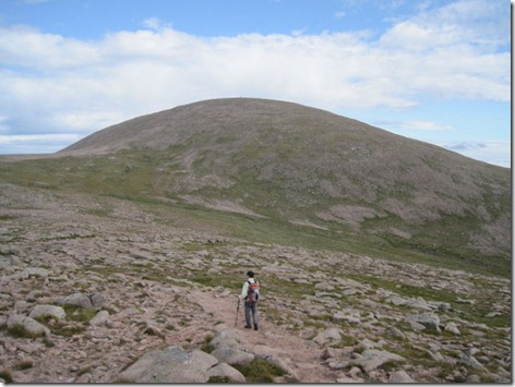
It was a warm and sunny ascent … to start with, at least:

IMG_9585

Once on top, I made a bee-line for the trig point, before we enjoyed butteries and tea in a nearby wind shelter (“Is there a shelter on the top?” I asked Mick on the way up, with my mind on the butteries and a flask of tea. “One or two” he replied. The top is actually liberally littered with shelters.)

IMG_9591

It was as he stood there looking at me at the trig point that Mick thought “I’ve been here before. I could have stayed in bed with my book today!”. Here he is, thinking those thoughts, with Cairn Toul behind him:

IMG_9594

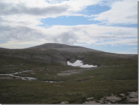
On our way to Cairn Gorm, marvelling that there are paths hereabouts:IMG_9603There’s snow still lingering too:

IMG_9598

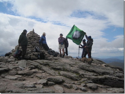
You’ll find these chaps on top of Cairn Gorm on the 19th of August every year, flying their flag and reciting Gaelic poetry. Something to do with commemorating the battle of Culloden. We didn’t hang around for the poetry … it was a bit nippy up there!

IMG_9606


(*Today didn’t start as midgeyly as yesterday ended, when I accidentally allowed an entire swarm to enter Colin. It’s a lot easier finding and killing midges in a backpacking tent than it is in a van!

**Twice Ben Macdui nearly featured in a TGO Challenge crossing. On one of those occasions wind speeds of over 100mph were recorded on Cairn Gorm on the day in question, so we were glad to have heeded Challenge Control’s advice that it may not be a wise choice on the day. The second time on the Challenge we waded through deep snow in the Lairig Ghru, being ill-equipped to go high. Last February we were thwarted by very stormy weather. Last November I set out in snow and awful visibility and got half way before deciding that if I was going to go to a summit which has a 360-degree-view-point symbol on the map I wanted to be able to see something, so I modified my plans and visited Cairn Lochan instead. Mick made it up there on the Challenge this year, but I was on a different hill at the time.)