The Road goes ever on and on; Down from the door where it began;
Now far ahead the Road has gone; And I must follow, if I can;
Pursuing it with eager feet; Until it joins some larger way;
Where many paths and errands met; And whither then? I cannot say.

[JRR Tolkien, Lord of the Rings]

Sunday 26 April 2015

SUW Day 13 - Blakerstone Moor to Cockburnspath

Sunday 26 April
Distance: 9.5 miles
Weather: wall-to-wall sunshine to start, with fluffy clouds developing later

Incredibly, we woke again to clear blue skies and a frost, which gave us quite a clear indication that we were going to complete this coast-to-coast walk with a cumulative total of under an hour and a half of precipitation.

With only 9 miles to walk, and not needing to reach our destination until lunchtime, we once again proved that the ability to have a leisurely start always causes us to be super-efficient in packing away. Thus, were walking at 7.30.

The first part of the day was what I expected yesterday: farm tracks and fields, but then we crossed over the A1, went down a horrible bit of old road covered with fly-tipping (so much so that we had to walk over it; I shall report it), and entered a some woodland/forest. A very pleasant green path took us through there and by the the time we popped out the other end of the woodland, the sea was only just ahead of us.

A long second breakfast, on a convenient bench in the sunshine, killed some of our excess time, then along the cliff tops we went. I'm not sure who snuck lead into my shoes during that break, but (for me) 'last half-mile syndrome' was in full swing.

Even so, when I spotted the pretty cove (accessed by a tunnel through the cliff) and harbour below us, I was in no doubt that it would be worth descending to it, to call it our official end point of the walk - even though we did then need to walk into Cockburnspath anyway. It was a very pleasing location for the 'end photo' - far more so than the middle of the village.

Per my previous post, in the absence of a cafe, we took advantage of having gas and water to spare by brewing up in the village centre. There we looked back on the last couple of weeks and agreed that it has been a most enjoyable walk, and all the more so for the weather. (As glorious as it has been, it didn't quite match the record held by our Wainwright's C2C in 2008, when we had no rain at all, but I suspect we had more sunshine on this one.)

(It can now rain for a week and a half, but I'm sure about 300 Challengers would be happy if Scotland then saw another two-week sunny spell, like the last fortnight.)

Sent using BlackBerry® from Orange

Makeshift Tea 'Room'

In the absence of a real tea-serving establishment, we're making do at the memorial in the middle of Cockburnspath, whilst waiting for the bus.


Sent using BlackBerry® from Orange

Cockburnspath Harbour

SUW Day 12 - beyond Nun Rig to Blakerstone Moor

Saturday 25 April
Distance: 16.25 miles
Weather: 4 seasons

It rained on and off through the night. I'm not sure how much on and how much off, because I was mainly sleeping, but there were certainly plenty of sizeable puddles around today.

With the rain still pattering down on us as we awoke, an early start wasn't on the cards. The day ahead of us was neither long nor arduous, so we figured we could lounge around until 10 and hope the rain abated.

By 10 the pattering had become so light as to be barely noticeable, and out into the world we went ... to find that the reason for the reduction in the sound of water-on-nylon was because it had turned to snow. Proper snow, too.

So, we packed away and started walking in conditions which we couldn't quite believe. Yesterday morning we set out in t-shirts and vented trousers, and were soon overheating. This morning, with snow in our faces, we were layered up, including every waterproof item (more for warmth than necessary weather protection).

It must have only lasted another 20 minutes after we started walking and by the time we reached the enormous cairns atop Twin Law it wasn't just dry, but we could see blue skies heading slowly in our direction.

I'm sure that last time we walked this way (on our East to West in 2011, I believe) we must have left the SUW before Twin Law, as I recognised neither the cairns, nor did I recall previously having seen Watch Water Reservoir, which is the next notable feature.

Beyond there, by the presence of so many roads shown on the map, I had expected to feel like we were getting back into civilisation, and for the walking to be across farmland (as in lowland fields). In the event, I was pleasantly surprised, as even where we did hit roads there was nothing on them, and there was still rough, open land to be crossed (where hares were plentiful and we even saw two stoats/weasels).

A good pitch could have been had at our originally intended night-stop of Owl Wood, and an even better one could have been had near to the crystal-clear burn on the SW side of Abbey Hill (Outer), but in both cases we decided to continue in order to reduce tomorrow's distance to around 10 miles.

We've ended up beyond Abbey St Bathans, where (in the warm wall-to-wall sunshine that now shone on us) it was tempting to try out the wood-fueled hot-tub we found on the side of the burn, not near any houses. I wonder who uses that?

A few minutes later I deviated from our path to search for a pitch. What I found (which is where we are now pitched) isn't bad at all, but it would be improved by not being 2 feet away from a pylon!


Sent using BlackBerry® from Orange

Friday 24 April 2015

SUW Day 11 - Galashiels to beyond Nun Rig

Friday 24 April
Distance: 19.75 miles
Weather: clear sunny start, then varying amounts of cloud, finally clouding completely by 5pm and raining by 6.

To my surprise, we stepped out this morning to find yet another warm sunny day. Everyone (including the weatherman) had said the fine spell was to break, and even though the rain wasn't forecast to reach us until evening, I had expected it to be overcast and cooler.

The first task of the day (after another quick dash to the supermarket to pick up cheese (omitted from last night's shopping so it didn't spend the night sweating)) was to get out of Galashiels, and I thought I had a good plan to achieve that*. Not feeling the need to follow the Way into Melrose, having walked through there on a couple of previous occasions, the intention was to take the path which follows the disused railway along the riverside. Unfortunately, what isn't apparent from either my (4-year-old) map or aerial photos is that a new railway line is being constructed along that old railway bed and thus the path is no more.

Heading along a minor road going in the right general direction, we were about to cross the river to take another road on the other side when we spotted a well-trodden path along the riverbank and opted to follow it. The route came good (kinda), but I wouldn't recommend it. The bit where we squeezed along the tiny bit of ground lying between the railway fence and the steep drop to the river was bad enough, but at the top of the next rise we found ourselves in a construction site, complete with heavy plant.

Faced with the prospect of backtracking a mile to the nearest accessible bridge, I voted to continue, apologise and plead for permission to proceed to the road just 50 yards hence. Apologies and pleading were unnecessary. The chap who came out to intercept us merely gave us directions to get off the site and join the new path that proceeds from there. Phew!

The day was pretty uneventful after that start (well, until the teabags incident; that was certainly an event!). Under blue skies we walked predominantly along an old drove road through gently undulating, lush grazing land full of sheep and lambs.

In Lauder we intended to buy scones from the bakery, but somehow walked past without so doing (not that we're in any way short of food) and ended up just with orange juice from the convenience store. Past the castle and onto more undulating green grazing land we then went until at Blythe Water we reached our intended night-stop. It's a location I selected based on prior knowledge of what a good spot it is, having stayed there before.

However, it was only 3pm and, with a need to be in Cockburnspath in time for the 12.44 bus on Sunday, it made sense to go further today, even though we knew we wouldn't find another pitch of anywhere near such quality further on.

Happily, in the tussocky moorland we then entered there sits a rusty iron barn, and next to it is some flat(ish) grass. With the skies behind looking ominously dark, we took it; a good decision, as half an hour later the rain hit.

(*Looking at the map now I wonder why I didn't consider heading N out of Galashiels to take the route to the E of Buckholm Hill, then via Langshaw to take the path which joins the Way by Bluecairn. I'm sure it would have been a more straightforward way out of town.)

(Sorry, no picture today. Completely failed to get the Blackberry out during the day.)

Sent using BlackBerry® from Orange

Picture the Scene

After the best part of 20 miles of walking and with an increasingly cold wind, the tent is pitched and in we crawl. The kettle goes on and out come the mugs. I've declared that we have enough gas left to be extravagant and have two cups of tea apiece tonight - the second will come after we've eaten.

Both food bags are then searched, calmly at first, then frantically. Eventually it has to be concluded that the teabags (a fresh bag of 40) are still in the room of last night's B&B, and there are no more shops before us and the coast.

The kettle has almost boiled and the disappointment in the tent is immense.

The kettle boils and I'm about to pour.

Mick then has a flash of inspiration. He opens up his cook-pot, and there they are - a plump ziplock full of glorious teabags.

Suddenly there are grins and the mood in the tent soars. It's not tealess-tea for the rest of the trip after all :-)


Sent using BlackBerry® from Orange

SUW Day 10 - Blake Muir to Galashiels

Thursday 23 April
Distance: 16.5 miles
Weather: Another clear start, with fluffy clouds building later. Very warm

It was a surprise to look outside this morning and see wall-to-wall sunshine. Having not seen a weather forecast since last Saturday morning, I had convinced myself that the incredible, fine weather would end yesterday. I cannot believe how lucky we are to have enjoyed another day of sunshine.

It was warm again too, which was nice as we could afford ourselves a very leisurely start this morning, in order to be on time for a second-breakfast date in Traquair. It was half an hour later than usual when we got up ... then somehow we managed to be super-efficient and were ready to go by the usual time.
So, we dawdled. What I should have done was switch my phone on; had I done so I would have seen that TVPS (the very same chap who suggested the excellent route east of Moffat to us) had arrived early himself.

A very enjoyable two and a half hours were spent catching up with TVPS over second breakfast and it could so easily have been longer. Eventually, we had to concede with 13.5 miles still ahead of us, and stuff we needed to do once we got to Galashiels, we did need to press on.

Up was the direction out of Traquair, more so than strictly necessary, as this time (unlike the previous two occasions we walked this way) we took the trouble to make the short diversion to the top of Minch Moor - our ninth and final Marilyn of this walk. Up there we found not only fabulous views, but a local couple who had just nipped up there for a picnic during their lunch break. From them I learnt that I've been pronouncing Traquair wrong for years.

Back down to the Way (where we had dropped our bags for the short hop up to the top) we undulated our way along the ridge until the Three Brethren (today's piccie) came into view. It's the third time we've visited these three substantial cairns, and from the third different direction.

Down through the forest, on a path neither of us remembered from 7 years ago, a quantity of height was lost. We weren't done with climbing, however, as there still lay one little lump between us and Galashiels.

Navigating through a town is always trickier than on the open hill, but we only walked past a couple sitting outside of a pub three times in three minutes before we orientated ourselves to find our B&B for the night.

Showers, chores, a (huge!) meal out, shopping, public transport research and the booking of train tickets to get us home then took up the rest of the evening - hence the delay in this post as I chose sleep over tapping away at my keyboard come 10pm last night.

(TVPS - thank you once again for travelling over to meet us - always great to see you.)

Sent using BlackBerry® from Orange

Wednesday 22 April 2015

SUW Day 9 - Bell Craig to Blake Muir

Wed 22 April
Distance: 17 miles(ish)
Weather: wall-to-wall sunshine to start, some fluffy clouds building later. Very warm

A cool NW wind accompanied us whilst we walked yesterday and when we pitched we did so according to that wind. By 7.30pm it had switched to E, but it wasn't strong enough to make us move the tent and, in fact, by 9pm it had died completely.

With a completely still, cloud-free night we expected a frost and a condensation-fest. But, no! It was positively balmy and we woke this morning to not a single bead of moisture on Vera.

Very soon after setting off we discovered that, if we had continued to the other side of Bell Craig yesterday, we wouldn't have needed to detour for water at all. A trickle was present there right in our path. Then we discovered that as top-rate as our pitch was last night, there was an even better one on the top of Andrewhinney Hill (first Marilyn of two today).

After gawping at the views and making use of the phone signal for a quarter of an hour, onwards we went along the boundary line to Herman Law, where we left it to descend via Peniestone Knowe. At Pikestone Rig we almost touched the SUW, but having come within feet of it we veered off again to take the path to the west of Peat Hill, which (as we had been advised) gives excellent views over the lochs below.

It was at Tibbie Shiels Inn (where its closed state prevented us from getting the tea and second breakfast about which we had been fantasizing) that we finally rejoined the Way. Obviously we were helped by the most incredible weather, but I would recommend the high level route to anyone walking that way in reasonable weather. It really was a superb walk and there are good places to camp on most of the high points (not so much in the dips, so a sturdy tent or calm conditions would be desirable).

St Mary's Loch, along whose entire length we walked, was pretty indeed, with the still conditions giving a perfect mirror surface.

Not counting the workmen, over whose newly laid tarmac we walked at the end of the loch, the only person we saw out and about today was a mountain biker as we made our way past Dryhope Tower. An information sign there told us that we could get good views from the top of the tower, but it didn't move us to make the small detour to check it out.

A grassy forest track gave a little respite from the heat of the day, and a conveniently placed bench gave our feet another rest, before we burst out onto the side of Deuchar Law.

It was a decent yomp through knee high tussocks to get to the summit and another yomp (including dashing through a bog to try to shake off a lamb which confused us for its mother) to get back to the path. Having omitted a bit of SUW which crosses a stream by virtue of going via Deuchar Law, a little detour was then needed for water, and then we needed a little patch of flat, level grass. The latter proved a little troublesome (and I made quite a meal out of the former too; when will I learn that it's always wise to take both a mug (to act as scoop) and water bottles when going to a water source?) but we found ourselves a suitable place between tussocks in the end, albeit a little further on than we wanted. A little lie-in will be had in the morning accordingly.


Sent using BlackBerry® from Orange

Andrewhinney Hill

8.10am
Mick at the cairn, with Loch Skeen and White Coomb behind. Gorgeous. Mist in valleys to east. Spectacular!


Sent using BlackBerry® from Orange

SUW Day 8 - Moffat to Bell Craig

Tuesday 21 April
Distance: 14.5 miles
Weather: wall-to-wall sunshine

I've mentioned on these pages before a chap known as TVPS, who is a Star of the First Order. He deserves another mention today for having given us some advice and a recommendation which turned today into a truly excellent experience.

The first advice was that there is now a SUW official alternative route going over Gateshaw Rig and Croft Head. As I had intended an out-and-back up the latter (it being a Marilyn), it was welcome news that we could take it in as a traverse.

Following the alternative route in its entirety didn't quite work out as a 'path closed' sign was found at its start point (NT122043), due to blow-downs obstructing the path. As it went there was also a 'no unauthorised persons' sign on the low-level route due to forestry operations, but in the absence of diversion signs we went that way, and took the second track on the left to join the alternative further along. (Incidentally, the bit of forest through which the closed path runs has very recently been felled and as we walked by it looked to us like the alternative path is now clear again.)

Thus we had a very fine high-level walk, rather than a trudge along a forest track.

Descending from Croft Head on the knee-friendly path which has been made down the spur, we then stayed on the Way for less than a mile, before taking TVPS's recommended route.

At the boundary marking our entry into the Scottish Borders we chatted a while to a local chap who was just having his lunch then preceded him up to Capel Fell (2nd Marilyn of the day). We met him and chatted twice more (as we lunched, then as he had another break later on) as we continued along the boundary fence/wall all the way from Capel Fell to where we are now pitched atop Bell Craig.

I don't think I could possibly adequately describe what this walk has been like on this clear-skied day. The views have been incredible and the going underfoot has been superb, mainly on firm grass with just the very occasional mild squelch. The good tread made the climbs seem much easier than they looked (even with heavy packs, after yesterday's resupply), with the exception of Bodesback Law. That one did seem quite a haul, partly because it was the third significant climb of the day, partly because it was just plain steep! Two chaps gave us the excuse for a breather on the top (as if an excuse was needed), as we watched them gear up with their paragliders and prepare to jump. We later saw them soaring well above the summit.

The only logistical issue of taking this route and spending the night on the ridge is that of water. However, it wasn't far to drop off from the dip just before Bell Craig to fetch some - in fact it was no distance at all for me, as Mick volunteered himself for the task (the things he'll do to get more Fitbit steps than me!).

Armed with water our pitch tonight is up there as one of our best ever. Such incredible views in such an attractive area. We're happy campers tonight. And, of course, the rest of the ridge awaits us in the morning :-)

(Today's snap is of the hills we/I walked last November taken from Croft Head. I should have got my phone out to take a few more snaps to share of today's attractions, but my Blackberry lives in my pack and I was too lazy to keep stopping to get it out.)

Sent using BlackBerry® from Orange

Tuesday 21 April 2015

Lunchtime view

It's a hard life, having to put up with lunch spots like this on sunny, clear days.


Sent using BlackBerry® from Orange

Monday 20 April 2015

SUW Day 7 - Lowther Hill to Moffat

Monday 20 April
Distance: 18 miles
Weather: overcast till mid-afternoon, then clearing

Last night's pitch, on the summit of Lowther Hill, was fully exposed to the keen wind, and that wind had a bite to it. Just nipping outside at bedtime to clean my teeth left me with numb hands and eager to dive back inside. Vera, being the sturdy thing she is, stood up just fine, with only the need to re-tension a guy in the early hours, and thus a good night's sleep was had (by me; Mick complained that's the third pitch out of five where he's had a lump or a dip whereas I've had comfortable flatness).

Even after a good rest, I was feeling the effort today and I have to put it down to under-eating and over-exercising yesterday, as I was also ravenous all morning. By elevenses, I reckon I could have eaten the entire contents of my food bag and still had room for pudding. Fortunately, we had a generous lunch today, and I ate more than my fair share.

Jumping back to this morning, as a result of ending up atop Lowther Hill yesterday, we didn't have much ascent left to reach our first Marilyn of the day: Green Lowther Hill, just over a mile from our pitch.
We had left the SUW to reach that hill (in fact, we spent more of today off the route than on it), but the going was simplicity itself: leave the radar station, and follow the service road past a BT mast and on to three further masts atop our objective. There, as we stood at the trig, the low cloud that had allowed us to see nothing on our way there, started to break a little.

It was still a navigation exercise as we left the road and dropped pathlessly down the SE shoulder, where we (correctly) guessed that the tyre tracks in the grass would be useful to us, even if they weren't quite on the right bearing.

It wasn't too long before we did get below the cloud, and having got off the hill we took an impulsive decision not to follow the obvious track to regain the SUW, but to yomp along the Potrenick Burn. It was rough going and sometimes soggy but it cut off some unnecessary distance and ascent so, even with hindsight, I'd go that way again.

We didn't have to deviate far at all for our next Marilyn, as the Way goes over Hods Hill and the highest point was only just over 100m away from the path. What views from up there, albeit including an enormous windfarm.

Into the forest (where the trodden line now weaves its way around the many blow-downs on the Way's original path), we followed the official route until the turn for Brattleburn bothy. There we went not to the bothy, nor straight-on along the SUW, but turned left to take a more direct route, initially along forest tracks, into Moffat (Moffat isn't actually on the SUW, but we had elected to incorporate it for resupply).

A motorway underpass not shown on the 1:50k map, but revealed to me during a tour on Streetview a few weeks back, when I was trying to find a sensible way into Moffat, took us onto a path around the golf course and only a few minutes later I was doing a 'shopping when hungry' thing at the Co-op.

It was then on to the campsite where I feel like I've done an extra mile, partially due to chores, but not helped by the back and forth caused by the builders (snagging, following a complete refurb of the facilities is ongoing) having turned off the hot water to the ladies showers. Perhaps I should have just used the gents whilst I was in there, having not noticed that they'd switched the location of the ladies and gents since we were here in November (an error in the design stage for the refurb, says the warden). It was the presence of urinals that was the giveaway. Ooops!

(Today's piccie was taken from our hungry-enough-to-eat-a-scabby-dog elevenses spot, overlooking Daer Reservoir.)

Sent using BlackBerry® from Orange

Last Night's Pitch

I'm glad I took that photo last night, as we've woken fully enveloped in cloud this morning.

Sent using BlackBerry® from Orange

Sunday 19 April 2015

SUW Day 6 - Chalk Memorial Bothy to the Lowther Hills

Sunday 19 April
Distance: 18.5 miles
Weather: sunny start and end, but heavily overcast middle, with one light shower

Having seen only 2 people out and about over the last two days it made me jump when, before 8am, someone ran up behind me. We had, after all, only just started down a very long dead-end road and we hadn't passed any parked cars, so didn't expect anyone to be about. It turned out to be the woman who lives at the farm at the road end, out for her morning exercise. She slowed and we sped up and thus in company we walked and talked together for over 2 miles, until we turned off the road and she turned to return home.

Of the various things discussed, she asked if we'd been surprised by the bothy last night, based on the picture shown in the guidebook. As I've not seen the guide (and indeed, didn't know the bothy existed until Friday) I had no expectations above what we found, but it seems that originally the bothy boasted running water, a sink, toilet, fire place and furniture. Sadly predictably, the place was abused and the answer was to remove all the facilities. Still, it did the job nicely for us.

Leaving our companion and the road behind, up we climbed, gaining good views of the pretty valley as we went. The effort in that climb kept us nice and warm, even though the day had clouded over. Then we topped out, saw Sanquhar ahead, and started heading downhill - with the wind head-on - and goodness, it was cold! I had to stop to don warmer gloves and a buff. Quite a contrast to the last couple of days.

Not much was open in Sanquhar when we passed through but we only needed the Co-op, and the cafe was an added bonus (moreover as they allowed us to charge our phones whilst we drank tea and made short work of their fine scones). It was quite a while before we walked out the other side of the town.

A couple of miles later on, we lopped a corner off the official route, but this time for good cause: I wanted to go via Green Hill (as it's called on the Marilyn list; the map suggests its called Stood Hill). I had forewarned Mick that the following four miles might be arduous yomping, as we were to follow a single-dotted-line shown on the map. The reality was that although there was no clear path on the ground, the going was very good. The only tiresome feature was the length of time spent with ankles rolling to the side as we contoured a steep hillside for a couple of miles (sheep trods were sometimes pleasantly flat walking, but often not).

The summit was an excellent 360 degree viewpoint on what has been another clear day, then it was down into Wanlockhead, where we searched the cemetary for a tap but found none. A tap would have been handy, as the map said we weren't due to cross any streams for the rest of the day (and hadn't for hours previously either). As it went, the detour for water (gorgeous sparkling clear stuff too) was tiny. It was just a pity to then discover a hole in one of the Platty bottles. Must get my glue and repair tape out later and see if I can patch it back together.

A little trouble was had in finding a pitch, which was a bit worrisome as the wind was blowing enough to want some shelter. We didn't achieve shelter, but did achieve an interesting pitch. I shall post a photo of it in the morning.


Sent using BlackBerry® from Orange

SUW Day 5 - Dalry to Chalk Memorial Bothy

Saturday 18 April
Distance: 17.5 miles
Weather: wall-to-wall sunshine, but cool breeze

The surroundings, path, sunshine and air clarity combined today to make our walk a joy.

We did occasionally wander very slightly off course during the first six miles of the day. Having had, for the last 4 days, a path so well waymarked that it would have been a feat to lose it, we haven't felt the need to navigate. That meant that when a number of markers were lacking today (mainly that the posts across open ground had rotted and fallen over - usually you can clearly see at least one ahead) we just followed a line on the ground. We were always within 100 yards of the correct route - it's just that regaining it when we realised we had strayed required the crossing of a bog each time!

Reaching Stroanpatrick, 7.5 miles in, we knew we were reaching the main event of the day - heading over the ridge containing Manquhill Hill and the arch-sculpture-topped Benbrack.

From up high the views were excellent thanks to the air clarity and from Benbrack (whose arch we had first spotted some distance back), we could see the sister arch on Colt Hill. The latter isn't on route, but as it's a Marilyn that lies just a kilometre each way from our path, it would have been rude not to visit it.

Stashing our bags out of sight in the forest (in case a thief happened by who felt like carrying away two full packs - a smaller-than-miniscule possibility, given we've only seen two people out and about in the last 2 days) it was a remarkably quick (and light!) visit to the top.

A little while later I felt sure that the Waymerk placers would have chosen Allan's Cairn for a kist, but even so I wasn't moved to do the extra distance to go that way. From the map there didn't look to be merit in adding on the extra few hundred yards when we could just head straight down the forest track, so the shortcut was taken.

Before we knew it, the bothy was visible below us - a bothy we wouldn't have known was here had I not picked up a SUW accommodation guide from a box somewhere in the middle of nowhere the other day. I really didn't do any research for this walk, other than the location of shops along the way.

Mick's spent a good while doing housework on arrival. Some Israeli chaps 'kindly' left a whole bag of rice here, complete with a "help yourself" note, at the end of March. Someone since thought it'd be fun to spread the contents liberally around the inside of the building. I wonder if it was the same person who lobbed a rock through the window?

(The photo is today's lunch stop, nicely out of the cold wind, with Benbrack ahead of us.)

(Incidentally, I forgot to mention yesterday that we heard our first cuckoo of the year. Thankfully there has only been the one so far and it didn't follow us for long.)

Sent using BlackBerry® from Orange

Saturday 18 April 2015

From Colt Hill

I don't think this snap is going to do justice to quite how good the air clarity is today.

Sent using BlackBerry® from Orange

Friday 17 April 2015

SUW Day 4: White Laggan Bothy to St John's Town of Dalry

Friday 17 April
Distance: 14 miles
Weather: partial cloud but some good sunny periods

With a 14-mile day ahead of us, we had a lie-in this morning so we wouldn't arrive in town too early, thus it was a quarter past eight before we picked our way down the side path from the bothy back to the Way.

The first 6 miles of the day were on a track though a commercial forest and were uninspiring, save for a few good views. It's possibe that distance might have been shorter had we heeded the 'SUW closed ahead, please follow diversion' sign. However, I completely missed the sign (it wasn't until we reached one at the other end of the diversion that I became aware of the closure) and althought it transpired that Mick had seen it, he hadn't read more than the first line and didn't think it important. As it went, we didn't encounter any forestry works directly on our path and no-one stopped us walking through.

The next bit of forest was far more pleasant*, as we followed a narrow path through a wide break in the trees. Beyond the forest was one of two highlights of the day as we went over Shield Rig, where the big open space gave no hint of civilisation anywhere near (I should have troubled myself to get the Blackberry out for a photo at that point, but I didn't; sorry).

The next highlight of the day (after a 3-mile road walk which was hard on the feet) was Waterside Hill. We may have topped out at only 150m, but the views were superb (the snap above is looking back the way we had come), as was the firm grassy path underfoot.

From there St John's Town of Dalry was clearly visible just ahead of us and a short while later we arrived. After a number of failed attempts to contact the B&Bs listed in the SUW accommodation guide, we took a room at the Clachan Inn, where they didn't bat an eyelid at showing us to our room at 2pm. They were most apologetically negative in response to my question as to whether they have any live music on tonight, not realising that "No" was exactly the answer I was looking for. Nothing worse, in my view, than trying to sleep in a room above a bar, when there's loud music immediately below you.

(*As we walked along that nice path I noticed a metal badge on a waymarker post saying (I thought) "ultra" and, giving it only the most fleeting thought, I wondered why only this post out of the many we've passed had a maker's name badge on it (as I assumed it was). I've now found out that it said "ultreia" and that it's the sign used to indicate that there is a kist containing waymerks nearby.)

Sent using BlackBerry® from Orange
Thursday 16 April 2015

SUW Day 3: Waterside to White Laggan Bothy

Thurs 16 April
Distance: 16 miles
Weather: glorious

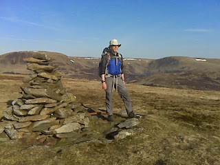
It's not unusual for people to accuse me of being mad for my tendency to travel on foot and live a chunk of my life outside. I seldom agree, but ever now and then I see a tiny glimpse of their view and this morning was a case in point. I'm not sure whether it was the fact that the fly sheet was so frozen that it held its shape when we took it away from the poles, or whether it was watching Mick struggle to get his feet into his frozen-solid boots that did it. Twenty minutes later we were walking along in the sunshine and suddenly it didn't seem a mad thing to be doing at all.

The photo above was taken on the summit of the diminuitive Glenvernoch Fell, where second breakfast was taken. It wasn't really far enough into the day to warrant our first break, but it was a nice location as well as seeming a likely point to get a phone signal to send yesterday's blog.

Onwards through some slightly squelchy terrain, followed by some (far worse) horribly churned up by cows, we passed by a <1-minute old lamb and reached Bargennan. There, so an information sign informed us, the SUW gave us two route options. We took neither. There's an old path shown on the map, cutting straight through the (now mainly felled) forest, and we decided to have a little adventure by following it. Past experience has told us quite firmly that such paths are not always evident on the ground; moreover, where a forest is concerned they can involve nightmarish obstacles caused by blow downs, and bog. (Hmmm, perhaps some would say, armed with that knowledge, that we were mad to even think of going that way?)

We certainly lost the course of the line as shown on the map, and I'm not sure I'd recommend our route, but we did successfully come out the other side and with far less difficulty than expected.

Approaching the south end of Loch Trool it suddenly became apparent that we were in the environs of a car park; suddenly there were lots of other walkers. Most seemed to be doing a circuit of the loch and it looked a good choice; the views from the south side were excellent - the best of the trip thus far, being now in rugged, lumpy surroundings.

Our lunch location, just under 5 miles before the end of the day, gave us chance to finally defrost and dry the fly sheet, as well as giving us clear water from the adjacent babbling burn. I know that the colour of water is no indication as to its purity for drinking purposes, but it's definitely more pleasing to have clear water, free of debris, than the peaty stuff we've been drinking the last couple of days.

Beyond the loch, the waymarkers surprised me as it transpires that the SUW has been rerouted since my map was published. We followed the new route and it sped us over the pass (stunning views down to Loch Dee) and onwards to White Laggan Bothy.

Arriving so early we considered continuing on, but failed to come up with a compelling reason so to do. So, I'm writing this, sitting behind the bothy on a plastic school chair, with a glimpse of Loch Dee through the trees ahead of me and surroundings in general which bear little resemblance to those of where we woke this morning.


Sent using BlackBerry® from Orange

SUW Day 3 afternoon snap

Over Loch Dee

Sent using BlackBerry® from Orange

SUW Day 2: by Craig Fell to Waterside

Wed 15 April
Distance: 15.5 miles
Weather: wet first hour, then increasingly bright until wall-to-wall sunshine achieved.

Disturbances in the night involved trains, rain, a slamming kissing gate and a woman talking. I've a feeling that two of those may have taken place inside my head, but they woke me up all the same. The rain, however, was real and it was still going strong when we awoke.

After an hour and a quarter of staring at the ceiling of the tent I decided to procrastinate no more and by 0830 we were striding off, in rain that didn't feel as bad as it sounded from under nylon.

If I had to choose one word to sum up today it would be "soggy", and that wasn't to do with the rain (which stopped after an hour). It felt like we walked though more boggy terrain than firm. Aside from the sogginess, the day was perfectly pleasant.

We don't have a guidebook for the SUW, but if we did I'm sure it would have told us more about the historical features we passed today (e.g. chambered cairn, Linn's grave, standing stones) than we gleaned from the information signs. Likewise, the beehive bothy wouldn't have come as a surprise; I knew there was one on the route somewhere, but hadn't expected it to appear so soon. In a nice clearing in the woods, with views to the SE, we came upon it to find a chap sitting outside in the sunshine. He had stayed last night and upon waking to rain this morning had decided to stay put another day.

It being gone noon, Mick asked if we were going to lunch there, but I had other plans. The top of Craig Airie Fell was where I had earmarked for our break and it was a good choice with 360 degree views encompassing the sea in one direction and hills in the other (and five wind farms, but the least said about those the better).

From the top (where the tent dried nicely whilst we polished off an obscene amount of cheese) we could clearly see our originally intended night stop, just a couple of trail-miles further on. However, as we had walked further than planned yesterday it made sense to do the same today, hence we continued another 5 miles and are now about half a kilometre off route (the detour being to find somewhere discrete to camp) on a pitch that's just fine ... on my side of the tent.


Sent using BlackBerry® from Orange

Wednesday 15 April 2015

Southern Upland Way (SUW) Day 1: Stranraer to by Craig Fell

Tues 14 April
Distance: 10.75 miles
Weather: overcast with just a few spots of rain

An eight-hour journey deposited us in Stranraer* today and, thanks to an early start, it was only 2pm when we arrived giving us plenty of day remaining to stretch our legs over the course of a few miles.

Opting not to follow the SUW out of Stranraer, we walked along the sea-front for a while before turning inland. The thinking was that we would be road walking whichever way we went, so we may as well shortcut to the more interesting bits. Merrily we went along (well, as merrily as one can when carrying a full pack for the first time in 10.5 months!) until, when Mick stopped to nip behind a hedge, I killed time by perusing the map. It was then that I realised that we were supposed to have made a turn a kilometre earlier. Ooops.

Backtracking would have been the shorter option, but instead we took to a pleasant woodland track, which took us onto the Way. From there, being a national trail, waymarkers were plentiful.

White Loch, in the grounds of Castle Kennedy, was picturesque indeed, and there we nearly met another couple of backpackers, except that she was busy on the phone and he had wandered off a distance. I wonder if they're heading our way?

A couple of miles later, on a short section of road, a large armoured vehicle rumbled to a stop next to us. The mightily-thick drivers door swung open and the driver confessed to being a bit lost. Directions were given whilst wondering why the army doesn't equip its vehicles with SatNav (or an able navigator, complete with map).

We had thought we would stop for the day about a mile after that encounter, but the terrain didn't include any flat, level, tent-sized patches, so on we went. A couple of off-path forays saw us twice nearly settle for "it'll do" spots (only ticks stopped us the second time), but both times the decision was to hold out for something better.

A bit of extra interest was thrown into our continuation when a Waymerk cache was found. Waymerks are special SUW coins which are placed at various points along the Way. I didn't look up any information about their locations before we set out (and Mick had never heard of them; he wondered what on earth I was wittering about when I realised what I had spotted just off the path) so if we find any more it will be purely through chance.

Just as we met the railway line along which we travelled just a few hours ago, some grassy areas presented themselves in amongst the old woodland. "That'll do nicely" we said, and that is where we are now ensconced - although with no phone signal here we'll be long gone before anyone reads this.

(*Stranraer isn't strictly the start of the SUW, but as it has a railway station and is on the coast it was the start point we selected.)

Sent using BlackBerry® from Orange

Friday 10 April 2015

Birks Fell

Friday 10 April

image

When I told Mick, before this trip, that I had worked out starting points and route options for 14 hills, he exclaimed “Fourteen!” in such a way that I promptly reassured him that I had no intention of squeezing all 14 into the space of a week, but that it was best to be armed with information so that we could pick and choose accordingly.

Thanks to the glorious weather that we’ve enjoyed, it turned out to be no squeeze at all and today we went up the fourteenth and final hill of the trip: Birks Fell.

Although we could barely make out Buckden Pike across the valley, such was the haze, it was another lovely sunny day. So, when we had visited the summit we figured that, rather than going straight back down, we may as well walk the ridge to the south east, via the tarn and the trig point, to pick up the bridle way which leads down to Starbotton.

The Dales Way then took us along the river (with a clear high-water mark which told us that the path had been underwater sometime this last winter) back to our start point in Buckden.

As tempting as it was to pop up Buckden Pike to see what it was like when not under drifting snow and in a howling wind (and by now the haze had cleared), we opted instead to journey south in search of an ice-cream vendor. It was, after all, turning out to be the warmest day of the year so far. (Incredibly, it was only last month that we were on Buckden Pike in full winter conditions.)

So, that’s it for this trip; we now have three days of rest before we start the Southern Upland Way on Tuesday.

Thursday 9 April 2015

Hoove and Dodd Fell Hill

Thursday 9 April

image

The plan of attack this morning was to try to get up and down Hoove and through the Tan Hill Road before the closure kicked in (it’s a one-day closure, for today only). The plan failed, in that we didn’t make it to the road in time, but by 7.45 we had, in the glorious glow of a clear-skied early morning, been up and down Hoove.

“A horrible hill” was Mick’s verdict, which I thought a little harsh. It was one of those completely featureless ones, with a plateau large and flat enough that it’s impossible to discern the highest point with the eye alone. Our approach probably didn’t show off the hill to its best advantage either, as we yomped pathlessly from the North Yorkshire/County Durham border, through tussocks, bog and heather.

Perversely, we probably doubled our total ascent for the outing on our way back to Colin. Having ascended a slightly longer route so as to keep to the higher ground, we returned via a more direct route, taking in the dips and climbs. Even so, it was still a very modest outing, at 2.5 miles with just over 200’ of up.

Having driven around the houses (but not as around the houses as expected as it turned out that yesterday’s road closure at Gunnerside had re-opened), and paused for second breakfast at the top of Butter Tub Pass, off to Gayle, and a little beyond, we trundled, to a place which is probably not a common starting point for an ascent of Dodd Fell Hill.

image

Another period of pathless yomping through bog and tussock saw us to the top of the hill, where we met a SOTA (amateur radio) chap just reeling away an impressive meterage of wire, whilst he and Mick talked radio frequencies and we chatted about various hills.

With the day being young (it wasn’t even a quarter past eleven yet!), we didn’t do an about turn on the summit, but rather we turned westward to drop down to the Pennine Way before picking up the road above Oughtershaw Side. It’s just a pity that the day, which had started out so clear and sunny had become so hazy, obscuring the views down the valleys.

With no more hills on the agenda today, by twenty past noon we were at leisure to spend the rest of the afternoon with our feet up and reading our books … except for our planned amble into Hawes later to pick up some supplies and eat chips.

(2.5 miles, 200’; 4.8 miles, 500’)

Wild Boar Fell, Rogan's Seat and Kisdon

Wednesday 8 April


imageWild Boar Fell, the first of 3 tops today, was notable as being the first hill of this trip which had a mountainous look to it. That wasn't strictly related to its height (708m - the biggest of the trip), but rather due to its rugged, pointy appearance from our easterly approach. It's not just a fine-looking hill from the valley either; the plateau was equally pleasing, and we spent a good while enjoying it in the sunshine.

Watching Tocano (sp?) flying below us on our descent (they became something of a feature of the day), we impulsively tried a bit of a road-walking-avoidance short-cut, which worked a treat (and only involved the tiniest bit of trespass) and by 11.30 we were off on our way to Keld for our next 2 hills.

That journey didn't go to plan. In the same way that we were plagued with closed lay-bys last Friday, today we kept encountering road closure notices. A significant back-track and a detour saw us to Keld a little later than expected.

image

We've liked Keld since the first time we visited and the village and surroundings were as pretty as ever, but Rogan's Seat itself was a wholly unremarkable hill (except as a viewpoint to see over a dozen heather burns going on all around; obviously the ideal conditions for it today). With a very good track leading to within 100m of the highest point, and with the last 100m of height being gained over the course of 2km, it was also a very easy one.

Back down at the Pennine Way junction, just a stone's throw from Keld, we had a decision to make: whether to do Kisdon today or return for it tomorrow. Logistically it made sense to do it today (even though it was rapidly heading towards tea time and tummies were thinking about rumbling) so off we set.

Having had the binoculars out from across the valley, to scope out the best wall-avoiding route up, we promptly discarded all of the mental notes made per our cross-valley observations, and just followed our noses. A good tactic on this occasion, as 25 minutes after deciding to go for it we were standing on the top - it would have been silly to have had to return tomorrow for such a quick and easy walk.

With two more closures affecting roads we intended to use tomorrow, a bit of replanning has been required. As a result we're not where we expected to be tonight, but instead sitting very close to (and almost at the same height as) tomorrow morning's summit. What is the local authority up to closing almost every route in the area at the same time?!


Sent using BlackBerry® from Orange

Wednesday 8 April 2015

Howgills from Wild Boar Fell

Just having elevenses (at 10.25) on top of Wild Boar Fell, with the sun beating down, hardly a breath of wind, and skylarks tweeting all around.

The views are fine in every direction, but for this snap I've chosen to go in the direction of the Howgills again.

Quality of the snap is probably appalling - phone cameras have moved on a long way since this long-obsolete model of Blackberry was launched - but hopefully it gives some vague representation of the views.

Sent using BlackBerry® from Orange

Howgills from Aye Gill Pike

Taken Tuesday afternoon

Sent using BlackBerry® from Orange

Tuesday 7 April 2015

Baugh Fell (Tarn Rigg Hill) and Aye Gill Pike

Tuesday 7 April

image

We strode off into the unknown this morning. Visibility was such that we couldn’t even see the huge car park (which lies adjacent to the road) at the Garsdale viewpoint as we approached. We weren’t put off. We simply chose the bigger of the two hills which we were to tackle from this start point and hoped that the top would be in sunshine.

It turns out that there’s a vehicle track (by which I mean two lines of flattened grass, as opposed to a surfaced track) which leads all the way up this hill. We didn’t know that as we set out, and thus when we hit Ringing Keld Gutter (a beck), we yomped up the tussocky, undulating bottom of the dip in which it runs. I did contemplate, quite early on, climbing up to the top of the dip on the north side, as it looked like the going might be better up there, but it was some time later when Mick did just that; what he found there was the vehicle track. That made the going easier the rest of the way.

If someone, in ancient times, had built a modest burial mound at the location where the trig point now sits on this hill, we would have been saved a couple of kilometres of walking, as that would now be recognised as the summit of this hill. As nobody thought to do that, way back when, we continued another quarter of an hour along the (soggy) plateau until we reached the completely featureless point which is a whole 2m higher than the location of the trig.

With the cloud now rising, we were soon back into it as we made our descent, but happily it had cleared from the valley by the time we got back down. In fact, by the time we reached Colin, we could finally see the nature of what we had just been up.

(7.5 miles; 1900’)

A good long lunch break was had in Colin back at the Garsdale viewpoint (where lots of people were now arriving to take a quick snap of the view before leaving again), before we set out in the opposite direction for Aye Gill Pike.

Well, if we thought the track up this morning’s hill had been soggy, it was nothing to this afternoon’s tyre-track lines through the bog! However, with all of the surrounding land being tussocks as big as I’ve seen, the flattened tyre lines, even if bog-fests, were still preferable to yomping cross-country.

Aye Gill Pike is the lowest hill of this trip so far (556m), but it was the best viewpoint. From its trig we could see every hill we’ve been up on this trip, except for Fountains Fell. And what fine conditions in which to enjoy those views, there being now absolutely no hint of the grey start to the day.

Back through the bogs we went to make our return to Colin after two lovely, gentle-gradient outings.

(5 miles; 1100’)

Monday 6 April 2015

Yarlside and The Calf

Monday 6 April

image

Outstanding! That’s what today’s walk was, although we didn’t initially appreciate that, as we set out from the Cross Keys at Cautley in fog. It took us a while to rise above it, and when we did get to see our surroundings it was with an ‘oooh’. I hadn’t expected Cautley Spout to be such a tall waterfall – and at that point I could only see the top half, as the bottom still lay below the cloud.

Yarlside is a pleasant, steep-sided, grassy lump, from the top of which we enjoyed 360 degree views, and took the opportunity to work out which of the surrounding lumps was our next objective and how we were going to get there.

Back down to the pass we went, before pulling up the slope opposite to join the motorway of a public footpath which leads up to The Calf.

Whilst moving it was a hot one today, but sitting in the lee of the trig atop The Calf, we soon cooled down in the breeze. Even so, the pause had given us long enough to despatch some cake and make a decision about our onward route. On our way up to The Calf we had seen a chap walking across the top of Cautley Crag, which suggested to us that there was a way down via the top of the falls. It looked a fine walk via Bram Rigg Top and Calders, but the finest bit was across the top of the crag (Cautley Crag isn’t a feature I would describe as a crag – it’s a very steep scree slop, not a rocky outcrop; I use the term crag only as that’s what it’s called on the map). What stunning surroundings! It was something of a treat to have not been able to see them on the way up, making them a surprise on the way back.

The path down the side of the waterfall is not just steep, but also eroded, so we opted not to use it instead walking two sides of a triangle to get back down into the valley, from where the retracing of our steps saw us back to Colin, parked in a now-busy layby.

The stats for this fantastic outing: 8.2 miles; 2600’.

From Yarlside this morning

Sent using BlackBerry® from Orange

Great Coum and Calf Top

Easter Sunday, 5 April

image

Having woken above the cloud this morning, most of our drive down to Barbondale was in fog. We knew, however, that we would be able to rise above it as we headed up Great Coum.

It took a while, as we made initially slow progress, via a route apparently not taken by others, towards Crag Hill. Yomping arduously upwards, eventually, I had to conclude that not only is the grass greener on the other side of the fence, but the trod was also much better trodden that side too. Finding a way over the fence was a wise move and the going finally got easier.

Having said yesterday that I'd never seen a spectacle like the mating-frog-pond, today we saw two more, with it being again the sound that drew our attention towards them. We must have hit the peak of mating season on this trip.

The first such pond was just a short way before the trig point atop Crag Hill, which is only a tiny bit lower than the twin summit of Great Coum. It may be the lower of the two nobbles on this top, but it gave the better views. By now the cloud had cleared from Barbondale, but behind Calf Top (our next objective) we could see a substantial inversion, with just a few peaks poking through in the distance.

Whilst my perusal of the 1:25k mapping prior to this trip had led me to plan out-and-backs to both of these tops, when on the summit it seemed much more sensible to head straight down the side of the hill into Barbondale, then straight up the other side of the dale to Calf Top. Having a 1:25k map with us would have been handy, as we weaved about a bit due to repeatedly finding walls in our way.

The side of Calf Top looked ridiculously steep when viewed from the side of Great Coum, and it didn't look much less so when viewed from its foot. However, the formula (that I'm yet to define) that decides when it's preferable to gain 400m in the space of 1km rather than walk 5km around to take a less-sharp ascent, said that the effort of the pull up the hill would be worth it.

Mick has since commented that I made it the whole way up without whinging once about the effort. That's unheard of! I must be feeling reasonably fit! Actually, it wasn't that bad; we took it steadily and zig-zagged our way up.

The trig point atop Calf Top is unmissable, being painted bright white and we stood there a while enjoying the views (still of the top of the cloud to the NW).

Making our way back south to complete our circuit, over Castle Knott we went before dropping off the side of the hill. That was quite steep too. Barbondale really isn't the best start point for Calf Top if you want a little spacing between the contour lines.

The dale was busy with cars parked up by the time we reached it, yet we had only seen one sole chap a little ahead of us on top of Great Coum, as well as picking out a couple of moving dots on Calf Top as we descended our first hill.

I don't know if people were put off by the fog, or whether these two hills are just too obscure (even for a sunny Easter Sunday), but it was a very fine outing (for which I'm sure our knees will forgive us in due course!).

(10.2 miles; 3200')


Sent using BlackBerry® from Orange

Sunday 5 April 2015

Great Knoutberry Hill

Saturday 4 April

image

Ribblehead isn't the obvious start point for the bagging of Great Knoutberry Hill (what a fine name!), but as we'd backtracked from the closed layby to spend the night there and, as we had a full day available to us to dedicate to this hill, we thought we may as well have a longer walk and not need to drive anywhere this morning. The decision was helped by waking up to the promise of a fine day.

The promise held true, involving far more sunshine than the forecast had suggested. Moreover, the air clarity was excellent, giving us the best views.

Judging by the number of cars parked at Ribblehead even before we set off (and an unfeasible number by the time we returned), Whernside must have been incredibly busy today. By contrast, we met not a single person until we approached the junction of paths that lies in the dip between Wold Hill and our objective, about 5.5 miles in. There we briefly observed something akin to rush hour, although we still didn't pass anyone close enough to greet, as we promptly left the path to take a soggy short-cut.

A pause for hot cross buns allowed a group of 18 to get ahead of us on the final ascent and by the time we got to the summit they had cleared it, giving us complete solitude again.

The summit views were outstanding and we turned in circles making sure we missed none of them. Then, in a move that could be considered dull and unimaginative (although I would beg to differ on the first count at least), we retraced our steps, admiring the Yorkshire Three Peaks as we went. (Ingleborough had a swarm of paragliders above its summit today, like wasps around a pop bottle.)

Noise from a flooded sink hole, that we hadn't even noticed on our outward leg, drew our attention on the way back. Approaching it, a great disturbance of the water occurred and we stood and watched, curious. Within a couple of minutes they started to come up for air: frogs - and not just one of two but dozens upon dozens of mating couples, making a sound like a contented cat. I've never seen anything like it!

The sink hole wasn't the only bit of sogginess in the area. Substantial sections of today's paths were waterlogged and I did slightly rue my decision to bring with me only two pairs of GoreTex boots, all of which ceased to be waterproof many a year ago. I was squelching by the time we reached the road on our return.

Even with uncomfortably soggy feet (it's the problem with failed waterproof linings: once the water gets in it can't easily get out), it was nothing short of an excellent outing. A bit shorter than I expected at just 12.4 miles, but we'll likely go and stretch our legs with a walk past the viaduct later.


('Urgh' incident of the day: after despatching our sandwiches, I had a furtle in the bottom of my bag to see if I could find any chocolate lurking in the depths. I didn't find chocolate, but did discover a very black, squashed and mouldy banana. No idea how long that had been languishing down there. Definitely an 'urgh' incident, but thank goodness I found it before it decomposed any further!)


Sent using BlackBerry® from Orange

Saturday 4 April 2015

Fountains Fell

Good Friday, 3 April

image

A 10-mile walk, taking in Fountains Fell, starting from a layby by Helwith Bridge had been the plan for this afternoon, but that plan was thwarted when we found the layby to be closed. What to do instead? Drive nearer and have a shorter walk was the answer, which wasn't a bad change of plan, considering the rain and low cloud.

"Is Pen y Ghent around here somewhere?" asked a white van man who happened along soon after we had parked up. We pointed into the cloud and confirmed that it was there, albeit hiding. Armed with the directions and distances we gave, he and his children set off, completely ill-attired for their outing. I'm sure they'll have been fine, though. It was pretty warm out, even if a bit damp.

I've not attached a photo to this post, but if you go back to my post about White Coomb, back in November, and take a look at that photo, then it would give a pretty good idea of what Fountains Fell was like today: a cairn and a lot of low cloud. Still, we've been very close to this top twice before, so we've seen the view (thus I decreed, if there's a good hill to do in poor visibility, out of the batch pencilled in for this trip, then this was the one).

Nobody has told Fountains Fell that mud-season is coming to its close, and on the way down it was Mick who slipped and hit the deck first. I followed suit a while later, but Mick definitely won the slathering-self-comprehensively-with-mud prize.

We trod more carefully the rest of the way down, and by the time the road was reached the cloud had lifted. There were even small patches of blue sky appearing. If only we'd set out an hour later!

With 4.6 miles walked and an amount of ascent that I've not calculated, off we headed to spend the night in the layby from where I had intended for us to tackle tomorrow's hill. It obviously isn't our day for laybys, as we got there to find it not just closed but barricaded off as the site office compound for renovation works on Dent Head Viaduct. Two Plans B were then required: B) for somewhere to spend the night; and B) for a different start point for tomorrow's walk. I do hope today's 100% record of layby closures was a coincidence that doesn't persist through the rest of this trip!

(Other failures of the day: 1) a tea loaf, baked this week, is still sitting on the side in the kitchen at home, in the exact same location as we left the flapjacks on the last trip; 2) after a very thorough search of every storage place in Colin it was agreed that the only place my Paramo trousers could be was at home (I would have sworn I packed them!). Fortunately, I did pack both my summer trousers and some overtrousers.)

Sent using BlackBerry® from Orange