Monday 21 October
Distance: 8.9 miles
Ascent: 470m
Weather: Lightly overcast and cold

Short version account of the day: A really hard outing that nearly defeated me just 2.5km into the intended 16km. The day was saved by turning an out-and-back into a linear walk.
Long version:
Before a hill-bagging trip I usually research my potential hills in some depth. I'll use StreetView to check out local roads and parking places and hill-bagging.co.uk to see what routes others have taken, then I'll plot my intended route and note the start point, route and mileage & ascent figures in my hill-bagging notebook.
Our rough intentions for this trip (where we were going and how long we were staying) changed so much during September that I didn't do any of that. In fact, we thought we were only going to be spending 10 days in Scotland, five of which were to be with other people, so the entirety of my planning was to note a few hills that I wanted to visit around the Newtonmore area.
I have thus been 'winging it' this week, and it was only when I got back to Bertie after yesterday's outings that I decided, as the weather forecast was due to be fine, I'd like to go up Earl's Seat today. We were going to be driving along the B822 anyway and with a county boundary (thus almost certainly a fence or wall to follow) running east from that road to the summit, it looked a feasible route. At the point of making this decision I had no mobile phone reception to see how most people approach this hill and later, when I did have reception, it didn't enter my head to do so. Not that it would have changed my plan; I've approached many a hill from a different direction from everyone else as I prioritise ease of parking.
The parking turned out to be perfect. We were heading for a car park further along the road, but right on the boundary found a parking area that looked suitable for spending the night, meaning I could get up and go this morning without needing to either get my bike out or trouble Mick to drive me back up the road.
 Pedestrian gateway, Forestry Commission sign (no forest, mind), well-trodden line, all right opposite Bertie's night-stop. This looks good!
Bertie's heating kicked in three times during the night (it's quiet when it's running, but sounds like a jet engine for about 2 seconds when it fires up, so I tend to notice it), which told us it was a cold night. Unsurprising given the clear sky to which we'd gone to bed. It was thus no surprise to step out this morning to a frosty world.
 Looking back down to Bertie. Most of the ground I crossed this morning was semi-frozen but the most striking hard frost was down in the glen
The going up to the first minor top (Holehead) was easy, if boggy and almost (but not quite) frozen enough to bear my weight.
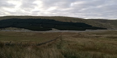
 I'd seen this from a distance but was still surprised to come over a rise and find it right in front of me.
I think I can say with some confidence that most people go up to Holehead, admire the view from the trig point, then retrace their steps. From there to Hart Hill the path became but a trod and the going became rough. Boggy wallows, a few hags and with deep heather in places.
 Over there is Earl's Seat. I'm not sure whether this snap conveys how rough and wet the going was in between me and it.
Just before Hart Hill I got the first view of my objective, still over 4km away, and of the terrain I needed to cross to get there. I dithered at length. It wasn't the getting to Earl's Seat that was concerning me, it was the fact that I was going to have to toil my way through the same rough bogginess (including a descent and reascent) on my way back. Add in already having freezing feet and the fact that I was plunging them into icy water on a regular basis* and the return journey was looking even less attractive.
I texted Mick to let him know how I was getting on and that I was considering turning back. In response he kindly offered to come and pick me up from the road to the south of Earl's Seat if I wanted to make the route a linear one. I dithered some more. I plodded on a bit further. I dithered some more. Finally I concluded that I'd spent far too long on Hart Hill dithering, made a decision and marched on towards Earl's Seat. The speed didn't last long. I was soon passing through hags and deep bogs again, needing to be vigilant about old rusty wire on the ground that was the exact same colour as the surrounding autumn upland grass, although at least for the moment I was going generally downhill, making the stretches through knee-high grass and heather easier going.
 I'd been bashing through a particularly rough section when I suddenly found myself on an ATV track. I've no idea where it'd come from and thus whether it could have been useful to me much earlier.
My intended route had skirted the head of Fin Glen, so as to avoid losing too much height. By the time it was in my sight I'd modified my plan: to dead-head to the summit. As my recorded route at the top of this post shows, that's exactly what I did.
 On the summit. Note the earphones. My entire walk had been powered by two particularly engrossing running podcasts involving endeavours far harder than this little walk. Note also that there's a well-trodden line behind me. Unfortunately, that wasn't the way I'd come up nor the way I was going down.
 See that windfarm over there? That's where I was for yesterday's first hill.
Descending to the south included some reascent to another minor summit (Dunbreak) and the need to wade through another 24 icy bogs.
I was mightily glad to make it through Ballagan Farm without being savaged by any dogs, to find myself on the road where Mick was to pick me up just a few minutes hence. I plonked myself on a handy rock, looked at the map on my phone ... and realised that the lat/long I'd sent Mick was wrong. It was about 200m (and out of sight around a bend) before where I was sitting. A quick trot down the road and I was in the right (well, wrong really) spot and a couple of minutes after that along trundled Bertie.
I'm sure I have done hills that I've found as hard as this one, but just now I'm struggling to name one. I'm also sure that if I had done this very route in one of the dry Aprils I've enjoyed in Scotland in recent years, I would have found it a joy. The surroundings were truly superb.
(*Describing the outing to Mick later, I said that I had waded through 57 icy bogs. That was a fictitious number plucked out of the air, but I doubt it was far wide of the mark. As a result of all this bog-wading, I kicked myself again for having failed to pack a pair of waterproof socks for this trip. I also pondered whether I would have been better wearing my boots. My feet would have been warmer, but also would have been much heavier for all the high-stepping. A tough call, but I think if I was to do the same again tomorrow (please, noooooo!), I'd still chose the mesh trail-runners.
As an aside: my legs were fine after yesterday's bike rides; not tired, heavy, aching or sore. My shoulders and arms were a different matter. Who'd have thought that they could be so exercised by riding a bike?!)
Distance: 8.9 miles
Ascent: 470m
Weather: Lightly overcast and cold
Short version account of the day: A really hard outing that nearly defeated me just 2.5km into the intended 16km. The day was saved by turning an out-and-back into a linear walk.
Long version:
Before a hill-bagging trip I usually research my potential hills in some depth. I'll use StreetView to check out local roads and parking places and hill-bagging.co.uk to see what routes others have taken, then I'll plot my intended route and note the start point, route and mileage & ascent figures in my hill-bagging notebook.
Our rough intentions for this trip (where we were going and how long we were staying) changed so much during September that I didn't do any of that. In fact, we thought we were only going to be spending 10 days in Scotland, five of which were to be with other people, so the entirety of my planning was to note a few hills that I wanted to visit around the Newtonmore area.
I have thus been 'winging it' this week, and it was only when I got back to Bertie after yesterday's outings that I decided, as the weather forecast was due to be fine, I'd like to go up Earl's Seat today. We were going to be driving along the B822 anyway and with a county boundary (thus almost certainly a fence or wall to follow) running east from that road to the summit, it looked a feasible route. At the point of making this decision I had no mobile phone reception to see how most people approach this hill and later, when I did have reception, it didn't enter my head to do so. Not that it would have changed my plan; I've approached many a hill from a different direction from everyone else as I prioritise ease of parking.
The parking turned out to be perfect. We were heading for a car park further along the road, but right on the boundary found a parking area that looked suitable for spending the night, meaning I could get up and go this morning without needing to either get my bike out or trouble Mick to drive me back up the road.

Bertie's heating kicked in three times during the night (it's quiet when it's running, but sounds like a jet engine for about 2 seconds when it fires up, so I tend to notice it), which told us it was a cold night. Unsurprising given the clear sky to which we'd gone to bed. It was thus no surprise to step out this morning to a frosty world.

The going up to the first minor top (Holehead) was easy, if boggy and almost (but not quite) frozen enough to bear my weight.

I think I can say with some confidence that most people go up to Holehead, admire the view from the trig point, then retrace their steps. From there to Hart Hill the path became but a trod and the going became rough. Boggy wallows, a few hags and with deep heather in places.

Just before Hart Hill I got the first view of my objective, still over 4km away, and of the terrain I needed to cross to get there. I dithered at length. It wasn't the getting to Earl's Seat that was concerning me, it was the fact that I was going to have to toil my way through the same rough bogginess (including a descent and reascent) on my way back. Add in already having freezing feet and the fact that I was plunging them into icy water on a regular basis* and the return journey was looking even less attractive.
I texted Mick to let him know how I was getting on and that I was considering turning back. In response he kindly offered to come and pick me up from the road to the south of Earl's Seat if I wanted to make the route a linear one. I dithered some more. I plodded on a bit further. I dithered some more. Finally I concluded that I'd spent far too long on Hart Hill dithering, made a decision and marched on towards Earl's Seat. The speed didn't last long. I was soon passing through hags and deep bogs again, needing to be vigilant about old rusty wire on the ground that was the exact same colour as the surrounding autumn upland grass, although at least for the moment I was going generally downhill, making the stretches through knee-high grass and heather easier going.

My intended route had skirted the head of Fin Glen, so as to avoid losing too much height. By the time it was in my sight I'd modified my plan: to dead-head to the summit. As my recorded route at the top of this post shows, that's exactly what I did.


Descending to the south included some reascent to another minor summit (Dunbreak) and the need to wade through another 24 icy bogs.
I was mightily glad to make it through Ballagan Farm without being savaged by any dogs, to find myself on the road where Mick was to pick me up just a few minutes hence. I plonked myself on a handy rock, looked at the map on my phone ... and realised that the lat/long I'd sent Mick was wrong. It was about 200m (and out of sight around a bend) before where I was sitting. A quick trot down the road and I was in the right (well, wrong really) spot and a couple of minutes after that along trundled Bertie.
I'm sure I have done hills that I've found as hard as this one, but just now I'm struggling to name one. I'm also sure that if I had done this very route in one of the dry Aprils I've enjoyed in Scotland in recent years, I would have found it a joy. The surroundings were truly superb.
(*Describing the outing to Mick later, I said that I had waded through 57 icy bogs. That was a fictitious number plucked out of the air, but I doubt it was far wide of the mark. As a result of all this bog-wading, I kicked myself again for having failed to pack a pair of waterproof socks for this trip. I also pondered whether I would have been better wearing my boots. My feet would have been warmer, but also would have been much heavier for all the high-stepping. A tough call, but I think if I was to do the same again tomorrow (please, noooooo!), I'd still chose the mesh trail-runners.
As an aside: my legs were fine after yesterday's bike rides; not tired, heavy, aching or sore. My shoulders and arms were a different matter. Who'd have thought that they could be so exercised by riding a bike?!)


