The Road goes ever on and on; Down from the door where it began;
Now far ahead the Road has gone; And I must follow, if I can;
Pursuing it with eager feet; Until it joins some larger way;
Where many paths and errands met; And whither then? I cannot say.

[JRR Tolkien, Lord of the Rings]

Friday 29 May 2015

Another Surprise Five

Thursday 28 May
 
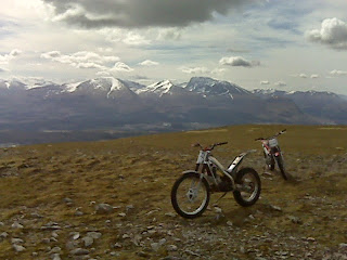
As we approached the car park last night, which would position us nicely for our first hill this morning, I had a great sense of déjà vu, commenting to Mick that I felt like I’d been there before and that there had been a chap in residence in the car park, in a caravan. Mick responded that the chap in the caravan had a generator running outside. Then I saw the Herring Road sign post, confirming that this wasn’t a memory trick; we had walked through this very car park on our Lowestoft to Ardnamurchan walk in 2011. The snap above is looking down on the car park this morning; Colin is the white van on the right.
 
Spartleton
image
Arriving in pouring rain yesterday afternoon, we expected (from the forecast) to be in for a very wet night, with the rain persisting into the morning. So, it was a surprise to peer out of a window this morning (after a night during which I’d heard not a drop of rain fall; the afternoon’s wetness had abated mid-evening) to find that there wasn’t a cloud in the sky. Cereal was wolfed, tea necked and at quarter to seven we made haste for fear of the fine weather being short-lived.
 
As I’m finding is often the case, when I stand at the foot of the hill and look at it, there’s a more obvious route than the one I’d picked from the map. On this occasion, I’d planned to take a longer route making the most use of the tracks and paths marked on my map. In reality we headed straight up, via a good trod. There was a bit of heather-bashing to the very top, but it was all very straightforward, and whilst there were clouds forming, it didn’t look like we were in for any wet weather before second breakfast.
 
Down we headed, via a slightly different line, involving a trod sporting half a dozen untagged snare traps. If they are checked daily (as the law requires) then they will all have been reset by now…
(2.3 miles, 700’)
 
Dirrington Great Law
image
Considering that this was the hill that had led me to even contemplate returning home via the east coast (we’d seen it from the Southern Upland Way in April and it had called my name), it was careless that I’d missed it off my list for the day! All’s well that ends well, though, and I realised the omission before it was too late (even if it meant that we didn’t do the hills in this area in the most obvious order), so after Spartleton we headed off to park in a gateway from which, so t’internet told me, I could follow a track all the way to the top of this pimple in the landscape.
 
The parking situation wasn’t such that Mick could join me for this one, so off I wandered on my own, wondering where this track was going to take me as it appeared to head off in the wrong direction.  Sticking with it, it did come good, even if it wasn’t the most direct line ever taken up a hill. By virtue of its indirectness (combined with the small stature of the hill), it would have given me the most ridiculously easy ascent if it hadn’t been for the strength of the headwind.
 
I did have to pause and back off at one point a few paces from the top, to allow a family of fluffy grouslings to cross the track ahead of me. Peeking around the corner again, they all seemed to have gone, so on I went, only noticing the sole grousling which had been left behind when I put my foot down about an inch away from it. My goodness, they’re well camouflaged, even when sitting on a track! I trod so very carefully the rest of the way.
 
Maybe I didn’t tread as carefully as I should, or maybe it was because I was scanning the ground for brown and yellow balls of fluff that I stepped wrong and took a good tumble on my descent. No harm was done, and I did spring back up like someone was watching, even though it seemed highly unlikely that I was going to have a human encounter on this hill. Sometimes unlikely things do occur though, and about ten paces away from the gateway back onto the road, I encountered a very chatty gamekeeper. For a full twenty minutes we passed the time of day, covering a great multitude of subjects, making Mick wonder if I was ever going to get away. We were later glad I hadn’t chatted for five minutes longer… 
(3.4 miles, 600’)
 
Lamberton Hill
image
This one has to be a contender for the most pointless Marilyn I’ve visited to date. It was so pointless that Mick declined to join me, even though Colin was neatly parked. So, on my own I left the road, went through a gate and walked up to the top of a field. Then I walked back down. To add a bit of interest to this visit to the high point of a grassy field, I did visit the hill fort which also lies within the field, extending the round trip to a whole three quarters of a mile with about 130’ of up.
 
Ros Hill
image
Having crossed the border back into England, this hill could have been another outing of less than a mile and only a couple of hundred feet of ascent, except that we found a good car park at the picnic area to the south of Chillingham Park, which meant that Mick could (and did) join me on this one. The revised start point gave us a steep start, but it was an interesting little walk, up onto heather moorland, via some big boulders (and apparently another hill fort, but I didn’t notice the evidence of this one), before heading up to the prominent high ground ahead of us, which was Ros Hill.
 
As we stood taking in the views, we couldn’t help but notice that there was one particular shower that looked to be on a collision course with us, so we upped the pace for the return journey. We failed to outpace the shower, but we did get lucky in that only the very edge of it hit us, not requiring any waterproofs (of course, we did don jackets, which is probably why it missed us).
 
It was rather a pleasant outing, and our last for the day … or so the plan said. 
(1.9 miles, 500’)
 
Long Crag
image
We reached our intended night-stop at half past one, second lunch was had (first lunch had been had in a different picnic area at 10.30am; I was hungry today!) and it was still far too early to call it a day, so we figured we may as well bring forward Long Crag, which was pencilled in for tomorrow morning.
 
A really nasty forest track (big chunky stones, like walking on a railway bed) took us so far, then a grassy break to our right looked likely to lead us out of the forest, so we thought we would give it a go. The presence of a well-trodden line soon gave us confidence that the route would work, and it wasn’t too long before we were out the top and onto the ridge just west of Coe Crags, from where we walked further west to the top of Long Crag, enjoying the views as we went. A suitably nice walk to end my month of Marilyns, I thought. I even extended the outing a little to include a visit to the top of Coe Crags, just to check out what could be seen to the east.
 
Then it was back the way we came, increasing pace as we made our way back along the nasty forest track, as there was an ominous darkness that suggested that we weren’t quite going to achieve five rain-free hills on this poor-forecast day. It was a close run thing. The last couple of minutes were accompanied by light rain, and a couple of minutes after we climbed into Colin the heavens opened. That was when Mick commented that he was glad I hadn’t been any longer chatting to the game keeper earlier in the day; we would not have wanted to have been out in that!
(4.7 miles, 550’)
 
The End
And that was that for this trip. Thirty-eight Marilyns, and a few other tops, the vast majority in good conditions. In combination with some involvement with the TGO Challenge, it’s been a very enjoyable time. I’m now expecting that the Marilyn count to remain static for at least a few months … but I will return to them in due course.


Thursday 28 May 2015

Allermuir Hill and Meikle Says Law

Wednesday 27 May

Allermuir Hill

image

The conclusion I reached on the question of where to head next was that the Pentland Hills lend themselves to longer walks, taking in multiple tops, whereas the Marilyns to the east (starting with the Lammermuir Hills) involve several shorter outings. Given a damp and windy weather forecast for the next few days, I thought the Pentland Hills would be best left for better weather.

We didn't ignore them completely, though, as we nipped up Allermuir Hill on our way past, which (being so close to the city) is an excellent vantage point over Edinburgh. In the other direction is a scene of lumpiness.

Having visited our top (where we shared the summit with five other people, even though the day was still relatively young), the sensible route back down seemed to be along the ridge and over Caerketton Hill, so that's exactly where we went. I can't say that the second top gave views that were wildly different from the first, but the walk was a very nice one (3.5 miles, 1200').

Meikle Says Law

image

Back down at our starting point, Colin's nose was then set towards the Lammermuir Hills, where we arrived just at lunchtime.

After a nice leisurely lunch (which, it turned out should have been at least 10 minutes shorter), my inclination to sit under a blanket with a book was far greater than my inclination to go and walk up a heathery lump which was smothered in tracks. I did, however, drag myself (and Mick) out, and soon discovered that my initial, unfavourable opinion of the hill was unjust, as we were soon off the surfaced tracks and onto tyre lines through heather, which eventually petered out completely to give us a rough heathery yomp to the top. (The OS has that track down as double dotted lines; I don't think it warrants that status; neither did our descent route, for that matter.)

So much did my opinion of the hill increase whilst we were on it that I decided against the option of retracing our steps and went back to the original plan of forming a circuit over Little Meikle Law. That was rough and heathery too, but easier going than the last bit of the ascent.

Having left Colin at around 1350', and with a summit height of around 1750', at a very quick glance this may have looked like a very low ascent sort of an outing. However, the first thing we did when setting out was to descend quickly down to a burn. That, of course, meant that the final thing we had to do was regain that height: a sting in the tail. To make that final climb worse, the rain which had already been falling lightly for a while really upped the tempo for the final ten minutes of our outing. With our end in sight, it didn't seem worth stopping to don overtrousers, so all we could do as our legs got soggier was to rue not finishing our lunch ten minutes earlier. (5.6 miles, 900')

IMG_4852

(If today's snap was of better quality, you'd be able to make out Colin and a windfarm in amongst the landscape (incidentally, six windfarms could be seen from Meikle Says Law))

Tuesday 26 May 2015

Benarty Hill and Dumglow Hill

I somehow managed, having spent the whole of last week in a room with a plentiful supply of plug sockets, to leave Montrose with both of my laptop batteries flat. Careless! That has meant that I’ve not been able to look at my electronic maps, which in turn has meant that I’ve not been able to make any sort of a plan as to what to do beyond today (I’d come up with the plan thus far before leaving Montrose).

We are now at a campsite. The laptop is powered up, and I’ve spent a couple of hours plotting and contemplating – yet I still can’t decide whether to go to the Pentland Hills next and head home via the M6, or head for the Lammermuir Hills and go home via the M1. Decisions, decisions (gosh, I’m really not good at making decisions).

Anyway, before the campsite chores and the powering of devices, there were a couple of hills. Surprisingly nice hills too (I’m not sure why I didn’t expect either to be nice; maybe it was how they looked on the map?).

Benarty Hill

imageMick didn’t much like the parking spot for Benarty Hill, so off I went by myself, almost immediately making a meal of the ascent as I walked back and forth trying to find the track I needed to get out of the forest. I didn’t find the track, but I did eventually find a path which led me nicely to the top of the forest, from where clear lines through the heather took me slightly circuitously to the summit. An excellent viewpoint, it was, and I enjoyed a few minutes up there before heading back down. I made a better job of the ‘down’ portion of the outing: I’d covered 1.7 miles in 45 minutes to get up, contrasted with 1.1 miles in 21 minutes to get back down!

Dunglow Hill

image

Not dreadfully far away was Dumglow Hill, which was even worse for parking, although this time it wasn’t a litter-strewn lane (in fact the lane by the first hill had been one of the most litter-strewn and fly-tipped lanes I’ve ever seen) causing an uncomfortable feeling, it was a complete lack of parking for a Colin-sized vehicle at my chosen start point. Mick duly waited again (moving Colin when someone needed access to the gateway he was blocking), as I headed off.

With this hill being well protected by forest I had taken careful note of other people’s routes and knew that at the track end I needed to go: “35m left, 35m south, 300m right”, which seemed like an odd set of directions (why left and right rather than points of the compass?), but on the ground they made perfect sense and worked a treat.

Breaking out of the forest my objective was still hidden by trees, and it was a treat to finally catch sight of it standing proud before me:

IMG_4833
A few minutes later I was on the top, waving down to Mick.
IMG_4834I resisted all urges to try out other breaks through the forest (short cuts make for long delays and all that), so retraced my steps … until I got back to the track when suddenly a good break on my right seemed too good to ignore. My instinct was (for once!) right, and it cut off a chunk of distance without throwing any obstacles or difficulty in my way, although I suspect that in a few weeks once the undergrowth has got a bit higher, it may be a less straightforward option.

The stats for the outings were incredibly similar: both were 2.8 miles long, but the second hill involved 100’ more ascent at 800’.

Now, what do you reckon? Pentland or Lammermuir Hills next?

Monday 25 May 2015

East Lomond

Monday 25 May

image

At 4pm, with the car park rapidly emptying, off we set for East Lomond. The delay was worthwhile for more than one reason: the haze had lessened and the sunny periods become longer, with just the occasional wispy cloud drifting in to obscure it.

An easy path led us the mile and a quarter to the summit, and a topograph there told us what we could see in the 360 degree view. We didn't need any help to identify some of the landmarks, such as this morning's hills. Berwick Law, which we visited in February last year, was barely visible through the remaining haze.

Within an hour we were back at Colin, having met not a single person on this clearly (and justifiably) popular pimple.

IMG_4823
(The snap is West Lomond and Bishop Hill, taken from East Lomond.)

Sent using BlackBerry® from Orange

West Lomond and Bishop Hill

Monday 25 May

image

Ooops – forgot to start the GPS at the beginning of the walk, hence the break in the West Lomond & Bishop Hill circuit.

My incredible run this month of 25 hills in excellent air clarity came to an end today. But, I can't complain; whilst there may have been a haze, it was still a fine day with plenty of sunny spells, albeit cool when we set out early this morning.

Our first objective of the day was West Lomond: one of a pair of very distinctive protruding pimples which sit either end of a ridge (I remember first remarking on them when walking on the south side of the Firth of Forth during one of our Big Walks).

20150524_165522

The two prominent pimples, as seen from quite a distance, from Moncreiffe Hill yesterday.

After an easy walk in on a motorway-esque path it was a relatively short, but quite sharp, pull up to the excellent viewpoint of the summit, where we tarried just long enough to lose the heat we'd generated on the way up.

Steeply down to the south we then went before starting our ascent of our next objective: Bishop Hill. We were joined during that ascent by three gliders who kept us company until after we had cleared the summit. We were now to head back east, whereas they preferred the west side of the escarpment.

The route taken off Bishop Hill didn't feel particularly sensible at the time (as we yomped through heather, bog and tussocks), but as the outing came in 2 miles shorter than the route I had measured, it seems that we simply took a much more direct line than intended. I confess, there was a complete failure to navigate; not a single glance was had at the map - we could see where we needed to get to and we simply dead-headed towards it.

We reached the car park just at lunchtime, and had every intention of heading back out to East Lomond as soon as we had eaten. Then it came to our attention that it is a bank holiday today as, by the time lunch had been despatched, the car park was full to the gunwales. East Lomond has thus been postponed until late afternoon so that we don't find ourselves walking in procession.

Incredibly, considering the number of cars now parked around us, the only people we passed during this morning's 8 miles formed one large group of RAF personnel in camouflage gear. After passing them, about half a mile into our walk, they disappeared; I'm not sure whether it was the effectiveness of their camouflage, or whether they headed off over a lump in the landscape.

Sunday 24 May 2015

Turin Hill, Craigowl, King's Seat and Moncreiffe Hill

There were three more hills that we could have tackled from our position in Glen Esk, but I adjudged that the only one I was unlikely to include on a cross-Scotland route was Hunt Hill (which we visited yesterday), so the remainder were left for another time and southwards we finally headed.

Turin Hill

image

The first stop en-route was Turin Hill, the site of a hill fort/castle, to the NE of Forfar. I'd been unable to locate anywhere nearby to park for this one (although there was a layby relatively close, on the B road, we discovered), so Mick offered to drop me at the bottom of the track and pick me up afterwards.

Had I read the route notes I'd made, I wouldn't have found myself climbing over barbed wire, with a strand of electric fence protruding either side, on my way up. It was only as I stood on the summit, looking back the way I had come, that the instruction of 'continue to the end of the woodland, where there's a gate' came back to me. So, having enjoyed the far-reaching views from the summit (and waved to Mick, who I could see parked up in a layby up the road) I took a slightly longer route back down, to take full advantage of the gates.

Craigowl Hill

image

Next up was Craigowl Hill, a good handful of miles SW of Forfar. It seems that the majority of people who log their Marilyns on hill-bagging.co.uk approach this hill via the tarmac track which leads all the way to the masts on its summit. However, as exploration of Streetview and aerial photos had failed to reveal a Colin-sized place to park for that approach, instead we went to the car park in the community woodland further W along the road. The result was a far more pleasing walk than the tarmac track would have been. A waymarked trail took us through the native woodland, and after only 200m on an old track, a gateway gave us access to a trodden line on grass all the way to the top. The result was not only a nice walk, but one that was half the distance I'd anticipated (I'd hoped there would be a way through the forest, but had measured a longer route in case there wasn't). It's just a pity about all of the masts and buildings on this top, which otherwise gave fine views down to Dundee and the Tay to the south and snow-spotted hills to the north.

Trig poing on Craigowl Hill, together with a taste of the industrial nature of the top and hopefully a glimpse of the fine views to the north.

The car park in that woodland was so nice (save for the multitude of bags of dog poo; it seems that many people there pick up after their dogs, only to then deposit the bag of poo neatly next to their cars) that it was tempting to stay the night - but the day was young...

... so off to King's Seat we went.

King’s Seat

image

I'd decided that I fancied a linear walk over this one, so Mick dropped me off to the SE of it, and off I went. I soon decided that people don't usually tackle this hill from this direction (probably because of the lack of parking for this start point), and thus there was no trodden line. Well-advanced nettles stung my legs through my trousers before I weaved through blooming gorse, following which I picked my way up a section of gorse-graveyard, before finally yomping through heather.

It was the worst heather of any hill of this trip, being very old, very woody and knee-deep. I was certainly glad to reach the gleaming trig at the top.

A trodden line led me away from the summit and towards Black Hill, and I thought the rest of my outing would be relatively quick and easy. It wasn't. In fact it was hard work, through yet more heather, with a bit of bog and some very uneven path thrown in. I strongly suspect I had lost the line taken by most people. It was only when I climbed up to the top of Black Hill that I found not just a well-trodden line, but boot prints - and finally, the rest of the route was easy.

Another walker, heading towards King's Seat himself, was encountered on the hill fort to the SW of Black Hill, and from there it was just an easy trundle down hill to find Mick patiently waiting exactly where I expected to find him.

Moncreiffe Hill

image

The next on the list, Moncreiffe Hill (lying to the S of Perth) wasn't on the agenda until tomorrow, as I had rather hoped that its car park would be suitable for a night stop. My hopes were dashed when we found it to be too sloping, so the hill was brought forward to today. To my surprise, Mick chose to sit this one out, so I was on my lonesome as I trundled up to the higher of the two hill forts and back, which I achieved in just under 35 minutes. It's a very good (and fast) path which has been engineered to wend its way gently up, forming one of a number of waymarked routes.

So, four hills and four excellent view-points on this very clear-aired day. I'll happily take more of the same tomorrow, please...

Distances: Turin - 2.3 miles; Craigowl - 2.8 miles; King's Seat - 4 miles; Moncreiffe - 1.9 miles.

Hunt Hill

Saturday 23 May

image

TGO Challenge Control closed promptly at 1700 last night (the final finisher having come in an hour earlier), which left us free to head out of Montrose. The question was: to where? We hadn't even decided in which direction to travel next, but we couldn't stay put, such was our aversion to giving the campsite in Montrose a seventh night of our business.

Eventually a decision was made to head south, but as we sat in Tesco's car park cooking and eating tea, we were struggling to come up with somewhere to stay. So, we started our southbound journey by heading northwest, spending the night at Tarfside (well known to the Challenge community; this year well over half of all participants stayed there). I'd like to say it was a quiet night, but one of the groups camped on the playing fields didn't heed the "please be quiet between 2200 and 0800" bit of the notice that says you can camp there for free. We could have driven four miles further for a quiet night, as that's where we were headed first thing this morning, but such was our fatigue by half eight last night that even four more miles of driving was too much. It's a tiring business, sitting in a room for a week, you know!

Having relocated those final four miles at just after nine this morning, we watched the car park fill around us as we drank tea, before heading off ourselves. I had been a little undecided as to which hill to visit and had finally opted for Hunt Hill. A good decision, I thought, as we watched most people (including a particularly large group, with a clipboard-wielding leader) head for Mount Keen, which had been the other main contender for our time today.

IMG_4772

I soon learnt, as we approached Loch Lee (the length of which Mick had walked only a week ago) that the clear blue skies were deceiving as to the true nature of the day. That head-wind had a bite to it and, rather than dejumpering (as I had expected to need to do), I was soon digging around for my gloves.
Only one couple was seen up to the point where we left the track to head up our hill, and unsurprisingly nobody was encountered on the hill itself. We did see plenty of hares and there must be quite a population of deer, as their trods helped us through some of the heathery sections. Dropping down off the hill into Glen Lee was another story; it was busy with day-walkers and the occasional backpacker.

IMG_4776

The plod back alongside Loch Lee (oh to have a couple of bicycles to hand...) was broken by a good chat with a family group, before we returned to a car park which had overflowed onto all nearby verges:

IMG_4783

Although it clouded over whilst we were out, it proved to be a fine day to be out and quite warm as the day went on. A very enjoyable day it was too, with gorgeous surroundings, and excellent views from our hill (the snap attached is looking down to Loch Lee, from our ascent route).

The stats for the day came out at 10.9 miles with an amount of ascent that I've not yet worked out.

Sent using BlackBerry® from Orange

Saturday 16 May 2015

Make That 21

I just couldn’t resist! When I saw last night that there was a little pimple of a Marilyn that sits just off the road in Ballater, by the name of Craigendarroch, I had a vague thought that maybe I could visit it on my way over to Montrose, and that’s exactly what I did.

There are paths which lead to its summit, but for my ascent I took a direct line through the pleasant woodland. Not fancying the same route for my descent (it having been so steep in places that I could reach out and touch the ground ahead of me), a slightly more gentle route, down a well-trodden line, was taken.

No clever measuring device was carried, so my best estimate from measuring on the map is that the outing came in at 0.9 of a mile, with 600’ of up, taking smack on half an hour. I might have lingered a few minutes on the top, except that my arrival was timed perfectly to coincide with a passing shower. A shame, as two thirds of the outing was done under fine skies.

Not only did I not think to take my Garmin Gadget, but I also omitted to take a camera. Thank goodness for multi-purpose devices - here are a couple of snaps taken with my phone*:

Craigendarroch1Craigendarroch

(*My proper, modern phone that is, so hopefully better quality than the last few which I’ve posted from my old (but trusty) Blackberry.)

Friday 15 May 2015

Creag Bhalg

image

For no good reason, I awoke too early this morning and after a little lounging around, decided that I may as well take advantage of the long hours of daylight and seize the day. Thus, it was before 6am when I left the Linn of Dee car park and headed for the track that I knew Mick would be treading this morning.

I didn’t expect to meet him, as I was only going to overlap his route for less than half a kilometre, but I did leave a note so prominently in the middle of the path that I felt sure that he would see it (just to let him know that I’d changed my route and thus he needn’t worry when he didn’t walk past Colin later on his way to Braemar).

Leaving the main tracks behind, it was quite a pretty walk along an old heather-bound track, as I made my way up to what proved to be a quite unremarkable hill. When the paths ceased to head in the right direction for my purposes, uphill I bashed. It turned out that the heather wasn’t quite as deep as it looked from a distance, so I wasn’t having to pick my leg up high on every single step. Even so, I certainly generated some heat, which was quickly lost when I got into the cold wind on the top.

I set out on this trip with a plan involving 18 Marilyns, but with no expectation of actually achieving that many. This was number 20 (17 from the original plan, plus three bonus ones) and what I found absolutely incredible as I stood on this top was that I have achieved a cloud-free summit on every single one of them. Today’s was a close run thing, with the cloud base not being far above me, meaning it was the only hill of the trip from which the surrounding higher tops have been shrouded (those higher tops cleared within a couple of hours; if only I hadn’t woken so early).

My note had gone by the time I got back (it turned out Mick, walking with Byron today, had passed within half an hour). We subsequently bumped into each other in Braemar.

I’m now off to Montrose for the next week, which will involve a lot of sitting in a room answering a phone and no hills. Hopefully we’ll squeeze a few more in on our way home, if the weather is favourable.

Ord Ban, Carn Ealasaid, Geallaig Hill and Meall Alvie

1) Ord Ban

image

It was third time lucky on this tiny pimple that sits beside Loch an Eilein. On the last visit I abandoned before even setting foot on the hill, due to very strong winds (and the fact that reaching the top of this hill requires a walk through ancient woodland, with the attendant danger of falling limbs). On the visit before I think it was snow (or more precisely ‘I’m not sure I can be bothered in this snow’) that caused it to be dropped from a circuit of the loch.

Today it was very straightforward. Once I’d heaved myself over the excuse-for-a-stile over the deer fence, a trodden line (mainly following the line of a very-long-abandoned trackway) took me all the way to the top. It’s surprising that it’s only a thin (and at times relatively feint) trodden line, considering how popular Loch an Eilein is, and how good a viewpoint this little hill provides. I’ll bet that given a sign from the car park and a couple of way-markers, it’d be heaving with people on a fine summer’s day.

As it went, I was up and back in 40 minutes, returning to the car park just before 8am, and saw not a single person (although there was a car in the car park when I arrived and a different one when I left).

(1.2 miles, 550’)

2) Carn Ealasaid

image

According to the Cicerone guide to the Corbetts, there is nothing to recommend the route that I took up this hill, which was from The Lecht Ski Centre. I would beg to differ. I’ve certainly had far duller walks up hills (take yesterday’s for example).

Up a track past the infrastructure of ski lifts and slopes I went to reach Beinn a’ Chruinnich where a big flock of gulls escorted me, whirling around overhead, for a good ten minutes. From there I was off-piste, with excellent views, making my way down to the col and through peat hags before picking up a path which led to my objective.

The cairngorms looked fine under skies which were beginning to brighten (I’d been promised clear skies again today, but they took quite a while to materialise where I was), and I thought of Mick, who was on his way up Ben MacDui.

The gulls escorted me again on the way back, yet somehow I completed my outing without getting ‘splatted’.

(4.3 miles, 1100’)

3) Geallaig Hill

image

Both this hill and the one above were late additions to my plan, both getting added a few minutes before bed-time last night, when I was looking at the map thinking I hadn’t got enough hills to keep me entertained today. The unknown about this one was whether there would be anywhere to park, so when I happened across a pull-in a few hundred yards before the track I wanted to take, I took advantage. Lunch was had there, then I wandered off down the road to my track, whereupon I found a much bigger and more off-road parking area, so back I went to move Colin.

Faffing complete, off I set for a walk that didn’t look interesting on the map, due to the number of tracks in this area, including the one which would take me the whole way to the summit. The difference between this outing and yesterday’s, however, was that today’s track wasn’t lorry-loads of aggregate dumped and rollered, creating a track which stands out as a scar on the landscape. This was an old one, where two rough, rocky lines make their way through heather. It was far more pleasant to walk; moreover, there was barely a cloud left in the sky now, and the views up the River Gairn were particularly enticing, along with Lochnagar in the other direction.

Oddly, the trig point on this summit is fully enclosed within a substantial stone shelter, but it’s easy enough to clamber over.

My favourite hill of the day, was this one.

(4.2 miles, 1200’)

4) Meall Alvie

image

The car park by the foot print is Pay & Display. I opted to park for free in a road-side pull-in.

Three easy hills had set my expectations for this little one to be the height of simplicity, even though it sits completely covered in forest. Alas, the presence of a walkers’ car park at its foot, and various way-marked walks nearby, doesn’t seem to cause many people visit the top of this pimple. I can see why, really. It’s a bit of a bash through heather at times, and there’s not great reward when you get to the top, with the trees robbing it of views. On the plus side, the forest isn’t a commercial plantation, so at least forest-bashing wasn’t an issue.

Approaching the top (gasping for a drink, which I’d realised, about a third of the way up, was still in Colin) I paused for a moment to check my note to find if there was any feature marking the highest point. “Small cairn by a tree” was the answer I got, which seemed of scant help given that I was surrounded by trees. For once my instinct was right and I found it almost immediately. Then I legged it back down with my mind on a nice drink of squash. By now it wasn’t just a clear-skied day, but a warm one too.

(3.9 miles, 900’)

Thursday 14 May 2015

From Geallaig Hill

Looking to Lochnagar. The skies have cleared and it's quite a lovely place to be.

Sent using BlackBerry® from Orange

From Ord Ban

Sent using BlackBerry® from Orange

Wednesday 13 May 2015

Carn na h-Easgainn

image

I had two hills on the agenda today, but I knew from the outset that this was the day of the plan that was flawed. To do both hills, go shopping and arrive at Coylumbridge campsite ahead of Mick would have required a 5am start, and there was no way that was happening considering how tired I was last night.

So, my hill target for the day became halved and I opted for the longer walk of the two.

It was disappointing to set out with rain gently falling and having not seen a single glimpse of blue sky. I'd seen a number of forecasts last night and this morning and every single one said it was going to be sunny and calm over the whole of the UK today.

The rain turned out to be one of a few passing showers, each so short and light that waterproofs were not required.

As for the hill, it was another very fast and easy striding-out job, as a track led me the whole way from Colin to within paces of the summit.

Unfortunately, the hill itself was a bit of a let-down by comparison to all of the others I've walked in the last week. I think I've been spoilt by a run of spectacular surroundings. This one was grouse moorland and whilst not offensive, it had nothing particular to recommend it.

The descent somehow felt longer than the ascent, but was again speedy, and within 2 hours of setting out I was back at Colin, where I opened his door to an overwhelming smell of dead deer. The pile of wet socks and my sodden boots sitting in the passenger foot well were festering nicely. (When I say 'nicely' what I, of course, mean is 'offensively'.)

So quick and easy had my hill been (7.2 miles, 1200') that even after stopping for a spot of shopping in Aviemore, I was too early to arrive at the campsite, so I parked up in the car park of the Rothiemurchus Centre for a cup of tea. Twenty minutes later along came a Challenger, who I invited in for a cup of tea. He gratefully accepted: it was Mick.

He'd had a late start today. It turns out that whilst I was awake worrying about mad axe murderers on Monday night, he was awake due to the wind. Even after an early night last night (incredibly, he was the only person at the Red Shed) he overslept this morning. A good job really, or he would have been in Aviemore by half past nine!

Having heard about his adventures of the last 3 days (featuring a magnificent glen, buffeting winds, difficult water crossings, man-eating bogs and lots of rain) I threw him back out to continue his last mile up the road, soon overtaking him as I made my way to the campsite.

Whilst the blue sky never did materialise, except in tiny patches, it has been dry since mid-morning, so at least today when Connie Competition was put out to dry that's exactly what she did.


Sent using BlackBerry® from Orange

Tuesday 12 May 2015

A Mobile Tea Room

(Pre-Blog Note: I realise that to most people reading this post the names won’t mean anything (although four have hyperlinks embedded to the relevant blogs). The purpose of this post is really for my own benefit of remembering who I met and in what order.)

After an awful night’s sleep*, I was up bright and early this morning to relocate myself to a parking area not far from the entrance to the Dumnaglas Estate, on the edge of the Monadhliath Mountains. Arriving there at 7am, I would have had time to go and visit the nearby Marilyn, but instead I opted to do nothing more energetic than sit and read my book for a few hours, whilst thinking what an awful day it was out.

At quarter to eleven I stepped out into the rain and, heading straight into the strong wind, battled my way along the road. I was out to try to intercept Louise, who I knew was due to cross Loch Ness this morning. 

When my mission was accomplished and I found Louise, accompanied by Norma and John, it was a great relief to turn so that the wind was from behind. Did I mention that it wasn’t a nice day to be out?

A while later the mobile tea room was open for business.

The group was swelled when Emma happened past (the look on her face when she realised tea, cake and respite from the weather were on offer was priceless). Then came Lindy, who may have feared she had an odour problem as the first group left upon her arrival, but not far behind her was Gordon. I’d not met him before, but we got to have a chat as Lindy made tracks first.

As Gordon left I thought that everyone who was going to pass must have passed, so I started tidying up to leave. So busy was I with my hands in the sink that I nearly missed Alan and Phil, and hot on their heels was Barry (who didn’t think we’d met before, but I reminded him when and where). A few minutes later Peter and Jayme were happy to join the tea-party, even though they’d only had a break a short while before. Colin was now full to capacity.

Just packing way again after another mass departure, another two figures happened into sight and it didn’t take me long to recognise JJ who was walking with Mark (I’d not met Mark before and it is possible that I may have just given him a new name).

At half past three they made tracks, and as we were all quite sure that they were bringing up the rear for the day, I left too. What an excellent day, though! I got all of the social side of the Challenge, catching up with people I don’t see very often and meeting a few new, without having to spend hours battling through bogs in the rain ;-)


(*caused by an overactive imagination that kept trying to convince me that there was a mad axe murderer patrolling outside of Colin)

Monday 11 May 2015

Five! That Was A Surprise.

(Long post alert; I probably should have broken it into two)

1) Beinn a’Bhacaidh

image

The road closure that was scheduled to scupper my day was avoided by an early start and a modification to significantly shorten my route up this hill. Having waved Mick off at 0630, I wasn’t too far behind him and at 0730 off I set up this hill, figuring that I needed to be back at Colin by 0930 in order to beat the closure. I didn’t trot, but certainly went at a faster pace than I would otherwise have chosen, helped for the first few minutes by an engineered path (South Loch Ness Trail?), then a bit later picking up a track which proved useful to me. That track deposited me at a fence and from there I was on my own, yomping through heather and bog, with a section of peat hags thrown in for good measure.

A slightly different route was taken down (still managed to hit the fence at the exact same point, mind), and I was back at Colin before the clock struck 9, giving me such a comfortable margin that I took the time to remove my sodden shoes and socks before I moved on (my boots have some pretence of waterproofness, but for this one I opted to wear mesh trail-runners).

(3.5 miles, 950’)

2 & 3) Creag nan Clag and Tom Bailgeann

image

Taking in both of these hills in a single circuit, I started by wading through bog along the end of Loch Ceo Glas before heading uphill. It was as I stood on the top, bracing against the wind, that I thought “Well, that was straightforward”, which was swiftly followed by a reality check. If I wasn’t as fit as I am right now then I likely would have bitched and whined and hated my way up that hill, as I became a full member of the Ministry of Silly Walks, so as to negotiate the soft, deep vegetation, without a single animal trod to help me on my way. Happily, with my current fitness, it qualified as good fun.

Arguably, my way down was even worse, with the combination of steepness and knee-deep heather hiding tussocks and holes. That wasn’t quite as fun, as part way down it started to rain, but I did reckon I’d done well to avoid all showers (and, in fact, have lots of sunshine) to that point.

A little lane allowed me to stride out, and I knew that my next hill was going to be simplicity by any hill-bagger’s standards: there’s a track which runs from the road right to the mast at the top.

I reached the top at the exact same time as a big chunk of particularly violent weather. The wind desperately wanted to make me horizontal and the rain hurt as it hit my face. Even so (and despite having a precise grid reference for this one and knowing that the trig point was the summit feature) I still felt the need to go and visit the other two prominent points. However, I lingered at none of them, not even to take a photo or to dig out my gloves. Instead, I made haste to take the most direct route back down to Colin.

My direct line worked well, helped by all of this hillside having suffered a burn (which, by its size, didn’t appear intentional or controlled) which had reduced what would have been deep heather to just charred stalks.

It was noon as I got back to Colin, with all of the day’s hills walked, and as I sat there looking at the rain lash outside I thought of all the Challengers.

(4.3 miles, 1400’)

4) Stac a Cathaig

image

With a whole afternoon stretching out before me, I thought I may as well relocate to where I intended to spend the night, with the thought of maybe climbing tomorrow morning’s hill this afternoon. What I didn’t expect was to find a car park that was almost brimming. Thanks to some kind hand gestures from a chap in another motorhome, I managed to squeeze into the last remaining space (I’m sure I would have squeezed into it anyway, it just would have involved me jumping out a few times to check I wasn’t about to hit anything).

Over lunch, rain hurled down with violence again, Colin rocked back and forth and I looked at the map, which is when it came to my attention that there were two Marilyns that could be tackled from where I was parked. So, I decided that rather than bringing tomorrow’s hill forward, I would do this one as a bonus one.

The only potential issue with this one, particularly when approached from this side, is that there’s a forest in the way, without tracks usefully leading to its top edge.

“Hold on Gayle”, I hear you say, “Only five days ago you swore you would never again try to get pathlessly through a commercial forest.” How short a time that resolution lasted…

In my defence, I did set out with the mindset of ‘if it gets difficult, I’ll abandon’.

After nothing worse than a lot of crouching (and one incident of plunging my foot into a pool of water up to my knee), I was about 550m through a 700m deep swathe of forest when I ran out of luck. So, did I sensibly turn back? Or did I think ‘but I’m so close’, take my pack off and crawl towards daylight I could see in an adjacent clearing?

Happily, once I made it through to that clearing, things became more straightforward again and with only a bit more crouching I was delighted to see a clear way out of the forest ahead of me.

With the weather being rather more hospitable on this one, I got to spend some time appreciating the top and the views, before I headed back into the forest, hoping I would be able to find my way back through.

With only one moment of near panic, when I had to give myself a talking to, reassuring myself that I wasn’t hopelessly lost as I went back and forth through dense trees, unable to see where to go next, I did make it back down into the open, whereupon the heavens opened again. However, that was followed by more sunshine (there has been much clear sky in between the violent showers) such that when I got back to Colin I was pretty dry.

(4 miles, 900’)

5) Stac Gorm

image

The car park had emptied whilst I had been out, and that’s how my plan to spend the night, and visit Stac Gorm in the morning, unravelled. With the car opposite gone, I could now see the ‘no overnight parking’ sign, which although probably not enforceable, did invite other people to question my presence. I didn’t want to go somewhere else for the night only to spend time and diesel returning in the morning, which meant I needed to do one final hill today.

Sitting out another violent squall, I leapt out just as soon as the next patch of blue sky hit, hoping (with this last one being such a short outing) that I would be up and back before the next batch of rain came.

It would have helped, in that respect, if I’d headed out of the car park on the right path. I’d read that there was a path right up this hill from the car park, and I could see a line through the heather part way up, but the only path I could see from the car park was the one leading to the nearby bird hide. So, I figured it probably branched off from that path at some point, so I went all the way to the hide. Then I came all the way back, jumped over the fence at the back of the car park and immediately before me was a trodden line. Sure enough, it’s a well-trodden hill, and I can see why, as it’s not only attractive to look at, sitting as a pointy, craggy thing next to Loch Ruthven, but it’s also a superb viewpoint. I even got the added spectacle of a perfect rainbow, although that did, of course, mean that my detour to the bird hide caused me not to miss the next shower.

Thanks to the initial detour, I walked 1.5 miles to get up to the top of this hill, but only 0.75 to get back down. The ascent was around 700’.


It’s potentially another rest day (from the hills at least) tomorrow, as Stac Gorm was the only one I had on the agenda.

From Stac na Cathaig

Looking towards two of this morning's hills. If it's blurred it's because it's really windy up here!

Sent using BlackBerry® from Orange

Sunday 10 May 2015

Fort Augustus

Yesterday I stated that today was a rest day, which is exactly what my itinerary for the week says too. Even so, I couldn't resist poring over the map last night trying to find a little Marilyn, that had previously escaped me, lying conveniently on my route north. There wasn't. The rest day stood.

Thus, at 9am this morning I arrived in Ft Aggie, ahead of the tourists, being only the second vehicle in the main car park. It soon started filling up, with many cars and the occasional coach load. I strolled around, up the canal, down to Loch Ness, then around and about, pausing every now and then to take advantage of BT internet hotspots (I have few good things to say about BT, but I do love that almost everyone who has BT internet also hosts a hotspot; it seems that in this area almost everyone who has internet has BT).
At noon I relocated Colin to the campsite, then went for another stroll. It was on my way back, in the early afternoon, that I espyed an advance notice of a road closure telling me that the road I intend to use tomorrow will be closed for 5 hours from 10am. That puts a fly in the ointment as I had planned one hill (7 mile walk) this side of the closure and two the other side and it's not going to be feasible for me to do the first hill and be through the closure in time. The most annoying thing is that I could have detoured to do the first hill today, had I spotted the sign as soon as I arrived in town.

By the time I did see it there was no time and shortly afterwards Challengers started arriving, including Mick. By coincidence Colin (tramplite.com; not to be confused with Colin the Campervan), who is walking the Scottish National Trail (Kirk Yetholm to Cape Wrath) is also here tonight.

Mick wasted no time in getting his tent set up, not because I've declined to host him tonight, but to dry it out after a rather damp start to the day. It promptly rained and unlike the morning's short showers this one didn't pass. Thus, whilst I hosted a tea-party in Colin, Connie Competition got wetter and wetter.

For four and a half hours that rain came down. Mick was picturing setting off tomorrow with his tent wetter than when he put it out to dry, but eventually it did stop and a few minutes ago he declared it as dry as it's going to get. A good decision as it is now raining again.


Sent using BlackBerry® from Orange

Saturday 9 May 2015

Stats

I forgot to state the stats for the day (which are perhaps only of interest to myself):

Beinn Bhan: 5.6 miles, 2600'

Stob a Ghrianain (hopefully spelt right this time!): 7.4 miles, 2500'

Those ascent numbers perhaps explain why my calves are feeling quite so exercised!

Sent using BlackBerry® from Orange

Beinn Bhan and Stob a Ghrianain

image

Spot the navigational failure!

Perusing the maps last night, looking at all the other hills in the immediate vicinity, it struck me that given another fine day (due to the crags I wouldn't want to do them on a poor day), there were a couple more nearby Marilyns which could be done as a single walk.

That thought then completely left my head until I was half way to Fort William this morning, looking at the snowy top of Ben Nevis under a cloud-free sky. Doh!

The only real benefit of that plan would have been a second night in the lovely quiet car park there*. So, it was no hardship to continue, per the original plan, to Glen Loy, where I arrived early enough to grab the single parking space by Inverskilavulin (an official, signed parking spot, but really only big enough for one Colin-sized vehicle or maybe two cars if they were parked neatly). With a hill on each side of the road I had a decision to make as to which to go for first and opted for the bigger: Beinn Bhan.

Being a Corbett, I didn't need to come up with a route of my own for this one. Rather, I consulted the Cicerone guide to the Corbetts and made the suggested circuit, up relatively smooth grassy slopes (such a contrast to the cragginess of the last couple of days) to the west end of the ridge.

Pausing there for cake (not so negligent in my packing today!) it was then a very easy walk along the broad, grassy ridge, along a line of ornate fence posts from some long-abandonned boundary marking, to the east end, where lies the highest point.

It was a few paces from the summit when I heard the sound of engines and realised I was about to have company. Perfectly pleasant company too, even if I may not wholly approve of their mode of transport to such a spot.

I spent quite a while up there, eventually in solitude, enjoying the views. Then it was down, down and down some more, to lose all of the height I had gained only to need to regain all bar 50 metres on the other side of the glen.

With this being my longest and hardest (on paper) planned day of this trip, I had wondered whether to leave the second hill until tomorrow. That thought was quashed when I downloaded the MWIS forecast whilst waiting for a supermarket to open in Ft William this morning. Tomorrow is forecast wet; today was fine (the cloud which built during the morning has now cleared; as I type it is absolutely clear again).

So, after lunch off I set up a track which was very clearly and repeatedly marked as closed for forest operations (with a stated anticipated re-opening date of end April 2015). I figured that being Saturday I would be fine to walk though and so I was.

As it turned out, I shouldn't have walked the gently rising track right through the main area of timber stacks. I was out the other side when it occurred to me that I was heading away from my hill, and realised I had missed a turn. Given that the route through the forest is marked by sign posts about a foot wide by four and a half feet tall, I'm not quite sure how I didn't see the sign at the turn - particularly as I had actually noticed the grassy track I should have taken.

Back in the right place, the (soggy) track took me up out of the forest, from where I expected a yomp. As it went there were tyre tracks, albeit feint at times, which eased my passage all the way up to 500m, and it wasn't much beyond there that the going became smooth and firm on short crunchy vegetation.

Unusually, none of my sources listed a 10-digit grid reference for this one, nor a summit feature, so I spent some time visiting all possible high points - a worthwhile exercise just for the vantage points.

If I'd wanted a longer walk, I could have made a circuit of it, but it would have been longer than my legs would have appreciated, so I simply retraced - except for the outward navigational failure; I omitted that detour.

And now I'm parked up in a truly stunning location after another exceptionally enjoyable day, looking forward to doing nothing tomorrow (okay, I will go for a little strollette somewhere, but there are no hills on my agenda tomorrow).

(*I did have a neighbour last night - a Challenger named Paul camped in the adjacent trees.)

Sent using BlackBerry® from Orange

From Beinn Bhan

Not the company I expected atop this Corbett! Glorious day, though, and Ben Nevis is looking fine again.

Sent using BlackBerry® from Orange

From Beinn Bhan

Not the company I expected atop this Corbett! Glorious day, though, and Ben Nevis is looking fine again.

Sent using BlackBerry® from Orange

Friday 8 May 2015

Cruach Doir'an Raoigh and Meall a Bhainne

image

Having waved a boat full of Challengers off from Mallaig, for their crossing to Inverie, off I set for my two planned hills, the first of which was not far east of Lochailort (another Challenge start point).

A well used (but soggy) path goes out to Peabmeanach bothy, and I had intended to follow it for a short while before heading straight up hill. That plan got modified when I saw that the hillside was the type of rough terrain that I had expected to find (but didn't) on yesterday's outing. Suddenly, staying on the gently ascending path for as long as could be considered sensible was the appealing option. Leave it, I eventually did and uppity-up-up I went. Well, maybe not quite that far, as this is a sub-300m hill!

It wasn't too long before the top was before me, and so good were the views that it demanded that I sat down for an early lunch.

That I, a confessed cake-fiend, had forgotten to pick up any cake to go with my lunch was a uncharacteristic omission, and it may account for why I took the direct route back to Colin. That route worked well, with only one tiny backtrack when I found myself atop a crag that didn't have an obvious route through.

The shorter return route balanced out the longer-than-intended outward route, such that the outing came in at about the length I had originally measured: 2.6 miles, with 1100' of acent.

Without pausing for more than a slab of cake, off I then took myself to my start point for my next objective (which I overshot on the first pass and had to go an extra couple of miles to find somewhere to turn Colin to head back). There I found a littered layby with the broken glass that looked suspiciously like it had come from two car windows, not just one.

I tried to convince myself that with all of the bikes and support vehicles coming past (the Scottish Six Day Trials were in this area today) Colin would be safe. It was with my boots laced, my hat on my head and my hand on the door handle that it suddenly occured to me that with 26 Marilyns marked on the bottom quarter of Page 97 of my road atlas, I could just choose a different hill and not have to worry about dodgy-looking parking areas.

It took just a glance at the atlas, followed by a quick look at the OS map to see that Meall a Bhainne was conveniently located, had a nearby parking area and an obvious route up. What I didn't notice, in my haste, was that this hill was the southern-most of Page 97 of my atlas...

To my relief there was nothing dodgy looking about the car park to which I then relocated and off I strode up the glen, where it came to my attention that there was quite clearly more than one Marilyn in this area - something I would have noticed if I'd turned the page of my road atlas. Maybe it would have been sensible to combine more than one in a single outing? But maybe, at gone 1pm and having already set out, it was a bit late in the day to have that thought?

A quick check of the map confirmed (by luck rather than judgment) that it made perfect sense to do Meall a Bhainne by itself. Thus reassured, onwards I strode along the glen track for a wee while longer before striking off uphill.

image

It was another rough ascent through great big beige knots of last year's now-dead grass (through which the green shoots of this year's growth are just starting to show), but it wasn't a steep one via my chosen approach. After four false summits, which wouldn't have come as a surprise if I'd paid a bit more attention to the map, I eventually made it to the right place and what rewards there were for me up there. Even Ben Nevis was free of cloud for my admiration.

After considering a shorter descent route, which I rejected for the unknown of the type of fencing I would have to tackle to get through a field at the bottom, I headed back down on a route vaguely similar to that of my ascent.

Back on the track through the glen, a hop, skip and a few jumps saw me back to Colin, reflecting that: 1) it had been a fine day for these two hills; and 2) I've been really lucky with the weather the last couple of days, as I wouldn't have wanted to tackle any of the last four crag-bound hills in bad visibility. Alas, as the day has gone on the sky has started clouding ominously and I fear I may not have clear tops tomorrow.

(4.7 miles, 1800')

(The piccie is a view from the first hill.)
Sent using BlackBerry® from Orange

From Meall a Bhainne

I'm not supposed to be on this hill. A last minute change of plan (intentional!) brought me here. Maybe my originally planned hill would have been an equally good viewpoint, but this really is superb.
Sent using BlackBerry® from Orange

Colin's Morning View

Not bad weather for the first day of the Challenge.

Sent using BlackBerry® from Orange

Thursday 7 May 2015

Carn a'Ghobhair and Sgurr Bhuidhe

image

Having told Mick that today's walk was 10.5 miles over potentially hard-going terrain, he opted out. Understandable that he would want to keep his legs fresh, as his first day of the TGO Challenge, which starts tomorrow, is no stroll in the park. He did, however, get up to drive me a mile down the road, saving me both distance and tarmac-pounding.

It wasn't actually as hard an outing as I had anticipated. A good (engineered) path took me to Loch an Nostarie, then a perfectly obvious, albeit sometimes waterlogged, path took me to Loch Eireagoraidh. With blue skies and excellent air clarity (a good job; I'd not have liked to have done this walk in poor visibility) not only did I have excellent views, but I had the opportunity to study my hills and see if my paper-based plan looked like a good one.

I did nearly go against the plan and go straight up the very steep and craggy S side of Carn a'Ghobhair, but common sense prevailed (helped along by yesterday's ridiculous route decision being so fresh in my mind) causing me to opt for a longer route so as to avoid the worst of the crags.

On nice firm grass I started the real ascent and soon had myself thinking that I was going to be too tired to do both of my planned tops today. It wasn't until I tackled the same slope in descent that I realised that the issue hadn't been one of tiredness, but simply of a severe gradient.

Even more severe was my final pull up to the top. When I first caught sight of the rocky outcrop which houses the summit, I had wondered how I was going to get up it, but on closer inspection there was a line through the crags. Only the tiniest amount of scrambling was required, but I did hope I could find an easier way down.

After a quick chat with Mick to let him know I had made it to the first top, I sought out the easier way off and found nice grassiness which looped me around the top-most crag, back to my ascent route.

Keeping about 50m above the loch, as I made my way to its east end, kept me on firm terrain and it was only when I dropped down to cross the inflow that I hit the type of rough squelchiness I had been expecting for the entirety of this outing. As I was now over half way through, I saw that as a bonus, even though the going remained wet all the way over my next top (and with that special type of top layer which parts company with the subsoil as soon as you step foot on it; it's a miracle I didn't slip over at any point).

From the vantage point of my ascent route up Sgurr Bhuidhe, my first top looked like a big craggy monster of a hill (it was only actually 548m) with unfeasibly steep sides. I'm glad I climbed it before I saw it from that direction!

The top of Sgurr Bhuidhe also looks like a huge lump of rock from some angles, but from my approach there was nice grassy slope to the top. I didn't linger too long there; the wind had picked up bringing with it a wind-chill that numbed my fingers as soon as I removed my mitts.

A slightly circuitous route was taken off the NW side of the hill. Whilst the view from my walk in had suggested some good lines through the crags there, I though the easiest option would be to walk further so as to avoid the bulk of the cragginess and the worst of the steepness. I ended up rejoining the path on which I had walked in about half way between the two lochs.

The easy thing then to do would have been simply to retrace my steps, followed by a road-walk back to Mallaig (where Mick had returned after dropping me off), but I was seduced by a fingerpost reading "Mallaig Circular Walk" and opted for a bit more uphill and lots of mud and squelch, rather than a cruise down a made-path and tarmac. Good decision! It was a nice path which brought me down above the harbour, which looked fine with the blue skies and the Isle of Skye as a back-drop.

It hadn't been sunny the whole time I was out. In fact, when I spoke to Mick from the first hill he forewarned me that rain was heading my way. I could also see the shower he was watching and I thought it was just going to skirt me. To make extra sure it missed, I donned my jacket, and it did the trick. The next shower just missed too, and thus I had a very enjoyable rain-free day.

(10.5 miles, 3000')

Sent using BlackBerry® from Orange