The Road goes ever on and on; Down from the door where it began;
Now far ahead the Road has gone; And I must follow, if I can;
Pursuing it with eager feet; Until it joins some larger way;
Where many paths and errands met; And whither then? I cannot say.

[JRR Tolkien, Lord of the Rings]

Tuesday 25 November 2014

Gun

Having plenty of daylight and energy remaining following my jaunt up Shining Tor, as I headed back to Blackshaw Moor I decided that it would make sense to take advantage of today’s good weather and take the trip up Gun, which (in this morning’s re-plan) had been deferred until tomorrow.

Aside from the weather, being already out and about in Colin meant gave me the further advantage of being able to park a bit closer, saving a good mile of road-based out-and-back when compared with starting from the campsite. Not knowing whether there was any parking (moreover Colin-sized parking) very near to the hill*, Colin was abandoned in Meerbrook (a couple of kilometres east of my objective) and off I strode.

Grazing land bordered the road, giving me the initial impression that I was right that this wasn’t going to be an interesting hill. Then came a sudden change as I reached the summit of the road: off to the north was moorland, and that was the direction in which I was heading.

The patch of moorland isn’t large, but it’s certainly popular and affords excellent views, including Shining Tor, on which I had been standing a few hours prior:

IMG_7931

I think, but could be wrong, that Shining Tor is the rounded lump to the right of the notable peak

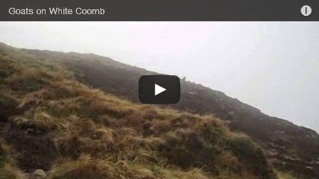
Incredibly, considering the number of people around, the only company I had near the summit was a radio ham (see, there he is in the photo below):

IMG_7932

My initial thoughts of ‘what a disturbance’ and ‘why does he need to shout?’ morphed into interest as I realised how far away were the people to whom he was talking (although I’m sure the distance didn’t necessitate the shouting!). Florida and Ohio were included whilst I was there, and he certainly seemed to be rattling through contacts without pause, so I didn’t disturb him with my nosiness.

On the spur of the moment, I didn’t turn to retrace my steps, but instead opted for a circuit, even though that was going to take me past some farms with the attendant danger of more killer-dog encounters. Fortunately, the only dog which took an interest that I would perceive as aggressive didn’t reach the path until I was safely over a stile and hot-footing it across a field.

Although cloudier than the morning had been, no rain arrived until a good couple of hours after I was ensconced back within Colin (after 4.3 miles on this little outing with 600’ of up), happy to have achieved all of this week’s hills in good weather.

The question now is what to do tomorrow?

(*as it happens, there is a parking area almost opposite the footpath to the summit, but it was also full)

Shining Tor

Peeking out of the window just as the day was thinking of dawning, a swift re-plan was had. With clear skies and not a hint of fog, compared with a forecast of rain and ‘almost nil’ probability of cloud-free summits for tomorrow, it made eminent sense to visit the more interesting-looking hill today, saving the less interesting for tomorrow’s poor weather.

That did mean that Colin would have to move, necessitating a flurry of activity whilst an explosion of stuff got re-stowed, but it was still before 8.30 as I set out towards Derbyshire Bridge for a trip up Shining Tor.

The frost was heavy and the views (particularly of the Roaches and Ramshaw Rocks) were truly superb as I trundled my way north, but the final approach road to my car park was doing a good impression of an ice rink. The road along which I then needed to walk for a while was similarly slippery, so I was glad to get off it, even though the temperatures hadn’t been quite low enough to fully freeze the bogginess I then encountered.

My ‘why are you working when you could be here?’ email to Mick from the summit told him that it was “either a grin-inducing place to be on a day like today, or a grin-inducing day to be in a place like this, but either way the combination of place and weather are mightily pleasing”. Unfortunately, my snaps from the summit don’t do justice to quite how far the views extended:

IMG_7910

There was low level fog visible in the distance in this direction, as well as three valleys along to the east.

It certainly wasn’t a day for a quick out and back, so along the ridge I continued to Cats Tor. The path was getting busy by then, including a group of 20 or so who merrily took up the entire path, forcing me off it. Even so, they all got a cheery “good morning”. Later, having dropped down to the road and then veered off towards Errwood Reservoir, I wasn’t quite so cheery to the owner of a killer dog (although I concede that ‘Baldrick’ is a good name for a dog!).

Foxlow Edge took me back upwards for a while, which looked the better alternative (rather than simply heading down the valley) on a day like today. It was so nice up there that I declared it to be lunchtime at the top of the pimple, even though it was only 11.15. I do consider lunch to be a very moveable feast!

Down at Errwood Reservoir, there was a severe lack of water, but that added to the interest, I thought:

IMG_7924

Gorgeous weather, and still frost in the shade

A couple of miles along the (still icy in places) road took me back to Derbyshire Bridge with 8.8 miles walked with somewhere around 1600’ of ascent.

image

What I should have done then (I now realise) was take a trip over to Shutlingsloe. It had been such a feature in the morning’s views, that I have no idea why I didn’t think of it at the time, given that I had plenty of daylight and energy remaining. Instead I headed back to Blackshaw Moor and …

…to be continued (don’t get excited, there’s no cliff-hanger. If I hark on much longer here, it’s going to be a ‘mare to get this to post; as it is I have to hold the laptop at an uncomfortable angle at the window to get enough signal.)

Monday 24 November 2014

The Cloud and Rudyard Reservoir

If this morning’s hard frost wasn’t the first of the winter in the Midlands, then it’s certainly the first that I’ve noticed. Perishing it was (particularly after being spoilt with such mild temperatures thus far) as I left the house and pointed Colin’s nose northwards. On the plus side, there was absolutely no hint of fog, and lots of blue sky. Was I actually going to get a view from a summit?!

At just after 9am (and after a number of multi-point turns that I’m not going to disclose; it wasn’t my finest bit of driving navigation!) I pulled into a car park in Rushton Spencer and, over a cup of tea, promptly changed my plan.

The original intention had been a 11.5-mile circuit, taking in The Cloud (yep, another Marilyn), but as I sat there, tea in hand, looking at the 1:25k map, I noticed that I was very close to Rudyard Reservoir, and that the larger scale of map (in contrast to my newer 1:50k mapping) showed a path going the whole way around it. My circuit therefore became an out-and-back, to be followed by a circumperambulation of the reservoir.

image

After a bit of muddy farmland and a bit of muddy woodland, a few more muddy paths took me up to my objective, and before I reached the top I could already appreciate what a fine place it was going to be. With a bit of a grit stone outcrop on top, the lump stands proud amongst land which is, predominantly, very flat indeed. I couldn’t resist sending a smug email, complete with photo, to Mick to let him know what he was missing; .

The topograph by the trig point gave me the ability to take a self-timed photo (far better than an arm-outstretched, double-chin-inducing selfie), but I now realise that I completely failed to even glance at what the topograph was telling me.

IMG_7879

Cloud-free on The Cloud…

After cake and no small amount of view-admiration in solitude on the summit, I saw that people were approaching from all directions at once, which I took as my cue to leave. The return journey was remarkably similar to the outward one.

Lunch and more tea in Colin set me up nicely for Walk #2. Initial indications were that it was going to be far duller than the map had suggested, as I trogged along first an ex-railway line and then a tarmac track. It all came good after a while, with the main source of interest for me being the variety of dwellings dotted along the water’s edge to the north of the village of Rudyard. Varying from shacks to a stone-built house that sits fully within the water, I’m sure they all boasted fine views, although some of their boat-ramps were clearly currently useless, with the water sitting many feet below their ends.

It didn’t strike me as a lake big enough to be attractive to yachters, but this snap suggests that I know little on the subject. It also, hopefully, conveys what a pretty spot this is:

IMG_7896

The railway bed on the east side of the water is not entirely an ex-railway, as part of its width (admittedly a very small part!) has been taken over by a narrow-gauge, an engine on which was just testing out a newly repaired bit of track as I passed by, but it wasn’t interesting enough to cause me to break stride. Only the views (I took lots of photos today!), waylaid me from my route, until, at the end of the reservoir, the views ran out and from there it was only thirteen hops, eight skips and a few jumps until Colin was back within my sight.

The stats for the day were 5.6 miles on the first outing and 6.2 on the second, which I make to be 11.8 miles in total. I believe that Anquet has seriously over-reported the ascent on both walks and that rather than 2400’, there was actually nearer to 900’.

Tomorrow, I shall be visiting the Marilyn with the shortest name. According to the last weather forecast I saw, it’s going to be foggy in the morning and raining in the afternoon, and I’m not fancying my chances of hitting the middle ground, after the fog has lifted and before the rain arrives!

Wednesday 19 November 2014

Walton Hill (Worcestershire)

I was almost at my chosen start point for this morning’s walk when it struck me that the number of brown ‘Country Park’ and ‘Visitor Centre’ signs meant that it wouldn’t be a free car park. That was a bit of a problem, and on this occasion it wasn’t entirely due to my severe aversion to paying for parking that made me rethink my start point; it was the fact that the entirety of the cash I had with me was 2p. Even if this was a cheap car park, it wasn’t going to be that cheap!

A quick re-plan and I headed off to park at the foot of my hill, which wasn’t my ideal choice. Parking further away makes sure that I don’t get overcome by laziness and call it a day after just nipping up the hill and back. Happily, not far from the Country Park I came across a large (and empty) layby, which served my purposes perfectly.

After a few crop fields, a lane (which I walked in both directions without meeting a single car) took me through extensive attractive woodland whilst taking me down, down and down some more. Why was it taking me downhill? So that I could climb back up, of course!

The climb back up gave me pleasing views:

IMG_7855

With lovely autumn colours in some directions:

IMG_7856

Then a gently rising path, initially through more woodland, took me to the top of Walton Hill, where I did take a selfie but it’s so awful (far more so than yesterday’s!) that I’ll keep it to myself and just share a piccie of the trig point itself:

IMG_7861

So much was I enjoying myself, that I opted to walk on further, dropping the north side of the hill to venture into the Country Park that lay in that direction (a different Country Park to the one I didn’t park in – this little area doesn’t seem to be short of Country Parks). There was a view point marked on the map there and I reckoned that I would reach it just about lunchtime. Lunch was thus taken admiring the view from a bench by the ‘Four Stones’. A fine view it was too. I could only imagine what it would be like on a clear day.

IMG_7863

The topograph nearby proved difficult to read, but it has stood there since 1929, and it must be a popular place (i.e. lots of fingertips rubbing over the names), so it’s not surprising it’s a bit on the worn side:

IMG_7866

A perusal of the map over lunch gave me a route for my return (it’s such a nice area that I wanted to see more of it, rather than retracing), and off I set in the direction of Clent. Some of the paths were horribly muddy…

IMG_7867

…although in the case of the one shown above, I shouldn’t have even been there. I got my compass out to check my direction before I took this path, and have no idea (having now looked at the GPS track) how I came to the conclusion that this was the right way. I hadn’t gone too far before realising my error, but to put myself right, I had to wade right back through it again.

Back on track, more fine colours were around me:

IMG_7869

It was a lollipop shaped walk, and as I re-joined my outward route I passed this view again…

IMG_7871

That’s the same as the first photo above, but with slightly better weather

… before I had to go up, up and up some more on that little lane I had descended along earlier.

It was a most enjoyable little outing, measuring exactly 8 miles in distance with 1600’ of ascent.

image

(For anyone wondering what led to these last couple of walks, it was all down to those hill-list gpx files that I downloaded last week. Both Bardon Hill and Walton Hill are Marilyns, and having visited them I’m now left with just one more Marilyn within sensible day-trip driving distance of home.)

Neither The Weather, Nor The Season

I suspected that the lack of joy that I took in yesterday’s surroundings was largely due to the weather and the season. Today I proved that not to be the case.

On paper, I thought that yesterday’s walk in the area circled below…

image

The red triangle marks Bardon Hill, which was my objective

…looked more promising than today’s walk in a little chink in the urban sprawl that surrounds Birmingham:

image

Today’s red triangle was Walton Hill

Paper can be deceiving. Yesterday’s walk was mainly thoroughly dull surroundings, walking along muddy alley-esque paths behind houses, across open land that had a wasteland look about it, through old woodland that boasted no prettiness, and past quarry extension works. There were a few short good bits, but they were the exception.

Today I only knew that I was so very near to major urban areas because the map told me so. If someone had just plonked me there blind-folded and sent me on the walk I walked, I would never have guessed my true location. The weather was similar to yesterday’s and obviously the season is still the same (mud, mud, glorious mud…), but there were fine (even if severely curtailed) views, the woodland was (without exception) attractive, the autumn colours stood out (thanks to the lumps and bumps in the landscape) and it was all quite lovely. I’d very much like to go back on a sunny day.

Tuesday 18 November 2014

The Heady Heights of Leicestershire

It was nice and sunny when I left home this morning – a fine day for a walk up the biggest hill in Leicestershire – Bardon Hill.

Somehow (not to mention rather cruelly), I’m still suffering the same luck as stalked me on the latter part of my Scottish trip, as the sunny day had transformed itself to a grey one as I crossed the border into Leicestershire and, by the time I had ascended up to the heady heights of 278m, I was well and truly in the cloud. Harrumph!

IMG_0944

First ‘view’ of my objective. How inviting…

IMG_0947

There’s the trig point – and a hint of blue sky

IMG_0949

Proof that I was there, and a stunning view behind.

With the hint of blue sky above me, I thought that the sun might be about to burst through, so (even though it wasn’t yet 11.30) I sat myself in the shelter of the trig point for lunch, overlooking the huge quarry below. Or, more precisely, overlooking lots of cloud, in the direction from which quarry-like noises were emanating, and where the map tells me there is a huge quarry.

I might have sat up there even after my sandwiches had been despatched (for example, I might have drunk my flask of tea, if it hadn’t still been sitting next to the kettle at home), except that it was rather cool, so rather than putting my jumper back on, I hauled myself back to my feet and opted for the shorter descent route. I’d walked around the base of the hill before ascending and it wasn’t an attractive route. My descent path was one of the nicer bits of the outing.

Back at the car (which I’d parked at Cademan Wood, just north of Whitwick), I thought it would be rude not to make the very short out-and-back detour to the trig point shown in the woods. It only took a small handful of minutes for it to come into view, on a little rocky outcrop:

IMG_0951

It even boasted a bit of a view (only a bit though, on account of the trees). This snap doesn’t really show it off; I might have managed a slightly better snap if I’d had the camera with me.

IMG_0953

The whole outing was 7.5 miles with a whole 850 feet of ascent.

Incidentally, I used the Ivanhoe Way to get me from Cademan Wood to Bardon Hill, and I’m not sure if my perception was unfairly skewed by the weather and the season, or whether it really is the dullest of walks. Apparently (so t’internet tells me), it’s only a 36-mile circular route, so I saw a reasonable chunk of it. The bit through a National Forest plantation was pleasant enough (but exactly the same as the National Forest plantations near home), and Cademan Wood was okay too, but otherwise it didn’t leave me feeling inspired to investigate any more of it. On a positive note, it was reasonably well waymarked – once you know to scrutinise street name signs for the smallest waymarking stickers known to man.

image

Friday 14 November 2014

I Blame Conrad…

Last night I downloaded GPX files giving the locations of the current lists of Munros, Corbetts, Marilyns and Munro Tops*. It’s not something I would have thought to do if it hadn’t been for Conrad, who is convinced that I am teetering on the edge of becoming a confirmed list-ticker. I now have my maps festooned with red crosses, amber triangles, red triangles and red pins (and at some point I may recall without thought which symbol I’ve used for which).

I *really* wish I’d done that before my recent trip. My eye has now been drawn to lots of hills that have had me thinking “Oooh, I’d like to take a closer look at that one.”. Ideas for future trips are springing into my head accordingly.

For the avoidance of doubt, I still have no intention of aiming towards the completion of any of those lists … but I am liking having these symbols as focus points on the map.


(*The files for these and many other classifications of hill are downloadable from www.haroldstreet.org.uk, with a request for a £1 donation per file, which seems a very reasonable request to me.)

Thursday 13 November 2014

Flashback to GT Day 11: Loch an Eilein in the Wind

On Day 11 of my trip, when I went up neither Ord Ban nor Cruban Beag (actually, there were an awful lot of hills I didn’t go up that day; thousands, in fact), I took a few little video snippets of conditions at Loch an Eilein. Here’s one (just 14 seconds long), looking out to the castle, which I think captures conditions reasonably well; it even shows a bit of the flying-spray, just before the end.

Wednesday 12 November 2014

GT Day 16: A Splosh in the Rain

Tuesday 11 November 2014

Although I didn’t actually have to be home until Thursday morning, my planned outings for Tuesday and Wednesday were put on the back-burner, for another trip, when I saw the forecast for those days. I decided to finish my trip on a high, after Monday’s excellent outing – except that it was too late for someone with night-vision (and an ability to sleep) like mine to drive home straight after that outing, so I stuck around in the Moffat area for one more night.

I know that it rained in the early hours, but by the time I got up it was dry, reasonably bright (for an overcast day) and without any hint of the predicted strong winds, so I thought I may as well stretch my legs before hitting the motorway.

Given that I had kipped within three paces of the Southern Upland Way, it was the obvious place to walk, even though no obvious short circular route jumped out at me, and even though it looked less-than-inspiring on the map. My plan was simply that I would walk either for an hour, or until it rained, and then turn back.

IMG_7853

As it turned out, the surroundings weren’t quite as uninspiring as the map suggested, but it was most certainly wet underfoot. I rued having put on clean and dry boots and socks when, after sploshing through a section into which I sank only a couple of inches, I suddenly plunged into some muddy bogginess up to mid-calf.

IMG_7854

Yep, that’s where my one foot went in. Careless!

Three quarters of an hour in, just as the path was doing a jolly good impression of a muddy stream, it started to rain, and after giving it a few minutes to see if it was going to pass, I decided that I couldn’t be doing with water from both directions, so back I turned.

I managed 4.6 miles in total .. and then spent the rest of the day driving.

GT Day 15: White Coomb & Co

Monday 10 November 2014

image

What a good day that was! I set out with optimism that I was going to get a view (once again the forecast said there was an 80% chance of cloud-free summits, and I surely couldn’t be in the unfortunate 20% again, could I?!) and, to an extent, I did.

After a chilly boot-off crossing of the burn, followed by a splashy, wall-hugging path, I got to the top of White Coomb and this is what I saw:

IMG_7831

Not ideal, and not the sunshine in which I had set out. On the plus side, I hadn’t entered the cloud until 700m (White Coomb is 821m), and I had a plan: I was going to add a few more tops into my planned circuit and amble about until either the weather obliged me with a view or I ran out of daylight.

Over to Firthrig Hope I went, thence to Donald’s Cleuch Head where, instead of turning right to drop back down (per the original plan), I turned left, leaving the security of the wall to follow a line of old fence posts to do an out-and-back to Great Hill. Barely able to see the next post from the one before for most of the way, I was almost at the top of this small raise when I noticed a small patch of blue above me, which soon expanded such that I could see this:

IMG_7832

Acknowledging that this may be the only view I saw all day, I declared an early lunch and plonked myself down on the grass to enjoy it. As I sat, this was the progress I witnessed:

IMG_7833IMG_7834IMG_7835

It was still looking pretty good as I headed back along that line of posts, back to Donald’s Cleuch Head:

IMG_7836

It didn’t clear entirely (there was always a wall of cloud in one direction or another) and that cloud keep drifting back over me, but even so, when I reached Firthybrig Head I decided that I had plenty of time for another out-and-back, this time to Molls Cleuch Dod, where I was again a happy ambler:

IMG_7841

I was so pleased to finally see a few snippets of the loveliness of this area!

Alas, by the time I got to my last top of the day (Lochcraig Head), there was not a single view to be seen. In fact, a couple of minutes after I took this snap, I was struggling to see my hand in front of my face:

IMG_7845

Carelessly, I was fooled by this cairn, and now realise that I missed the actual summit.

With the day marching on, and no other top falling naturally on or near my route, down I went, steeply at first, then taking what felt like a non-standard (i.e. heather- and bog-wading) route to cut over to Loch Skeen once the land levelled out. The trodden line around the loch was wet in the extreme, and my boots are no longer entirely waterproof, but it mattered not. I’d had a cracking day and only had a mile and a half of walking downhill to get back to warm dry socks and a cup of tea.

The stats for the day were extensively stated in my previous post, but now that I’ve resurrected Anquet and have imported my track, I see that I actually walked 10.25 miles with just over 3000’ of ascent.

---------------------------------

As an aside, early in this outing I had stopped to listen to what initially sounded like distant cries for help. I very quickly decided that it was an animal, but it went on and on and I couldn’t positively decide what animal it was (donkey was my best guess from a distance, but that seemed unlikely in this location!). I eventually found the culprit – a goat. You can barely see him/her in this 9-second video snippet, but it does capture the cry:

Monday 10 November 2014

GT Day 15 (Holding Post): White Coomb & Co

I will write a proper account of today when I have more battery and a better signal, but for now, here are a few stats:

Number of tops (wot appear on lists) visited: 5

Number of miles walked: 10

Number of hours taken: 5 (plus lunch)

Number of summits where the cloud cleared to give a view in at least one direction: 2

Number of summits with less than 50 yards of visibility in all directions: 2

Number of feet of ascent: I was just counting contours when the police pulled up next to me, in my night-stop location, to ask me what I was doing*, and I lost count! 2500’ ish??

Number of slips: 11

Number of trips: 0

Number of falls: 0

Number of people encountered: 0 (1 person seen at a distance)


(*I didn’t answer “Well, I was counting contours until you distracted me!”)

GT Day 14: Loch Skeen

Sunday 9 November 2014

The weather this morning wasn’t such as to make us leap out of bed and seize the day. On the contrary, we got off to a very slow start and it was approaching 11am by the time we drove up towards Eric’s Stane, just north of Moffat. Plan A had been a walk from there, but before we even got to our parking area we were in the cloud.

It struck me that, after all the rain of the last few days, it would probably be a better day to visit a waterfall than to be on a cloud-covered hill, so Plan B was quickly formulated and we hotfooted it to Grey Mare’s Tail, to the east of Moffat (a feature of which I was only aware thanks to a passing mention in an email from TVPS t’other day).

The fall certainly was a spectacle worth seeing (sorry, no photo due to poor signal), but even more attractive was Loch Skeen, which was like a millpond when we reached it.

Its shore provided us with a very pleasing lunch spot, and it was as we lunched that the slightest hint of a bright orb appeared behind a thinning of the cloud. Within ten minutes we could see all of the tops surrounding us, including the Corbett, White Coomb.

I was sorely tempted to grab the opportunity and go up it, but Mick had a date with a motorway and was unconvinced that my speed versus the hours of daylight remaining were such that it would be sensible for me to take the upwards diversion. I, therefore, did the good wifely thing and returned back to the car park to wave him off on his way back south.

With a reasonable bit of daylight remaining, rather than spending the rest of the day absorbed in my book, off I went to explore the line of an old track (not marked on the map) I had seen a little way up the other side of the valley. It took me to Dobb’s Linn, which the information signs at Grey Mare’s Tail car park tell me is an important geological site, but I didn’t get to explore it as the burn was running high enough that I didn’t want to risk trying to cross it without my walking poles (this being just an little afternoon stroll, I hadn’t got anything with me except my phone). I noticed that the cloud was back down by the time I made my way back down the valley and with excellent timing, I had just closed Colin’s door behind me when it started to rain.

Combined, the two pleasant little outings amounted to 5.3 miles with 1500’ of ascent.

Saturday 8 November 2014

GT Day 13: A Hart Fell Circuit

Saturday 8 November 2014

I’m sure that today’s walk was full of gorgeousness and was spot on target for being the sort of walk that I really like. From what I could see it certainly appeared that way. Unfortunately, most of the walk was done blind, so I’m only going to be able to prove that theory by returning in better weather.

The conditions were rendered even more unfortunate by the MWIS forecast giving an 80% chance of cloud-free summits for this area today. That was the exact same chance of cloud-free summits as was given for the Cairngorms on Wednesday, when I was on Cairn Lochan, so I have to deduce that I am just languishing in amongst the unfortunate 20% this week.

A shower, which started just as I was buying a map in Moffat this morning, was just dying off as we parked at Capplegill, and with blue sky being seen in the distance we weren’t put off by the cloud shrouding our objective:

IMG_7788

As we quickly gained height, the blue was soon above us and many an appreciative comment was made about our surroundings:

IMG_7791IMG_7793

It didn’t last. By the time we were atop Saddle Yoke, the cloud had again descended and it stayed down for the rest of our outing, so the views from the top of Hart Fell were notable by their absence.

IMG_7798

Hiding behind the shelter, just as a prolonged shower petered out, an early lunch was enjoyed, before onwards we went to complete our circuit by following the top of the crags which line the west wall of the Blackhope valley. I know there were crags there, because the map told me so; we didn’t actually see them!

Descending the end of the ridge, we finally dropped back below the cloud at 600m (our high point having been at 808m), by which time we had made the wrong choice at a fork in the path, and took what we believe to have been something of a non-standard descent route:

IMG_7799

It still got us to the right place, and just as another shower came through we reached the road where a few hops, skips and jumps (the latter occurring when four farm dogs in a nearby truck set up a sudden racket which took me by surprise) took us back to our start point.

Many thanks go to TVPS for suggesting this route. It wouldn’t have jumped off the map at me, appearing on paper to be a completely pathless circuit. As it turns out, it was far from pathless*, and was good walking. I very much look forward to walking around there again sometime in better visibility.

The stats for the outing were smack on 9 miles walked, with somewhere in the region of 3000’ of ascent (I can’t be doing with counting contours, nor re-plotting the route in Memory Map; when I have Anquet back up and running I will import our track and get an ascent figure).

(*Mick would like me to clarify, in case anyone is using this page as a resource, that when I say ‘path’ I mean a trod which varied from a vague line in the grass, to an obviously well-trodden line, both of which gave a sensible route and (relatively) easy walking. We’re not talking engineered paths or tracks here!)

Friday 7 November 2014

GT Day 12: A Perth Pimple

Friday 7 November 2014

Setting out before full daylight this morning, I had a plan of driving a little way down the road and (even though it was raining) taking a quick stroll up Cruban Beag (from the more sensible side). Ten minutes later, I caught sight of my hill and saw that it was covered in cloud. I did a quick sum in my head:

Rain + Low Cloud = Not a Chance!

So, I sailed past the turn I would have taken, and a few minutes later realised that I had been looking at the wrong hill, when the right hill hove into view and was completely free of cloud. Being now on a dual carriageway, I didn’t turn back, but decided to find somewhere else to walk further south. I’m so glad I didn’t go back, because instead I had a lovely time on a little pimple in Perth, by the name of Kinnoull Hill.

It’s not even 750’ high, but the glory of a pimple is that it stands proud relative to its surroundings and thus gives excellent views. With the weather being decidedly on the brightening side by now, I revelled in those views. I even grinned out loud at the joy of it. Or to put that another way, I had a jolly good hour and a half wandering through woodland and drinking in views. Here is a selection of the snaps I took to illustrate the outing (note that I had to re-ascend for the summit photo, as I got a couple of minutes into my descent before I remembered that I’d forgotten to take a snap at the top):

IMG_7774

It doesn’t stand out too well in this snap, but that’s a ruined tower sanding at the top of the crag. Admittedly, it’s a shame about the presence of the A90, more for its noise than its appearance.

IMG_7782

Poser!

IMG_7783

I had to look twice when I first spotted this, it looked so realistic.

IMG_7784

Fortunately, nobody has been and painted a target on it!

IMG_7786

 This one was a real, and he posed nicely for me.

I had such a good time on this little hill that I completely lost track of time, which was compounded by an aberration as to how long it would take me to get from Perth to Moffat, where Mick was due to arrive at 3pm. As I was bringing the accommodation, and as he had made the effort to escape work earlier than is his norm, it was particularly important for me to arrive before him. I drove faster than I usually do and did indeed beat him … by 90 seconds. Considering how far we’d both come from opposite directions, that was incredibly closely timed!

Thursday 6 November 2014

GT Day 11: Not Ord Ban, Nor Cruban Beag

When I arrived at the Rothiemurchus Visitor Centre car park this morning, conditions seemed far more benign than they had been up at Glenmore. The rain had stopped, the cloud was high and the howling wind was no longer howling. Maybe my little lump of Ord Ban was going to be feasible after all!

Off I set and, sure enough, it was a perfectly pleasant (if overcast) day where I was, although it looked heavy and wet over to the west. My little hill was in my sights from quite early on and there was no doubt in my mind that I would be able to pop up it. Then I got to the end of Loch an Eilein, and I came to realise that the wind had not dropped - I had simply been sheltered. It was the monster waves and great walls of spray coming off the loch that gave it away. That and the way that the trees were trying to bend double.

My little hill being well guarded by old woodland, I reluctantly concluded that even though I was so close, it wasn’t a sensible place to go. Death by a falling tree branch is not how I would choose to go. So, I just pottered up the loch a short way, took a few video snippets of the conditions (oooh, it was wild!) and then ran scared when my over-active imagination started thinking about falling trees again.

I took a different route back, equally as sheltered as my outward route, had an early lunch, drank tea, and headed into Aviemore, where I failed to buy the map that I need.

With the day still young, off to the Falls of Truim I trundled and another little wander was had. I even started going up the ill-advised (i.e. craggy) side of Cruban Beag, before I reminded myself that: a) I had nothing with me, bar my mobile phone; and b) it was still ridiculously windy, so for the second time today I did an about turn.

Despite the wind and the failure to go up any hills, a good time was had. Alas, the day has now taken a turn for the worse as, in running out of power just as Anquet was loading, Anquet has now lost all of my maps. My laptop and my electronic maps are my main plan-as-you-go resource on this trip, so that is rather a bugger and something I don’t think I’m going to be able to put right until I get home.

GT Day 11, 7.30am: An Express Train Is Coming At Me!

I was woken about an hour ago by the sound of an express train coming straight for me*. In the last hour, gentle rocking has been joined at regular intervals by sudden buffeting.

I had only planned on a very small hill today, but I’m already thinking of abandoning that plan, as the approach goes through woodland, and I’m not sure woodland is wise in wind like this.

There will certainly be some walking today, as I need to venture into Aviemore to see if I can find a map for my next destination, but I fear that it may otherwise turn into the third Foul Weather Alternative day in four. I suppose those are the perils of holidaying at this time of year as a fair weather walker!


(*Those who have never camped at Langdale, or similarly sited valley campsites, in strong winds, may fear that I’m pitched on some train tracks! Fear not – I refer to the sound the wind makes as it comes racing down a valley. At least in Colin, I don’t find myself bracing for impact and worrying about the security of pegs.)

Wednesday 5 November 2014

GT Day 10: Cairn Lochan

Wednesday 5 November 2014

Yesterday was mainly spent with friend Laura, indulging in much chatting. We would have liked to have gone for a walk, but were both equally decisive in our declarations of “I’m not going out in thatas we watched the rain pour down.

As daylight started giving way to darkness, I repositioned myself into the Cairngorm Ski Centre car park. Sitting in the cloud, listening to the rain drumming down, I had faith that, per the forecast, today would prove to be the best weather of the week. The mountain forecast told me that there would be little wind, only a few passing showers and an 80% chance of cloud free Munro summits, with good visibility.

The morning didn’t start with promise: the rain was now snow, but the cloud was still low. I set about wasting some time to delay my departure. Alas, the number of daylight hours at this time of year don’t allow for indefinite waiting around, and my objective of Ben Macdui was far enough away to need quite a few hours, so I had to make a decision: go anyway, or go somewhere else. Whilst I’m not one for climbing hills for the sake of it (I want a view at least most of the way up, if I’m going to go to all that effort), I clutched at the straw that the cloud would rise at a faster rate than I would, and off I set. 

There was just one set of footprints in the snow heading in my direction. I discerned that it was a big-footed chap, with a very short stride length, who stopped every few paces and turned around. When I finally caught up with him, it turned out that he was looking for ptarmigan, which explained the odd trail of prints. Of course, having passed him, I no longer had his prints to follow. He said he would follow mine instead. He did. That may not have been wise. 

I should probably mention that by now I was well and truly in the cloud and visibility was severely restricted accordingly. Plus, of course, as I was getting higher the snow was getting deeper and obscuring the path, although I only lost it once, and not for more than a couple of hundred yards.

My ‘Plan B’ had been that if conditions weren’t conducive to going all the way to Ben Macdui, then I would instead pop up to Cairn Lochan and walk the edge over to Cairn Gorm, which looks a lovely walk (in good conditions…). As I trudged along, Plan B got elevated to prime position, but just as I might have turned off the path to take a more direct line up to Cairn Lochan, there was a glimpse of blue sky and even a small window of a view. Optimism soared that this was the first sign of the cloud lifting and that Ben Macdui would be back on the cards, so instead of turning, I carried slowly on, delaying the decision for another few hundred yards.

My optimism wasn’t warranted. In fact, after that brief glimpse of blue, conditions got even worse. I turned off the path, got out my compass, and with absolutely no visual aids (other than the compass in my hand), eventually made my way up to Cairn Lochan.

A bite to eat and the quick downing of my flask of tea and onwards I continued … for about 50 yards, whereupon I decided to abandon my circuit. I just couldn’t see any point (in fact, I just couldn’t see!) in continuing on a navigation exercise; I’d rather complete the circuit when I can enjoy the surroundings. So, I did an about turn and followed my footprints all the way back to the place where I had lost the path on the way up, not seeing a single other person’s prints on my way.

The originally-missed bit of path was far more obvious in reverse and at the end of that untrodden section I found that other people had come up the hill after me but every single one had followed my prints as when I had accidentally left the path. Ooops! I’ve no idea where those people went, as I saw no evidence of them further up the hill, although the it appears that some turned back, as the path from there on down was full of prints in both directions.

Arriving back down at Colin the cloud base was clearly lower than when I had set off; the Corbetts, across the other side of Loch Morlich, which had been fully visible when I set out were now heavily shrouded. As the day raced towards dusk, the sky did gradually clear, but too late to be of use to anyone but a night-hiker.

Objectively, it wasn’t such a bad day to be on a hill really. The few showers which passed through were all snow (and thus didn’t get me wet), and the wind was so low as not to be noticeable. However, I can’t really say that I enjoyed my outing (8.4 miles with 2000’ of ascent) and to add insult to injury, I finished with wet socks (the snow up high was deeper than I had expected – beyond ankle deep in many places – and I hadn’t taken gaiters)!

There was rather an absence of photo opportunities today, but I did take a quick selfie at the top, to illustrate the view behind me…IMG_7751

Monday 3 November 2014

GT Day 9: Exercising the Foul Weather Alternative

Monday 3 November 2014

Today was the last day of Mick’s guest appearance on this trip, and the main focus of the day was drinking tea and catching up with a friend in Elgin. That still left us with a couple of hours of the afternoon free, and I had in mind the stroll through Culloden Forest, which I was too lazy to take on Thursday.

Unfortunately, the fine, cold start to the day had been replaced by greyness and persistent rain, and Mick’s face, together with the exclamation of “In this weather?!”, when I shared with him my planned walk suggested that he wasn’t overly keen. He called for the Foul Weather Alternative, which was to sit in the comfort of Colin and read the newspaper. So, that’s what we did (well, Mick read the newspaper, I tried and failed to make some decisions as to where I’m going to head towards the end of this week).

A couple of hours later, I deposited Mick at the airport, from where FlyBe has now transported him back into England. I’m on Culloden Moor, listening to the rain continuing to drum down.

GT Day 7: The Bimble of the Bizarrely Buzzing Boob

Sunday 2 November 2014

During Saturday’s walk a decision was made by the Executive Committee (comprising solely the female members of the party) that it’s not wise to over-do things on a Sunday, and thus instead of taking another lengthy walk, we would just take a moderate bimble, with the main focus being lunch.

David kindly drove us all to our start point, from where we enjoyed the surroundings of the lovely forest (it’s an old, spacious forest, not a modern commercial plantation), before popping out (after a bit of an adventure around some farm buildings) in the grounds of Brodie Castle:

IMG_7739

The blue skies lasted all day, even though the weatherman had foretold of rain

Away from the castle and past a sizeable pond, it was then but a hop and a skip to reach our eatery for lunch. It was a busy place; a good venue for people-watching, and the food was rather tasty too, not to mention so generously sized that I couldn’t fit in a cake for pudding.

Suitably fuelled, back out into the sunshine we went, taking a wiggly path through the castle grounds, which landed us at Rodney’s Stone, which was named in 1782, even though it dates back 1200 years.

IMG_7745

A bit of tarmac saw us onto a grassy track, just a hundred metres or so away from which lay a trig point. Louise, being a bagger of trig points when the opportunity arises, had almost written off this one, as no access point presented itself through the intervening barbed wire fence. Then Mick noticed that there was a section without barbs, and he soon demonstrated that even those with a 30” inside leg could step over it quite easily. A couple of minutes over the stubble of a harvested crop field, and the trig was bagged.

IMG_7746

No obvious exit point could be seen from the field, even from the vantage point of the trig (which wasn’t actually at the highest point of the field), but we headed in approximately the direction of our onwards route with the intention of following the boundary until an exit was found. As it went, the fence was about 2’ high at the point where we met it, and as an added bonus, as David waited for each of us to step over, his eagle eyes spotted a geocache. A trig point and a geocache bagged, all within a five minute period, and without any prior knowledge of the latter’s presence – this was turning into an unexpectedly productive end to our walk!

A tiny section of road put us back into the forest where the car was patiently waiting for us. A total of 5.7 miles were walked, with a couple of hundred feet of ascent.

As for the title of today’s post, I’m not sure whether I should explain it further than saying that ‘I have a bizarrely buzzing boob’ comprised the quote of the day, and that quote didn’t emanate from me! Something to do with carrying the GPS in the breast pocket, apparently…