The Road goes ever on and on; Down from the door where it began;
Now far ahead the Road has gone; And I must follow, if I can;
Pursuing it with eager feet; Until it joins some larger way;
Where many paths and errands met; And whither then? I cannot say.

[JRR Tolkien, Lord of the Rings]

Monday, 19 April 2010

Day 27 - Staveley to Grisedale Tarn

Sunday 18 April
Distance: 16.25 miles (Tot: 470.25 miles)
Ascent: 4700' (per Anquet); 5000' (per Mick's watch)

Last night didn't feel as cold as all of those that preceded it, but that was deceptive (and perhaps based on a huge meal and a hot shower in a heated shower block before bed) as we awoke this morning to frost on the tent again.

Making use of the excellent backpacker's cabin meant that we could swing our arms around as we packed away, although the leisure to pack simultaneously didn't seem to speed us along, so it was our usual hour of 7.30 by the time we set out.

Reaching Staveley, lanes, tracks and paths (with a bit of the A591, which was reasonably quiet on this Sunday morning) took us north-west towards Ambleside.

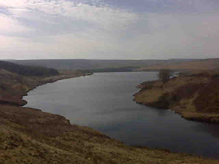
The track from Town End to Ambleside gave us fantastic (if hazy) views of the fells and down to Windermere such that there was undoubtedly quite a high 'photos per mile' ratio along that section - although nothing compared to this afternoon.

Reaching Ambleside provided us with a re-stocking point not just for food but also for a new pair of X-socks for Mick. One of his pairs (quite an aged pair, not new for this trip) has sprung a hole where a hole should not be, so a replacement was needed.

Having run around all of the necessary shops (I always find that getting the right selection of groceries in Ambleside involves visiting both the Co-op and the Spar, and finding X-Socks was even more of a challenge), the final thing we needed to do before leaving town was to have a massive meal. Because a massive meal is exactly what you want immediately before heading steeply uphill...

It was always clear that this was going to be a day of two contrasting halves. The morning was a nice easy amble, with views giving a taster of what was to come, whereas the afternoon saw us leave the low levels we've stuck to so far and head up, up and up.

I struggled a little on the lower reaches of Heron Pike until finally I decided the answer was to remove my jacket. I may have been a bit chilly on the downhills and flat bits, but a t-shirt was all that was needed for the climbs.

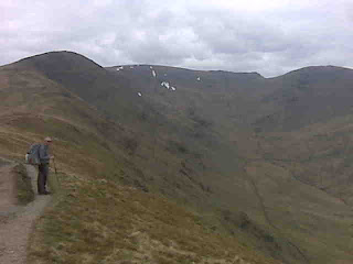
Once in my stride the walk was not difficult on the motorway of a path that leads over Heron Pike, Great Rigg and Fairfield and as a contrast to the last couple of days over fields, navigation was not required. In such good visibility (and it was good indeed today) even the most navigationally challenged couldn't have gone astray.

How to describe that walk though? I'm not sure there are superlatives to do it justice. The skies may not have been blue (in fact the light was very grey), but visibility allowed us to see the sea and every hill and lake in between.

Even better, having not left Ambleside until gone 1pm, the stream of people coming down the ridge thinned the further up we went, and by Lake District standards I wouldn't say it was busy.

Gaping at the views, we made our way up to our high-point of the day - Fairfield at 873 metres. Our luck with the weather ran out at that point. We still had views to the south and west, but low cloud was covering the tops to the north and east, and as we reached the summit so the cloud came down upon us.

With the temperature collapsing, all of the layers went back on before we ignored our intended descent route and headed down a horrible eroded path to Grisedale Hause (despite the horrible scree-ish surface (or lack of a surface really) Mick managed to stay on his feet the whole way down; I didn't).

By the start of our descent the cloud had started depositing hail on us, and just as we pitched by the outflow stream of Grisedale Tarn the rain started. It was good timing (and we had made far better time over the tops than I had expected), as we dived into the tent whilst still dry.

Fingers crossed that the cloud has passed through by morning, leaving us with clear tops as we tackle the Helvellyn Ridge.
Sent using BlackBerry® from Orange

Saturday, 17 April 2010

Day 26 - by Sedbergh to by Staveley

Sat 17 April
Distance: 17.5 miles (Tot: 454 miles)

Something very noteworthy happened today: we finally ate the lunch that we took with us from home down to Dover four weeks ago. We intended to eat it on Day 1, but we found a pub instead, and then everyday since we've found either an eatery or we've found something fresh to have instead and thus that first lunch has remained in our packs (call ourselves lightweight, eh?!). With no shop, no pub, no cafe and a definite need for lunch today, we investigated the state of the oat cakes, found them still largely in one piece and enjoyed them in the sunshine with tins of fish.

But I'm jumping ahead of myself, and what you all want to know (surely?) is whether we opted to freeze our feet off by wading the river this morning.

Well it was something of a cold night (by the fact that I keep mentioning cold nights you may gather that my sleeping bag is a bit too light for the conditions). With a heavy frost, we both found ourselves getting dressed in the middle of the night (preceded in my case by the best part of an hour lying awake contemplating the fact that I wasn't warm enough and yet reluctant to emerge from my sleeping bag to do anything about it). So, after a night of chilliness, I didn't much fancy more coldness by plunging into a river.

As a result of the detour (which wasn't on road - we found that the farm on which we stayed last night has a permissive path which led us to a bridleway, which led us to a footpath and avoided the roads nicely), an hour after setting out we were less than half a mile from the campsite as the crow flies.

Things didn't get much faster as at that point I needed a major layer-faff and so called for second breakfast. What we failed to notice, until we stood up to continue, was the sheep giving birth behind us. We opted not to disturb goings on in the maternity suite and took a bit of a detour to go around.

There were quite a few people around today (probably because it's Saturday), and the surroundings were once again lovely. A bit of riverside walking was interspersed into the crossing of lots of lush farmland (sheep and bouncing lambs have been keeping us amused for days now), which led to a continuous game of 'spot the stile'. I don't know who designed some of those stiles, but I'm sure they had someone 8 feet tall as their model user.

Lunch was had in a nice sheltered vantage point next to the train line by Beckhouses, whereafter things became a bit of a game of leapfrog as we bunched up with some other walkers.

One of those walkers was a chap called Dennis with whom we walked down towards the crossing point of the A6, after he had hurried up behind us to give a donation to H4H.

There was a change of plan for the late afternoon, as I had noticed at lunchtime that not overly far off our route was a campsite. By the wonders of mobile internet I was able to confirm that it does exist, and thus rather than having to kill time until sundown and heading for our not-very-wild-and-potentially-a-bit-dodgy night-stop we re-routed to the campsite. My only annoyance was that I hadn't spotted it last night; if I had, we would have set out significantly earlier this morning.

It being a C&CC campsite (Windermere C&CC apparently), we had visions of charges akin to the £24 asked at Keswick in February. Arriving here we found it to have better facilities than Keswick (even if it is a lengthy walk up to the showers) and the wardens Maureen & Gerald donated half of the (reasonably priced) pitch fee to H4H.

Even better, there's a bar/eatery on site (funny how the things that would put me off a site ordinarily become an attraction when doing a long walk), so we've been able to have a proper meal, not to mention a small pint of beer.
Sent using BlackBerry® from Orange

Friday, 16 April 2010

Day 25 - Gayle Moor to by Sedbergh

Friday 16 April
Distance: 14 miles? (Tot: 436.5)
Number of killer alpacca: 2
Number of killer dogs: 1

I don't want to make any complaints about the current run of weather and would love for it to continue - but it doesn't half cause some cold nights. By the time we pitched last night the sky had cleared again and by the middle of the night it was decidedly nippy.

It wasn't an overly comfortable night for me either. The pitch had seemed so good until I lay down to find that not only did I have a lump on my side of the tent, but we were on a slight slope too.

I still managed to drag myself out of the sleeping bag this morning and in spite of the temperature we managed to get one more cup of tea apiece out of a near-empty gas canister (took a while, mind!) and by 8am we were yomping through dew-laden grass to pick up the Ribble Way.

Within a mile we were back on the Dales Way, and it was a road walk for 3 miles (we had two sizeable road sections today, which has been unusual in this walk).

The general theme of the day was more riverside walking, which was as pretty and as clear as the previous two days, but with more bird-life today (or maybe I was just paying more attention).

There was an exception to the riverside walking, when we went very slightly up the valley side, through farms and through a forest that has been recently felled and is just being replanted, so it's now a forest of stakes sporting green mesh sappling-protectors.

In between two chunks of such forest, a small field had to be crossed, and that field contained two massively fluffy alpacca. Mick got across unscathed, but upon seeing me they both ran straight at me. "Like being charged by a teddy bear" was how Mick described it.

About 8 miles through the day the river suddenly disappeared. That is to say, we were still walking alongside its bed, which had become bouldery, rather than its earlier state of stone slabs, but the river was apparently running under those boulders. When it did reappear it was hard to believe that so much water could have been hiding!

Arriving in the lovely village of Dent just after 11.30 we did things a little out of order by walking past the shop where we needed provisions in order to find the public conveniences, then on the way back to the shop we fell into Stone Close Cottage Tea Room. In a village that seems to have more than a generous sprinkling of pubs and tea rooms, we made a good choice: pleasing interior, excellent food (just wish I could have fitted in the chowder too - it smelt fantastic!) and nice owners.

Tummies full, we set out back the way we had come, as we still needed to visit the village store, but an hour and a half after entering the village, and on our fourth pass through it, we did manage to leave.

Beyond Dent there was a noticeable change in our surroundings again. As well as bigger hills imposing over us, the immediate scenery changed from the typical dales scenes that were with us until Dent, to less distinctive pasture-land.

According to the itinerary, and taking into account the extra distance we walked yesterday, today should have been 16 miles long. However, a quick tot-up at lunch time told me that we had walked the best part of 9 miles and only had about 5 to go. Now, I know that I can be a bit stupid when it comes to simple arithmetic, but that seemed to give us an unexpectedly short day.

No bad thing, though. Not only was I tired today (in contrast to yesterday when I felt fit and strong enough to climb any mountain) but we had campsite chores to do so arriving early was good. With the sun beaming down, the washing is drying nicely on the fence as I type.

Alas, on the way to the campsite we discovered that the disused rly bridge, which we had hoped to use to get us back on route tomorrow, so as to avoid a 2 mile road walk via the nearest road bridge, is not usable. It's not just the 'private property' signs preventing us from nipping across (it's only about 50 feet across to join a footpath one side with the Dales Way the other), but the massively tall palings liberally strewn with balls of barbed wire. They *really* don't want us to cross the river that way.
The choice we have now is whether to go for the 2-mile walk around, or whether to start the day with freezing legs by wading the river. It looks safe enough to do, but it's wide - and awfully cold for a nesh bird like me.

Sent using BlackBerry® from Orange

Day 24 - beyond Grassington to Gayle Moor

(Delayed posting due to lack of phone signal)

Thurs 15 April
Distance: 19.5 miles (Tot: 422.5 miles)
Number of rabbit carcasses: dozens

What were you doing on this day in 2008? I know what we were doing. We had just completed the first day of our LEJOG walk, and had done so in stunning weather. Little did we know at the time that 2 years later we would be nearly half way up the country on our second end-to-end.

But back to the present: we enjoyed a bit of a lie-in this morning (intentional this time!), and so the sun had risen high enough to hit the tent before we packed away, and it was 8am before we stepped out onto the moors for another cracking day in cracking surroundings.

With jaws almost literally agape the loveliness of our surroundings (typical dales scenes with the valley bottoms and lower sides being divided neatly with dry stone walls and with a healthy scattering of immaculate stone built barns) we made our way towards Kettlewell.

The morning may have been sunny, but it was also spectacularly cold in that headwind, so our packs were lighter as we wore everything warm (I even broke the buff out for the first time). Dropping out of the wind, a slight warmth of the sun was felt but the real warming was had in the tea-room in Kettlewell. Following LondonBackpacker's tip yesterday, as we topped up provisions in the village store, we likely would have indulged in bacon/egg sandwiches, except the tea room had cunningly made its presence known by putting an advertising board on the approach into the village. Needing to kill a little time during the day so as not to arrive at our night-stop too early, a sit down with a cup of tea seemed like a good plan.

The tea-room was deserted as we entered, but we timed our arrival well as within a quarter of an hour there was not a seat to be had (the arrival of Seven Platoon from an Army Training Academy (in matching logoed gear) and their instructors particularly swelling the numbers). An hour, multiple cups of tea and full-cooked breakfasts later, and we had to concede that we couldn't bask in the warmth of the sun streaming through the window for ever, so back out we stepped.

Quite a few of D of E-esque groups were seen, although it took Mick to convince me that it wasn't the same group we kept seeing (going in circles, I thought) as each one had one person out of the six or seven who had a pack on his back and a tent in his hand. Didn't strike us as being a comfortable way to carry a tent over any distance.

Riverside walking then became the order of the day for a few hours, with the riverside being much quieter today. Even with fewer people around we did have one chap pass us as we faffed only to double back a few seconds later to thrust money into my hand with an apology that it was all he had on him. We thanked him kindly and after a brief chat our paths diverged.

Passing Hubberholme at half past noon a pub threw itself directly in our path such that it would have been rude to ignore it. After our huge, late breakfasts we weren't in need of food, but did pop in for a sit down and some pop. A nice pub (can't remember its name), but it was a bit like being back at school in that you had to go to the barman to ask if you could go to the toilet (the toilets are outside, across a yard and to prevent people weeing unlawfully they keep them padlocked. The key will only be released to paying customers).

Even though the day had clouded over, we couldn't complain about the afternoon as once again our surroundings were first class. We had noticed how clear the river was yesterday afternoon, and this afternoon it wasn't just clear but packed with interesting geological features, like the rock beds featuring perfect round basins which have been eroded into the rock.

Except for a trio out picnicking in deckchairs and wrapped up against the cold ("We're not mad", they shouted across to us), we were on our own and so we continued for some miles until we were on the track along Oughtershaw Beck, when another D of E group was met as well as a few workmen.

Heading up out of the end of that valley we met up with the Pennine Way at a cairn that I clearly remember from when we passed it 2 years ago. On that day we saw absolutely nothing from within half an hour of setting out from Horton until the following day, after we left Gayle. By contrast today was beautifully clear, so we got to see the views that we had previously missed.

Even better were the views from higher vantage point of Gayle Wolds, where there were hills all around in the near distance as well as definite lumpy things in the far distance to the North West.

We were ready to find somewhere to pitch by that time, but it turned out to be easier said than done. A pathless yomp had been taken up to Gayle Wolds, where there were any number of suitable pitches (and quite a few patches of snow), but no running streams (admittedly we were right at the top of those streams, so perhaps not surprising they were dry in the recent spell of weather). Considering our options, we continued a way, chose a stream and followed it down until it started to run convincingly. The problem then was a lack of flat and level ground. We did come up trumps after a bit of poking around. We're pitched by the confluence of two small streams, well hidden from the nearby farm and road and with views to be enjoyed. As a side effect we've also walked further than intended today, making tomorrow shorter (tomorrow we end at a campsite, so an early finish is welcome so that some washing (of us and of clothes) can be done).

(Other stuff: Thanks to everyone who confirmed the pronounciation of Appletreewick. My guess had been 'Appletrick', but it seems I wasn't missing out enough letters.)
Sent using BlackBerry® from Orange

Thursday, 15 April 2010

Cold, but very fine

There must be worse places to wake up ...
Sent using BlackBerry® from Orange

Wednesday, 14 April 2010

Day 23 - Ilkley to beyond Grassington

Wed, 14 April
Distance: 19 miles (Tot: 403 miles)
Number of other people out: about 4000

Once again our public transport trip back to yesterday's end point didn't go entirely to plan. We seem to be jinxed, but this being the last time in the walk that we plan to do any such shuffling back and forth, it shouldn't happen again.

Thanks to the problems we had, it was 10am before we strode out of Ilkley, towards the River Wharfe, which we were to follow for the next 17 miles.

With Addingham being so close after Ilkley, it seemed to take a long time to get away from civilisation, but by and by we did get out of the sight of houses and quite lovely it was too.

It was north of Addingham, just after we had passed a restored Quaker Meeting House and just as we were ascending a stile, that someone asked whether we were walking the Dales Way. A chat ensued with a very nice group of people from Lincolnshire, who set out from Ilkley this morning to walk the length of the Dales Way (three of whom we had already encountered as they backtracked in search of a missing walking pole). A big thank you goes to Eileen, Ron, Ann, Christine, Terry and Tony for their generous contributions to Help for Heroes. It was a pleasure to meet you all and I hope your trip was a good and successful one.

The remains of Bolton Abbey (which looked good with the blue-skied backdrop) came into view well before we reached them, but at that point we didn't appreciate how far up the river the grounds extended (miles!), and how popular that riverside section would be. Admittedly today was a glorious day during school holidays, but if it was that busy on a Wednesday in April, then what must it be like on a summer bank holiday? There was picknicking, paddling, rubber-dinghying, playing and relaxing going on - and what a good setting for all of it.

Having been powering along (struggling to get past some ignorant women on a narrow path who knew we were behind them but seemed intent to make us walk at their pace) we weren't paying a great deal of attention to our progress, so it was a surprise to me when we found ourselves at Appletreewick (which seemed like an excellent location for an afternoon break). It was an equal surprise to Mick to learn how many miles we still had to go (that's the downside of late starts).

Incidentally, does anyone know whether Appletreewick is pronounced as it's written?

Grassington was reached at 5pm and a brief sojourn followed in the Black Horse, chatting on our way in to a quartet of Americans who are setting out tomorrow on the Inns Way. Having refreshed ourselves with pop and topped up with water (our bags were already heavy today with six evening meals apiece; with three litres of water added they became groan-worthily heavy), we were on our way again when Jacqui caught up with us to donate all of the money she had in her pockets. That brought our total donations for the day to £19, and we far exceeded any previous record of individual donations in a single day.

With new smiles on our faces we took ourselves out of the village (nice little place, Grassington) and uphill onto Grassington Moor, which was quite a contrast (and a pleasing one at that) to the rest of today's terrain. Unfortunately, what it gives in its scenery and rugged appearance it lacks in flat pitches, so there's some bumpityness going on under the tent tonight!

After such a fine day (gloriously sunny, but seldom warm enough in that north-easterly wind to take hat or gloves off), I think it's going to be another chilly night in Susie.

(As a complete aside to all that, anyone who is paying close attention to the itinerary may have noticed that we were due a day off a couple of days ago. We decided that we didn't need that day, but so as still to stay with Ma-in-Law for two nights, as planned, we did the unplanned shuffle back and forth from Ilkley. That puts us a day ahead of ourselves for the moment. We'll likely take it in due course.)
Sent using BlackBerry® from Orange

Tuesday, 13 April 2010

Day 22 - Denholme to Ilkley

Tuesday 13 April
Distance: 14 miles (Tot: 384 miles)
Number of hats in our possession whilst walking over Ilkley Moor: 4

Arriving back in Denholme at 7.25 this morning, Mick broke all previous records for the earliest 2nd breakfast when, as he paused outside a bakers for a shoe-faff, I popped in and bought him a sausage bap.

With Mick suitably fuelled we headed out through a housing estate which has been built since my map was charted, and onto farmland that would have been green had it not been sporting a good covering of white by virtue of last night's heavy frost.

The sun streaming through the high arches of Hewenden Viaduct was a fine sight, matched by the perfect reflections in the still surface of the adjacent reservoir. As much as viaducts are more impressive when viewed from below, we both fancied walking over it, but it wasn't until we were immediately below that I looked at the more detailed map and found that there is a permissive route over the top which we could have taken. We'll just have to return another day to appreciate that view.

Within a short distance (and not before christening my new shoes by plunging a foot deeply into a boggy area) we were exclaiming on how lovely our surroundings were, and so they continued for much of the day. It may not have qualified as spectacular, but with the streams (sometimes tumbling and falling) and delightful woodland, with some wonderfully uneven paths, festooned with root/stone obstacles, it was all certainly lovely.

By the time we joined the Leeds and Liverpool Canal (7th canal of the trip) for a very short distance, the sky had clouded over and not long after there was moisture being felt in the air. That wasn't ideal, given that we had not expected rain and thus Mick had no waterproof jacket with him and I had no waterproof trousers.

It was only the slightest hint of moisture, though, so clinging to the hope that it wouldn't amount to anything, we put all our layers back on (with the sun gone and that northerly wind blowing it had turned rather parky again) and turned off into Shipley Glen to enjoy some more delightful woodland.

We ignored our plotted route at this point as a very nice path seemed to be going in the right direction, and it turned out to be a good choice.

It was then but a bit more farmland before we were heading up onto the moors.

By the time we were up there we were in the cloud, it was jolly nippy and that bit of moisture in the air had developed into light rain. That rain was an annoyance to me as, giving my eyes a break from continuously wearing contact lenses, I had my glasses on, so the world was soon obscured by rain drops. Fortunately, it didn't amount to enough to make us rue our lack of full waterproof cover (good job I re-proofed Mick's windshirt before we left home, mind).

Having passed over Ilkley Moor with hats most decidedly in place, we met the masses on Ilkley Crags and on our descent into Ilkley, passing the White Wells bath house on the way (the cafe at which was, unsurprisingly, not open).

With spectacularly good timing we arrived at the train station in Ilkley (at 1.15pm - a nice easy short walk today) with just enough time to buy tickets before stepping straight onto a train, which (with a walk and a pause in Bradford) took us back to Halifax.

I had some errands to run in the town, and it turned into a pleasing couple of hours. Firstly there were the very friendly staff in H Samuels who chatted as they changed my watch battery, and then donated the charge to Help for Heroes (thank you Kirsty!). The next task, on the way to the barbers, was to see if I could get internet access in the library so that I could order some more socks. Jean on the Customer Services desk was extraordinarily helpful, and even though I don't live in Calderdale had me signed up with a library card in no time, giving me the same access as locals to their internet facilities (up to 2 hours at a time). Socks were soon bought (I resisted the new Montane Venture Jacket, at a very good price, which Mick was egging me on to buy), and I was impressed with the library service and facilities.

Alas, I failed in the hair cut. The only barber I know of in the town was closed, so the hair will have to wait another while yet.

All in all, a very pleasing day.


Sent using BlackBerry® from Orange

Another Shoddy Day...

Second waterfall of the day and it's not even 8.30 yet. And there's not a cloud in the sky either.

Sent using BlackBerry® from Orange

Monday, 12 April 2010

Day 21 - Marsden to Denholme

Mon 12 April
Distance: 19 miles
Number of shoe-faffs: 84 (all mine bar one)

There was a definite nip in the air as we were dropped off in Marsden at 0730 this morning, to counter which we headed out of the town uphill, which certainly got our lungs working and blood pumping.

I'm sure that there are spectacular views as you look back down towards Marsden, but we weren't to have the benefit of them today. The cloud was right down and looked like it was going to take quite a while to burn off. And so it was with mystery surroundings that we made our way across Slaithwaite Moor (I made the mistake yesterday of pronouncing Slaithwaite as it looks. After he stopped laughing at me, Phil told me the correct pronounciation (which may have been 'slough-it', but do correct me if I'm wrong).

As many will know, the lie of the land in this area is steep sided valleys, such that it would be difficult to go for a walk of any significant length without encountering at least one pull up a killer hill. We had many today, but the real extreme angle of ascent was up from Deanhead Reservoir where work was in progress on the dry stone walls (must be the season for it - we've seen quite a bit of walling going on during this past week).

The height we had huffed and puffed to gain was soon lost as we made our way down to the M62, to cross at the farmhouse that sits in the central reservation, between the two carriageways (and I'm sure that anyone who is familiar with the M62 will know where I mean).

We hit Ripponden just before 11, and adjudged that it was worth the detour to find a cafe - which was easier said than done as not everywhere that advertises itself as a tea-room in Ripponden actually trades as a tea-room.

Leaving Ripponden a while later I thought that the route I had planned was the same as we had taken with Martin (www.phreerunner.blogspot.com) last June. As we walked it we realised that our plan involved almost no repetition of that route. It seems that the paths (of the hundreds of paths in this area) I had picked from the map were not those we had previously trodden, even though that had been my intention. Our route may have been slightly more circuitous in some places, but was more direct in others, and in one place we decided that to avoid some unnecessary ascent we would switch to Martin's route for a wee while.

In amongst all of the route changes (we made many refinements today) we would likely have paused for lunch, except that elevenses had been so substantial that lunch seemed superfluous.

More pulls up hills (one not steep, but seemingly endless) and an interesting tour through a housing estate put us next to Mixenden Reservoir. One of the interesting (or perhaps counter-intuitive is a better description) reservoirs in the area, this one is D shaped, with the entire semi-circle of the shape being a dam. They must really have been desperate to put a reservoir there, as it seemingly wasn't an area naturally suited to the purpose.

The woodland around the reservoir is surrounded by tall concrete defences (Mick tells me that there used to be quite a problem of cars being dumped in the reservoir), and we likely would not have spotted the entrance to the start of the path except that we saw a woman disappearing through the wall. Following her we found the point where the wall overlaps itself, but the gap was so tight that Mick had to take his pack off to squeeze through.

At Ogden Water we would have stopped for a break, except by that time we realised that we were cutting it a bit fine for the bus we wanted to catch from Denholme (the buses being once per hour we really didn't want to miss it just by a few minutes). The turn of events meant that we did pause there long enough to consume an ice cream and to have a chat with the woman manning the Visitor Centre, and by the time we left we had 1 hour to cover 2.5 miles.

Not an issue, you may think, but add in uneven terrain, a bit of uphill and a lot of navigating through fields, whilst wearing backpacks, and we knew that we really were at risk of having to loiter at a bus stop for 55 minutes.

Well, we must have almost run those last 2.5 miles! With Pacerpoles under my arms, map in one hand and compass in the other, we powered along and made such good time that we arrived with 15 minutes to spare.

From Denholme a short bus ride had us arrive a Ma-in-Law's house where many cups of tea were waiting for us (not to mention two pairs of new shoes) followed by a fantastic dinner.

As for the shoe faffs: during the first two weeks, I found that I was constantly taking off one shoe or the other to remove pieces of grit, and rued not having taken my mini-gaiters with me (the ones designed for trail shoes). So, I thought I would pick them up whilst I was at home. For reasons I really can't explain, when at home I had those gaiters in my hand and spuriously decided that I didn't need them. As a result, I'm still having to take one shoe or the other off at least six times a day...

(Richard - I remembered that the area around Marsden was your old walking area (for the benefit of others: Richard is my reader in New Zealand). Absolutely stunning, isn't it? Particularly on a sunny day.
Carol - Hello! - and thanks for your comment. Always nice to hear from someone I didn't know was reading, and glad you're enjoying my witterings!
Robin - thank you for not jinxing our weather. Did you have a good trip with equally good weather? I look forward to reading about it on your blog when I get back.)


Sent using BlackBerry® from Orange

Day 20 Postscript

Whilst paused in Ripponden for elevenses this morning (which, unusually, fell before 11 as we had omitted 2nd breakfast) I had to re-read what I'd written last night as I was so tired as I wrote it that I feared that it said no more than "went for a walk past some reservoirs". I'm pleased to see that I managed to string together a few more words than that, but I did miss out a couple of notable points.

If you were to go way back to the post I made last September announcing the route that we intended to take on this walk you'll see that I said that as we touched the Pennine Way at Wessenden Head we would pause for an egg bap and a cup of tea at the snack wagon on the main road there.

Mick positively rushed up the hill once that van came into view, but it proved that our usual tea-room jinx was holding firm. The hatch was closed and we were advised that they'd sold out of everything except cold drinks. They were just packing everything up to leave.

With just a chocolate bar out of our rations with which to console ourselves (I dropped my half on the floor but wasn't going to forego it, so brushed it off and ate it anyway), we continued on our way (where John belatedly noticed that when he'd bought a bottle of pop from the van he'd been underchanged by a fiver).

It was at the snack van that we had our first (but not our last) convergence with our LEJOG route. For the next three and a half miles, into Marsden, we followed the exact same route as we did 2 years ago, except that just outside of Marsden John decided that rather than taking the road we were much better trying to kill our knees with a long flight of steps. It was the sort of flight where you wouldn't want to stumble on the top step if you wanted to make it to the bottom in one piece. It was also deceptive, as from the top you could only see the top two-thirds of the flight; the bottom third, being much steeper than the top part, was hidden from view until we got there. Our knees groaned again!

All else to be said about yesterday is a huge thank you to Phil, Rosa and Megan for the transport, hospitality and use of their facilities (and to Cathy for the use of her room in her absence). We enjoyed being spoiled to such an extent!


Sent using BlackBerry® from Orange

Sunday, 11 April 2010

Day 20 - By Hingcliffe Hill to Marsden

Sunday 11 April
Distance: 16 miles (Tot: 351 miles (that's more than 33% complete!))

A somewhat nippy night was had, which was perhaps predictable after our day of fine weather and given that we were camping at the bottom of quite a steep sided valley, and rising just after 6am it started to feel even colder as a mist descended, obliterating our surroundings.

The mist was shortlived, and by the time all five of us were setting off at 7.45 everything was starting to come into focus, although it didn't show much promise for the forecast glorious day.

Having ended yesterday somewhere slightly different (and undoubtedly far superior) to where originally planned, a bit of rerouting saw us back on track just beyond Langsett Reservoir this morning. A quick yomp on an obvious footpath took us across fields (and under power lines which Richard will be pleased to know were exactly where they should have been!) to join the Trans Pennine Trail, which gave swift passage (it being (at this point a disused railway line) to Winscar Reservoir, where a leisurely second breakfast was had.

The blue skies opening up above us convinced all of us that within minutes it was going to be a scorching day, so off we all stripped, only to find that the breeze was a bit keener than we had thought and thus although the day was gorgeous, at no point did I feel as hot as I did yesterday (incidentally, I have a glowing beacon in the middle of my face, thanks to putting suncream everywhere except my nose yesterday).

We're well and truly into reservoir country now, so after Langsett and Winscar we passed Riding Wood, Ramsden, Brownhill, Digley, Wessenden Head, Wessenden and Butterley reservoirs on the way to Marsden, although not without stopping at the Fleece Inn at Holme to refresh ourselves at lunchtime.

Reaching Marsden our numbers decreased as Dave and John departed for their trains home, having enjoyed (or perhaps they were just being polite and they meant 'endured'?) their weekend of walking with us in stunning conditions. Phil's time walking with us is also over (work tomorrow for all three of them), but he and his family are kindly putting us up tonight, so having paused briefly in another pub, Phil's wife Rosa arrived to transport us to their house, where we have enjoyed an enormous and mightily tasty tea.

So, tomorrow we're back down to the two of us, and unless anyone's going to surprise us along the way, as far as we're aware we're on our own now for the whole of the rest of the distance.

Day 19 - Hathersage to by Hingcliffe Hill

Sat 10 April
Distance: 14 miles (Tot: 325)
Number of bee/wasp stings: 2
Number of mountain hares: 1
Audio accompaniment to the day: the cackling of grouse

At the risk of sounding a bit repetitive: what a fantastic day we've had!

It had an extraordinarily lazy start, as there was no benefit in us arriving early at our night stop, what with it being an unlawful camp rather close to a ranger station.

So, it was 9.40 before we ambled out of the campsite and headed up to the already-heaving Stanage Edge.

Joining the edge beyond the most popular area, we didn't find ourselves surrounded by others, and skipped along in the sunshine with magnificent views.

After Stanage Edge (and not before a break for elevenses, which thanks to our late start came later today than its name would suggest) came Derwent Edge where the sky was still blue, the views still first class and the gritstone shapes interesting. Oh it's a hard life, walking through this sort of area on such a fine day!

The first sting of the day came at Back Tor, where we agreed with the dozen and a half people already there that it was a good lunch venue. With hunger dealt with, and feet rested, a move was just being made towards continuing on our merry way when an exclamation came from Dave following a wasp taking exception to his arm. Assuring us that he was fine and it just smarted a little, on we continued.

At this point in the day my original plan (taken from the End to End Trail route) took us down to Derwent Reservoir before climbing back up to the edge beyond Cranberry Clough, following Rights of Way. Last night the descent-to-reascend was pointed out to me and a revised plan was hatched to stay up high, and cut between paths by a bit of pathless yomping, (choosing to ignore the bog symbols on the map and names such as Featherbed Moss and Middle Moss). As well as avoiding an unnecessary 1000 feet of descent, it also cut about 2 miles off the day.

Our way at this point was about as clear as they come. John is strongly against the flagging of the peaty morasses that serve as paths in this area, so he was not overly pleased to find that the path leading up to Back Tor has been paved, and was even less pleased to find that the flagging continued for some distance afterwards.

It sped us along, but we didn't stay on the path forever, as we had some yomping to do and it was just as we were pondering the map to decide where we were best to leave the path that John took his turn with the bee stings.

Oh the fuss he made! The air turned blue. Either his was a far more painful experience than Dave's, or John's a bit of a girly wuss...

The pathless yomp that ensued turned out not to be pathless. Unsurprisingly many others had opted for the same plan in the past, and for most of the way there was a clear route through the peat and bog (not always a practical route, if you wanted to avoid losing a leg, but clear all the same).

It was good walking, and definitely more intersting than the flagstones, but it wasn't the fastest walking.

It was also across this 2km section, just as we came across the only patch of snow we've seen, that we spotted a mountain hare (in winter garb). It was even kind enough to sit and pose for a while, albeit not close enough to get a photo. That was a first - I've never seen one before.

Eventually we did re-emerge onto the edge path (with incredible views), just before Margery Hill (wonder how many people called Margery Hill have ever been up Margery Hill?). The path doesn't actually go up to the trig point at the top, and we likely wouldn't either, except that Phil had told us that it's the highest point in South Yorkshire and on that basis we felt obligated to take the detour.

All we had then to do was to drop down Cut Edge and along Mickleden Edge to find ourselves some pitches for the night.

My original plan for a pitch was abandoned when I saw how nice it looked alongside Mickleden Beck and so that's where we headed.

We're now waiting for a reasonably late hour before we pitch, after a very pleasing day indeed.
Sent using BlackBerry® from Orange

Friday, 9 April 2010

Day 18 - Alport to Hathersage

(Photo: view down to Bakewell, early in the day, from above Haddon Hall)

Fri 9 Apr
Distance: 16 miles (Tot: 321)
Number of people on Froggatt Edge: 423 (approx)

Oink (as I have always called my uncle - I have no idea why) got up extra early on his day off this morning to cook us breakfast*, which set us up nicely to be striding out again just after 8am.

The day seemed to start rather slowly, perhaps because we had to walk a mile and a half around the houses (or "right round the Wrekin" if you're from the Midlands) to get less than half a mile up the driveway of Haddon Hall.

Things then got a tiny bit faster as we pulled steeply up through some woodland and then across fields on easy terrain.

Before we reached the delightful Edensor we had excellent views over Chatsworth, and the sun was starting convincingly to burn through the high haze.

The manicured grounds of Chatsworth gave a bit more easy walking (and Mick couldn't help but think that on such manicured grounds there should be a golf course!) - and also saw us saying "hello" to dozens of people strolling along, most of whom tried their hardest to ignore us.

The pull out of Baslow, up to Baslow Edge seemed to be almost verticle, but perhaps that was an illusion based on having stopped for a shopping-faff just before we headed up the hill, combined with the growing heat of the day.

Baslow Edge was absolutely gorgeous, and it was up there that we heard feet running behind us and the words "let me make a donation". After a chat with mom and daughter of the family we had just passed, we carried on with smiles on our faces and a spring in our steps at such a pleasing encounter (and if you're reading this, we're sorry we didn't ask your name so that we could thank you more personally).

By the time we got onto Froggatt Edge we were flying, making up for earlier dawdling. Hoards of people were up there too - and quite rightly, as where else should one be if in the area on such a lovely day? The views were stunning, the gritstone rocks shapely and the terrain pleasing indeed. All in all it was a good place to be.

Nothing lasts forever though, and at the end of the edge we dropped down to follow the river to Hathersage. We could have taken a higher route, but the riverside was pleasant enough and it allowed us to go through the town, without diversion, to pick up provisions for the next couple of days.

Just a short stroll of a mile or so took us to North Lees Campsite, where we found a 'Site Fully Booked' sign and that Phil, Dave and John (see previous post) had also ignored it and pitched anyway. Of course, I was my usual nervous self as we pitched Susie, without permission, at the thought of being thrown off at an inconvenient hour of evening. Happily the office has just opened and we're now all legitimate, so I can relax and enjoy a long evening (we arrived at 1530).

So, another fantastic day enjoyed, and rumour has it that this good weather is sticking around for a while.

(*thank you Oink and family (particularly to George for giving up his bed for us))
Sent using BlackBerry® from Orange

A Scream of Banshees

Arriving at North Lees Campsite we find (from left to right) Phil, Dave and John (ex-colleagues of Mick's from Ferranti who have joined us for the weekend) with their matching Vango Banshee tents.
Sent using BlackBerry® from Orange

Thursday, 8 April 2010

Day 17 - Beyond Thorpe to Alport

Thurs 7 April
Distance: 15 miles (ish) (Tot: 305)

What a glorious day!

After something of a nippy night we woke up to a clear blue sky this morning, for which we have to thank Martin (phreerunner.blogspot.com). We call it the 'Phreerunner Effect', as far more often than not, when Martin is present the weather will be good.

Our other companion for the day was Jeff, who camped on the site with us last night, and at just after 8am we all set out, shunning the easy walking of the Tissington Trail (a disused rly converted for leisure use) to instead head uphill across fields.

Despite the perils of combining chatting and navigating, one or another of us managed to spot the correct turns and so having enjoyed the views up on the higher ground, we dropped down to follow Wolfscote Dale, then Biggin Dale.

Absolutely stunning it was, made even better by a second breakfast break in glorious sunshine and involving Caramel Chocolate Shortbread (thank you Sue!).

No part of the day lacked in prettiness. The dales were stunning under the blue skies, the views on the lumpier bits were mightily fine, and the villages couldn't be faulted either.

If you read Martin's blog then you'll probably be led to believe that two pubs featured in the day, managing to string out a sensibly short mileage into a full length day. So intent were we on a leisurely day that we even waited for the pub in Biggin to open, killing the ten minutes by polishing off the rather tasty sandwiches that Martin had very thoughtfully made for us (thank you Martin - with the excellent weather and the consumables, you can come walking with us again!).

The route taken today was an improvement on what I had originally plotted (which is how we walked further than intended for a shorter mileage (if that makes sense?!), and as part of that improvement we found ourselves walking down the river to Youlgrave this afternoon. Martin had promised that we would see fish and ducks along that section, and so we did in the delightfully clear pools.

Reaching the village, I found Youlgrave Youth Hostel was as I remebered it, having stayed there on a school trip when I was 10.

Youlgrave is also where Jeff left us(having a B&B booked in the village), and shortly afterwards Martin's lift arrived too.

By ourselves and with a short wait for my uncle, we figured that rather than staying in the pub we may as well continue walking into tomorrow's mileage, reaching beyond Alport before we were picked up.

So tonight we're being sociable with my uncle and family (who are putting us up tonight, which was a bit of a surprise to them as it seems that I had inadvertently told them that tomorrow was the night we would be here).
Sent using BlackBerry® from Orange

New Kit

Forgot to mention the other (more significant) change. A call to Backpackinglight.co.uk last week meant a parcel for me at the weekend, the main content of which was an OMM Trio Chestpouch.

It adds more weight and I was entirely unconvinced as to whether I would like it in use - but it did seem to be the answer to my constant changing of hats and gloves without having to keep taking my pack off.

Jury's still out as to whether I'll stick with it or whether it will stay in Halifax when we pass through next week, but I thought it worth a try.

The parcel also contained more Gehwol Footcream (a gorgeous luxury at the end of each day) to see us through to the end of the trip, and a new stuffsack (I've shuffled us a size in my two 'bits and pieces' bags). The bonus in the parcel was two packets of Skittles Crazy Sours. Oh, how I enjoyed my pack as we walked along yesterday!
Sent using BlackBerry® from Orange

Kit Changes

It was always intended that we would swap Wendy for Susie (assuming that all readers are now familiar with who Wendy and Susie are). Wendy may appeal with her low weight (which is how she made it into the bag for the first fortnight), and may have a huge floor area, but Susie now feels palatial in comparison with her head-room and arm-waving space.

With the luxury of choice whilst we were home, I also made a few other kit substitutions:

My Thermarest NeoAir Short was ousted in favour of my Prolite 3 (girls model). I was getting used to the short length of my NeoAir, but really couldn't be doing with the tacky surface which meant that to turn over in the night I had to wake up and bounce around to get my bag to come with me. After a night on my Prolite I can say that what it loses in squishy comfort it makes up for in delightful slipperiness. It won't have added too much weight to my pack either, as the Prolite has taken the place of the backpanel in my OMM pack.

Primus windshield substituted for silver foil windshield. The Primus windshield may look sexier, but using it with our Coleman F1 stove left a gap between the windshield and pan, and although it wasn't a big gap, use in breezy conditions suggested that a bit of tin foil would do the job better. It also allows me to put the gas canister inside of my pot, which wasn't possible with the windshield.

Thermawrap sitmat swapped for closed cell sitmat - a minor (and intended) change and one adding a little weight but lots of comfort for those rest stops (the main problem with the Thermawrap being its slidiness).

As for Mick, the only change he's made is his shoes (Salomon XA Pro changed for Fastpackers).
Sent using BlackBerry® from Orange

Wednesday, 7 April 2010

Day 16 - Uttoxeter to beyond Thorpe

Wed, 7 April
Distance: 15 miles (tot: 290 miles)
Number of non-killer dogs that I mistook for killer dog in a completely panicked way: 1

What a lovely day!

It didn't start off too well. As I woke to the alarm at 6am, it was to the sound of a violently dripping gutter. Looking out of the rain-streaked window, I had to wonder what had happened to the fine day that all of the weather forecasts had promised us.

"It'll have stopped by the time we get back to Uttoxeter" I promised, and so it had - albeit only because of the delays getting there.

Those delays originated with the bus journeys, which verged on a farce. Having been duly stood outside the house at the allotted time, the bus didn't arrive. For 25 minutes we stood there, then it was decided that our best bet was to walk down to the village where another bus also runs.

We did eventually reach Burton, just 1 minute after the Uttoxeter bus had left, so having checked the location of the bus stop and the timetable, off for a cup of tea we went.

When the Uttoxeter bus hadn't arrived within ten minutes of its time, it was starting to get a bit annoying. Then we overheard a conversation and it transpired that due to a road closure somewhere in the town, the bus had been rerouted and wasn't starting at the bus station. A bit of signage would have been useful.

When we did find a cryptic sign, we were informed that we needed to be at the stop outside of the Royal Bank of Scotland. No road name. No map as to where that may be. We set off on foot to find it and an hour later than planned finally found ourselves on our bus (and hearing other people talking, it seemed the one before hadn't arrived at all, so we'd lost nothing by our chase around town).

All of that meant that it was 10.45 by the time we set out from Uttoxeter, which is rather later than we would choose to be starting our day.

It wasn't even 11 o'clock when we spotted the big barriers, the crane lifting a bridge into place and the "Path Closed" signs. Oh this wasn't funny!

Having found that we could very easily get around the closure (the bridge not actually being on the path) I'm pleased to say that the rest of the day was rather good.

The green farmland gradually became more undulating and less manicured, and whilst the sun didn't beat down on us all day, it did make a few appearances.

From the dizzy heights of the lumpy bits (we hit an altitude of 270 metres today - by far the highest we've been so far on this trip!), the views were superb and got more and more so the further we progressed along the Limestone Way.

Not all of the route was new to us today. I had walked the stretch to Ellastone with Geoff (www.litehikersblog.blogspot.com) when he walked his LEJOG last year. As we approached Thorpe everything started to look familiar to me too, although Mick had no such recollection. It was when I saw the hotel marked on the map (the Peveril of the Peak) with a firing range immediately behind it that I realised where we were and confirmed that we had indeed walked the locale a couple of times before.

The late start meant a late finish for such a reasonable length of day and we arrived at Ashbourne Heights campsite more than ready to stop.

Being greeted by name in the reception was a bit of a surprise, as we hadn't booked, but it turned out that Jeff (who has come to join us for a couple of days) had arrived before us and pre-announced our arrival.

Having described what we are doing the campsite kindly donated the pitch-fee to Help for Heroes, and in chatting also mentioned a LEJOGer who stayed last week. "Was it Sue Oxley?" I asked, and they confirmed that it was.

We're now ensconced in Susie Superlite (our TN Voyager Superlite - we like Susie!), looking out at a clear blue sky (cold tonight then!) and looking forward to our tea which will be rehydrated and ready to eat any moment now.


Sent using BlackBerry® from Orange

Shoes

Over the first two weeks of this walk we averaged 18.75 miles per day. Most things stood up well to what I initially considered to be ridiculous mileages (but after the fact have adjudged those distances to have been fine (Mick may beg to differ!)).

The one problem I did find was that on Day 3 my left achilles fell out with my shoe, particularly when going down hill. It became bruised, swollen and painful, but with a regime of Movelat gel, oral Ibuprofen and (most importantly) a week of flat terrain it was doing okay.

Arriving home on Saturday not only gave it a day off, but also gave me the chance to try some different footwear that wouldn't clash with the tendon.

So, on Sunday I set out in (perhaps the odd choice, considering the issue) a pair of mids. My thinking was that as the heel cup of the mids moulded straight over the aggravated area there would be no issue of the shoe prodding the tendon on every step.

That hope was dashed within 200 yards of leaving Tamworth rly station. Fortunately, I had gone armed with a second pair of shoes.

Quite how I still came to be in possession of a pair of Inov8 Terrocs, I really don't know.

I initially bought them some years ago when everyone was first raving about Inov8. I wore them on a few outings, but found that (a) I couldn't live with cold wet feet (it took me a while longer to discover waterproof socks); and (b) the durability was awful - with just over 100 miles on them I had worn a hole through the back of each heel. They got relagated to the 'short local walks' shoe collection.

When I wore them on a short local walk the holes in the heel cup lining ate holes in my feet. I swore they were going in the bin as soon as we got home. I'm sure I even remember taking them out to the bin.

The evidence would suggest that as I went to bin them I had in my mind the thought that they would come in handy for something someday, as on Saturday I found them still lurking in the shoe pile. They turned out to be the only one of my 14 pairs of outdoor shoes that were cut low enough not to press on the sore area.

Some Duck Tape solved the problem of the holes on the heel linings and they were called back into service for the last two days.

After a successful 18 miles in them on Monday, it looked like the only sensible thing to do to ensure a continued comfortable walk was to buy another pair, to meet me in Halifax (trusting the old pair would last another seven days to get me there), and to hope the new pair would prove durable enough to see me up to Kilsyth.

Part of that plan went awry as we were about to dash out for the bus this morning, when I noticed something hanging off the bottom of a sole. That something was part of the tread, and with the bus due any moment I didn't have time for any detailed consideration of what to do for the best.

Today, for better or worse, I am back in the XA Pros which caused the issue in the first place (although I have been wearing the same make and model daily for the last couple of years without a problem). Hopefully next Tuesday I will be in possession of a new pair of Terrocs. Hopefully they'll last a few weeks, and then hopefully my achilles will be sufficiently recovered to wear my boots for the really lumpy bit of the journey. That's a lot of hoping, isn't it?
Sent using BlackBerry® from Orange

Tuesday, 6 April 2010

Day 15 – Rugeley to Uttoxeter

Tuesday, 7 April

Distance: 11.75 miles

Number of Stiles: about 2050 (or so it seemed)

There was no repetition of the failure-to-set-alarm-oversleeping incident this morning, which was a good thing in that we had people to meet.

Those people were Stephen, Mike and Sam, all of whom used to work with Mick, and so it was as a party of five that we set out from Rugeley to tackle the Staffordshire countryside up to Uttoxeter.

Not wanting to return to the canal to pick up the Staffs Way, local field paths transported us more directly to pick it up in Colton, from where we were to follow it for the rest of the day.

Stiles were the definite theme. Unfeasible numbers of the things. Sometimes with two being put in to clear a single field boundary, and many of them just a little bit higher than a stumpy-legged person (like me) would like.

Stockwell Heath has always struck me as a very pretty place (having walked through it many times before), and today was no exception. We paused for a self-timer group-photo in front of the village pond before Sam, who was only able to join us for the first bit of the day, bade us farewell and turned right out of the village as we turned left.

IMG_0861

(From left: Mike, Stephen, Sam, me and Mick)

A small deviation to the planned route at Blithfield Reservoir saw us walk over the dam rather than taking the Staffs Way route which runs below it – an option that was harder underfoot but gave much better views.

IMG_0863 

On reaching Abbots Bromley it was still too early for the pubs to refresh us, so hot cross buns were had on the benches on the little green, before we headed off for the Uttoxeter leg. The pubs didn’t miss out entirely, though; having reached the end of our day we returned to the village by car to refresh ourselves appropriately, and to find the Geocache that I had belatedly remembered was located exactly where I had been sitting earlier.

The second half of the day was just as pleasing as the first had been, as we chatted our ways along through the green landscape. Mainly green, I should say, as just as we approached Uttoxeter there were a few muddy path incidents, including this one (which wasn’t the worst of the day – the worst was one of those paths which is sandwiched in the 30 inch gap between two fences):

IMG_0867

Being finished as early as we were, it was effectively a half-day today, giving us plenty of time this afternoon to sort out kit and wonder how all of the stuff that fitted perfectly well in my pack last week no longer fits at all…

Monday, 5 April 2010

People (Mainly)

IMG_0722

Trevor, met by Rochester, poses with Mick as they show off their matching jackets and over-trousers

IMG_0703

Enormously fluffy cat makes friends with Mick

IMG_0160

With George, walking through Dartford

IMG_0165

With a whole load of very still chaps at Woolwich

IMG_0191

A trillion other tourists, with Westminster in the background

IMG_0198

With Baz (and Harry the dog), on the Thames Path

IMG_0199

With Karen on the Grand Union at Brentford (the tow-path goes through that building behind us!)

IMG_0792       Mick chats to the loudest donkey in the world (I’m surprised that people didn’t come running, with the racket it made when it saw us)

Of floaty things…

 Hi, it's Mick here again with a little note:


Many of the miles covered so far have been along the somewhat muddy canal tow-paths of England, which has made for rapid coverage of the miles but has lacked in the up-and-down of the hills. The canals themselves are filled with what essentially amounts to stagnant water – there may be thousands of miles of it but it is still stagnant so does not look very appealing. Added to this we noted a lot of dead, floaty things in the canals that do no belong there and, as is our wont, we kept count of them.  Today, as we departed from the canals of England at Rugeley, the count stood as follows:

  • 1 dog (breed unknown);
  • 1 Muntjac deer;
  • 2 lambs;
  • 2 pheasant (1 male, 1 female);
  • 1 pigeon;
  • 2 rabbits; and
  • 3 foxes.


Oh, and one dead fish, but I would claim that the water is a natural place for it to die.


So, as we now start the traverse across countryside and on to the hills we will need to start looking for something else to list.  Any suggestions?

Day 14 – Tamworth to Rugeley

Monday, 5 April

Distance: 18.25 miles (Tot: 262.25 miles)


“What time is it?” asked Mick as we woke up this morning. I was just checking with the third time-telling device on my bedside table and had to conclude that they weren’t all wrong. “Twenty minutes before we’re due to be on a train” I said.

Top tip: when setting the time on your alarm clock, it’s always wise to also turn it on…

Still, we’d had an extra hour and a half’s sleep and it made absolutely no difference to our day to set out an hour later, and so that’s what we did. By 8.50 we were back at Tamworth train station (sporting just dinky day-packs today), walking through the town, past the castle and to the river which we were to follow for the first couple of miles of the day.

As exits from towns go, it wasn’t bad walking at all. The terrain was firm (not muddy!) and grassy, and beyond the first stile (before which there were runners and dog walkers) it was absolutely deserted. If you ignored the high-rises to our right, and the retail outlets a distance away to our left, you could believe we were already out in the sticks!

IMG_0838 After a couple of miles we were pining for a bit more canal walking, so onto the Birmingham and Fazeley we went. Very pleasant it was too. The tow-path was good walking, and the surroundings were nicely litter-free. Hopwas Woods were looking fine with their bed of snow-drops too (so many woods we’ve passed have looked less than attractive in their winter garb):

IMG_0839The surrounding sights, from houses to nose at, farms packed with dozens of huge poly-tunnels (strawberry growers, was my guess), bridges with funny gated cupboards built in, all kept us diverted as we made our way along, marvelling that all of the weather forecasts had told us that we would get very wet this morning, and yet reality was showing no signs of imminent rain.

IMG_0842 IMG_0841

I had been initially confused as to what canal we were on. I knew that on Saturday we had left the Coventry to walk into Tamworth, and the map seemed to indicate that today we were joining the Birmingham and Fazelely. What was confusing me was that later the same canal, with no junction I could see, was marked as being, once again, the Coventry. All became clearer when we passed an old sign which confirmed that the canal did just suddenly switch name:

IMG_0844 We’d not been back on the Coventry for too long before we left it to head off across fields by Lichfield, which is so close to home that for a while we were walking paths that we’ve previously used in training walks. It made navigation a non-issue such that progress was still made as swiftly as if we were still on a tow-path.

Passing along one of those paths was a bit of a smelly affair:

IMG_0845 but mercifully almost all of the usual mud, which was fully in evidence a month ago, had dried up.

Our cross-country adventure ended when we reached the Trent and Mersey Canal (fifth canal of the trip so far), where in an adjacent field I saw the first rape in flower, heralding the beginning of the season of a patchwork green and yellow countryside.

This section of the Trent and Mersey we have walked any number of times before, but not for a while. Almost everything was as we remembered, and as always the most notable feature of the section is the huge works of Armitage Shanks (so many people are surprised to hear that Armitage Shanks really is based in Armitage), where there is always the sounds of activity, and where the yard is always full of an an unfeasible number of toilets and basins:

IMG_0850IMG_0851Thanks to a slight miscalculation on my part (or rather, I had accidentally misplaced the pub I had earmarked for lunch, which was careless given that we’ve stopped there so many times before), we walked 16 miles (at quite a lick) before lunch. Having indulged in just one short break (for Hot Cross Buns) during the morning, my feet were well and truly ready for a proper sit down.

Unsurprisingly, having walked 16 miles out of 18.25 before lunch, the second half of the day was short indeed. Well within an hour of setting out, we had finished our day and were heading back home for another night of homely luxury.

Saturday, 3 April 2010

Day 13 – Ansty to Tamworth

Saturday 3 April

Distance: 21.5 miles (Tot: 244 miles)

IMG_0244Wendy last night

It was something of a novelty this morning, after 6 days of canal walking, to start the day by heading across farmland. The dew-soaked grass had the benefit of cleaning our shoes, and I was quite surprised to be reminded that mine are light grey rather than the deep brown to which I had become accustomed!

A few fields later, and after a crop field had added four pounds to the weight of our shoes (that mud was as clay-like as it gets), we were back on the canal – not the Oxford with its awful tow-paths, but the Coventry (our third, but far from last, canal of the trip). The tow-paths were in much better condition, but even maintenance can’t get around the problem of mud after days of rain.

I’d really like to share with you some startlingly interesting point of the day or news of some stunning view, but we were on our sixth day of canal walking and as inoffensive as much of it is, breath-taking views and exciting terrain (unless you count nearly mud-sliding into the canal as exciting) there is not.  There were plenty of craft pootling along, and quite a few people out walking – and more unfortunately dreadfully large amounts of litter as we passed through Nuneaton and Atherstone.

Atherstone was where a big groan was wrenched from us. The size of the barrier across the tow-path and overhanging the canal, displaying a ‘tow-path closed’ notice, precluded us swinging around it or climbing over in ignorance of its prohibition even though we felt reasonably sure that no work would be taking place on Easter weekend.

Instead, we found a route around, which also led us past a bench, which gave me the opportunity to remove the bit of grit which had been lodged between two of my toes for the previous couple of hours. Stupid really. I knew that bit of grit was there, and kept thinking “If I don’t get that out of there, I’ll get a blister”, and yet, as it wasn’t actually painful, I couldn’t quite be bothered to take the trouble to sit down and take my mud-covered shoe off (did I mention that mud was still a prevalent feature? Seems that it’s rained quite a bit this last week…). Of course, by the time the bench presented itself and I took the trouble to take my shoe off, I had a blister, albeit as soon as I’d removed the grit it caused me no trouble.

The diversion had us back on the canal shortly before the pub we had earmarked for lunch (big diversion for lunch today – must have been 100 yards off route!), where I was served the best chips I’ve had in a very long time (real chips, made of real potatoes, cooked to perfection and never having seen a freezer).

By the time we were approaching Tamworth the feet, knowing that a day off was approaching, started complaining loudly. We did the only thing we could and ignored them as we strode on all the way to the railway station.

A train and a bus and a walk (because we needed a bit more of a walk!) saw us through our own front door, and so I’m typing this from the comfort of my own sofa, looking forward to a very lazy day off tomorrow.

Friday, 2 April 2010

Happiness is...

There is happiness within Wendy. It's the little things, and tonight in the "will there be olives in my pasta sauce" lottery, we were both winners.

Rumour has it there's a bar of chocolate lurking somewhere for afters too.

What more does one need on a rainy night?
Sent using BlackBerry® from Orange

Day 12 - Braunston to Ansty

Good Friday, 2 April
Distance: 20 miles (Tot: 222.5)
Number of canoeists seen in a day full of narrow boats: 1

On our original plan, as we left Braunston this morning we would have headed left at the canal junction, to continue along the Grand Union to Birmingham. Then I realised that route took us around three sides of a square, and so we went straight on instead, to join the Oxford Canal.

What a nightmare of a tow-path the Oxford turned out to have! To say that it was muddy would be a understatement of the conditions. The good bits were where it was just a mud-fest. The worse bits were where the tow path had fallen away into the canal; where it was a veritable quagmire; and (perhaps the worst) where the canal was leaking and flowing down the quagmire of a path. In a day that featured absolutely no ascent until the last mile, it added an element of effort (two steps forward, slide back, that sort of thing).

Whilst underfoot conditions were decidedly wet and slidey, weather conditions started much better than forecast.

The day-long persistent rain, that had us dreading a wet and miserable eight hours, didn't reach us until nearly 1pm (continuing a theme, the rain started whilst we were sitting in a pub). Even more happily the temperature was much more favourable too, with the wind having switched to a southerly.

Whilst the ground further deteriorated as the day went on (except for the bit of path which was supposed to be closed but which was actually freshly surfaced with crushed bricks - what a joyous five minutes as we passed along that bit!), the weather surprised us and by the time we were approaching Ansty (have you noticed that's a thinly veiled anagram of Nasty - although it didn't look a bad place to me) there was the hint of sun trying to get through the clouds.

Alas, the pub in Ansty, on which I had been setting my sights for a sit down and to fill up my water, turned out to be closed until this evening - a bit of a blow. We still took a few moments on their benches, before setting out across fields which we had optimisticly (and incorrectly) hoped would be drier than the tow path.

With nowhere to stay tonight, no water and with farms too close together to allow us easily to secrete ourselves out of sight, we only waded on for another mile before knocking on a farm door to beg a corner of a field for the night.
The immediate response was negative, as the farmer had lambs in every one of his fields, but he obliged with filling up our water bottles anyway. By the time he came back with them full, he had thought of a field we could use, albeit with the warning that "courting couples pull up in that gateway".

We've pitched well away from the gateway, and have managed to find a couple of square metres where water isn't standing (yet - the rain is coming down again as I type). Our companion tonight is the sound of the M69 (which we can see) and the M6, which should lull us off to sleep nicely.

I have plans for an early start in the morning, as after 21.5 miles of walking we're going to jump on a train that will take us home for our rest day on Sunday :-)
Sent using BlackBerry® from Orange

Thursday, 1 April 2010

Day 11 - Stoke Bruerne to Braunston

Thurs 1 April
Distance: 20.5 miles (Tot. 202.5)

It was after a fantastic breakfast that we left Dove Cottage this morning. Looking out of the window of our nice warm room I had been fooled, by the startling blue sky, into thinking it was going to be warmer out. Within moments of stepping out I realised that I had been mistaken. We were to spend another day beside a choppy canal, walking into a biting wind. That prospect was however cheered by the fact that in contrast to yesterday's greyness, this was a lovely day.

As days following canals go, this was to be a lumpy one. Not long after setting off Blisworth tunnel was met and as much as we would have liked to have gone through, we didn't fancy a 1.75 mile swim, so over the top we went.

All was then uneventful as we walked along, in close proximity to the train line, which was busy with traffic. The canal was reasonably busy too - all part of the great getaway for Easter?

Although early to stop for lunch in terms of mileage, when we found ourselves outside of a pub in Weedon Beck a bee-line was made for the warmth inside, to top up the energy levels (mine having been flagging a little this morning for no explicable reason).

The day had still been reasonably nice as we went inside, but by the time we came to leave it was grey, wet and miserable. We only made it ten paces before we decided that the rain wasn't going to pass and that waterproofs would be required.

It was a good call. Oh, that rain came down, driven by a head wind. All I saw for the next half an hour was the patch of grass in front of my feet as I kept my head down.

Even with heads down, we couldn't help but notice when we came alonsgside the M1. Up went the volume on the audio books (which were helping us along this afternoon) and then up went the outside noise as the canal became sandwiched between the motorway and the mainline. All those people in such a tearing hurry, compared to our sedate 3 miles an hour.

The rain did stop for a while, but had just started again when, bypassing the second tunnel of the day, we came to a 'Footpath Closed' sign. Not something you ever want to see, moreover 2 miles from the end of a 20 mile day.

Of course, we ignored the sign and found no impediment until about 100 yards from where we should have rejoined the tow-path. There we found great barriers blocking the way and heavy plant moving around in a way that suggested that trying to sneak through would be folly.

Into fields we went, to trespass our way around, which looked like it was going to be successful until we got to the obvious place to cross a fence, where a clear sign had been erected telling us that the land was private and we were to go no further.

Not wanting to trespass where such a clear sign had been erected to stop people like us from cutting through back to the canal, down the field we went to find an alternative route.

What did we find in the bottom corner of the field (an extraordinarily muddy field), but another sign, this time adding the information that dogs were running free and to cross the fence was to put ourselves in danger of a savage mauling (okay, I may have added the last bit, but it did warn of dogs running free).

There was no way I was backtracking a mile to find an alternative route, so judging that the killer dog warning was false, and with the towpath only about 20 yards away from us, we hurried though the deep mud, figuring that if you're going to trespass then it's best to minimise the duration.

Slithering down a bank, back onto the towpath we tumbled, only to find that we were still a few yards short of the closure hoarding at this end. And we were being watched closely by the British Waterways chaps working just up from where we had landed. Without hesitation we approached the hoarding and swung ourselves around it (perilously overhanging the canal in the process).

Now within ten minutes of our B&B for the night (scant few campsites on the route around here, and given the weather I'm not sorry to be taking the soft option), we made haste in the rain, with heavy shoes caked in the mud through which we had just waded.

At the risk of sounding like we're on some sort of glorified pubcrawl, we're now ensconced in a pub for tea, and at the further risk of ending this abruptly, I need to post this now before my dying battery gives out (no signal at the B&B to plug in and post later).
Sent using BlackBerry® from Orange