When I first sat down at the computer, with maps and various notes written on bits of paper surrounding me, I put a finger in the air and guessed that our route from Land’s End, via Lizard and Dunnet Head, to John O’Groats would be about 1200 miles long.
Working on that basis I calculated that we needed to aim at an average daily mileage of 16 miles.
I have now completed the first cut of the route planning (and am just dancing a jig by way of celebration; it’s been quite trying at times!).
The total distance has come out at 1252 miles. If we discount the last day (which is John O’Groats to Duncansby Head, at only 2.3 miles long; it doesn’t really come within the ‘LEJOG’ description, but we will walk it for completeness) then we will walk on 78 days, giving a daily average of a tiny smidge over 16 miles.
So, this is the plan:
DAY *** FROM/TO *** DISTANCE IN MILES (CUMULATIVE)
1 *** Land's End to Marazion *** 17 ( 17.0 )
2 *** Marazion to Mullion Cove *** 17.8 ( 34.8 )
3 *** Mullion Cove to Garras *** 14.75 ( 49.6 )
4 *** Garras to Carnon Downs *** 18.75 ( 68.3 )
5 *** Carnon Downs to Shortlanesend *** 6.3 ( 74.6 )
6 *** Shortlanesend to St Columb Major *** 16 ( 90.6 )
7 *** St Columb Major to St Mabyn *** 16 ( 106.6 )
8 *** St Mabyn to Alturnun *** 16.1 ( 122.7 )
9 *** Alturnun to Launceston *** 9.7 ( 132.4 )
10 *** Launceston to Sourton *** 19.7 ( 152.1 )
11 *** Sourton to Crediton *** 21.25 ( 173.4 )
12 *** Crediton to Tiverton *** 16.25 ( 189.6 )
13 *** Tiverton to Sampton Peverell *** 6.5 ( 196.1 )
14 *** Sampton Peverell to Taunton *** 18.75 ( 214.9 )
15 *** Taunton to Bridgwater *** 16 ( 230.9 )
16 *** Bridgwater to Cheddar *** 15 ( 245.9 )
17 *** Cheddar to Cheddar *** 0 ( 245.9 )
18 *** Cheddar to Gourdano *** 23.75 ( 269.6 )
19 *** Gourdano to Chepstow *** 18 ( 287.6 )
20 *** Chepstow to Monmouth *** 18.75 ( 306.4 )
21 *** Monmouth to Pandy *** 15.75 ( 322.1 )
22 *** Pandy to Hay on Wye *** 17 ( 339.1 )
23 *** Hay on Wye to Hay on Wye *** 0 ( 339.1 )
24 *** Hay on Wye to Kington *** 15.5 ( 354.6 )
25 *** Kington to Knighton *** 14.25 ( 368.9 )
26 *** Knighton to Mellington Hall *** 13.65 ( 382.5 )
27 *** Mellington Hall to Buttington *** 13 ( 395.5 )
28 *** Buttington to Llanymynech *** 10.5 ( 406.0 )
29 *** Llanymynech to Bronygarth *** 14.15 ( 420.2 )
30 *** Bronygarth to Hanmer *** 16.1 ( 436.3 )
31 *** Hanmer to Whitchurch *** 11 ( 447.3 )
32 *** Whitchurch to Whitchurch *** 0 ( 447.3 )
33 *** Whitchurch to Weston *** 18.8 ( 466.1 )
34 *** Weston to Congleton *** 17.5 ( 483.6 )
35 *** Congleton to Horwich End *** 17.8 ( 501.4 )
36 *** Horwich End to Edale *** 8.6 ( 510.0 )
37 *** Edale to Crowden *** 16.2 ( 526.2 )
38 *** Crowden to Marsden *** 12.5 ( 538.7 )
39 *** Marsden to Hebden Bridge *** 17.5 ( 556.2 )
40 *** Hebden Bridge to Hebden Bridge *** 0 ( 556.2 )
41 *** Hebden Bridge to Lothersdale *** 17.8 ( 574.0 )
42 *** Lothersdale to Malham *** 15 ( 589.0 )
43 *** Malham to Horton in Ribblesdale *** 14.7 ( 603.7 )
44 *** Horton in Ribblesdale to Hawes *** 14 ( 617.7 )
45 *** Hawes to Keld *** 12.9 ( 630.6 )
46 *** Keld to Baldersdale *** 12.25 ( 642.8 )
47 *** Baldersdale to Langdon Beck *** 14.1 ( 656.9 )
48 *** Langdon Beck to Dufton *** 12.7 ( 669.6 )
49 *** Dufton to Alston *** 19.3 ( 688.9 )
50 *** Alston to Greenhead *** 16.3 ( 705.2 )
51 *** Greenhead to Once Brewed *** 6.84 ( 712.0 )
52 *** Once Brewed to Bellingham *** 16.1 ( 728.1 )
53 *** Bellingham to Byrness *** 13.9 ( 742.0 )
54 *** Byrness to Refuge Hut *** 19 ( 761.0 )
55 *** Refuge Hut to Morebattle *** 13 ( 774.0 )
56 *** Morebattle to Lilliardsedge Park *** 12.4 ( 786.4 )
57 *** Lilliardsedge Park to Hog Hill *** 16.7 ( 803.1 )
58 *** Hog Hill to Peebles *** 21 ( 824.1 )
59 *** Peebles to Pentland Hills *** 18.4 ( 842.5 )
60 *** Pentland Hills to Linlithgow *** 21.7 ( 864.2 )
61 *** Linlithgow to Kilsyth *** 22 ( 886.2 )
62 *** Kilsyth to Kippen *** 15 ( 901.2 )
63 *** Kippen to Beyond Brig of Turk *** 18 ( 919.2 )
64 *** Beyond Brig of Turk to Killin *** 22 ( 941.2 )
65 *** Killin to Meall nan Sac *** 16.5 ( 957.7 )
66 *** Meall nan Sac to Loch Erich *** 16 ( 973.7 )
67 *** Loch Erich to Garva Bridge *** 22.5 ( 996.2 )
68 *** Garva Bridge to Fort Augustus *** 15.8 ( 1012.0 )
69 *** Fort Augustus to Cannich *** 24.25 ( 1036.3 )
70 *** Cannich to Loch Monar *** 19 ( 1055.3 )
71 *** Loch Monar to just after Craig *** 14.8 ( 1070.1 )
72 *** just after Craig to Kinlochewe *** 8.9 ( 1079.0 )
73 *** Kinlochewe to After Loch An Nid *** 14.8 ( 1093.8 )
74 *** After Loch An Nid to Beyond Inverlael *** 17 ( 1110.8 )
75 *** Beyond Inverlael to Oykel Bridge *** 13.25 ( 1124.0 )
76 *** Oykel Bridge to Lairg *** 17.8 ( 1141.8 )
77 *** Lairg to Loch Choire *** 17.6 ( 1159.4 )
78 *** Loch Choire to Kinbrace *** 18.15 ( 1177.6 )
79 *** Kinbrace to Sron Dubh *** 15.9 ( 1193.5 )
80 *** Sron Dubh to Watten *** 21 ( 1214.5 )
81 *** Watten to Dunnet *** 14 ( 1228.5 )
82 *** Dunnet to John O'Groats *** 21 ( 1249.5 )
83 *** John O'Groats to Duncansby Head *** 2.3 ( 1251.8 )
I’ve only scheduled in four rest days, which is not to say that we will only take four. Those that I have scheduled in have been for a purpose (in three cases we have family/friends accommodation nearby, in the case of Cheddar we just want a look around the area). Other rest days will be taken as and when we want or need them.
Next in the planning process is to print out the final 28 days-worth of maps and check that they look sensible, then I’ll be checking out the accommodation (most of which I’ve noted as I’ve gone along), then I’ll turn my thoughts to resupply.
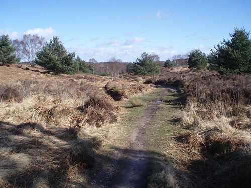
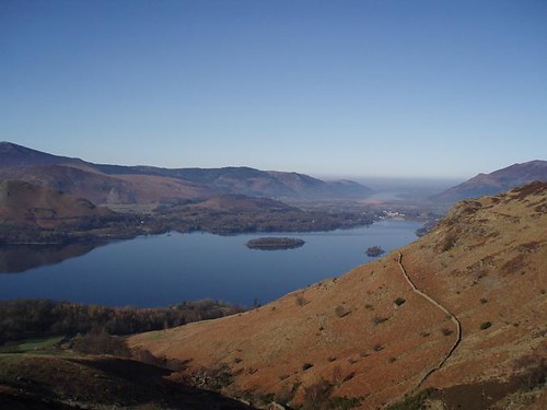
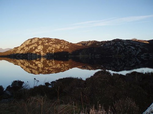
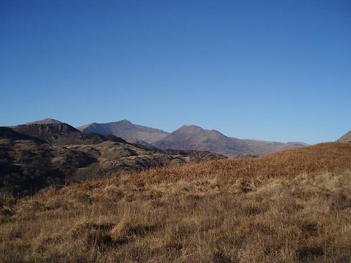


 The few people pottering around had petered out within half a mile and for the next mile or so we enjoyed solitude in which to appreciate the surroundings and the birdlife.
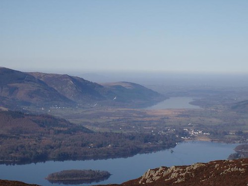
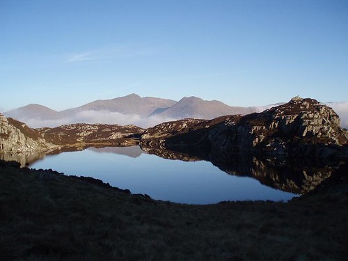
 Pity I didn't take a photo that showed the true nature of these rock features.
 Husband in his element (he *really* wants a dog)
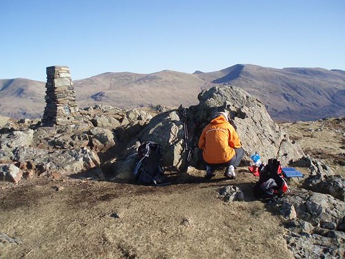
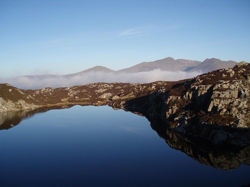
 It's not a good photo at all, but anyone know what that structure is?

